Surkanda Devi Trek
Tehri Garhwal, Uttarakhand
Opens without signal on this phone, with the map file and checklist. Saved for offline →
- Max altitude
- 2,756 m
- Days
- 1 day
- Distance
- 5 km
- Difficulty
- Easy
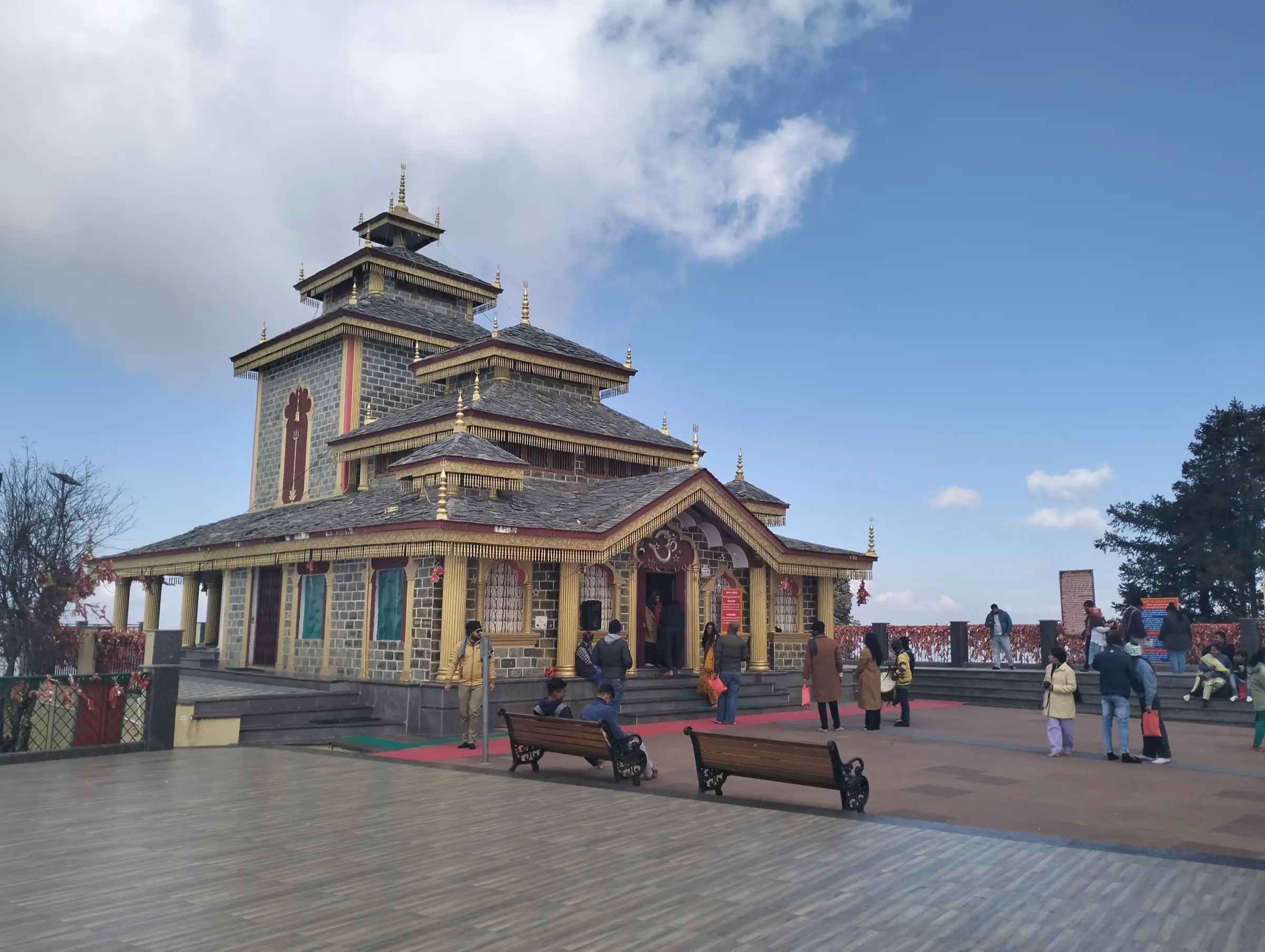
Only about 2.5 km each way on a paved, fenced path with steps and benches, but it climbs roughly 260 m without a break, so the steep gradient tires first-timers.
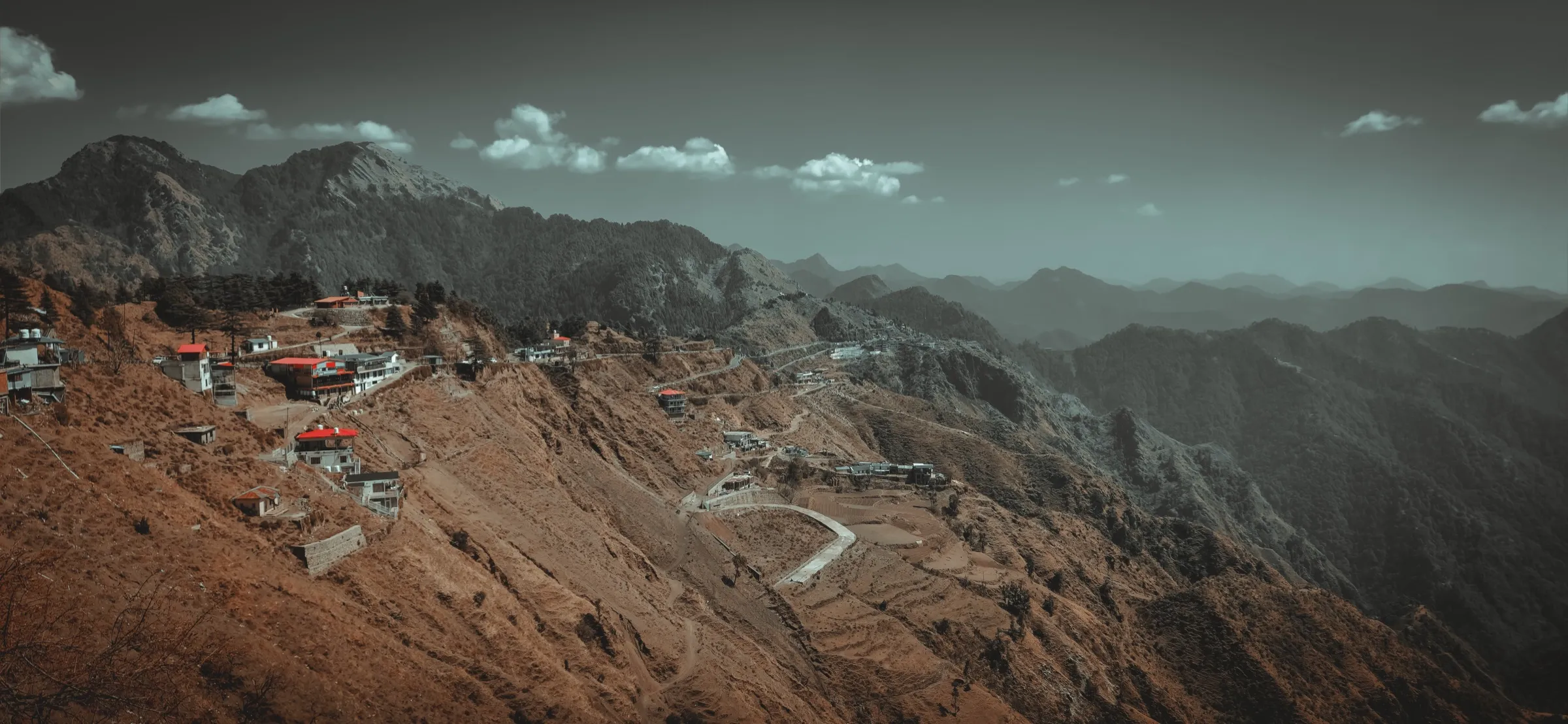
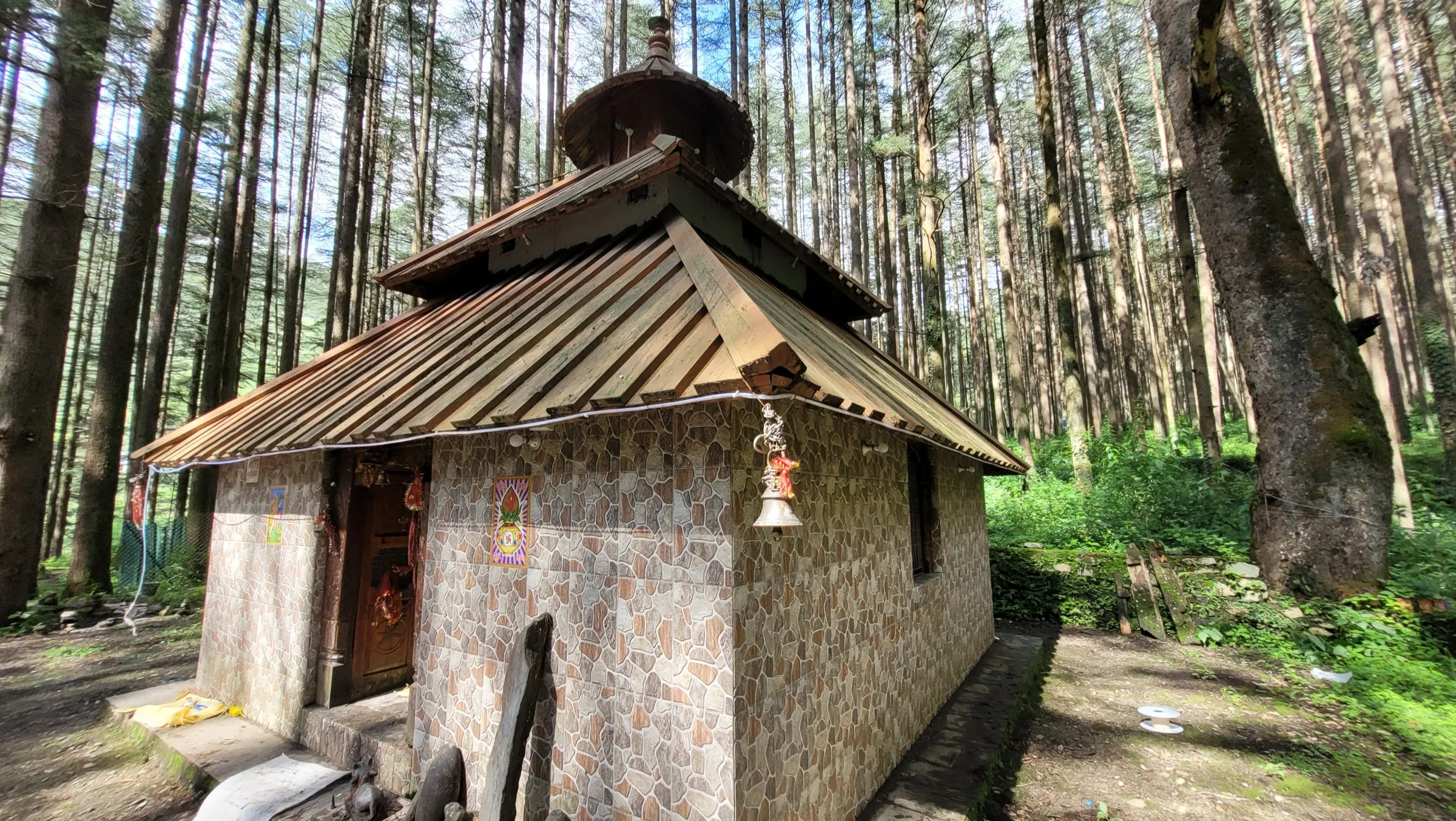
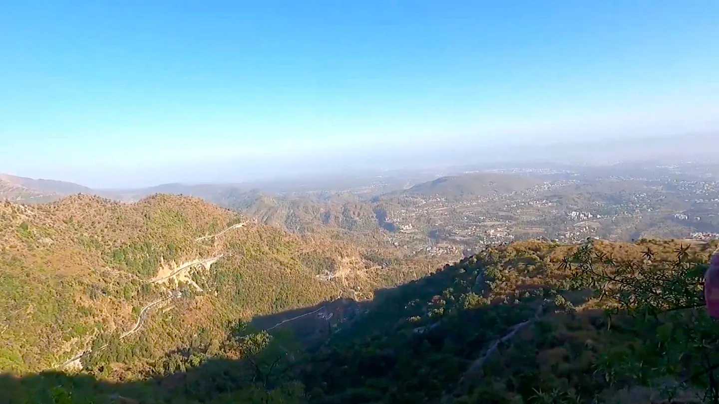
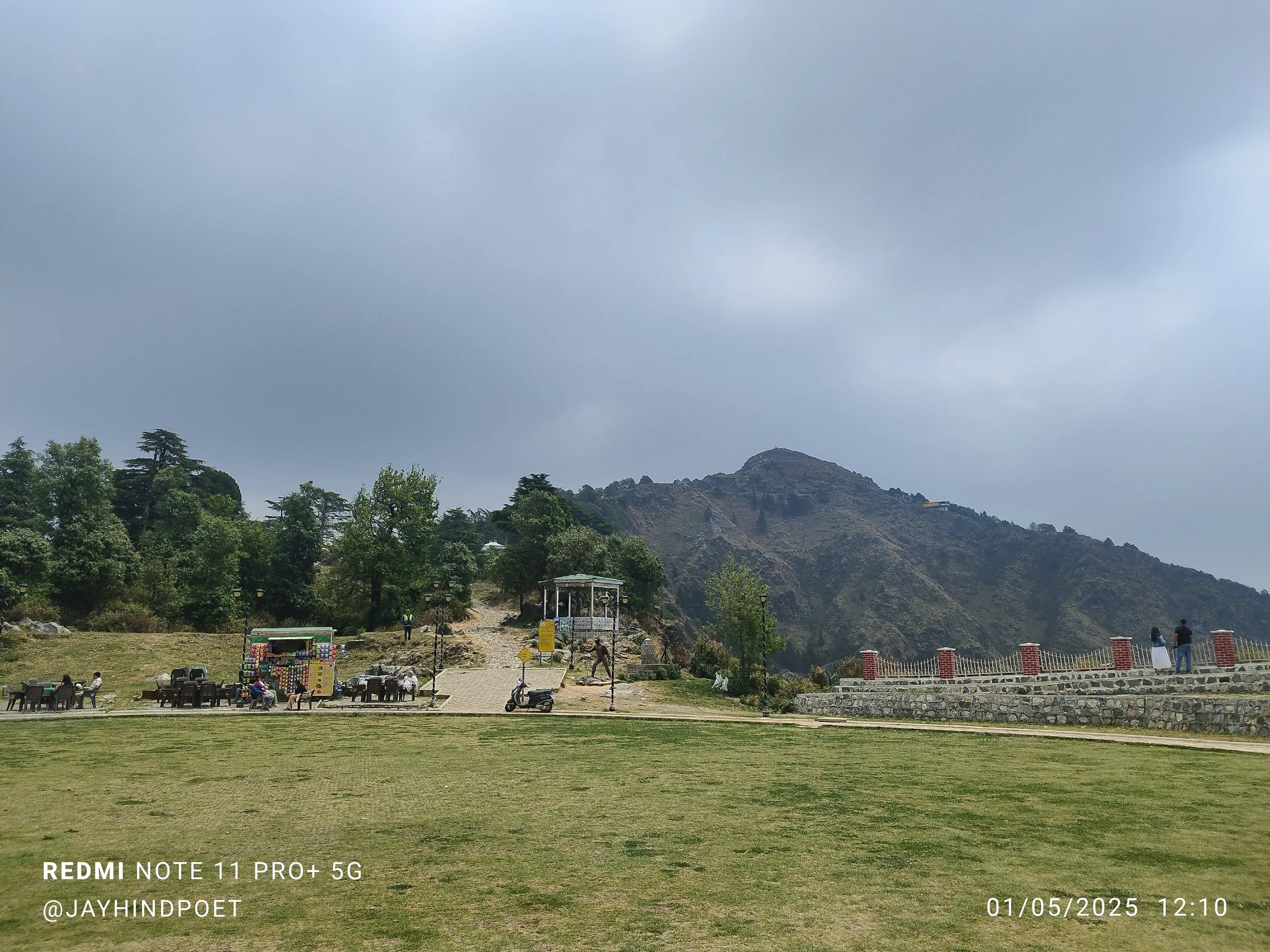
Photos
On the trail
The route
Day by day
Day 1 · highest point
Kaddukhal → Kaddukhal (via Surkanda Devi Temple)
2,497 m → 2,756 m → 2,497 m
Ups and downs
Altitude profile
Where it is
Map
Trailhead and high point only — not a recorded track. Use it with a proper map.
Weather
Next 5 days on the trail
Live forecast for the trailhead and the high point. Mountain weather changes fast — check again on the morning you start.
Trailhead · Kaddukhal
at 2,497 mLoading forecast…
High point · Surkanda Devi Temple
at 2,756 mLoading forecast…
Each day: high / low °C · rain mm and chance · snow cm · wind km/h
Weather data: Open-Meteo.comModel forecast, not an official warning. For alerts follow IMD and the local administration.
Plan the trip
How to reach
- Trailhead
- Kaddukhal (nearest town: Dhanaulti)
- Nearest railway
- Dehradun
- Nearest airport
- Jolly Grant Airport, Dehradun
- By road
- Dehradun (about 65 km via Mussoorie and Dhanaulti); Mussoorie (about 1 hour by road via Dhanaulti)
- Drive
- About 2 h from Dehradun
Plan the trip
Permits and fees
We could not confirm the current permit rules and fees from an official source. Check with the local forest department or tourism office before you go.
Plan the trip
Cost
Self-guided
₹300–2,500
With an operator
₹5,000–7,000
Per person, ex-Dehradun. Guided prices published October 2026: Himalayan Dream Treks ₹5,000 + 5% GST for a 2-day trip with Dehradun transport, a night in Dhanaulti, meals, guide and forest fees; WanderOn's Kanatal weekend trip, which includes Surkanda Devi, lists ₹5,699-6,999 by room sharing (start city not confirmed). Self-guided is an estimate: bus Dehradun-Mussoorie, morning bus or shared taxi to Dhanaulti and Kaddukhal (Indiahikes: ₹100-150 Mussoorie-Dhanolti), snacks and water, and optionally a stay in Dhanaulti or Kanatal (under ₹2,000). The ropeway is optional; it opened in May 2022 at ₹177 per head and the fare may have changed.
Gear
Top picks for this trek
The gear that matters most on this route, chosen from its altitude, season and risks.
 Ad · affiliate link
 Ad · affiliate link
 Ad · affiliate link
 Ad · affiliate link
 Ad · affiliate link
- Ad · affiliate link
 Ad · affiliate link
 Ad · affiliate link
Store buttons open a search on that store, not a product we picked. As an Amazon Associate we earn from qualifying purchases. Photos show the kind of item, not a specific product. Affiliate disclosure
Packing checklist
Matched to this trek: altitude, season, days and the risks on the route.
Packed 0 of 24
Monsoon months (Jun): pack everything in plastic or a dry bag and wear shoes with good grip.
Tick each item as it goes in the bag.
Know before you go
Good to know
- Mobile network
- Good Jio and Airtel signal along the whole path (Indiahikes).
- Last ATM
- Mussoorie; there is no ATM near Kaddukhal, so carry cash.
- Nearest hospital
- Landour Community Hospital, Mussoorie (about 30 km, 1 hour); police post at Dhanaulti about 6 km away.
- Water
- No stream or spring on the path. Carry 2 litres per person; packaged water and prasad are sold at the shops at the base and about half a kilometre up.
Highlights
- Darshan of Maa Surkanda Devi, revered as one of the Shakti Peethas, where the head (sir) of Mata Sati fell; the name Surkanda is said to come from Sirkanda
- 360° view from the hilltop: snow-capped Himalaya to the north and the Doon and Tehri valleys to the south
- A short, well-made path through deodar and oak forest, popular with bird-watchers and photographers
- Ganga Dussehra (May-June) and Navratri bring thousands of devotees for the mela and puja
Risks
- The path is steep throughout; walk slowly, use the benches and keep drinking water.
- In the July-September monsoon the concrete slope turns slippery; one operator advises avoiding these months.
- In December-February snow and ice can cover the path and temple compound, and temperatures fall to about 2-3 °C with strong wind; carry warm layers from October to April.
- Ganga Dussehra and Navratri bring large crowds and pony traffic on the narrow path; start early.
Know before you go
Questions
Can I still walk to Surkanda Devi now that there is a ropeway?
Yes. The ropeway from Kaddukhal opened in May 2022 and is about 502 m long, but the 2.5 km paved footpath is still used by devotees and trekkers. Ponies are also available. The ropeway, pony drop and footpath all end near the shoe stand, about 100 m below the temple.
How long is the walk and how much time does it take?
About 2.5 km one way from Kaddukhal, so roughly 5 km return. Fit walkers reach the top in 45-60 minutes; Indiahikes allows 1.5-2 hours up and about an hour down.
Why is Surkanda Devi a Shakti Peeth?
When Mata Sati gave up her body at Daksha Prajapati's yajna, Bhagwan Shiva carried her and Bhagwan Vishnu's Sudarshan Chakra divided the body; where each part fell became a Shakti Peetha. Devotees revere Surkanda as the place where her head fell, which is why it is called Sirkanda, now Surkanda.
When is the best time to visit?
The temple is open all year. April-June gives the clearest snow-peak views; March and October-November are also pleasant. Monsoon makes the slope slippery, and December-February can bring snow and icy wind.
Do I need a permit, and what are the temple timings?
Indiahikes says no permission is needed for the walk, and camping on the hilltop is not allowed. Temple timings vary by season (Indiahikes: about 5 am-7 pm in summer, 7 am-5 pm in winter). Shoes and leather belts are left at the stand below the temple.
In an emergency
Save these numbers before you lose signal. Tap to call.
- 112All emergenciesIndia’s single emergency number — works in every state
- 108Ambulance
- 1077District disaster control room
You are in
District: Tehri GarhwalUttarakhand
- Nearest hospital
- Landour Community Hospital, Mussoorie (about 30 km, 1 hour); police post at Dhanaulti about 6 km away.
- Last ATM
- Mussoorie; there is no ATM near Kaddukhal, so carry cash.
- Phone network
- Good Jio and Airtel signal along the whole path (Indiahikes).
Before you set off
- Tell someone your route and when you will be back.
- Carry a charged phone and a power bank.
- Download an offline map of the route.
- Turn back if the weather turns bad — the mountain will wait.
Questions about Surkanda Devi
No questions yet. Ask something and trekkers who have done it can answer.
Share your trek photo with #TreksAndTrails
I trekked this
Did Surkanda Devi look different from this page? Tell us what changed and we will check it.
Where this comes from
Sources
Last reviewed:
- Surkanda Devi Trek - Trek to one of the 51 Shaktipeeth Temples of India — Indiahikes
- Surkanda Devi Temple Trek 2026: Price, Itinerary, Details and All — Himalayan Dream Treks
- Surkanda Devi Yatra, Uttarakhand — eSamskriti
- Surkanda Devi — Wikipedia
- Now Pilgrims Can Take Ropeway To Surkanda Devi Temple — Outlook Traveller
- Surkanda Devi Temple — Incredible India (Ministry of Tourism, Government of India) (official)
- Kanatal Weekend Trip: Surkanda Devi, Camping & Tehri Dam Water Sports — WanderOn
Photos: आर्या जोशी, CC BY-SA 4.0; Guptaele, CC BY-SA 4.0; Guptaele, CC BY-SA 4.0