Parasnath Trek
Giridih, Jharkhand
Opens without signal on this phone, with the map file and checklist. Saved for offline →
- Max altitude
- 1,365 m
- Days
- 1 day
- Distance
- 27 km
- Difficulty
- Moderate
A long single-day walk of about 27 km on a cement-paved track: roughly 9 km up, about 9 km across the tonks on the ridge and 9 km down, started in the dark, with steps after the first 4 km and no food on the hill.
About this trek
Parasnath
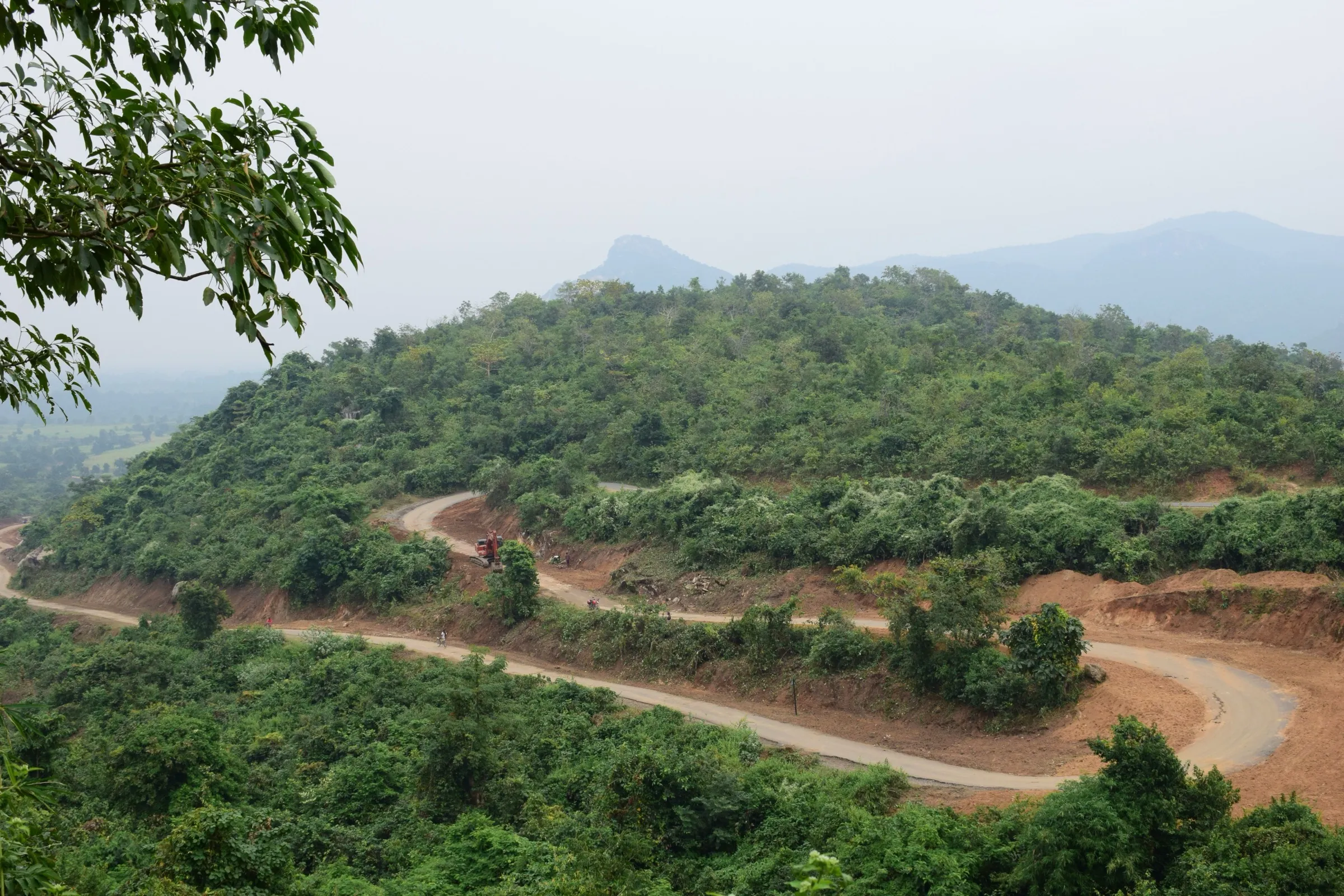
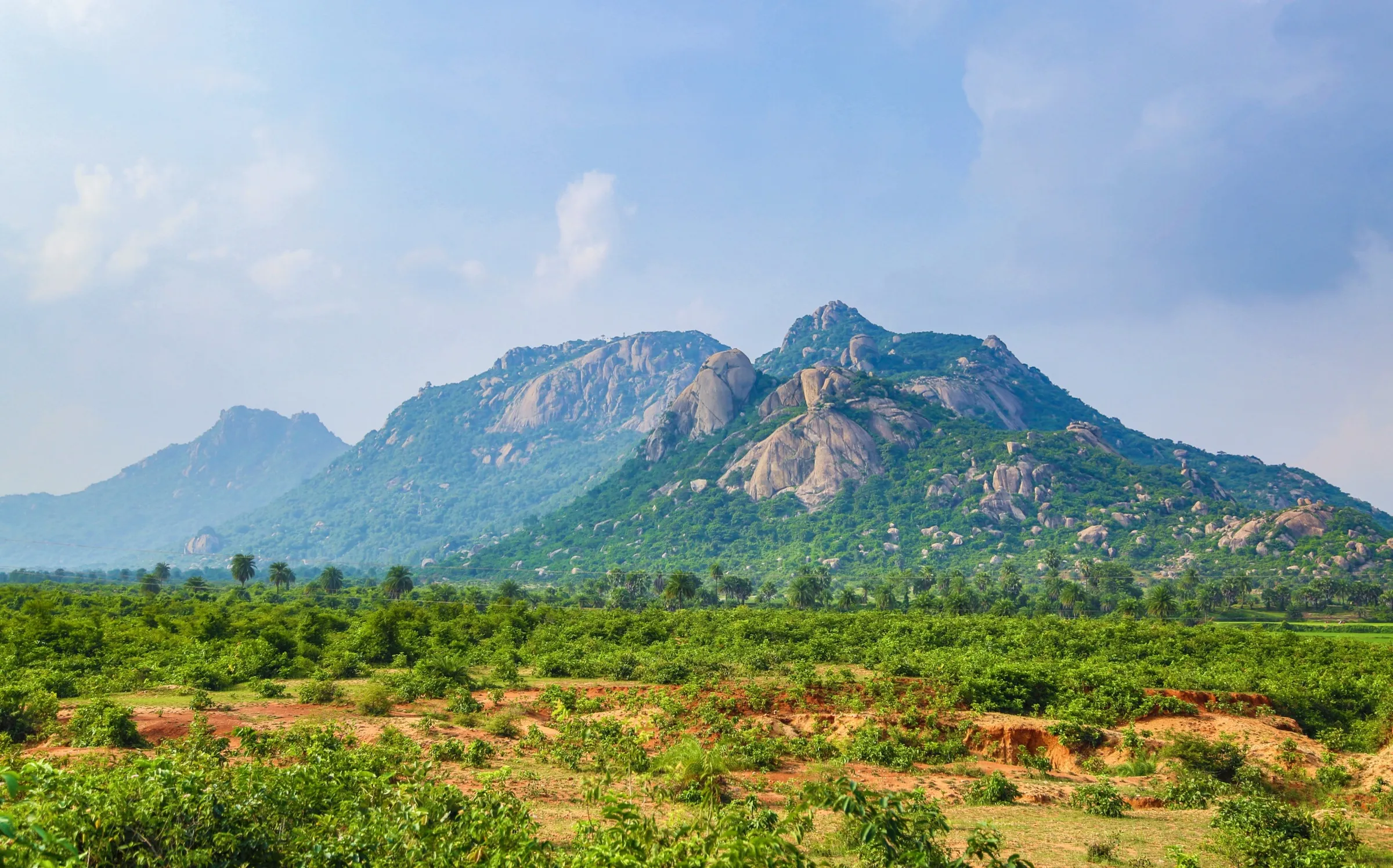
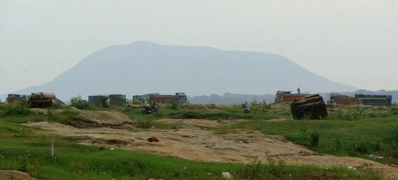
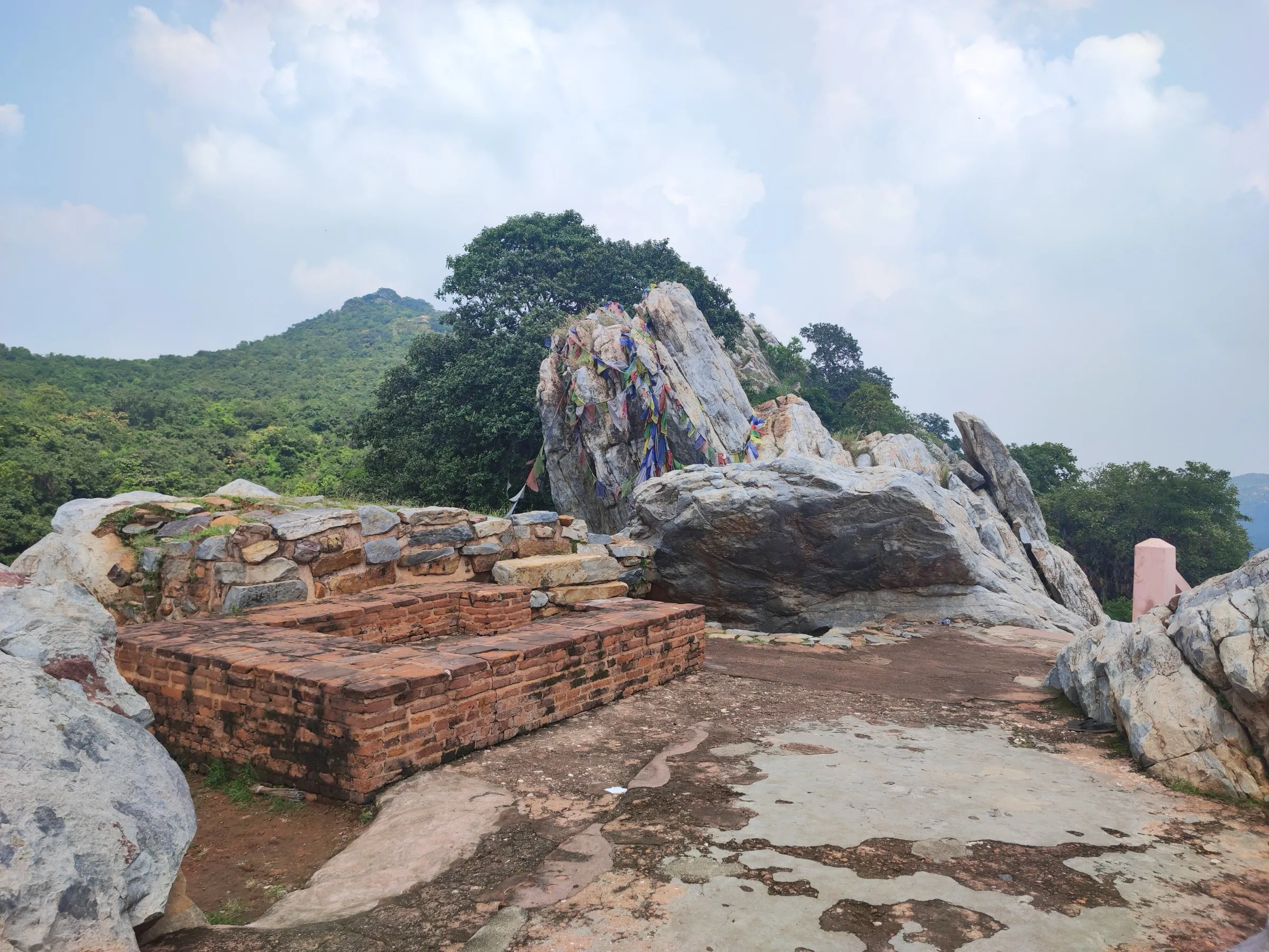
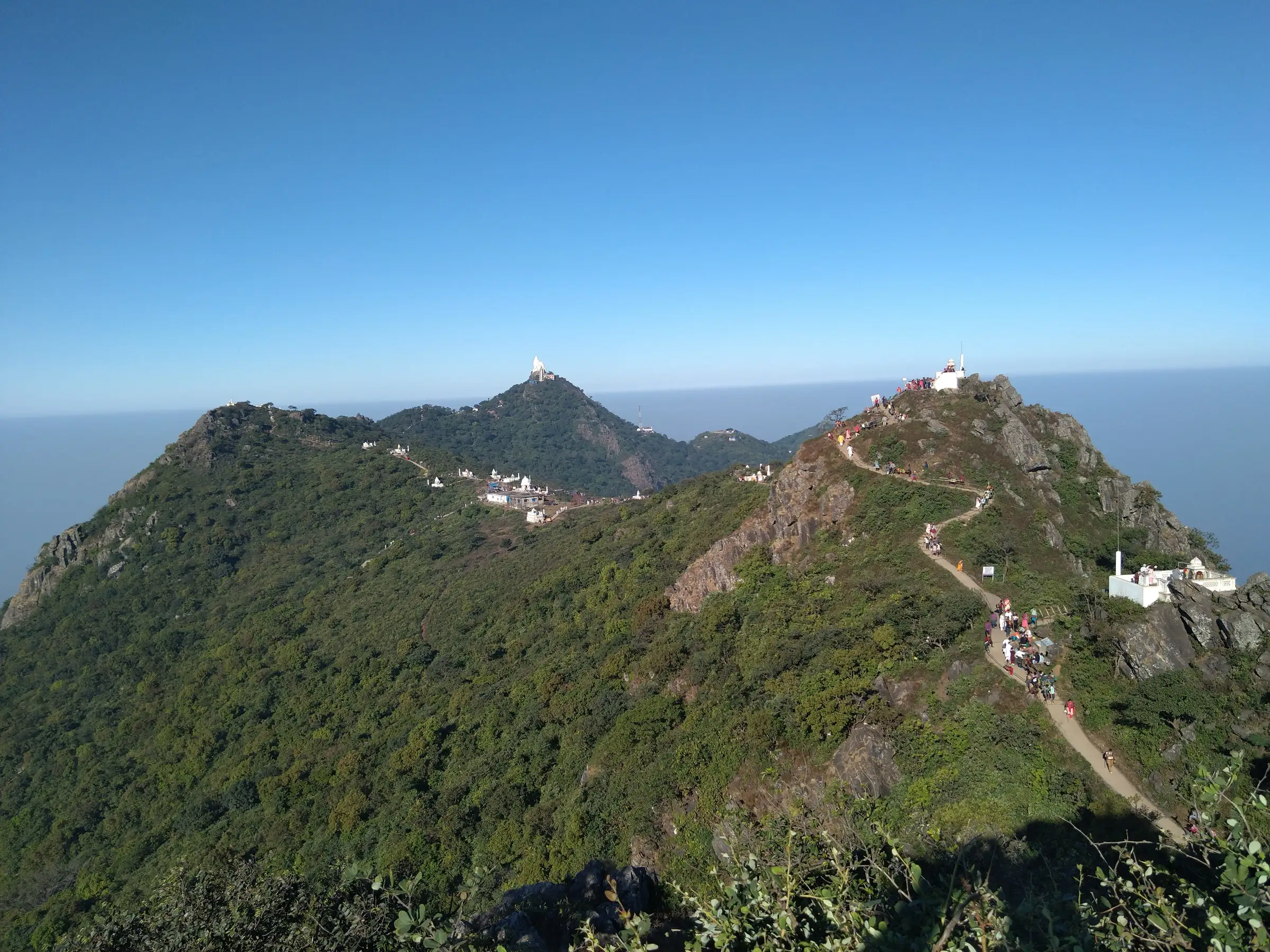
Parasnath, also called Shikharji or Sammet Shikhar, is the highest hill in Jharkhand at about 1,365 m and a major Jain pilgrimage. The yatra starts at Madhuban, climbs on a paved track and then steps to the first tonk, and continues along the summit ridge past small marble shrines and the Jal Mandir. It is walked in one long day from before dawn, and there is no food on the trail. It suits fit walkers and pilgrims who can start in the dark and finish by evening.
Photos
On the trail
The route
Day by day
Day 1 · highest point
Madhuban → Madhuban (via the tonks on Parasnath Hill)
400 m → 1,365 m → 400 m
- Starts at Madhuban (about 400 m); the suggested start is 3 to 4 am, and the Bhomiaji temple there opens at 4 am.
- The first 4 km are cement-paved and hilly with covered shelters; after that the climb is mostly steps.
- One operator counts about 27 km to see all 31 tonks (9 up, 9 along the summit, 9 down); a trip report gives 13 to 14 km by the short route.
- Tonks are small white marble shrines with Tirthankara footprints; refreshments are given at Gandharva Nala on the way down.
- Vendors sell only water, tea and biscuits; carry food and a torch, as there are no lights, and finish the descent before dark.
Ups and downs
Altitude profile
Where it is
Map
Trailhead and high point only — not a recorded track. Use it with a proper map.
Weather
Next 5 days on the trail
Live forecast for the trailhead and the high point. Mountain weather changes fast — check again on the morning you start.
Trailhead · Madhuban
at 400 mLoading forecast…
High point · Parasnath Hill summit
at 1,365 mLoading forecast…
Each day: high / low °C · rain mm and chance · snow cm · wind km/h
Weather data: Open-Meteo.comModel forecast, not an official warning. For alerts follow IMD and the local administration.
Plan the trip
How to reach
- Trailhead
- Madhuban
- Nearest railway
- Parasnath railway station (Isri Bazar, Dumri), about 23-25 km from Madhuban
- Nearest airport
- Deoghar Airport (about 107 km); Birsa Munda Airport, Ranchi (about 180 km)
- By road
- Parasnath station to Madhuban by taxi or van (about 23-25 km); NH-2 (Grand Trunk Road) passes the hill
- Drive
- About 4.5 h from Ranchi
Plan the trip
Permits and fees
We could not confirm the current permit rules and fees from an official source. Check with the local forest department or tourism office before you go.
Plan the trip
Cost
Self-guided
₹1,500–4,000
With an operator
Free
Per person, ex-Madhuban. No guided trek packages found: this is a pilgrimage walk done independently. Self-guided is a reasoned estimate only (dharamshala or lodge night, food, local transport from Parasnath station, torch and stick); doli (litter) hire is extra and was not priced by any source we could confirm.
Gear
Top picks for this trek
The gear that matters most on this route, chosen from its altitude, season and risks.
 Ad · affiliate link
 Ad · affiliate link
 Ad · affiliate link
- Ad · affiliate link
 Ad · affiliate link
 Ad · affiliate link
 Ad · affiliate link
 Ad · affiliate link
Store buttons open a search on that store, not a product we picked. As an Amazon Associate we earn from qualifying purchases. Photos show the kind of item, not a specific product. Affiliate disclosure
Packing checklist
Matched to this trek: altitude, season, days and the risks on the route.
Packed 0 of 16
Hot days in Mar: start at first light and carry extra water and ORS.
Tick each item as it goes in the bag.
Know before you go
Good to know
- Mobile network
- Not confirmed by any source.
- Last ATM
- Not confirmed; carry cash from Madhuban's town or from Giridih or Dhanbad.
- Nearest hospital
- Not confirmed; nearest large towns are Giridih and Dhanbad.
- Water
- Water, tea and biscuits are sold along the route; restrooms only at Jal Mandir, the Dak Bungalow and Chopda Kund. Carry your own food and water as there are no food facilities on most of the hill.
Highlights
- Sammed Shikharji, the most sacred tirtha of Jain dharma, where 20 of the 24 Tirthankaras are revered to have attained moksha; 31 hilltop shrines (tonks) hold the footprints of Tirthankaras
- The highest hill in Jharkhand at about 1,365 m, with a view over a sea of morning cloud
- A cement-paved yatra path through Madhuban forest, walked at night and dawn by pilgrims from across India
- Jal Mandir, the marble temple on the hill, and the Parasnath tonk at the summit
Risks
- The yatra is one long day (about 12 hours for a fit adult, up to 16 for elders or families) and must be finished before dark; there is no overnight stay on the hill except the Dak Bungalow by prior arrangement.
- There are no lights on the route; carry a torch or headlamp and a stick, especially for the descent, and avoid descending in darkness.
- Weather on the hill can change suddenly, and one source says mid-May to July (the rains) is not a good time to go.
- Winter and Diwali are the most crowded and expensive periods; book a dharamshala in Madhuban in advance.
- Local rules matter: Jharkhand courts have upheld bans on meat and alcohol on the hill, and in January 2023 the Centre halted tourism development there. Respect the sanctity of the tirtha and check current local instructions before going.
Know before you go
Questions
How long is the Parasnath (Shikharji) trek and how long does it take?
The yatra from Madhuban is about 27 km (about 9 km up, 9 km across the tonks and 9 km down). A healthy adult takes about 12 hours; elders or people with children may take up to 16. Some trip reports quote about 30 km round trip.
What time should I start the Shikharji climb?
Pilgrims usually start around 3-4 am, reach the first tonk around 9 am, see all the tonks by about 1 pm and are back in Madhuban by about 5 pm. Carry a torch, as the path is not lit.
Can elderly people do Parasnath?
Many do, using a doli (litter) carried by bearers along the paved track. One guide advises arranging dolis the day before for elders and children.
How do I reach Madhuban, the base of Parasnath?
The nearest railhead is Parasnath station at Isri Bazar, about 23-25 km from Madhuban, reached by taxi or van. Deoghar airport is about 107 km and Ranchi about 180 km away. Madhuban has many dharamshalas and vegetarian eateries.
Is there a permit or entry fee for Parasnath?
We could not confirm any official permit or fee. The hill has been declared a wildlife sanctuary according to one source, so check locally in Madhuban.
In an emergency
Save these numbers before you lose signal. Tap to call.
- 112All emergenciesIndia’s single emergency number — works in every state
- 108Ambulance
- 1077District disaster control room
You are in
District: GiridihJharkhand
- Nearest hospital
- Not confirmed; nearest large towns are Giridih and Dhanbad.
- Last ATM
- Not confirmed; carry cash from Madhuban's town or from Giridih or Dhanbad.
- Phone network
- Not confirmed by any source.
Before you set off
- Tell someone your route and when you will be back.
- Carry a charged phone and a power bank.
- Download an offline map of the route.
- Turn back if the weather turns bad — the mountain will wait.
Questions about Parasnath
No questions yet. Ask something and trekkers who have done it can answer.
Share your trek photo with #TreksAndTrails
I trekked this
Did Parasnath look different from this page? Tell us what changed and we will check it.
Where this comes from
Sources
Last reviewed:
- Shikharji — Wikipedia
- Parasnath Hill — Wikipedia (Parasnath Hill)
- Shikharji Yatra: A pilgrimage to the Holiest Jain Teerth — Siddhachalam
- Parasnath Hill - the revered pilgrimage of Shikharji in Giridih — Ghumakkar
- Parasnath Hills — CPREEC Eco Heritage
Photos: Nizil Shah, CC BY-SA 4.0; Nizil Shah, CC BY-SA 4.0; CaptVijay, Public domain