Jalori Pass to Serolsar Lake Trek
Kullu, Himachal Pradesh
Opens without signal on this phone, with the map file and checklist. Saved for offline →
- Max altitude
- 3,134 m
- Days
- 1 day
- Distance
- 11 km
- Difficulty
- Easy
A clearly marked forest trail of about 5 km each way with gentle ups and downs; the only steep bit is an optional 300 m climb to the 360-degree viewpoint, and the round trip takes about 6 hours at just over 3,000 m.
Photos
On the trail
The route
Day by day
Day 1 · highest point
Jalori Pass → Jalori Pass (via Serolsar Lake)
3,134 m → 3,134 m
Ups and downs
Altitude profile
Where it is
Map
Trailhead and high point only — not a recorded track. Use it with a proper map.
Weather
Next 5 days on the trail
Live forecast for the trailhead and the high point. Mountain weather changes fast — check again on the morning you start.
Trailhead · Jalori Pass
at 3,134 mLoading forecast…
High point · Jalori Pass
at 3,134 mLoading forecast…
Each day: high / low °C · rain mm and chance · snow cm · wind km/h
Weather data: Open-Meteo.comModel forecast, not an official warning. For alerts follow IMD and the local administration.
Plan the trip
How to reach
- Trailhead
- Jalori Pass (nearest town: Jibhi)
- Nearest railway
- Joginder Nagar (narrow gauge); Chandigarh for broad-gauge trains
- Nearest airport
- Bhuntar Airport (Kullu)
- By road
- Kullu (about 75 km via Aut, Banjar and Jibhi); Manali (about 110 km); Shimla (about 150 km via Narkanda and Ani); Delhi (about 500 km; overnight bus to Aut or Jibhi)
- Drive
- About 13 h from Delhi
Plan the trip
Permits and fees
We could not confirm the current permit rules and fees from an official source. Check with the local forest department or tourism office before you go.
Plan the trip
Cost
Self-guided
₹4,000–8,000
With an operator
₹7,000–8,200
Per person, ex-Delhi. Guided prices published October 2026: Himtrek ₹6,999 (Delhi to Delhi); Trekkers of India ₹7,799 + 5% GST (3 days, Delhi to Delhi, 2 nights in Jibhi). Himalaya Shelter sells the walk alone as a guided day hike from its Jalori base camp at ₹2,500 + GST (ex-Jalori). Self-guided is an estimate: overnight bus Delhi to Aut or Banjar and back, local bus or shared taxi to Jibhi and up to Jalori Pass, and one or two nights in a Jibhi or Shoja homestay.
Gear
Top picks for this trek
The gear that matters most on this route, chosen from its altitude, season and risks.
 Ad · affiliate link
 Ad · affiliate link
 Ad · affiliate link
 Ad · affiliate link
 Ad · affiliate link
 Ad · affiliate link
 Ad · affiliate link
- Ad · affiliate link
Store buttons open a search on that store, not a product we picked. As an Amazon Associate we earn from qualifying purchases. Photos show the kind of item, not a specific product. Affiliate disclosure
Packing checklist
Matched to this trek: altitude, season, days and the risks on the route.
Packed 0 of 27
Nights near 3,134 m can drop close to freezing even in summer. Pack one more warm layer than you think.
Tick each item as it goes in the bag.
Know before you go
Good to know
- Mobile network
- Airtel and Jio work on most parts of the trail (Indiahikes).
- Last ATM
- Jibhi, about 12 km below the pass
- Nearest hospital
- Sub Health Centre Jibhi (about 12.5 km) for first care; Kullu for serious cases
- Water
- No natural water on the trail until the lake; a spring near the Budhi Nagin temple. Carry at least 2 litres. Tea stalls sell bottled water.
Highlights
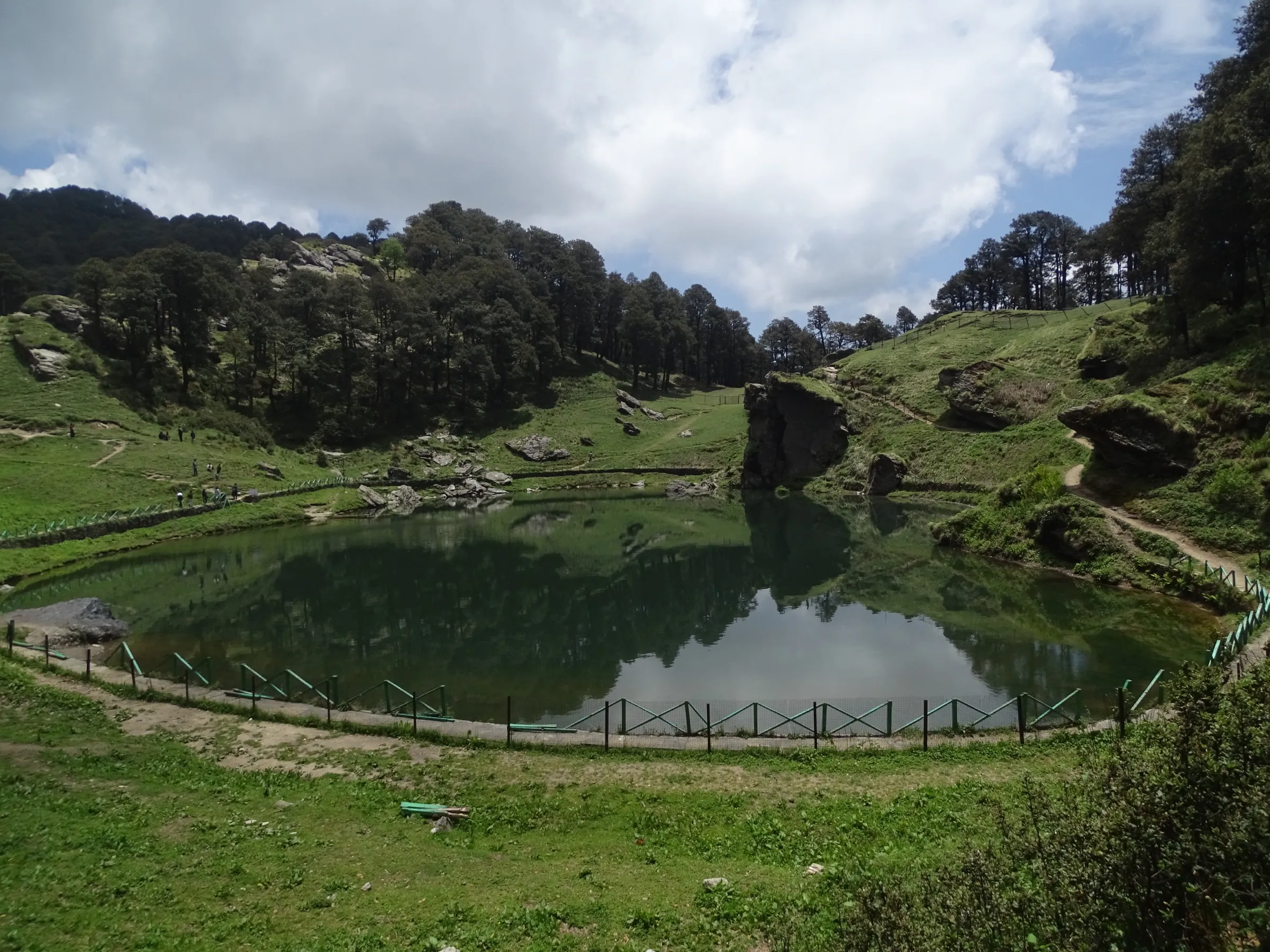
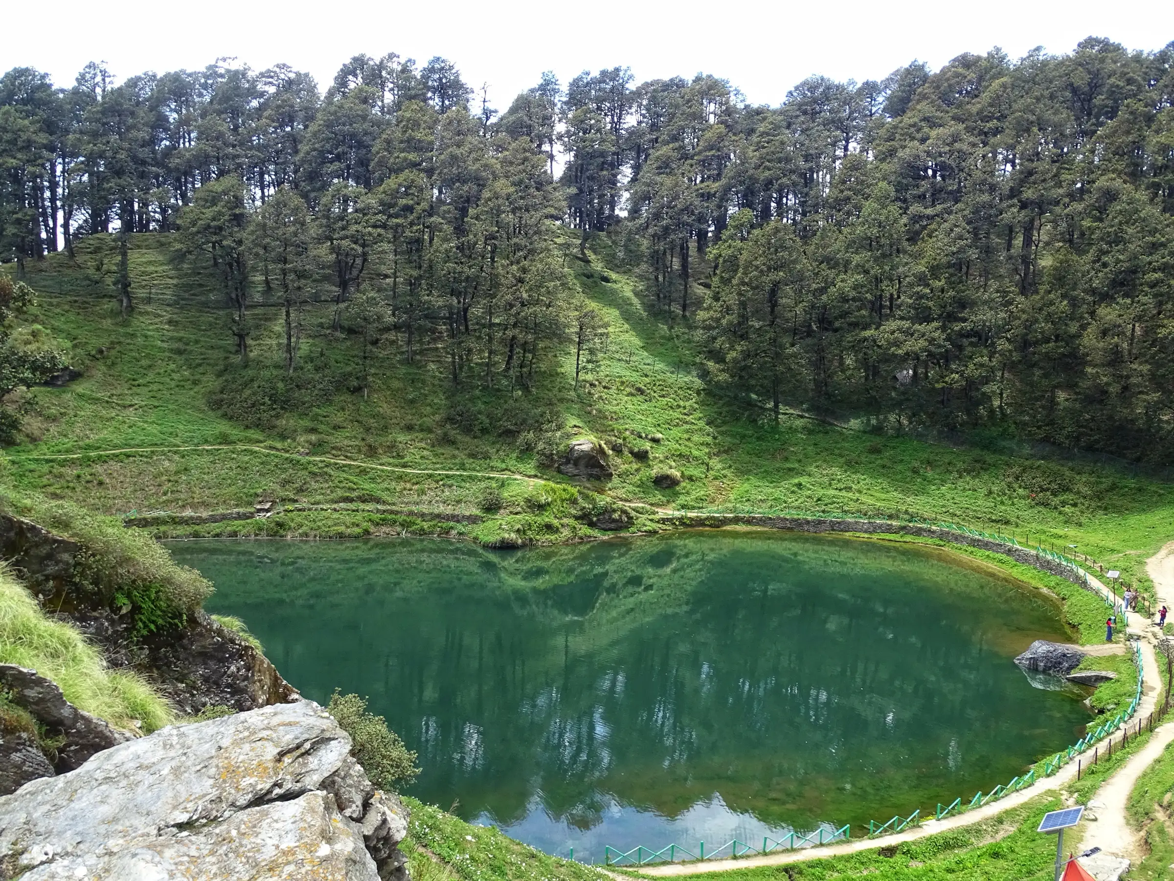
- Serolsar Lake at about 3,100 m, a small green lake ringed by oak, pine and deodar forest, with the Budhi Nagin Mata temple on its shore
- A shaded, clearly marked forest trail with clearings, tea stalls and rich birdlife
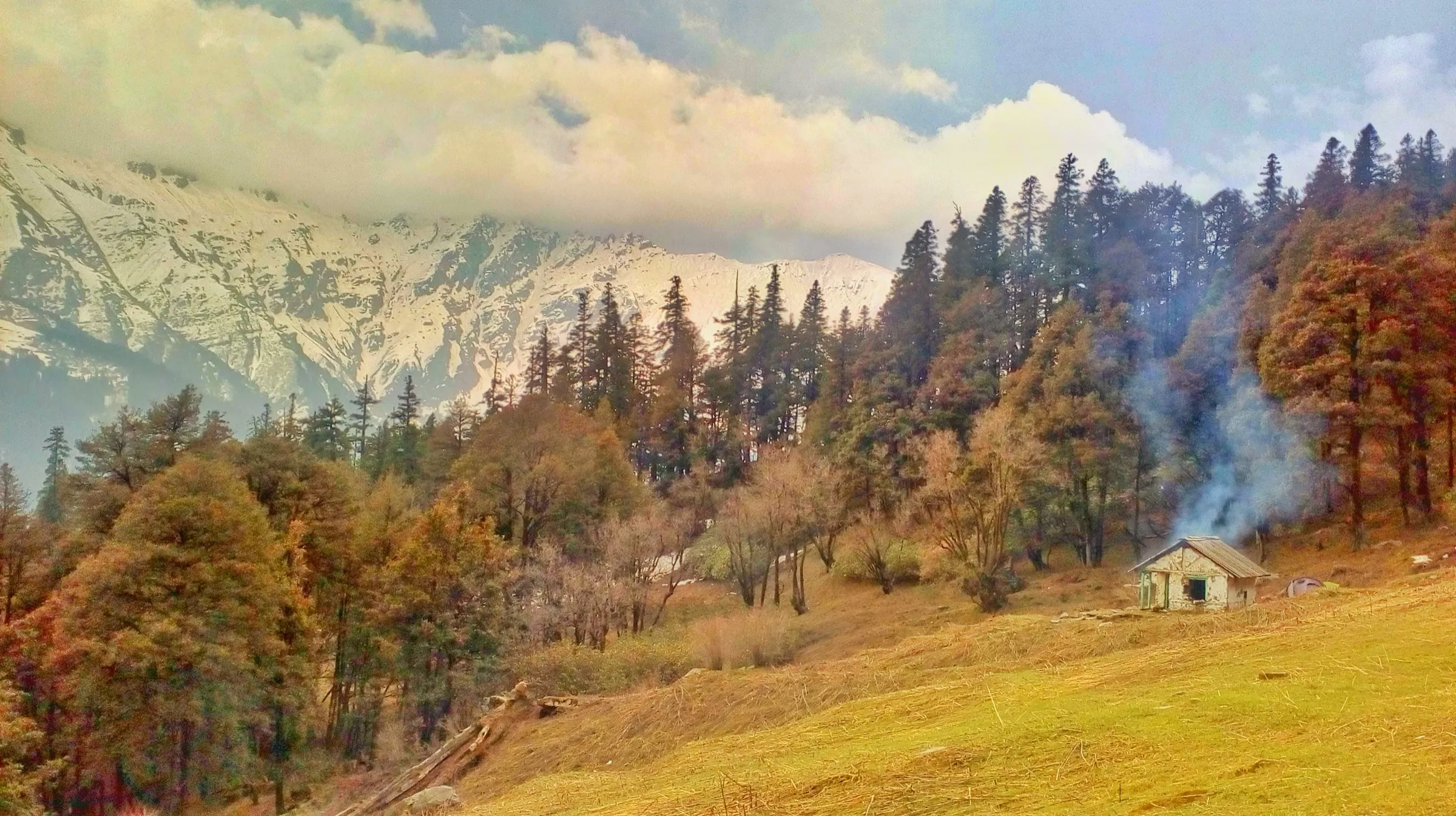
- The 360-degree viewpoint, a short detour above the trail, with views of the Pir Panjal and Great Himalayan ranges
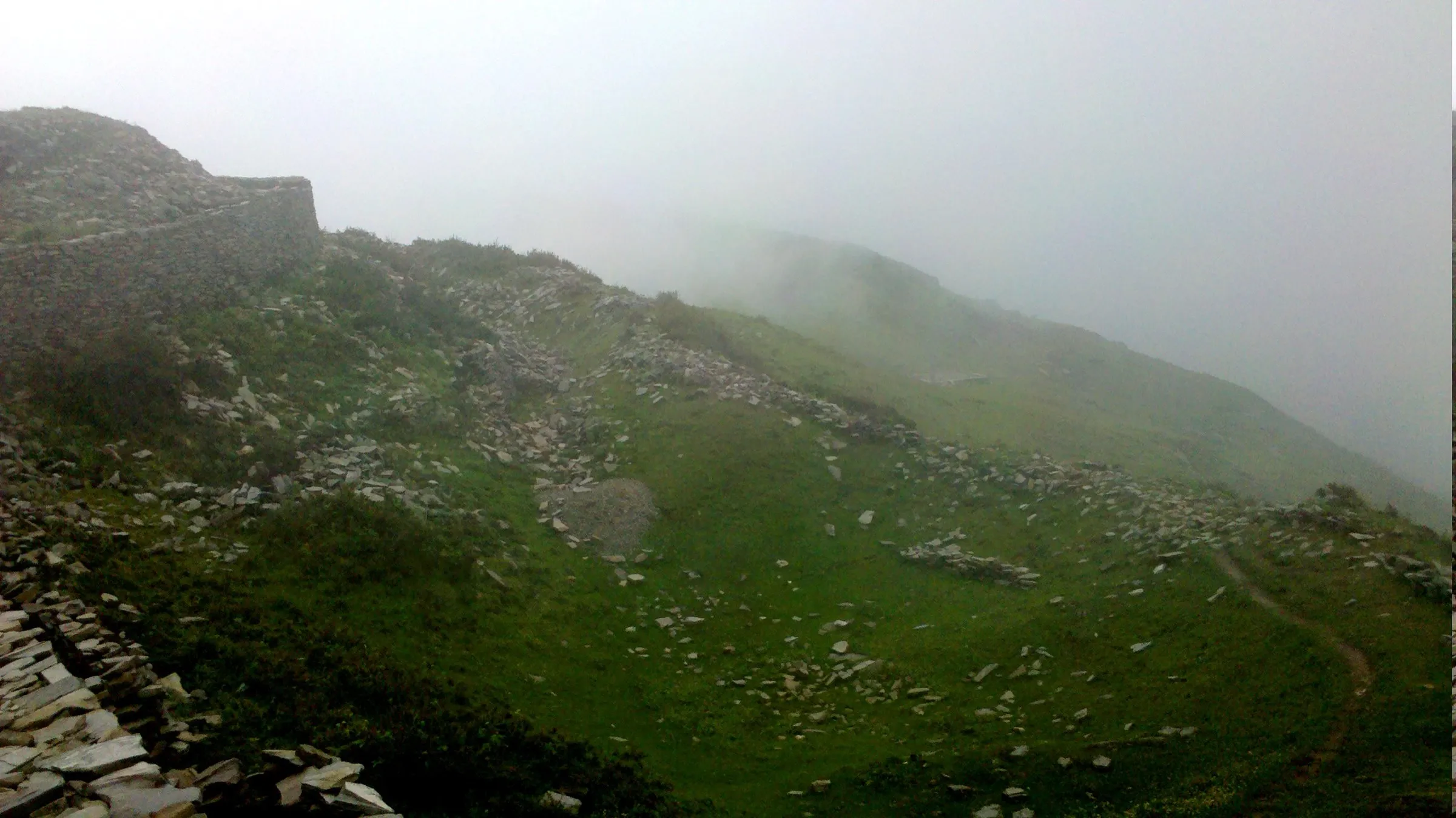
- Jalori Mata temple at the pass; Raghupur Fort, about 3 km the other way from the pass, makes a second day hike
Risks
- Jalori Pass (NH-305) is often blocked by snow from about December to March; closures have lasted from days to over a month, and buses may stop at Jibhi or Shoja. Check the road with HRTC or locals before going.
- In winter the trail is under snow and ice; Indiahikes does not recommend the trek then, and only experienced winter walkers should try it.
- July-August monsoon rain brings landslides on the roads to the pass and clouds that hide the views.
- Camping is not allowed around the lake; camp only at the clearing about 30 minutes beyond it, and ask the Forest Department about current camping rules.
- Set a turnaround time of about 3 pm so you are back at the pass before dark.
Know before you go
Questions
How long is the walk from Jalori Pass to Serolsar Lake?
About 5 km each way. Indiahikes measures 2 km from the Jalori Mata temple to the 360-degree viewpoint turn-off and 3.3 km on to the lake; operators quote 4-6 km one way. Allow about 3.5 hours up and 3 hours back.
Is the Serolsar Lake trek suitable for beginners?
Yes. Operators rate it easy: the trail is clearly marked and mostly gentle, with one steep optional climb to the 360-degree viewpoint. Families and first-time trekkers do it as a day hike.
When is the best time to go?
April to June and September to November. March to May can still have snow patches; July and August bring monsoon rain and landslide risk on the roads. In winter the pass is often snowbound and the road may be shut.
Do I need a permit?
Indiahikes (2022) says no permission is needed for the day walk. Camping is not allowed near the lake, and forest rules for pitching tents can change, so check with the Forest Department in Banjar or Ani before camping.
Is Jalori Pass itself a trek?
No, Jalori Pass is on a motor road (NH-305) between Banjar and Ani, about 12 km above Jibhi. The walking routes start from the pass: east to Serolsar Lake (this trek) or west to Raghupur Fort, about 3 km away.
Where can I stay?
Jibhi, about 12 km below the pass, has many homestays and hotels; Shoja, about 5 km below the pass, has a few homestays and a Forest and PWD rest house.
In an emergency
Save these numbers before you lose signal. Tap to call.
- 112All emergenciesIndia’s single emergency number — works in every state
- 108Ambulance
- 1077District disaster control room
You are in
District: KulluHimachal Pradesh
- Nearest hospital
- Sub Health Centre Jibhi (about 12.5 km) for first care; Kullu for serious cases
- Last ATM
- Jibhi, about 12 km below the pass
- Phone network
- Airtel and Jio work on most parts of the trail (Indiahikes).
Before you set off
- Tell someone your route and when you will be back.
- Carry a charged phone and a power bank.
- Download an offline map of the route.
- Turn back if the weather turns bad — the mountain will wait.
Questions about Jalori Pass to Serolsar Lake
No questions yet. Ask something and trekkers who have done it can answer.
Share your trek photo with #TreksAndTrails
I trekked this
Did Jalori Pass to Serolsar Lake look different from this page? Tell us what changed and we will check it.
Where this comes from
Sources
Last reviewed:
- Serolsar Lake Trek - A Popular Day Trek in Tirthan Valley — Indiahikes
- Jalori Pass Trek — Himalaya Shelter
- Jibhi Jalori Pass Trek — Himtrek
- Jibhi Jalori Pass — Trekkers of India
- Jalori Pass Trek Himachal — Himalayan Eco Travel Tours
- Jalori Pass Trek | Trek in Himachal Pradesh — Himalayan Hikers
- Serolsar Lake: A Delightful Trek from Jalori Pass — Travel Shoebum (trip report)
- Seruvalsar Lake — Wikipedia
Photos: Sukhjiwan Singh, CC BY-SA 4.0; Sukhjiwan Singh, CC BY-SA 4.0; Manish57335, CC BY-SA 4.0