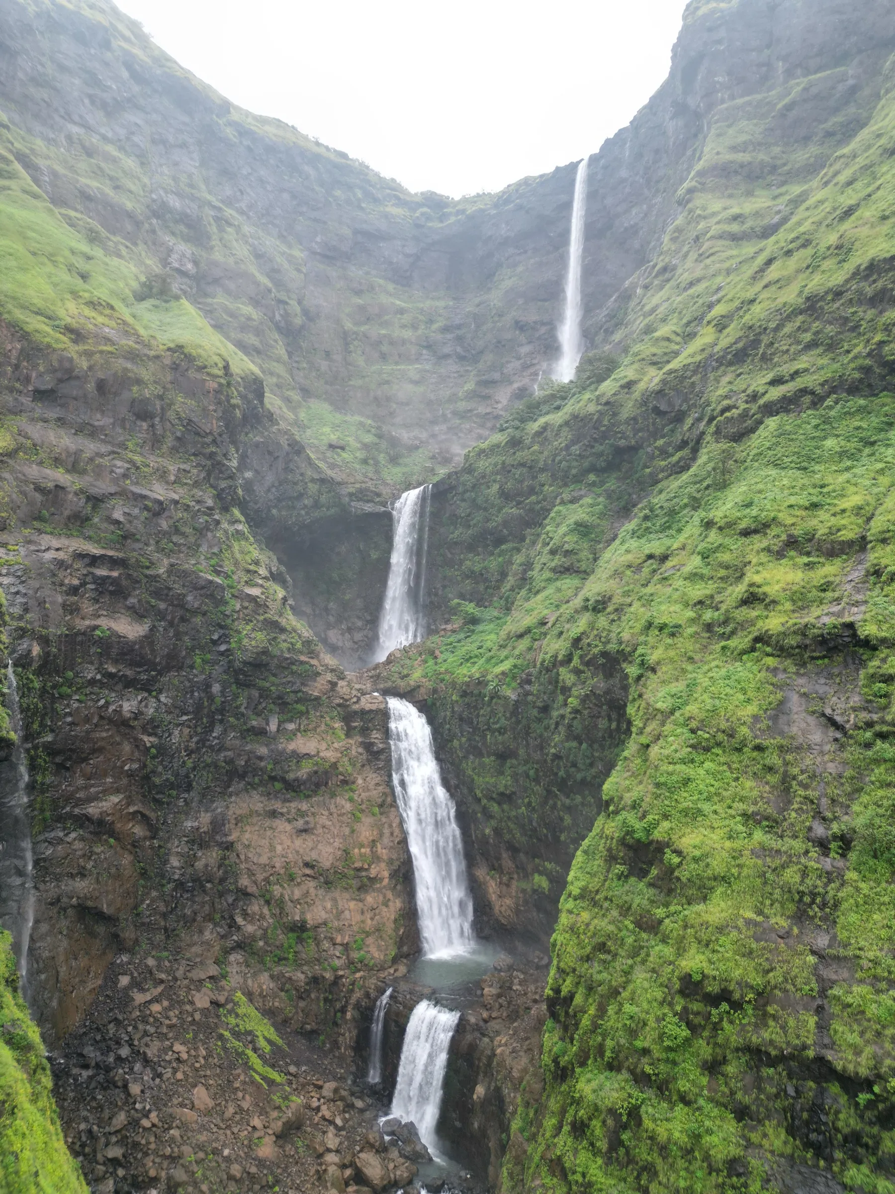
Harishchandragad Trek
Ahilyanagar (Ahmednagar); the Khireshwar base village is in Junnar taluka, Pune district, Maharashtra
Opens without signal on this phone, with the map file and checklist. Saved for offline →
- Max altitude
- 1,424 m
- Days
- 2 days
- Distance
- 13 km
- Difficulty
- Moderate
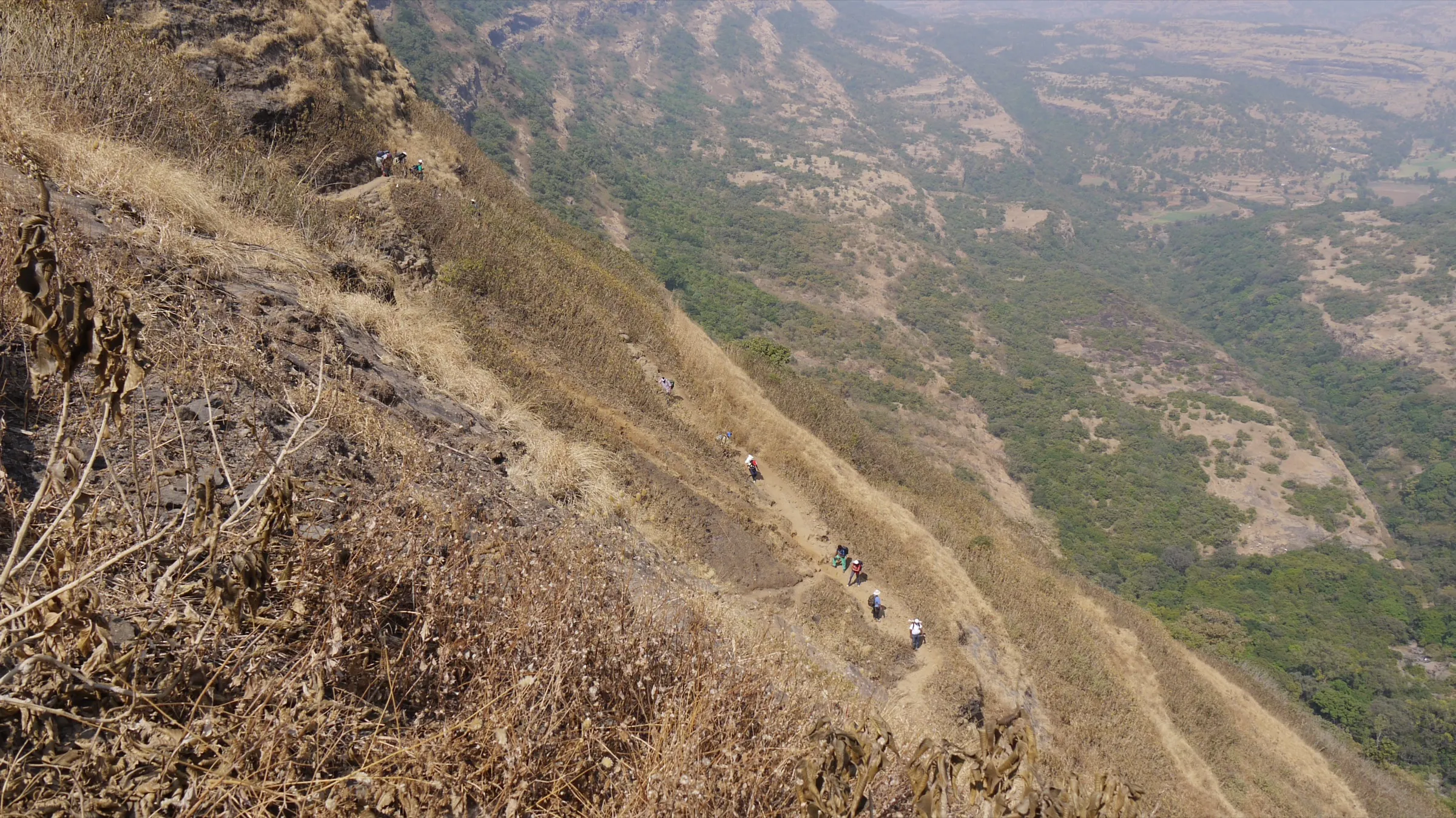
The Khireshwar route is long (about 6 km each way, around 5 hours up) and includes the Tolar Khind rock patch at about 65-70 degrees with fixed poles and chains; slippery and leech-ridden in the monsoon.
Photos
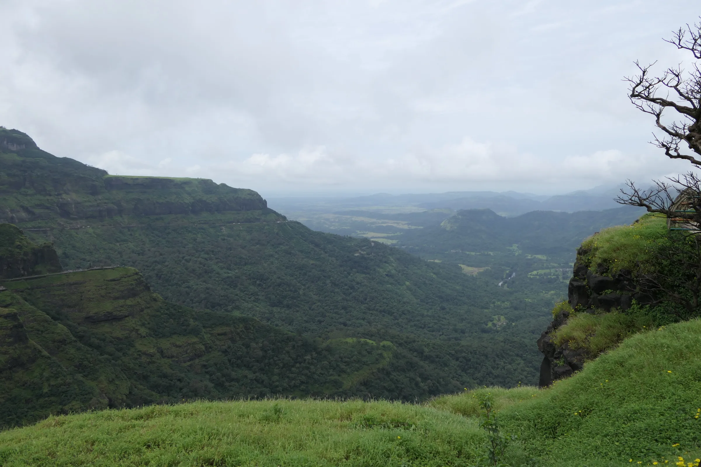
On the trail
The route
Day by day
Day 1
Khireshwar Village → Harishchandreshwar Temple (via Tolar Khind)
690 m → 1,220 m
Day 2 · highest point
Harishchandreshwar Temple → Khireshwar Village (via Taramati Peak and Konkan Kada)
1,220 m → 1,424 m → 690 m
Ups and downs
Altitude profile
Where it is
Map
Trailhead and high point only — not a recorded track. Use it with a proper map.
Weather
Next 5 days on the trail
Live forecast for the trailhead and the high point. Mountain weather changes fast — check again on the morning you start.
Trailhead · Khireshwar Village
at 690 mLoading forecast…
High point · Taramati Peak (Harishchandragad)
at 1,424 mLoading forecast…
Each day: high / low °C · rain mm and chance · snow cm · wind km/h
Weather data: Open-Meteo.comModel forecast, not an official warning. For alerts follow IMD and the local administration.
Plan the trip
How to reach
- Trailhead
- Khireshwar Village (nearest town: Junnar)
- Nearest railway
- Kalyan (Central Railway); buses towards Alephata via Malshej Ghat stop at Khubi Phata, 5 km from Khireshwar
- Nearest airport
- Pune International Airport (Lohegaon)
- By road
- Mumbai (about 130 km via NH 222 and Malshej Ghat to Khubi Phata and Khireshwar, about 3.5 hours); Pune (about 160 km via Alephata and Khubi Phata, about 4 hours); Kalyan (MSRTC bus towards Alephata; get off at Khubi Phata and walk or take a jeep 5 km along the Pimpalgaon Joga dam)
- Drive
- About 3.5 h from Mumbai
Plan the trip
Permits and fees
We could not confirm the current permit rules and fees from an official source. Check with the local forest department or tourism office before you go.
Plan the trip
Cost
Self-guided
₹600–2,000
With an operator
₹1,499–2,299
Per person, ex-Mumbai. Guided prices published for the 2025-26 season: Treks and Trails India ₹1,499 for the overnight Khireshwar trek with transport from Mumbai; Bhatakna ₹1,599 + 5% GST ex-Mumbai (Pachnai route, entry charges included); Treks and Trails India ₹2,299 for a 2-day trek with tent camping on top (Pachnai route, ex-Kasara/Pune). Self-guided is an estimate: train to Kalyan, MSRTC bus to Khubi Phata and back, a jeep to Khireshwar, meals from village homes and plateau stalls, tent or cave stay, and a share of a local guide.
Gear
Top picks for this trek
The gear that matters most on this route, chosen from its altitude, season and risks.
 Ad · affiliate link
 Ad · affiliate link
 Ad · affiliate link
 Ad · affiliate link
 Ad · affiliate link
 Ad · affiliate link
- Ad · affiliate link
 Ad · affiliate link
Store buttons open a search on that store, not a product we picked. As an Amazon Associate we earn from qualifying purchases. Photos show the kind of item, not a specific product. Affiliate disclosure
Packing checklist
Matched to this trek: altitude, season, days and the risks on the route.
Packed 0 of 28
Monsoon months (Aug–Sep): pack everything in plastic or a dry bag and wear shoes with good grip.
Tick each item as it goes in the bag.
Know before you go
Good to know
- Mobile network
- Not confirmed by our sources; expect patchy or no signal on the forest trail and plateau.
- Last ATM
- Not confirmed; there is none at Khireshwar, so carry cash from Kalyan, Junnar or Alephata.
- Nearest hospital
- Not confirmed; the nearest towns with medical care are Otur and Junnar on the Pune side. Confirm locally before the trek.
- Water
- Streams in the forest during the monsoon; on the plateau a perennial stream and tanks near the caves and Kedareshwar temple give water almost all year. Treat or filter it, and carry 2 litres for the climb.
Highlights
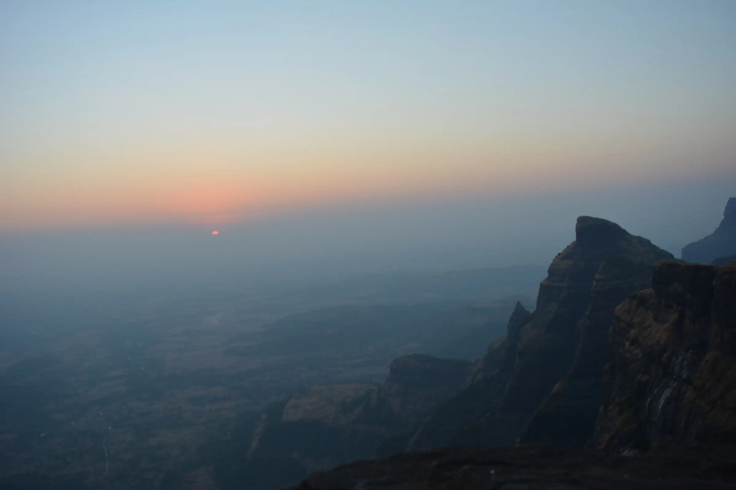
- Konkan Kada, a huge concave cliff that drops into the Konkan, famous for sunsets, vertical cloud bursts and the rare circular rainbow (Brocken spectre)
- The 6th-century Harishchandreshwar temple and caves, where daily worship still continues
- Kedareshwar cave, with a five-foot Shiva linga standing in ice-cold water all year
- Taramati Peak, the highest point of the fort, with views to Alang, Madan, Kulang, Kalsubai and Naneghat
- Fireflies in the Khireshwar forest before the monsoon and wildflowers on the plateau after it
Risks
- The Tolar Khind rock patch is steep (about 65-70 degrees); the fixed poles and chains become slippery in rain and very hot after about 11 am in sun.
- Peak monsoon brings slippery rock, swollen streams and leeches; Indiahikes advises avoiding the Khireshwar route in peak monsoon and summer, and a 2025 rockfall injured trekkers descending in heavy rain.
- Trail markings on the Khireshwar route are inconsistent and junctions on the plateau are confusing in fog; take a local guide on a first visit.
- The fort lies in Kalsubai-Harishchandragad Wildlife Sanctuary; the Forest Department has closed nearby spots in the monsoon in some years, so check for a current order before going.
- Never go near the Konkan Kada edge in wind, fog or the dark.
Know before you go
Questions
Which route to Harishchandragad should I take?
Pachnai (about 3 km one way, around 2 hours) is the easiest and suits beginners. Khireshwar via Tolar Khind (about 6-7 km one way) is the most popular and moderate, with one steep rock patch. Nalichi Vaat from Belpada is a technical route that needs ropes and experienced leaders.
Do I need a permit for Harishchandragad?
Indiahikes and Explurger say no forest department permit is needed and entry is free. Some operators include small entry charges in their packages, and the fort is inside a wildlife sanctuary, so check locally for any fee or seasonal order.
When is the best time to trek Harishchandragad?
August to February. October and November are the most recommended: trails are dry, the plateau is green and views from Konkan Kada are clear. December-January nights are cold (around 3-5 °C on the plateau). The monsoon is beautiful but slippery, and March to May is hot and dry.
Can I camp on top of Harishchandragad?
Yes. There are no camping restrictions; people camp near the Harishchandreshwar temple or shelter in the caves. Wind on the plateau can be strong, so peg tents well and stay away from the Konkan Kada edge.
How do I reach Khireshwar by public transport?
Take a local train from Mumbai to Kalyan, then an MSRTC bus towards Alephata via Malshej Ghat and get off at Khubi Phata. From there it is about 5 km (about 1.5 hours) on foot along the Pimpalgaon Joga dam to Khireshwar. From Pune, take a bus to Alephata and a Kalyan-bound bus to Khubi Phata.
Is food available on the trek?
On the Khireshwar side food is limited to a few village homes and a tea stall at Tolar Khind, so carry packed food. On the plateau, villagers run stalls selling meals, lemon water and buttermilk, especially on weekends.
In an emergency
Save these numbers before you lose signal. Tap to call.
- 112All emergenciesIndia’s single emergency number — works in every state
- 108Ambulance
- 1077District disaster control room
You are in
District: Ahilyanagar (Ahmednagar); the Khireshwar base village is in Junnar taluka, Pune districtMaharashtra
- Nearest hospital
- Not confirmed; the nearest towns with medical care are Otur and Junnar on the Pune side. Confirm locally before the trek.
- Last ATM
- Not confirmed; there is none at Khireshwar, so carry cash from Kalyan, Junnar or Alephata.
- Phone network
- Not confirmed by our sources; expect patchy or no signal on the forest trail and plateau.
Before you set off
- Tell someone your route and when you will be back.
- Carry a charged phone and a power bank.
- Download an offline map of the route.
- Turn back if the weather turns bad — the mountain will wait.
Questions about Harishchandragad
No questions yet. Ask something and trekkers who have done it can answer.
Share your trek photo with #TreksAndTrails
I trekked this
Did Harishchandragad look different from this page? Tell us what changed and we will check it.
Where this comes from
Sources
Last reviewed:
- The Complete Guide to Harishchandragad Trek — Indiahikes
- DIY Guide to Harishchandragad Trek — Bikat Adventures
- Harishchandragad Trek: Routes, Konkan Kada, Distance and Best Time — Explurger
- Harishchandragad Trek — TrekUp India
- Harishchandragad Trek via Khireshwar — Treks and Trails India
- Harishchandragad Fort Monsoon Trek 2026 — Bhatakna Tours and Travels
- Harishchandragad — Wikipedia
Photos: Swapnilraikar, CC BY-SA 4.0; Tokendra, CC BY-SA 4.0; Avinash Rohra, CC BY-SA 4.0