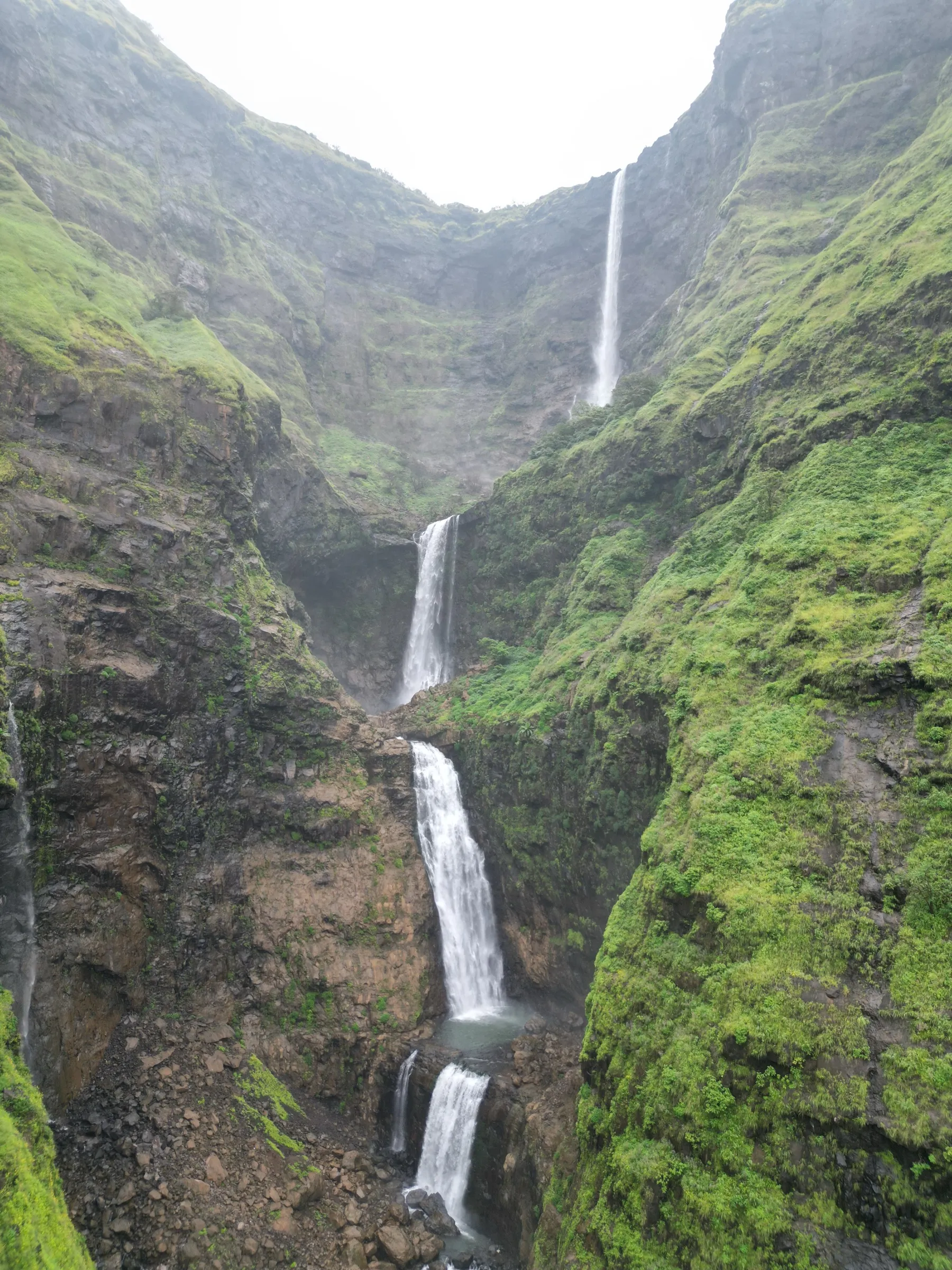
Kalu Waterfall Trek
Thane (Murbad taluka); the falls drop from the Khireshwar plateau in Junnar taluka, Pune, Maharashtra
Opens without signal on this phone, with the map file and checklist. Saved for offline →
 350 mhighest point
- Max altitude
- 350 m
- Days
- 1 day
- Distance
- 4 km
- Difficulty
- Moderate
Short (about 2 km each way) but wet and slippery, with several stream crossings and a crossing of the Kalu river itself, which in heavy rain needs a guide-run rope or zipline and can become impassable within minutes.
The route
Day by day
Day 1 · highest point
Thitabi road-head (near Sawarne) → Thitabi road-head (via the base of Kalu Waterfall)
270 m → 350 m → 270 m
Ups and downs
Altitude profile
Where it is
Map
Trailhead and high point only — not a recorded track. Use it with a proper map.
Weather
Next 5 days on the trail
Live forecast for the trailhead and the high point. Mountain weather changes fast — check again on the morning you start.
Trailhead · Thitabi Waghachiwadi road-head, near Sawarne
at 270 mLoading forecast…
High point · Base of Kalu Waterfall (God's Valley)
at 350 mLoading forecast…
Each day: high / low °C · rain mm and chance · snow cm · wind km/h
Weather data: Open-Meteo.comModel forecast, not an official warning. For alerts follow IMD and the local administration.
Plan the trip
How to reach
- Trailhead
- Thitabi Waghachiwadi road-head, near Sawarne (nearest town: Murbad)
- Nearest railway
- Kalyan Junction
- Nearest airport
- Chhatrapati Shivaji Maharaj International Airport, Mumbai
- By road
- Kalyan (about 80 km via Murbad on the Kalyan-Ahilyanagar highway; get down at Sawarne below Malshej Ghat); Pune (about 130 km via Narayangaon, Alephata and Malshej Ghat)
- Drive
- About 3.5 h from Mumbai
Plan the trip
Permits and fees
We could not confirm the current permit rules and fees from an official source. Check with the local forest department or tourism office before you go.
Plan the trip
Cost
Self-guided
₹500–1,500
With an operator
₹1,499–1,799
Per person, ex-Mumbai. Guided prices published October 2026 with return transport from Mumbai: Bhatakna ₹1,499 (+5% GST), Mischief Treks ₹1,500, Adventure Club Pune ₹1,799. Without transport (meet at the base village) operators quote ₹699-1,199. Self-guided is an estimate: local train to Kalyan, ST bus towards Malshej to Sawarne and back, the local zipline crossing (about ₹100 when it runs), food at the village stalls and, strongly advised in monsoon, a local guide.
Gear
Top picks for this trek
The gear that matters most on this route, chosen from its altitude, season and risks.
 Ad · affiliate link
 Ad · affiliate link
 Ad · affiliate link
 Ad · affiliate link
 Ad · affiliate link
- Ad · affiliate link
 Ad · affiliate link
 Ad · affiliate link
Store buttons open a search on that store, not a product we picked. As an Amazon Associate we earn from qualifying purchases. Photos show the kind of item, not a specific product. Affiliate disclosure
Packing checklist
Matched to this trek: altitude, season, days and the risks on the route.
Packed 0 of 23
Monsoon months (Jul–Sep): pack everything in plastic or a dry bag and wear shoes with good grip.
Tick each item as it goes in the bag.
Know before you go
Good to know
- Mobile network
- Patchy; operators warn that network issues may hamper connectivity at the base village.
- Last ATM
- Murbad (none at Sawarne or Thitabi)
- Nearest hospital
- Murbad for first care; Kalyan for serious cases
- Water
- Streams and the Kalu river along the trail, but carry 2-3 litres; treat any stream water. Tea and food stalls operate at the base village and along the route on monsoon weekends.
Highlights
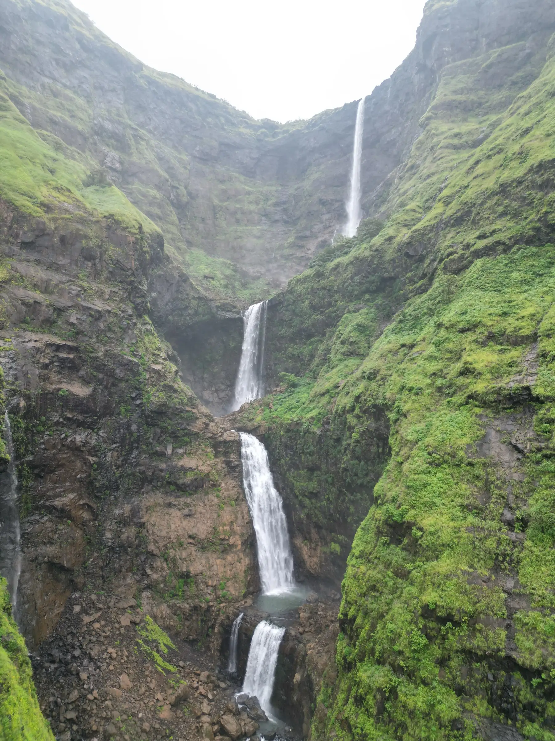
- Standing below Kalu Waterfall, a roughly 1,200 ft multi-tier monsoon cascade dropping from the Khireshwar plateau into God's Valley
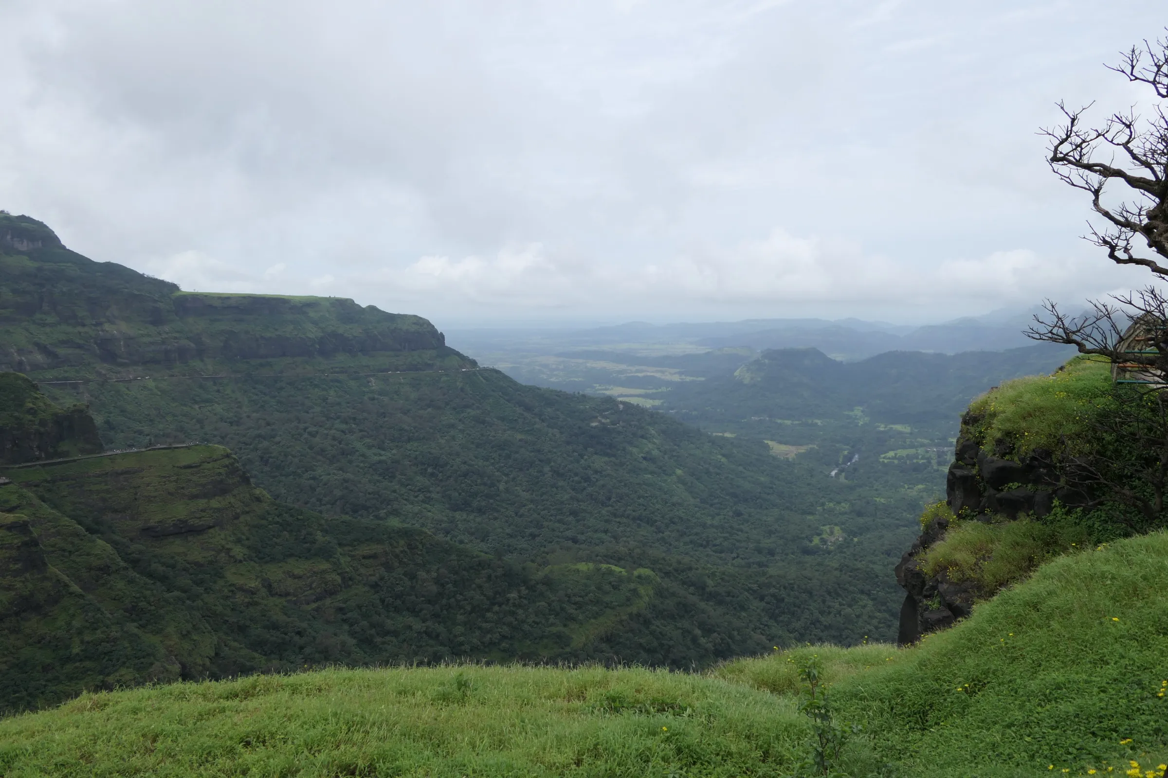
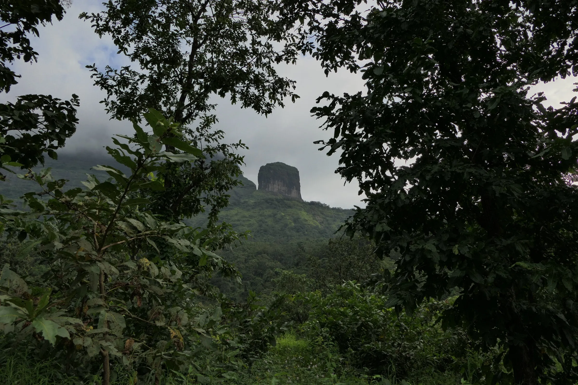
- Forest trail and stream crossings beside the Kalu river below the Malshej Ghat cliffs
- Zipline or rope crossing of the Kalu river run by local villagers when the river is high
- Short enough for a one-day trip from Mumbai, Thane or Pune
Risks
- Drownings: two young visitors were swept away while crossing the Kalu river near the waterfall on 25 July 2026 after rain upstream raised the water suddenly. Never cross the river without a guide-run rope or zipline, and never enter the plunge pool.
- Flash floods: on 26 July 2025 about 300 trekkers were stranded near Waghachiwadi when about 200 mm of rain fell in three hours and the Kalu river rose. Forest staff and villagers rescued them by zipline over seven hours. If the sky darkens over the plateau, turn back at once.
- Monsoon closures: one operator reports the trek was banned after the July 2026 deaths and reopened on 8 August 2026. Thane district has issued monsoon prohibitory orders covering 'all waterfalls in Malshej Ghat' in past years (2021, 2023), and the forest department can close the route on red-alert days. Check the current order with Tokawade police or the forest range before you go.
- Wet basalt near the falls is very slippery, with a fall risk past the marked viewing area; leeches, and venomous snakes such as pit vipers, are present in the forest.
Know before you go
Questions
How long is the Kalu Waterfall trek?
About 2 km each way (operators quote 1.8-2 km one side, about 4 km in all) from the road-head near Sawarne and Thitabi, taking around 2 hours each way. One trip report counts about 6 km one way from Thitabi village because part of the rough track can also be driven.
When is the best time to see Kalu Waterfall?
It is a monsoon waterfall: it flows from late June or early July to late September, with full flow in July and August and a calmer, safer trail in September. Water drops sharply after October and the cliffs are dry from December to May.
Is the Kalu Waterfall trek open or banned?
There is no permanent ban, but access is closed at times in the monsoon. After two visitors drowned in July 2026 the trek was stopped and, per Mischief Treks, reopened on 8 August 2026; past Thane district orders have closed all Malshej Ghat waterfalls for the monsoon. Operators were running departures in October 2026. Check the current order before going.
Is there a zipline at Kalu Waterfall?
Yes. When the Kalu river is high, local villagers anchor a zipline or rope across it; a trip report puts the charge at about ₹100 per person. If the river is too high, guides stop at a viewpoint short of the base.
Can I see Kalu Waterfall without the valley trek?
Yes. A top viewpoint near Khireshwar village on the Pune side is a 40-60 minute flat walk and is the better choice for families with young children.
In an emergency
Save these numbers before you lose signal. Tap to call.
- 112All emergenciesIndia’s single emergency number — works in every state
- 108Ambulance
- 1077District disaster control room
You are in
District: Thane (Murbad taluka); the falls drop from the Khireshwar plateau in Junnar taluka, PuneMaharashtra
- Nearest hospital
- Murbad for first care; Kalyan for serious cases
- Last ATM
- Murbad (none at Sawarne or Thitabi)
- Phone network
- Patchy; operators warn that network issues may hamper connectivity at the base village.
Before you set off
- Tell someone your route and when you will be back.
- Carry a charged phone and a power bank.
- Download an offline map of the route.
- Turn back if the weather turns bad — the mountain will wait.
Questions about Kalu Waterfall
No questions yet. Ask something and trekkers who have done it can answer.
Share your trek photo with #TreksAndTrails
I trekked this
Did Kalu Waterfall look different from this page? Tell us what changed and we will check it.
Where this comes from
Sources
Last reviewed:
- Kalu Waterfall Trek 2026 | God's Valley | Malshej Ghat — Treks and Trails India (treksandtrails.org)
- Kalu Waterfall - God Valley Trek - Old Malshej Ghat Route — Mischief Treks
- Kalu Waterfall Trek - God Valley Trek 2026 — Bhatakna
- Kalu Waterfall Trek Pune 2026 — Bhatakna
- Kalu Waterfall - God Valley Trek From Mumbai — Adventure Club Pune
- Kalu waterfall: Thrilling trek in beautiful God Valley, Malshej ghat — The Free Bird (trip report)
- Pune: Two Tourists Drown in Kalu River Near Malshej Ghat After Sudden Rise in Water Level — Punekar News
- Pune: 300 Trekkers Rescued After Sudden Flooding in Malshej Ghat's Kalu River Due to Heavy Rainfall — Punekar News (2025 report)
- Famous Tourist Spots In Maharashtra to Remain Closed till August 30 (Thane district order, 2023) — Pune Pulse
Photos: Daksh121, CC BY-SA 4.0