Bhairavgad Moroshi Trek
Thane, Maharashtra
Opens without signal on this phone, with the map file and checklist. Saved for offline →
- Max altitude
- 705 m
- Days
- 1 day
- Distance
- 10 km
- Difficulty
- Challenging
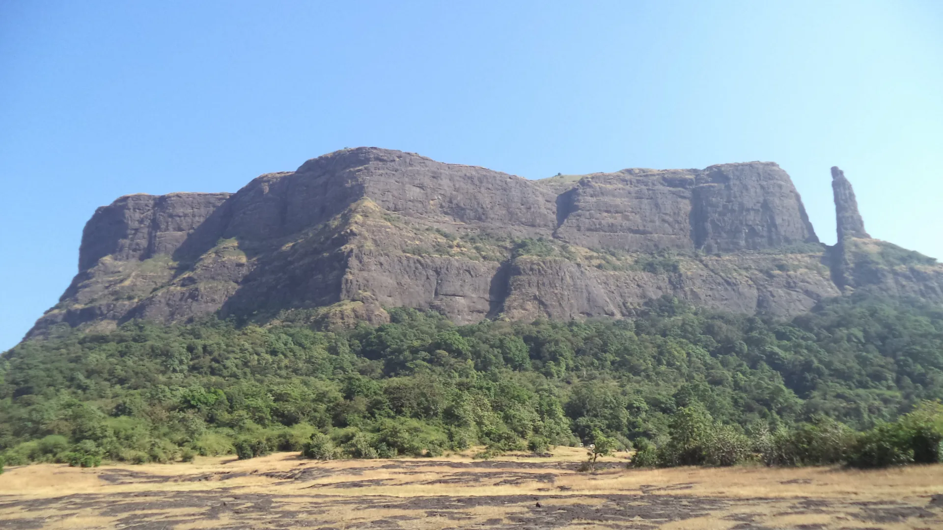
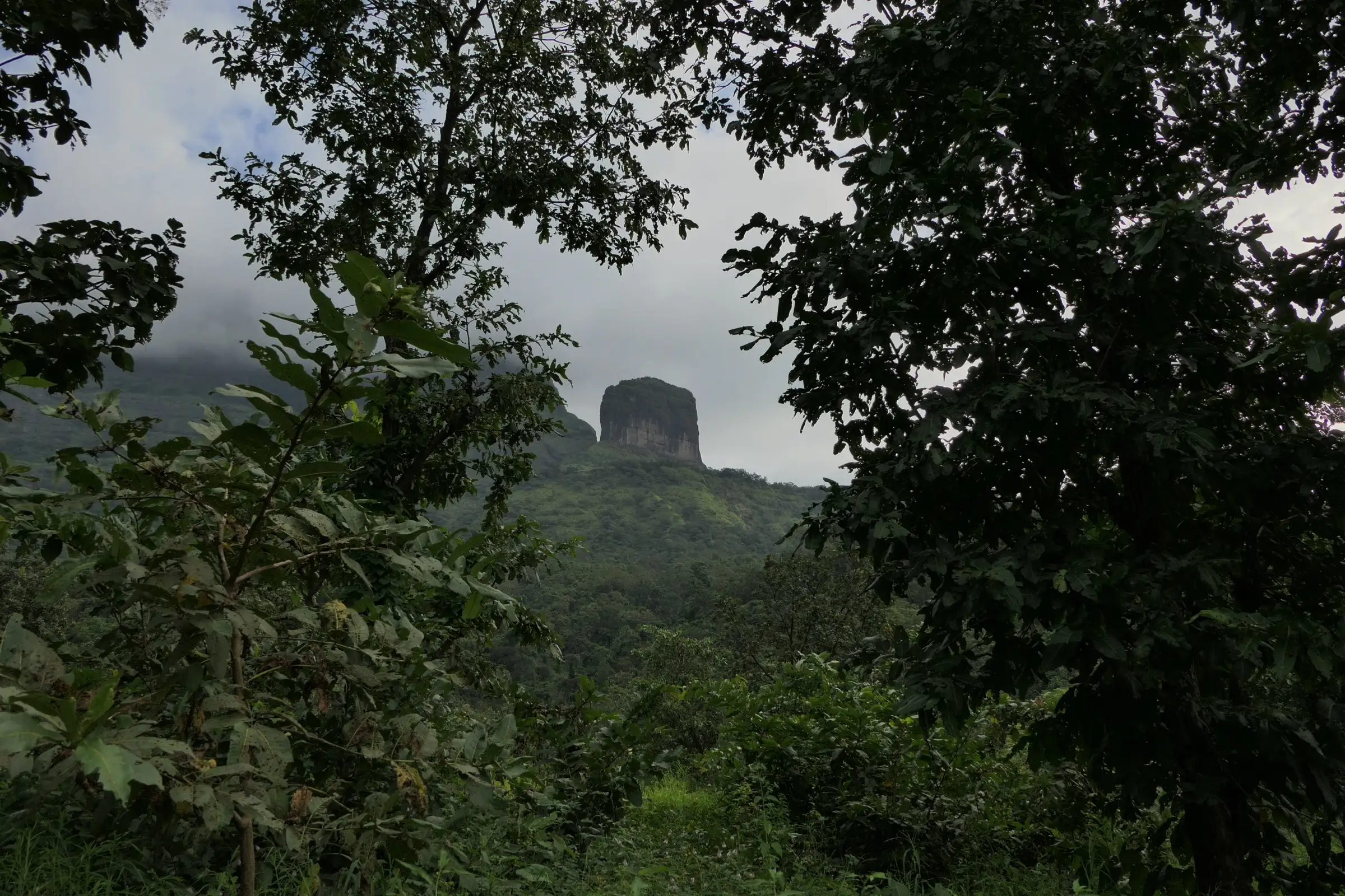
The walk to the machi (plateau) is gradual, but the citadel stands on a sheer basalt dyke. The only way up is a line of broken, narrow rock-cut steps at about 80 degrees, with one section where the steps were blown away. That section needs a rope and real rock-climbing moves, and operators bring harnesses, ropes and rappel the descent. Without climbing gear and a trained team the summit should not be attempted.
Photos
On the trail
The route
Day by day
Day 1 · highest point
Moroshi → Moroshi (via Bhairavgad machi and citadel)
190 m → 705 m → 190 m
Ups and downs
Altitude profile
Where it is
Map
Trailhead and high point only — not a recorded track. Use it with a proper map.
Weather
Next 5 days on the trail
Live forecast for the trailhead and the high point. Mountain weather changes fast — check again on the morning you start.
Trailhead · Moroshi
at 190 mLoading forecast…
High point · Bhairavgad citadel (top of the dyke)
at 705 mLoading forecast…
Each day: high / low °C · rain mm and chance · snow cm · wind km/h
Weather data: Open-Meteo.comModel forecast, not an official warning. For alerts follow IMD and the local administration.
Plan the trip
How to reach
- Trailhead
- Moroshi (nearest town: Murbad)
- Nearest railway
- Kalyan Junction
- Nearest airport
- Chhatrapati Shivaji Maharaj International Airport, Mumbai
- By road
- Mumbai (about 115 km via Kalyan and Murbad on the Kalyan–Malshej road); Kalyan (about 75 km; ST buses and shared jeeps towards Malshej Ghat stop at Moroshi); Pune (about 135 km via Junnar and Malshej Ghat)
- Drive
- About 3 h from Mumbai
Plan the trip
Permits and fees
We could not confirm the current permit rules and fees from an official source. Check with the local forest department or tourism office before you go.
Plan the trip
Cost
Self-guided
₹300–1,000
With an operator
₹750–1,699
Per person, ex-Mumbai or ex-Pune, as listed on operator pages in October 2026. Treks and Trails India: ₹1,200 if you drive to the base village, ₹1,699 with bus from Mumbai or Pune (breakfast, lunch and technical equipment included). Mischief Treks: ₹750 if you reach the base yourself, ₹1,600 with bus from Mumbai (rappelling and safety equipment included). Self-guided is an estimate for reaching the machi only: train to Kalyan, ST bus or shared jeep to Moroshi and back, plus food. The citadel needs a climbing team with ropes and harnesses, so do not plan the summit self-guided.
Gear
Top picks for this trek
The gear that matters most on this route, chosen from its altitude, season and risks.
 Ad · affiliate link
 Ad · affiliate link
 Ad · affiliate link
- Ad · affiliate link
 Ad · affiliate link
 Ad · affiliate link
 Ad · affiliate link
 Ad · affiliate link
Store buttons open a search on that store, not a product we picked. As an Amazon Associate we earn from qualifying purchases. Photos show the kind of item, not a specific product. Affiliate disclosure
Packing checklist
Matched to this trek: altitude, season, days and the risks on the route.
Packed 0 of 19
Hot days in Mar: start at first light and carry extra water and ORS.
Tick each item as it goes in the bag.
Know before you go
Good to know
- Mobile network
- Not reported by our sources; expect patchy signal on the hillside and check with your trek leader.
- Last ATM
- Murbad, the taluka town on the Kalyan–Malshej road; carry cash for Moroshi.
- Nearest hospital
- Murbad for first aid; Kalyan for serious cases.
- Water
- Treks and Trails India says there is no water on the trek and asks for 2–3 litres. A rock-cut cistern near the base of the dyke is the fort's only drinking-water source (Durgbharari), but a trip report found the water there not potable. Carry at least 3 litres from Moroshi.
Highlights
- A fort built on a basalt dyke: a 400-foot sheer rock wall rising from the Malshej range, clearly visible from the Malshej Ghat road
- Rock-cut steps winding up the eastern face, with cisterns and a crawl-through hole in one of them
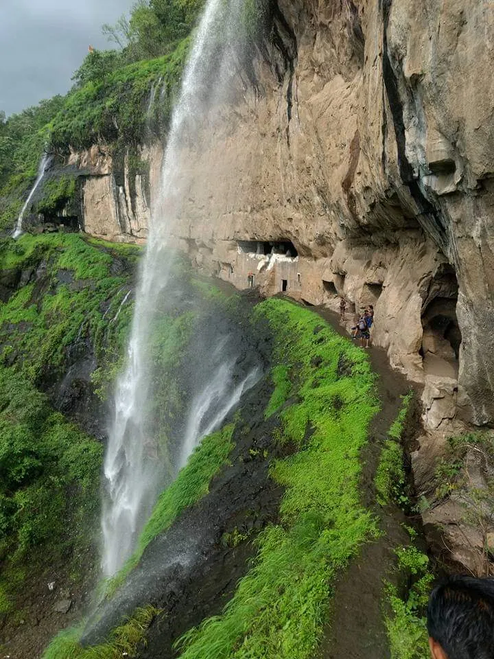
- Rock-cut caves and cisterns on the way, and a Bhairavnath temple on the machi
- Summit views of Naneghat, Jivdhan, Harishchandragad and Ajoba
- An old watch post over the Kalyan–Junnar and Naneghat trade routes
Risks
- Technical climb: the last stretch to the citadel is narrow, broken rock-cut steps at about 80 degrees with a cliff on one side; in one place the steps are missing and you must rock-climb on a rope. Climbing gear (harness, rope, helmet) and a trained team are needed for the summit; the walk to the machi and the col is non-technical.
- The rock wall overhangs in places, pushing you away from the narrow steps, and loose mud and scree lie on the steps. Operators rappel the descent, which is harder than the climb.
- No reliable drinking water on the route; heat on the exposed rock after mid-morning. Start before dawn.
- Monsoon makes the steps and scree very slippery. Thane district bans entry to forts during heavy-rain warnings (the Collector issued such an order in July 2026); check for a current order before a monsoon visit.
- A trip report notes a leopard sighting near the base and advises against starting the climb at night.
- Do not confuse this fort with Bhairavgad near Shirpunje (Akole) or near Chiplun; online altitude figures of 1,523 m belong to the Shirpunje fort.
Know before you go
Questions
Do I need rock-climbing gear for Bhairavgad Moroshi?
For the summit, yes. Durgbharari says you need climbing equipment and climbing technique to reach the citadel, and operators bring technical gear and rappel down. The walk from Moroshi to the machi and the base of the dyke is a normal, gradual trek.
Where does the Bhairavgad Moroshi trek start?
From Moroshi village on the Kalyan–Malshej road in Murbad taluka. About 100 m past the police check post towards Malshej, a Forest Department arch marks the path up to the fort.
How long does the trek take?
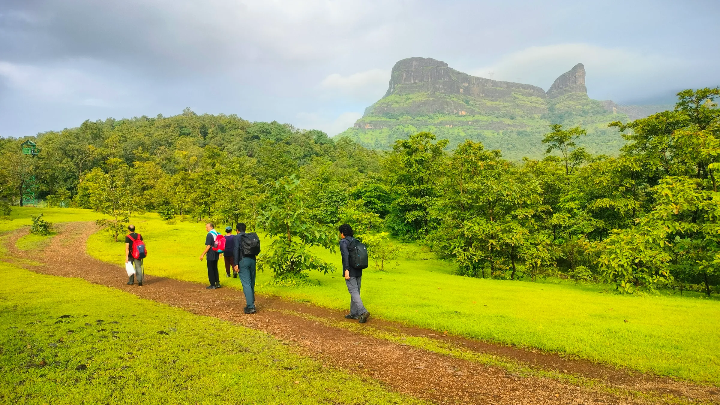
About 1.5 to 2 hours to the machi, 45 minutes to the col below the steps and about an hour up the steps to the top. Operators plan roughly 9 hours base to base, longer in big groups because each person climbs the rope section one at a time.
What is the best time for Bhairavgad Moroshi?
October to March, when the rock is dry and the weather cool. Avoid the monsoon: the steps get slippery and Thane district may close forts during heavy rain.
How high is Bhairavgad Moroshi?
Durgbharari gives 2,313 ft (about 705 m). Treks and Trails India quotes 2,830 ft but also a base of 624 ft and an ascent of 1,660 ft, which adds up to about 2,284 ft (about 696 m).
In an emergency
Save these numbers before you lose signal. Tap to call.
- 112All emergenciesIndia’s single emergency number — works in every state
- 108Ambulance
- 1077District disaster control room
You are in
District: ThaneMaharashtra
- Nearest hospital
- Murbad for first aid; Kalyan for serious cases.
- Last ATM
- Murbad, the taluka town on the Kalyan–Malshej road; carry cash for Moroshi.
- Phone network
- Not reported by our sources; expect patchy signal on the hillside and check with your trek leader.
Before you set off
- Tell someone your route and when you will be back.
- Carry a charged phone and a power bank.
- Download an offline map of the route.
- Turn back if the weather turns bad — the mountain will wait.
Questions about Bhairavgad Moroshi
No questions yet. Ask something and trekkers who have done it can answer.
Share your trek photo with #TreksAndTrails
I trekked this
Did Bhairavgad Moroshi look different from this page? Tell us what changed and we will check it.
Where this comes from
Sources
Last reviewed:
- Bhairavgad-Moroshi | Durgbharari — Durgbharari (Suresh Nimbalkar)
- Bhairavgad Moroshi Fort Trek From Mumbai Pune — Treks and Trails India
- Bhairavgad Fort Trek and Rappelling — Mischief Treks
- Bhairavgad Moroshi Trek Blog – Difficult & risky — TheFreeBird
- Children's Day 2025: 11-Year-Old Hridya Chavan Conquers Bhairavgad Fort Near Malshej Ghat — Free Press Journal
- Thane bans entry to tourist spots, forts, and water bodies amid heavy rain forecasts (7 July 2026) — Deccan Herald
Photos: Dinesh Valke from Thane, India, CC BY-SA 2.0; Tokendra, CC BY-SA 4.0