Ganpati Gadad Caves Trek
Thane (Murbad taluka), Maharashtra
Opens without signal on this phone, with the map file and checklist. Saved for offline →
 914 mhighest point
- Max altitude
- 914 m
- Satellite terrain suggests about 500 m
- Days
- 1 day
- Distance
- 7 km
- Difficulty
- Easy
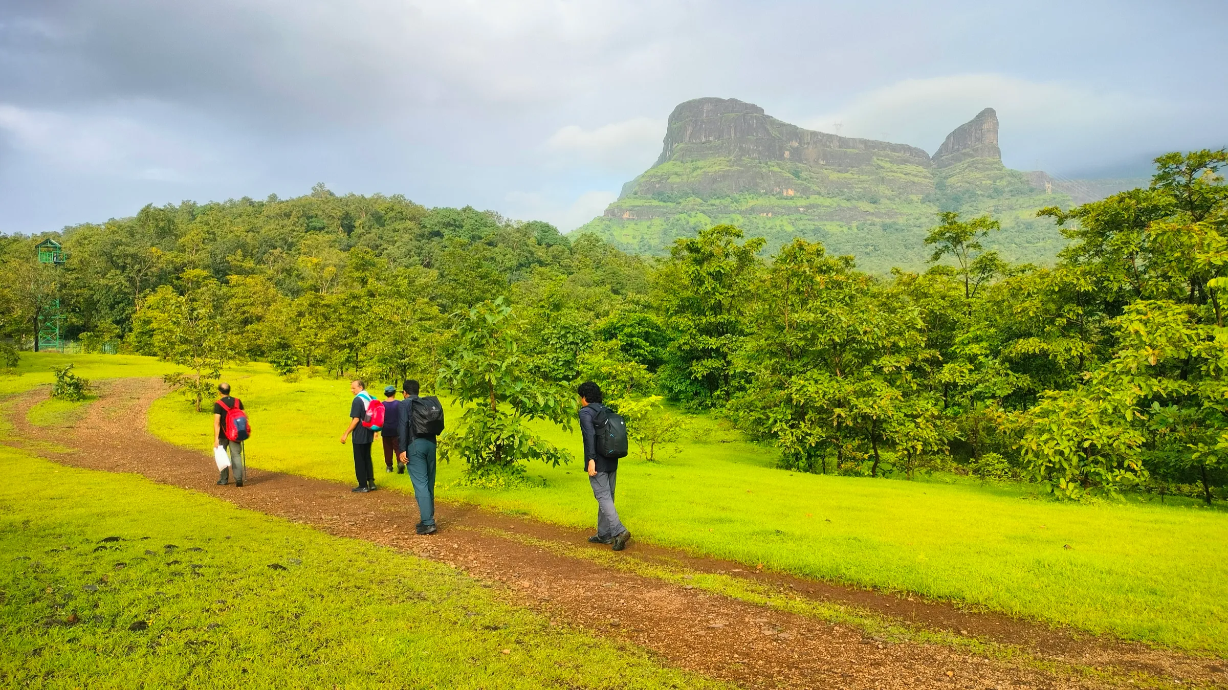
A short half-day walk of about 3.5 km each way from Sonavale: fields and a stream crossing, then a gentle forest climb and two short steep, slippery slopes to the cave ledge. Operators rate it easy, but monsoon mud and streams demand medium stamina.
The route
Day by day
Day 1 · highest point
Sonavale → Sonavale (via Ganpati Gadad caves)
186 m → 914 m → 186 m
Ups and downs
Altitude profile
Where it is
Map
Trailhead and high point only — not a recorded track. Use it with a proper map.
Weather
Next 5 days on the trail
Live forecast for the trailhead and the high point. Mountain weather changes fast — check again on the morning you start.
Trailhead · Sonavale (Sonawale, Palu)
at 186 mLoading forecast…
High point · Ganpati Gadad caves (cave ledge below the waterfall)
at 914 mLoading forecast…
Each day: high / low °C · rain mm and chance · snow cm · wind km/h
Weather data: Open-Meteo.comModel forecast, not an official warning. For alerts follow IMD and the local administration.
Plan the trip
How to reach
- Trailhead
- Sonavale (Sonawale, Palu) (nearest town: Murbad)
- Nearest railway
- Kalyan Junction (operators also pick up at Shahad)
- Nearest airport
- Chhatrapati Shivaji Maharaj International Airport, Mumbai
- By road
- Mumbai (about 120 km, roughly 3 hours by road via Kalyan and Murbad); Murbad (along the road to Umroli, then right towards Dhasai and on to Sonavale; ask locals for the village); Pune (about 180 km, roughly 5 hours by road)
- Drive
- About 3 h from Mumbai
Plan the trip
Permits and fees
We could not confirm the current permit rules and fees from an official source. Check with the local forest department or tourism office before you go.
Plan the trip
Cost
Self-guided
₹400–1,000
With an operator
₹750–1,300
Per person, ex-Mumbai. Guided prices as listed on operator pages in October 2026 (neither showed a scheduled departure): Mischief Treks ₹750 without transport, ₹1,200 with Mumbai pickup and drop; Treks and Trails India ₹1,299 with a non-AC vehicle from Mumbai, breakfast and a trek leader. Self-guided is an estimate: local train to Kalyan, bus or shared jeep via Murbad and Dhasai to Sonavale and back, food, and a local guide if you hire one.
Gear
Top picks for this trek
The gear that matters most on this route, chosen from its altitude, season and risks.
 Ad · affiliate link
 Ad · affiliate link
 Ad · affiliate link
 Ad · affiliate link
- Ad · affiliate link
 Ad · affiliate link
 Ad · affiliate link
 Ad · affiliate link
Store buttons open a search on that store, not a product we picked. As an Amazon Associate we earn from qualifying purchases. Photos show the kind of item, not a specific product. Affiliate disclosure
Packing checklist
Matched to this trek: altitude, season, days and the risks on the route.
Packed 0 of 22
Monsoon months (Jun–Sep): pack everything in plastic or a dry bag and wear shoes with good grip.
Tick each item as it goes in the bag.
Know before you go
Good to know
- Mobile network
- Not confirmed by our sources; expect patchy signal in the forest below the cliff.
- Last ATM
- Murbad (not confirmed for Dhasai)
- Nearest hospital
- Murbad for first care; Kalyan for serious cases (estimate, not stated by our sources)
- Water
- Several streams and small waterfalls along the trail and at the caves in the monsoon. Operators say to carry 2–3 litres; treat stream water.
Highlights
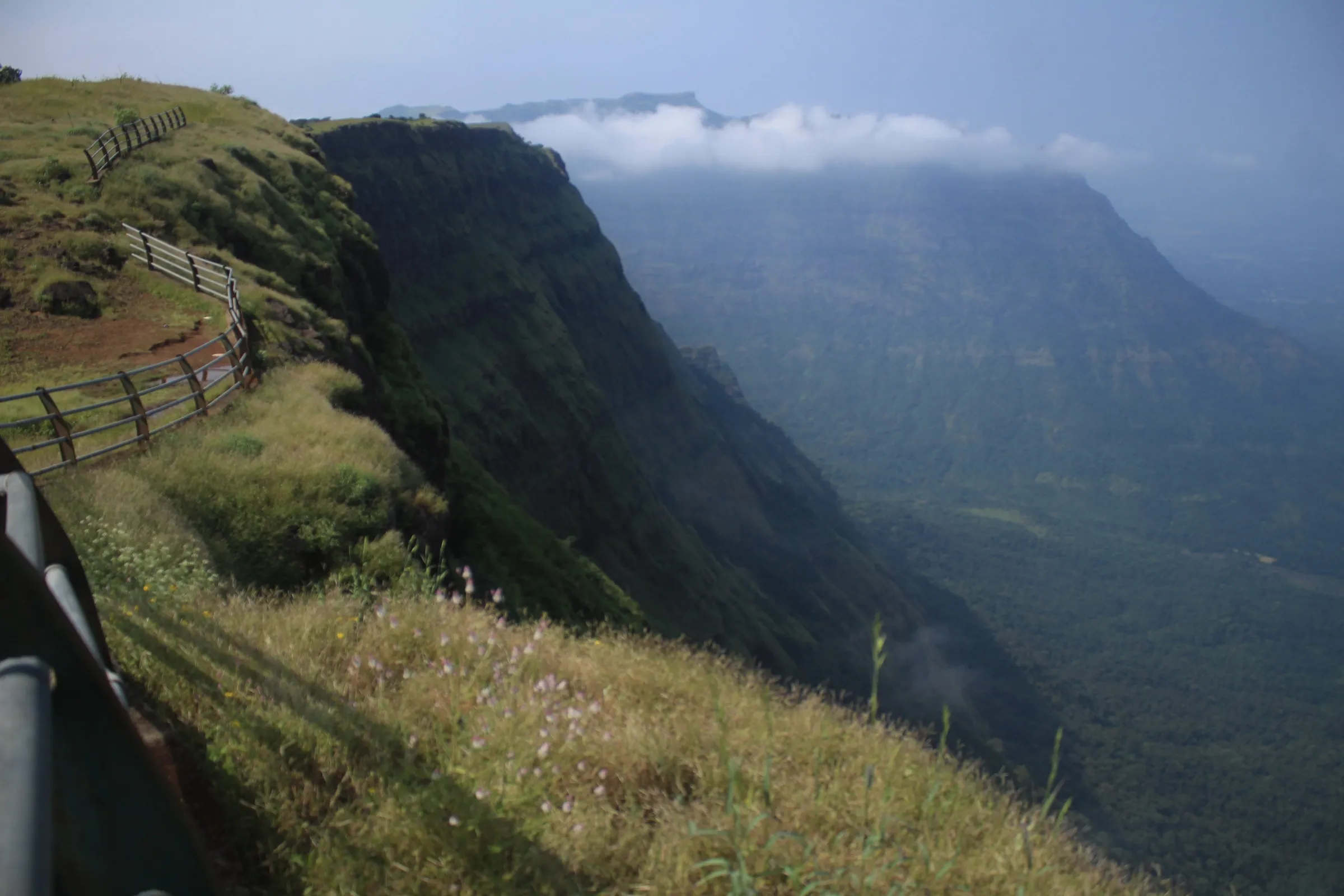
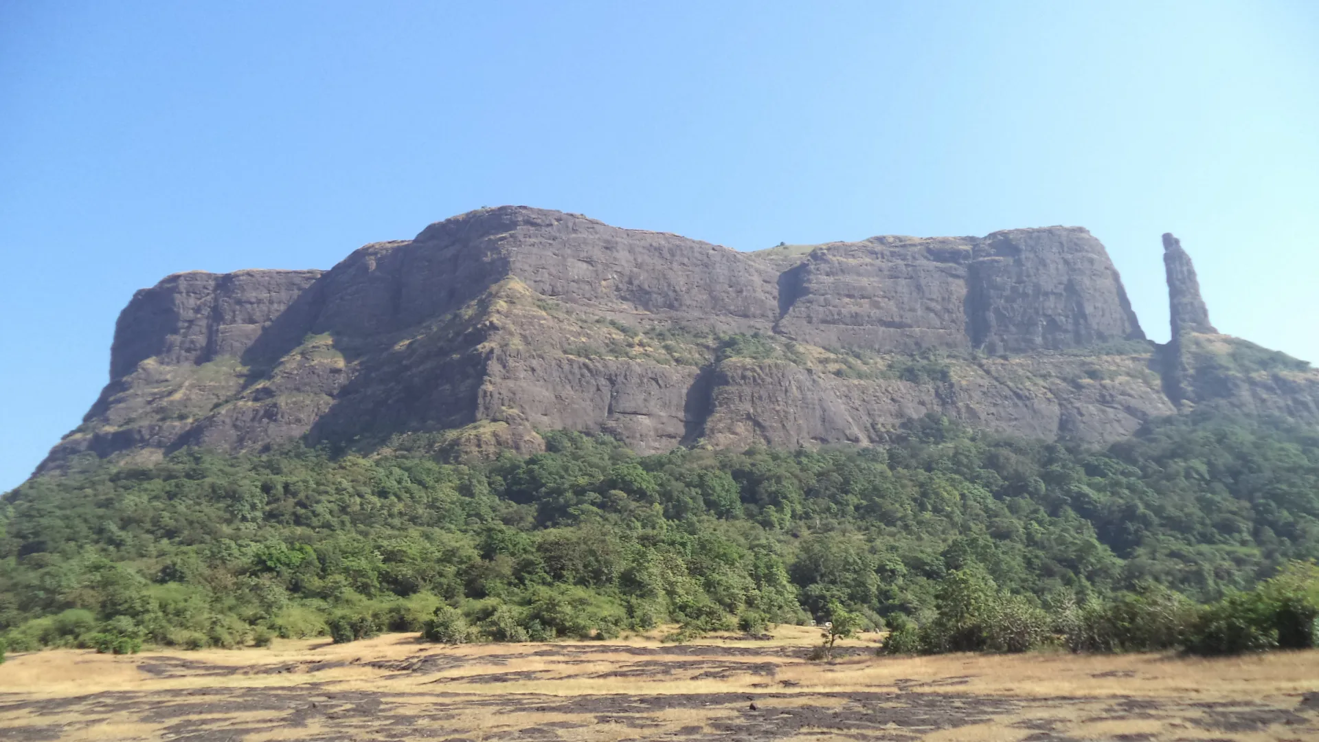
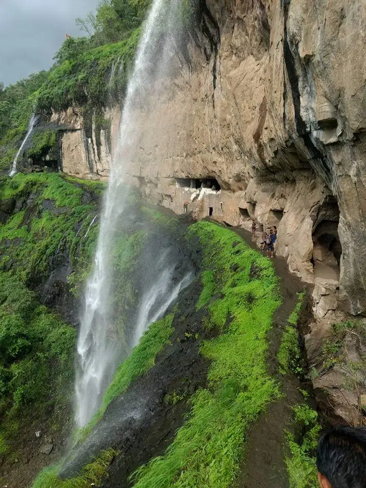
- A row of six or seven rock-cut caves on a ledge in a sheer cliff, with a carved figure of Bhagwan Ganesh in the main cave that gives the place its name (Ganesh Leni in Marathi)
- In the monsoon a tall waterfall pours off the cliff right beside the caves, and smaller falls stream down the rock all around
- A short, green monsoon walk through paddy fields, a stream crossing and forest below the Sahyadri escarpment near Dhasai
- Operators also run a waterfall rappel of about 180 ft here, subject to forest department and local approval
Risks
- The two steep slopes below the cave ledge and the ledge itself are muddy and slippery in rain; the path along the caves runs at the edge of a drop beside the waterfall.
- Stream crossings can rise quickly after heavy rain; do not cross a swollen stream.
- A trip report says trail markers had been removed and the group hired a local guide; Mischief Treks says it is not safe to visit alone. Go with a group or a local guide.
- Waterfall rappelling in heavy rain is dangerous: one trip report describes losing grip when the flow increased, with bruises and injuries.
- Thane district bans entry to forts, waterfalls and water bodies during heavy-rain warnings (for example the Collector's order of July 2026). Check for a current district order before a monsoon visit.
Know before you go
Questions
Where are the Ganpati Gadad caves and what is the base village?
They are in Murbad taluka of Thane district, near Dhasai. The walk starts from Sonavale (also written Sonawale or Palu), about 120 km and roughly 3 hours by road from Mumbai.
How long and how hard is the Ganpati Gadad trek?
It is a short day walk of about 3.5 km each way. Operators rate it easy (easy-moderate in the monsoon) and give 1¼ to 2 hours to reach the caves and about 45 minutes to 1½ hours back down.
When is the best time to visit Ganpati Gadad?
June to October, according to Mischief Treks; operators run it as a monsoon trek, when waterfalls fall around the caves. Check for Thane district heavy-rain orders before going.
Can I do the Ganpati Gadad trek on my own?
The trail is not well marked: a trip report says markers had been removed and the group hired a local guide, and one operator advises against going alone. Ask in Sonavale for a guide.
Is there water on the trail?
In the monsoon there are several streams and small waterfalls, but carry 2–3 litres of drinking water from the village, as operators advise.
In an emergency
Save these numbers before you lose signal. Tap to call.
- 112All emergenciesIndia’s single emergency number — works in every state
- 108Ambulance
- 1077District disaster control room
You are in
District: Thane (Murbad taluka)Maharashtra
- Nearest hospital
- Murbad for first care; Kalyan for serious cases (estimate, not stated by our sources)
- Last ATM
- Murbad (not confirmed for Dhasai)
- Phone network
- Not confirmed by our sources; expect patchy signal in the forest below the cliff.
Before you set off
- Tell someone your route and when you will be back.
- Carry a charged phone and a power bank.
- Download an offline map of the route.
- Turn back if the weather turns bad — the mountain will wait.
Questions about Ganpati Gadad Caves
No questions yet. Ask something and trekkers who have done it can answer.
Share your trek photo with #TreksAndTrails
I trekked this
Did Ganpati Gadad Caves look different from this page? Tell us what changed and we will check it.
Where this comes from
Sources
Last reviewed:
- Ganpati Gadad Caves Trek — Treks and Trails India (treksandtrails.org)
- Ganpati Gadad Trek — Mischief Treks
- Trek to Ganpaty Gadad (trip report, July 2014) — Tripoto
- 180 feet waterfall rappelling: Ganpati Gadad, Murbad — Tripoto (rappelling trip report)
- Ganpati Gadad Caves (path), OpenStreetMap — OpenStreetMap
- Thane bans entry to tourist spots, forts, and water bodies amid heavy rain forecasts (7 July 2026) — Deccan Herald
Photos: Vinodaghane, CC BY-SA 4.0