Durg Dhakoba Trek
Pune (Junnar taluka) on the plateau; the Konkan-side base villages Rampur and Ishtyachiwadi lie below the escarpment in Thane district (Murbad taluka), Maharashtra
Opens without signal on this phone, with the map file and checklist. Saved for offline →
- Max altitude
- 1,250 m
- Days
- 2 days
- Distance
- 22 km
- Difficulty
- Difficult
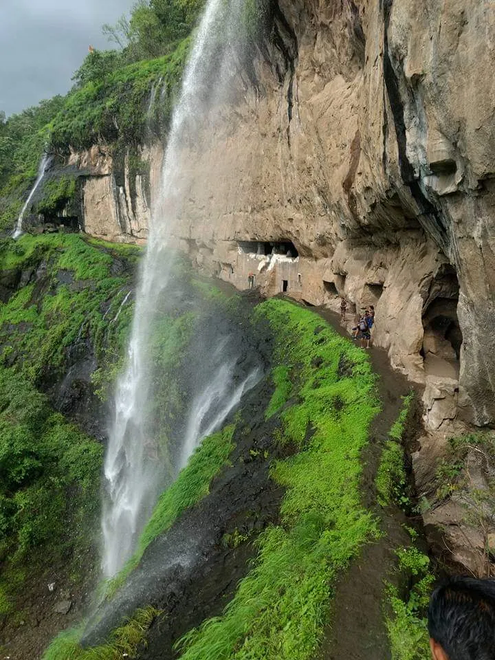
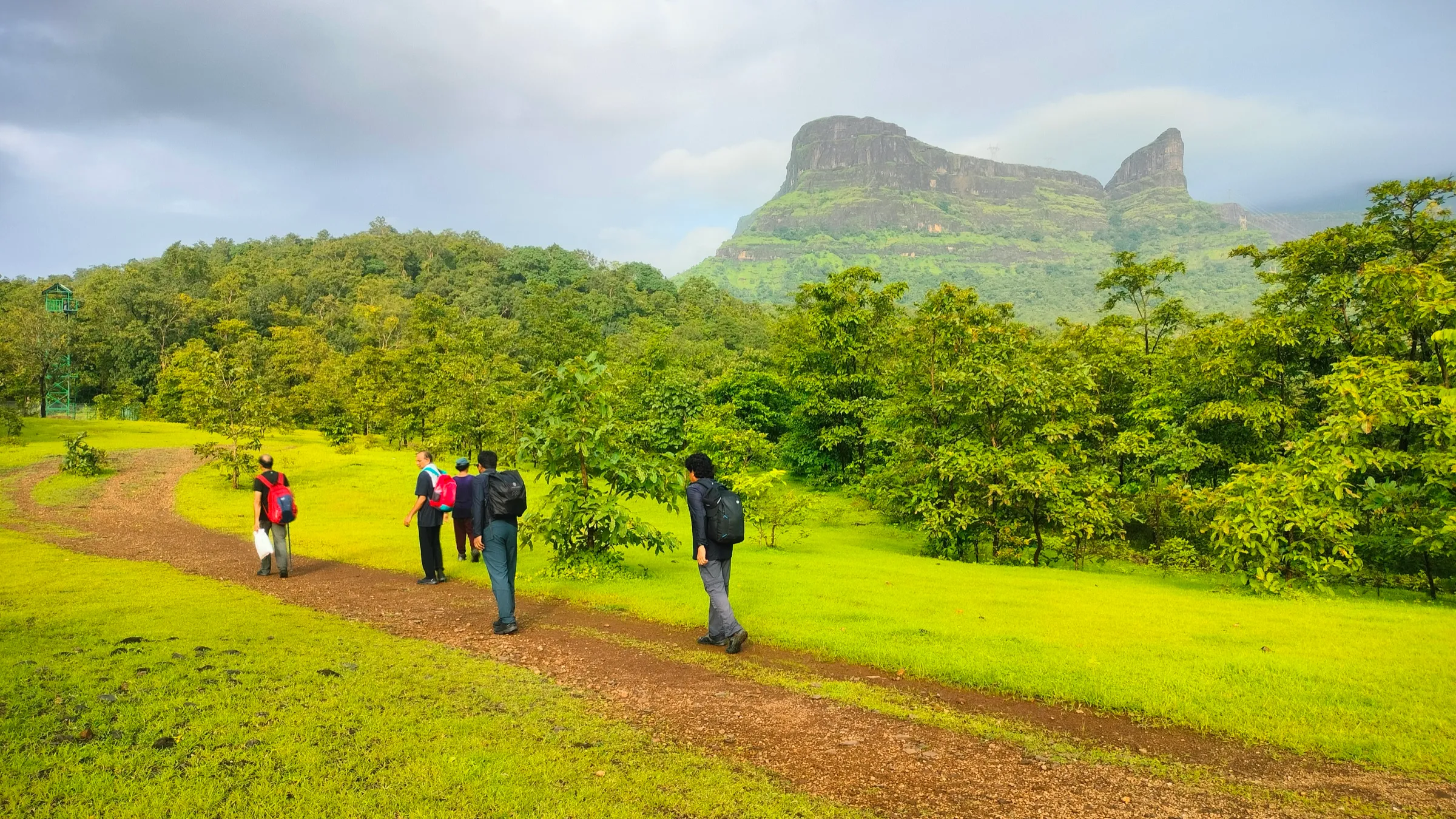
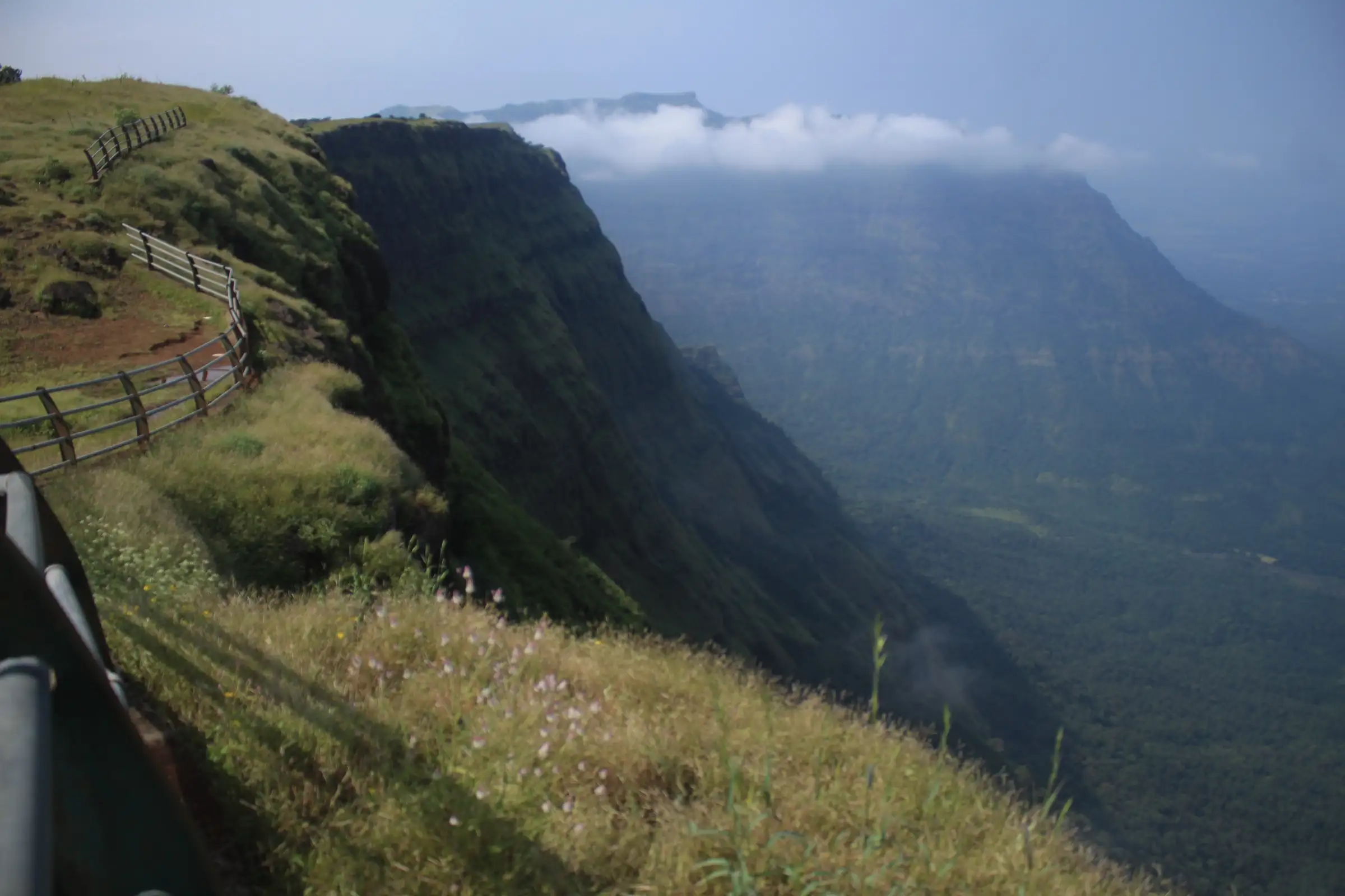
From the Konkan side the route climbs about 950 m up the steep Khutedara ghat, with grassy slopes, two 2-4 m rock patches and a final slope of loose soil and small rocks, then a long, hard-to-follow traverse through forest and meadows and a steep descent down a boulder-filled nala by Darya ghat. Indiahikes calls it challenging even for experienced trekkers; the Deccan-side approach is much easier.
Photos
On the trail
The route
Day by day
Day 1
Rampur → Durg temple (via Khutedara ghat and Durg fort)
200 m → 1,189 m → 1,120 m
Day 2 · highest point
Durg temple → Ishtyachiwadi (via Dhakoba and Darya ghat)
1,120 m → 1,250 m → 210 m
Ups and downs
Altitude profile
Where it is
Map
Trailhead and high point only — not a recorded track. Use it with a proper map.
Weather
Next 5 days on the trail
Live forecast for the trailhead and the high point. Mountain weather changes fast — check again on the morning you start.
Trailhead · Rampur
at 200 mLoading forecast…
High point · Dhakoba summit
at 1,250 mLoading forecast…
Each day: high / low °C · rain mm and chance · snow cm · wind km/h
Weather data: Open-Meteo.comModel forecast, not an official warning. For alerts follow IMD and the local administration.
Plan the trip
How to reach
- Trailhead
- Rampur (nearest town: Murbad)
- Nearest railway
- Kalyan (Central Railway), about 90 km from Rampur by road
- Nearest airport
- Chhatrapati Shivaji Maharaj International Airport, Mumbai
- By road
- Kalyan to Rampur via Murbad and the Malshej Ghat road, about 90 km; Mumbai to Rampur via Kalyan and Murbad, about 120 km; Deccan side: Junnar to Amboli (about 21-22 km) or to Hatvij and Durgawadi (about 34 km) by State Transport bus
- Drive
- About 3.5 h from Mumbai
Plan the trip
Permits and fees
We could not confirm the current permit rules and fees from an official source. Check with the local forest department or tourism office before you go.
Plan the trip
Cost
Self-guided
₹500–1,500
With an operator
₹1,500–3,500
Per person. No operator publishes a current price: Treks and Trails India lists its one-day Durg Dhakoba trek as 'available on request', so the guided range is an estimate based on comparable Sahyadri weekend treks from Mumbai, not a quoted fare. Self-guided is an estimate, ex-Kalyan: State Transport bus or shared jeep via Murbad to Rampur and back from Palu, food for two days and your own tent or a night in the temple.
Gear
Top picks for this trek
The gear that matters most on this route, chosen from its altitude, season and risks.
 Ad · affiliate link
 Ad · affiliate link
 Ad · affiliate link
 Ad · affiliate link
 Ad · affiliate link
 Ad · affiliate link
 Ad · affiliate link
 Ad · affiliate link
Store buttons open a search on that store, not a product we picked. As an Amazon Associate we earn from qualifying purchases. Photos show the kind of item, not a specific product. Affiliate disclosure
Packing checklist
Matched to this trek: altitude, season, days and the risks on the route.
Packed 0 of 24
Tick each item as it goes in the bag.
Know before you go
Good to know
- Mobile network
- Patchy; expect little or no signal in the forest on the plateau and in the ghat
- Last ATM
- Murbad (Konkan side) or Junnar (Deccan side)
- Nearest hospital
- Murbad for first care, Kalyan for serious cases; Junnar on the Deccan side
- Water
- None on the Khutedara ascent: carry 3-4 litres. There is a small lake about 5-10 minutes from the Durg temple, a stream on the plateau that holds water till about January-February, and a well behind the Dhakoba temple that has drinkable water all year. Treat all water.
Highlights
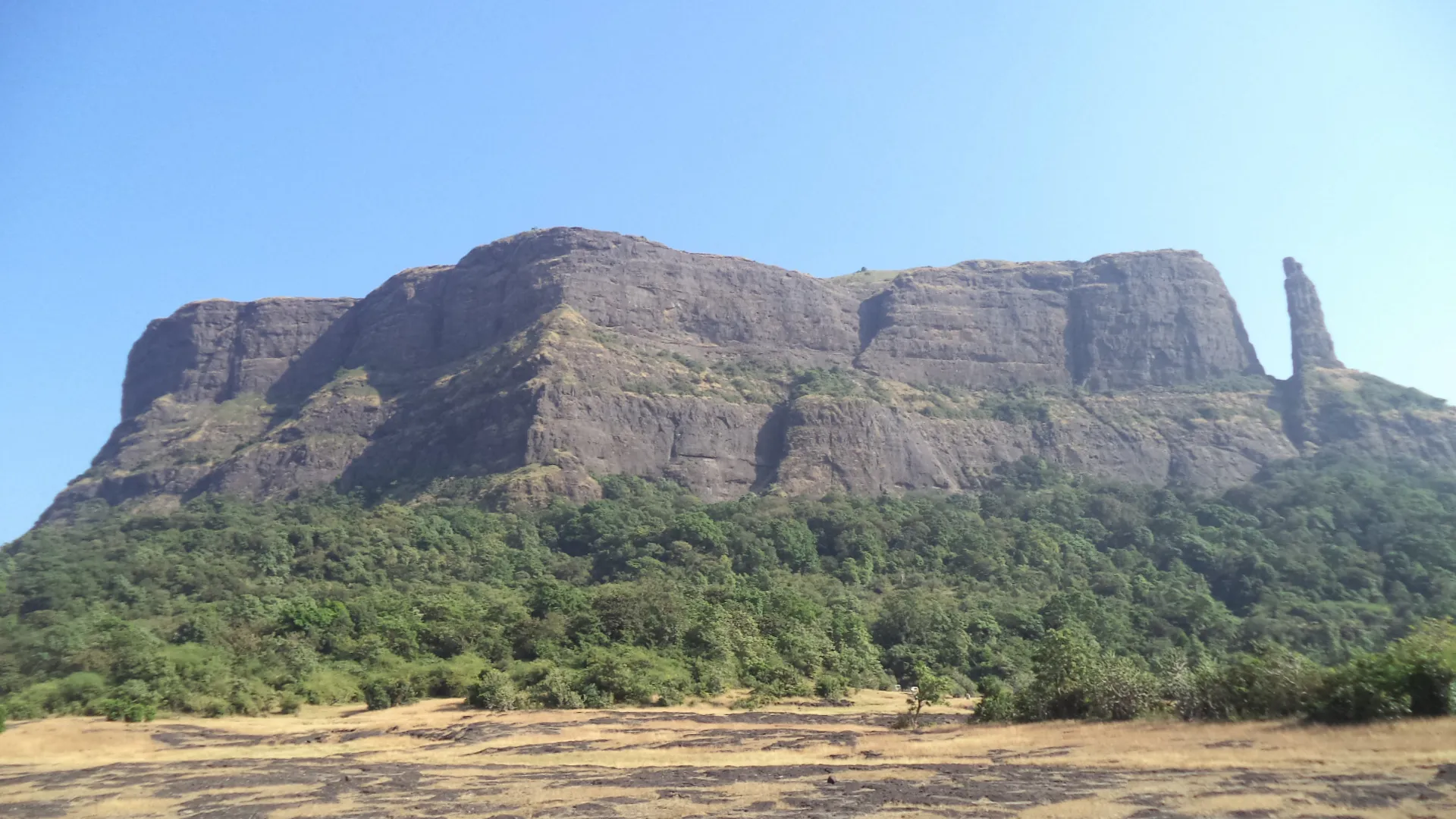
- Dhakoba (about 1,250 m) is one of the highest points on the Sahyadri crest between Malshej Ghat and Bhimashankar, at the source of the Kukdi river
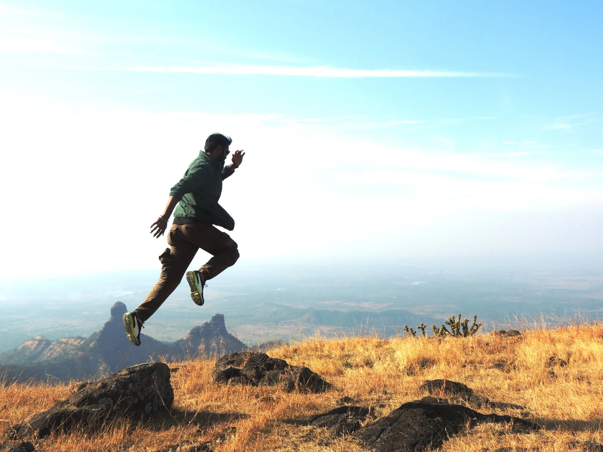
- Wide views over Gorakhgad, Machindragad, Siddhagad and the Bhimashankar forest on one side and Jivdhan, Vanarlingi and Naneghat's Nanacha Angatha on the other
- The shrine of Mata Durga in a dense sacred grove (devrai) below Durg, where the Devi is worshipped in the form of a sacred stone
- The tiled-roof Dhakoba temple on the plateau, with wooden carving inside, a shendur-anointed murti, a small Nandi, a stone deepmal and samadhi stones
- Sheer cliffs dropping to the Konkan, and lush meadows on the plateau covered in yellow flowers after the monsoon
Risks
- The Konkan-side ascent of Khutedara ghat is long and steep, with rock patches of 2-4 m to scramble and a final slope of loose soil and stones; the Darya ghat descent is steep and Indiahikes calls it dangerous, with boulder-hopping down a nala.
- Route-finding: the Durg to Dhakoba traverse runs through dense forest and wide meadows and is hard to follow; after the monsoon the trail can be hidden by tall grass. Go with someone who knows the route or a local guide.
- Monsoon district orders: on 8 July 2026 the Junnar Sub-Divisional Officer issued a prohibitory order for heavy rain covering tourist spots in Junnar taluka, including Amboli Waterfall (Daryaghat) and Kanchan Waterfall (Hatvij) on the approaches to Dhakoba and Durg. Check whether such an order is in force before a monsoon visit.
- In the monsoon, rock and grass are slippery, streams in the nala can run fast and mist hides the cliff edges; do not attempt the Konkan-side ghats in heavy rain.
- No water on the Khutedara ascent and a hot, open climb from October onwards; start early and carry plenty of water.
- There is no accommodation; trekkers stay in the temples or in their own tents.
Know before you go
Questions
How high are Durg and Dhakoba?
Operators give Durg as about 3,900 ft (about 1,190 m) and Dhakoba as about 4,100 ft (about 1,250 m). Durgbharari gives 3,816-3,820 ft for Durg and 4,051 ft for Dhakoba. Dhakoba is the higher of the two.
Is the Durg Dhakoba trek suitable for beginners?
Not from the Konkan side: the climb up Khutedara ghat and the descent by Darya ghat are steep and long. Beginners can approach from the Deccan side, from Amboli or Durgawadi near Junnar, where the plateau is reached with much less effort. Durgbharari rates Durg easy and Dhakoba medium from that side.
How long does the trek take?
The Indiahikes route is two days: Rampur to the Durg temple (8-10 km, 5-6 hours), then Durg to Dhakoba and down Darya ghat to Ishtyachiwadi (12-14 km, 7-8 hours). From the Deccan side it can be done in one day; Durgbharari says Dhakoba takes about an hour and a half to climb from Amboli and the walk between Durg and Dhakoba takes about 2 hours.
Where can I stay and find water on the plateau?
There is no accommodation. Trekkers camp near or stay in the Durg temple or the Dhakoba temple. There is a small lake near the Durg temple and a well behind the Dhakoba temple with drinkable water all year.
Is Durg really a fort?
Durg and Dhakoba are listed as hill forts, but Durgbharari notes there are no remains of fortifications on either top; they were probably used as lookouts over the old trade routes (ghats) between the Konkan and the Deccan.
In an emergency
Save these numbers before you lose signal. Tap to call.
- 112All emergenciesIndia’s single emergency number — works in every state
- 108Ambulance
- 1077District disaster control room
You are in
District: Pune (Junnar taluka) on the plateau; the Konkan-side base villages Rampur and Ishtyachiwadi lie below the escarpment in Thane district (Murbad taluka)Maharashtra
- Nearest hospital
- Murbad for first care, Kalyan for serious cases; Junnar on the Deccan side
- Last ATM
- Murbad (Konkan side) or Junnar (Deccan side)
- Phone network
- Patchy; expect little or no signal in the forest on the plateau and in the ghat
Before you set off
- Tell someone your route and when you will be back.
- Carry a charged phone and a power bank.
- Download an offline map of the route.
- Turn back if the weather turns bad — the mountain will wait.
Questions about Durg Dhakoba
No questions yet. Ask something and trekkers who have done it can answer.
Share your trek photo with #TreksAndTrails
I trekked this
Did Durg Dhakoba look different from this page? Tell us what changed and we will check it.
Where this comes from
Sources
Last reviewed:
- The Complete Guide to the Durg Dhakoba Trek — Indiahikes
- DURG DHAKOBA TREK | Treks and Trails India — Treks and Trails India
- DHAKOBA | Durgbharari — Durgbharari
- DURG | Durgbharari — Durgbharari
- Heavy Rain: Restrictions Imposed at Tourist Spots in Junnar, Ambegaon to Ensure Visitor Safety — Punekar News
Photos: Nikhil More, CC BY-SA 4.0; Nikhil More, CC BY-SA 4.0; Nikhil More, CC BY-SA 4.0