Vishramgad Trek
Ahilyanagar (Ahmednagar), on the Nashik border, Maharashtra
Opens without signal on this phone, with the map file and checklist. Saved for offline →
- Max altitude
- 1,392 m
- Days
- 1 day
- Distance
- 6 km
- Difficulty
- Easy
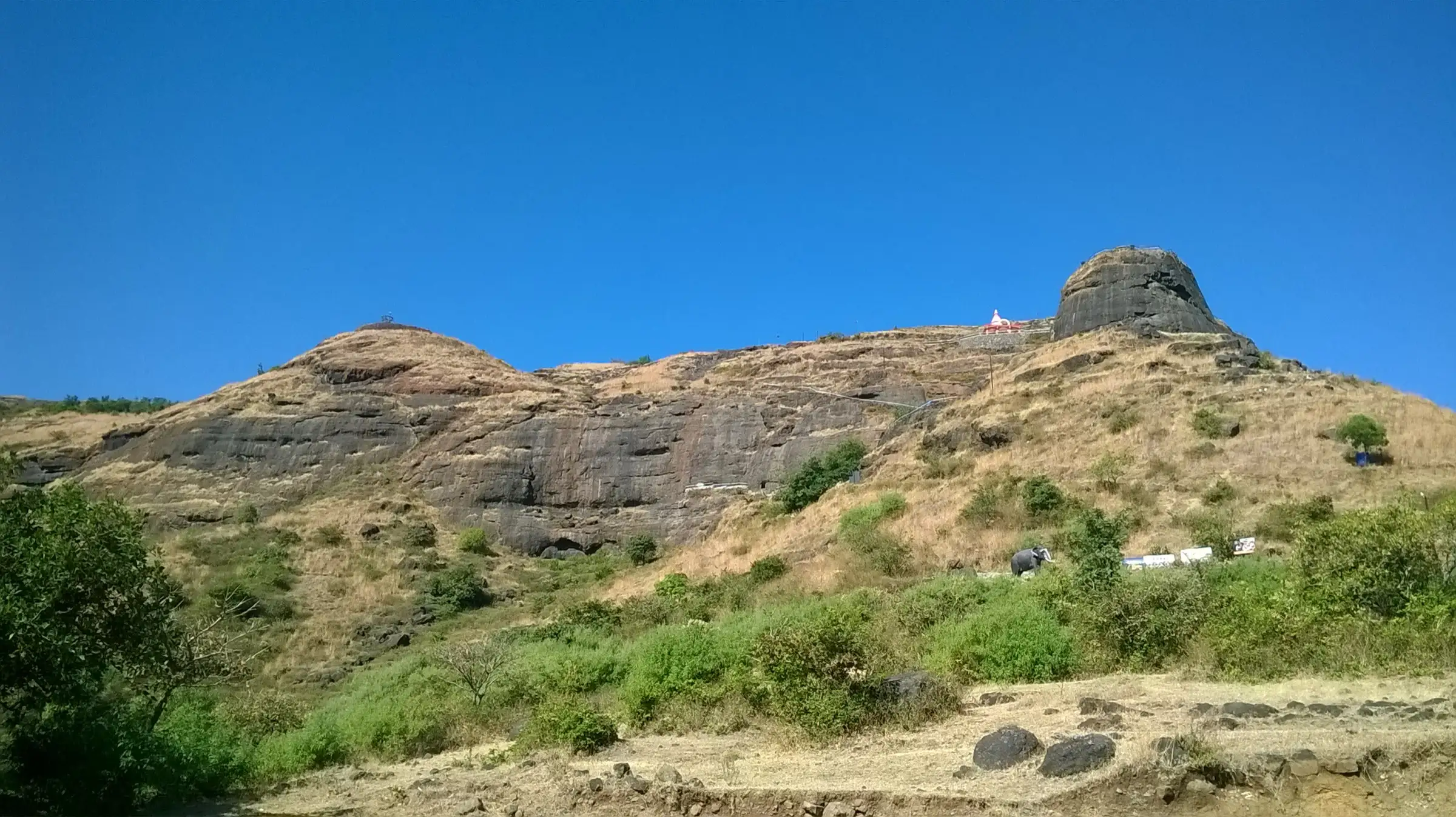
Every source grades it easy: about 900 ft (roughly 300 m) of climbing from Pattawadi on a forest-department path with built steps, about 1–2 hours up; the fort round on the wide plateau adds a few hours of easy walking.
Photos
On the trail
The route
Day by day
Day 1 · highest point
Pattawadi → Pattawadi (via Vishramgad top)
1,060 m → 1,392 m → 1,060 m
Ups and downs
Altitude profile
Where it is
Map
Trailhead and high point only — not a recorded track. Use it with a proper map.
Weather
Next 5 days on the trail
Live forecast for the trailhead and the high point. Mountain weather changes fast — check again on the morning you start.
Trailhead · Pattawadi (Pattewadi)
at 1,060 mLoading forecast…
High point · Vishramgad (Patta Fort) top
at 1,392 mLoading forecast…
Each day: high / low °C · rain mm and chance · snow cm · wind km/h
Weather data: Open-Meteo.comModel forecast, not an official warning. For alerts follow IMD and the local administration.
Plan the trip
How to reach
- Trailhead
- Pattawadi (Pattewadi) (nearest town: Ghoti)
- Nearest railway
- Kasara (Mumbai suburban line); Igatpuri for long-distance trains
- Nearest airport
- Nashik (Ozar) Airport; Mumbai for most flights
- By road
- Kasara station by hired or shared jeep to Pattawadi (operators allow about 2.5–3 hours at night); Ghoti–Bhandardara road to Taked, then 9 km via Mahismal Ghat to the Konkanwadi fork and 8 km on to Pattawadi; Mumbai via Thane, Kalyan and the Nashik highway to Igatpuri and Ghoti
- Drive
- About 4.5 h from Mumbai
Plan the trip
Permits and fees
We could not confirm the current permit rules and fees from an official source. Check with the local forest department or tourism office before you go.
Plan the trip
Cost
Self-guided
₹500–1,500
With an operator
₹1,099–1,200
Per person, ex-Kasara. Treks and Trails India (treksandtrails.org, not related to this site) lists ₹1,099 with Kasara–Kasara jeep and breakfast; Mischief Treks lists ₹1,200 with a shared jeep from Kasara (₹750 if you drive to the base yourself). Neither had dates listed in October 2026. Self-guided is an estimate: local train to Kasara, a jeep to Pattawadi split among a group, a meal in the village and the small forest entry fee.
Gear
Top picks for this trek
The gear that matters most on this route, chosen from its altitude, season and risks.
 Ad · affiliate link
 Ad · affiliate link
 Ad · affiliate link
 Ad · affiliate link
- Ad · affiliate link
 Ad · affiliate link
 Ad · affiliate link
 Ad · affiliate link
Store buttons open a search on that store, not a product we picked. As an Amazon Associate we earn from qualifying purchases. Photos show the kind of item, not a specific product. Affiliate disclosure
Packing checklist
Matched to this trek: altitude, season, days and the risks on the route.
Packed 0 of 21
Monsoon months (Jul–Sep): pack everything in plastic or a dry bag and wear shoes with good grip.
Tick each item as it goes in the bag.
Know before you go
Good to know
- Mobile network
- Not confirmed; expect patchy signal on the plateau and in Pattawadi.
- Last ATM
- Not confirmed; Ghoti or Akole are the nearest towns with banks, so carry cash.
- Nearest hospital
- Not confirmed; Ghoti or Akole for first care, Nashik for serious cases.
- Water
- Durgbharari counts more than 30 rock-cut cisterns; water from a cistern near the Pattai Devi temple is piped to a tap outside the large cave, and a large cistern on the plateau on the way to Aundha holds drinkable water. Carry 2–3 litres and treat tank water.
Highlights
- Chhatrapati Shivaji Maharaj rested here in November 1679 on his way back from Jalna, which is why the fort is called Vishramgad
- The Ambarkhana, a large stone hall restored by the forest department, with a bust of Shivaji Maharaj in a meghadambari outside
- The north-facing Trimbak Darwaja, the Devi Pattai temple beside Satavahana-era rock-cut cisterns, and the row of twelve cisterns called Bara Taki
- Caves on the climb, including the samadhi of Laxman Maharaj, a murti of Devi Chatushrungi and a Jain cave with images of Tirthankara Neminath
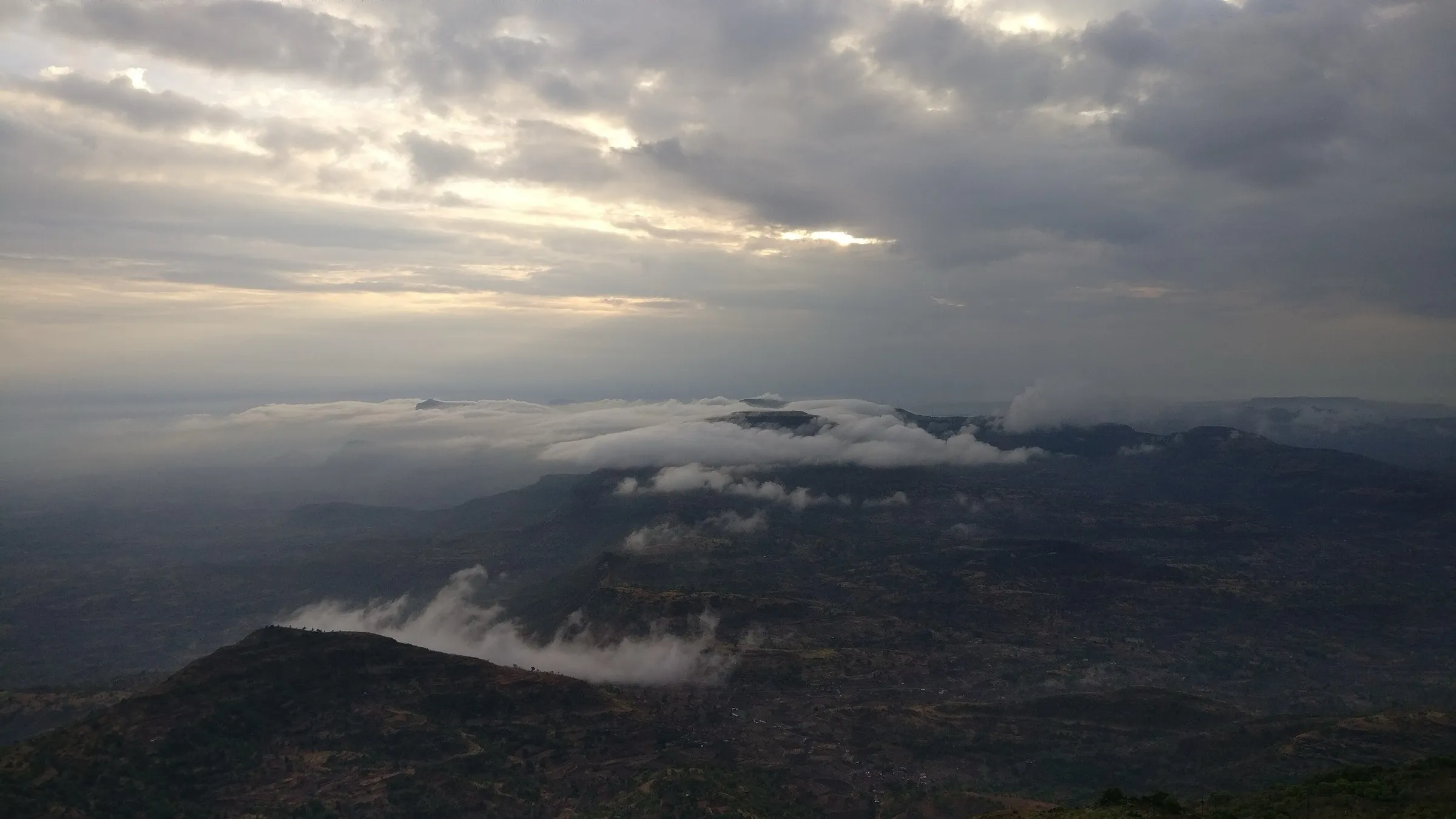
- Views of Aundha, Aad, Bitangad, Kalsubai, Alang, Madan, Kulang and Trimbakgad, and the wind-turbine ridge on the drive to Pattawadi
Risks
- Monsoon (June to September) brings heavy rain, fog and strong wind on the open plateau; the steps and rock-cut sections get slippery.
- The plateau is very windy and has little shade; carry a cap, sunscreen and a windproof layer.
- The route from Konkanwadi and the path towards Aundha Fort are harder than the Pattawadi route; Durgbharari calls the route from the Aundha–Patta path the hardest.
- Most groups reach the base by jeep at night; the last roads through the ghats are narrow.
Know before you go
Questions
Where does the Vishramgad (Patta Fort) trek start?
From Pattawadi, a small village on a plateau at the east foot of the fort. A paved road runs to the base, where a forest department post registers visitors. Durgbharari also lists harder routes from Konkanwadi and from the path between Aundha and Patta.
How long does it take to climb Patta Fort?
About an hour to two hours up from Pattawadi. Treks and Trails India plans one hour up and one hour down; Mischief Treks allows about two hours each way. Durgbharari says a full round of the fort takes about 4 hours.
Why is Patta Fort called Vishramgad?
Chhatrapati Shivaji Maharaj halted and rested here with his army in November 1679 after the Jalna campaign, and the fort was named Vishramgad, the fort of rest.
How do I reach Patta Fort from Mumbai?
Take the late-night Kasara fast local and a jeep to Pattawadi, or drive via Igatpuri and Ghoti to Taked, then through Mahismal Ghat and the Konkanwadi fork to Pattawadi. By car it takes about 4–5 hours.
Is there an entry fee or permit?
No permit is needed. Durgbharari reports a forest department post at the road end where you register and pay a small entry fee; check the current amount locally.
Can you stay on the fort?
Durgbharari says the courtyard in front of the caves has a tin shelter where you can stay, and Wikipedia says the restored Ambarkhana can hold about 200 people overnight. Check with the forest post before planning a night on top.
In an emergency
Save these numbers before you lose signal. Tap to call.
- 112All emergenciesIndia’s single emergency number — works in every state
- 108Ambulance
- 1077District disaster control room
You are in
District: Ahilyanagar (Ahmednagar), on the Nashik borderMaharashtra
- Nearest hospital
- Not confirmed; Ghoti or Akole for first care, Nashik for serious cases.
- Last ATM
- Not confirmed; Ghoti or Akole are the nearest towns with banks, so carry cash.
- Phone network
- Not confirmed; expect patchy signal on the plateau and in Pattawadi.
Before you set off
- Tell someone your route and when you will be back.
- Carry a charged phone and a power bank.
- Download an offline map of the route.
- Turn back if the weather turns bad — the mountain will wait.
Questions about Vishramgad
No questions yet. Ask something and trekkers who have done it can answer.
Share your trek photo with #TreksAndTrails
I trekked this
Did Vishramgad look different from this page? Tell us what changed and we will check it.
Where this comes from
Sources
Last reviewed:
- PATTAGAD | Durgbharari — Durgbharari
- Patta Fort — Wikipedia
- Vishramgad Patta Fort | Treks and Trails India — Treks and Trails India (treksandtrails.org)
- Vishramgad Fort Trek | Mischief Treks — Mischief Treks
- A Hike to Patta Fort #TWC — Holidify (trip report)
- Patta Fort Vishramgad: Your Ultimate Guide To History And Trekking — TripXL
- The Twin Peaks Expedition: Aundha-Patta Trek & Nashik Exploration — ClimbOn Adventure Club
Photos: Ccmarathe, CC BY-SA 4.0; Ccmarathe, CC BY-SA 4.0; Ccmarathe, CC BY-SA 3.0; Ccmarathe, CC BY-SA 3.0