Vishalgad Trek
Kolhapur, Maharashtra
Opens without signal on this phone, with the map file and checklist. Saved for offline →
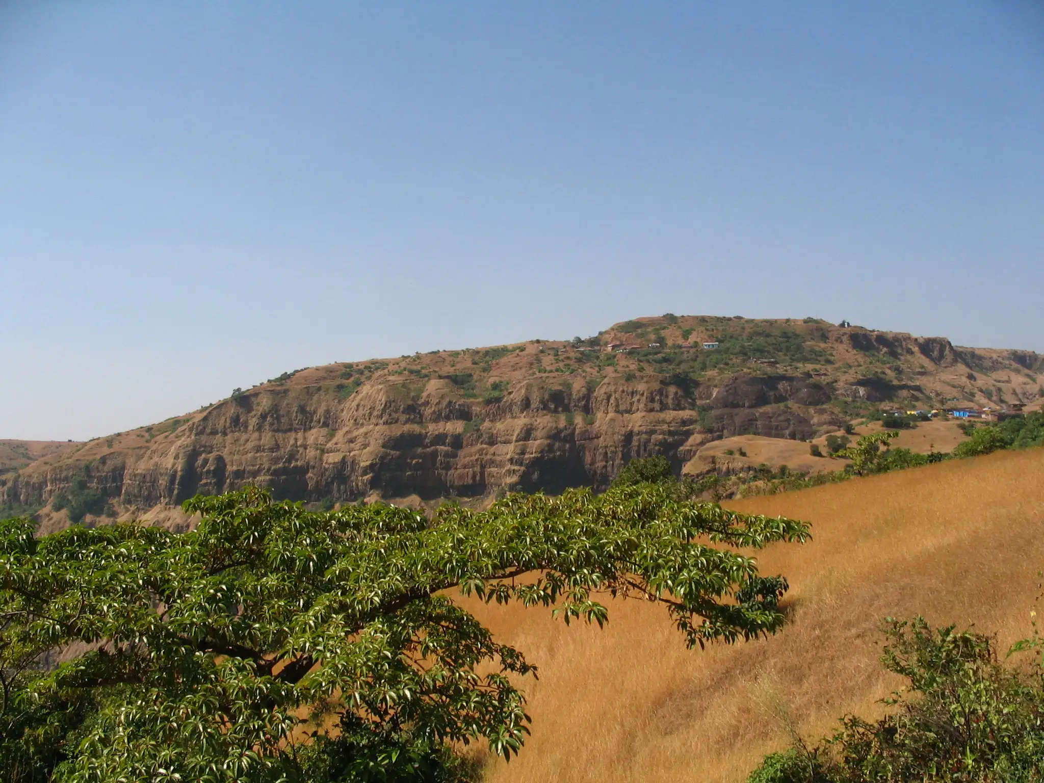
- Max altitude
- 1,090 m
- Satellite terrain suggests about 775 m
- Days
- 1 day
- Distance
- 5 km
- Difficulty
- Easy
From the Gajapur parking the fort is about a 15-minute walk on steps, a bridge and ladders; a full round of the fort takes about six hours on mostly level ground. The older Konkan-side climb from Machal is longer and steeper, about two and a half hours up.
Photos
On the trail
The route
Day by day
Day 1 · highest point
Gajapur (Vishalgad base parking) → Gajapur (round of Vishalgad fort)
740 m → 1,090 m → 740 m
Ups and downs
Altitude profile
Where it is
Map
Trailhead and high point only — not a recorded track. Use it with a proper map.
Weather
Next 5 days on the trail
Live forecast for the trailhead and the high point. Mountain weather changes fast — check again on the morning you start.
Trailhead · Gajapur (Vishalgad base parking, via Malkapur)
at 740 mLoading forecast…
High point · Vishalgad fort top
at 1,090 mLoading forecast…
Each day: high / low °C · rain mm and chance · snow cm · wind km/h
Weather data: Open-Meteo.comModel forecast, not an official warning. For alerts follow IMD and the local administration.
Plan the trip
How to reach
- Trailhead
- Gajapur (Vishalgad base parking, via Malkapur) (nearest town: Malkapur (Shahuwadi taluka))
- Nearest railway
- Kolhapur (Chhatrapati Shahu Maharaj Terminus)
- Nearest airport
- Kolhapur Airport (about 76 km)
- By road
- Kolhapur (about 80 km via Shahuwadi, Malkapur, Pawankhind and Gajapur); Kolhapur (about 85 km via Ratnagiri road and Sakharpa); Konkan side: Lanja taluka (Ratnagiri) to Chinchurti and Machal village for the older climb through the Konkan Darwaja
- Drive
- About 6.5 h from Pune
Plan the trip
Permits and fees
We could not confirm the current permit rules and fees from an official source. Check with the local forest department or tourism office before you go.
Plan the trip
Cost
Self-guided
₹300–1,200
With an operator
₹1,500–3,500
Per person, ex-Kolhapur. We found no operator currently publishing a Vishalgad trek price, so both ranges are our estimates: self-guided = MSRTC bus or shared jeep Kolhapur-Malkapur-Gajapur and back plus food; guided = a typical day trip with transport from Kolhapur run by local trek groups. No entry fee is published.
Gear
Top picks for this trek
The gear that matters most on this route, chosen from its altitude, season and risks.
 Ad · affiliate link
 Ad · affiliate link
 Ad · affiliate link
 Ad · affiliate link
 Ad · affiliate link
 Ad · affiliate link
- Ad · affiliate link
 Ad · affiliate link
Store buttons open a search on that store, not a product we picked. As an Amazon Associate we earn from qualifying purchases. Photos show the kind of item, not a specific product. Affiliate disclosure
Packing checklist
Matched to this trek: altitude, season, days and the risks on the route.
Packed 0 of 17
Tick each item as it goes in the bag.
Know before you go
Good to know
- Mobile network
- Not confirmed by our sources; expect patchy signal on the Konkan edge.
- Last ATM
- Malkapur or Kolhapur; carry cash.
- Nearest hospital
- Malkapur and Shahuwadi for first care; Kolhapur city for serious cases.
- Water
- The rock-cut tank in front of the Amruteshwar temple holds rainwater that a fort-research site describes as drinkable, and a well near the dargah path supplies visitors; carry your own water and treat tank water.
Highlights
- Sheer cliff edges and the Elephant point with views down into the Konkan valleys
- Amruteshwar and Bhagwanteshwar temples of Bhagwan Shiv, with Ram, Hanuman, Vitthal and Ganesh temples on the fort
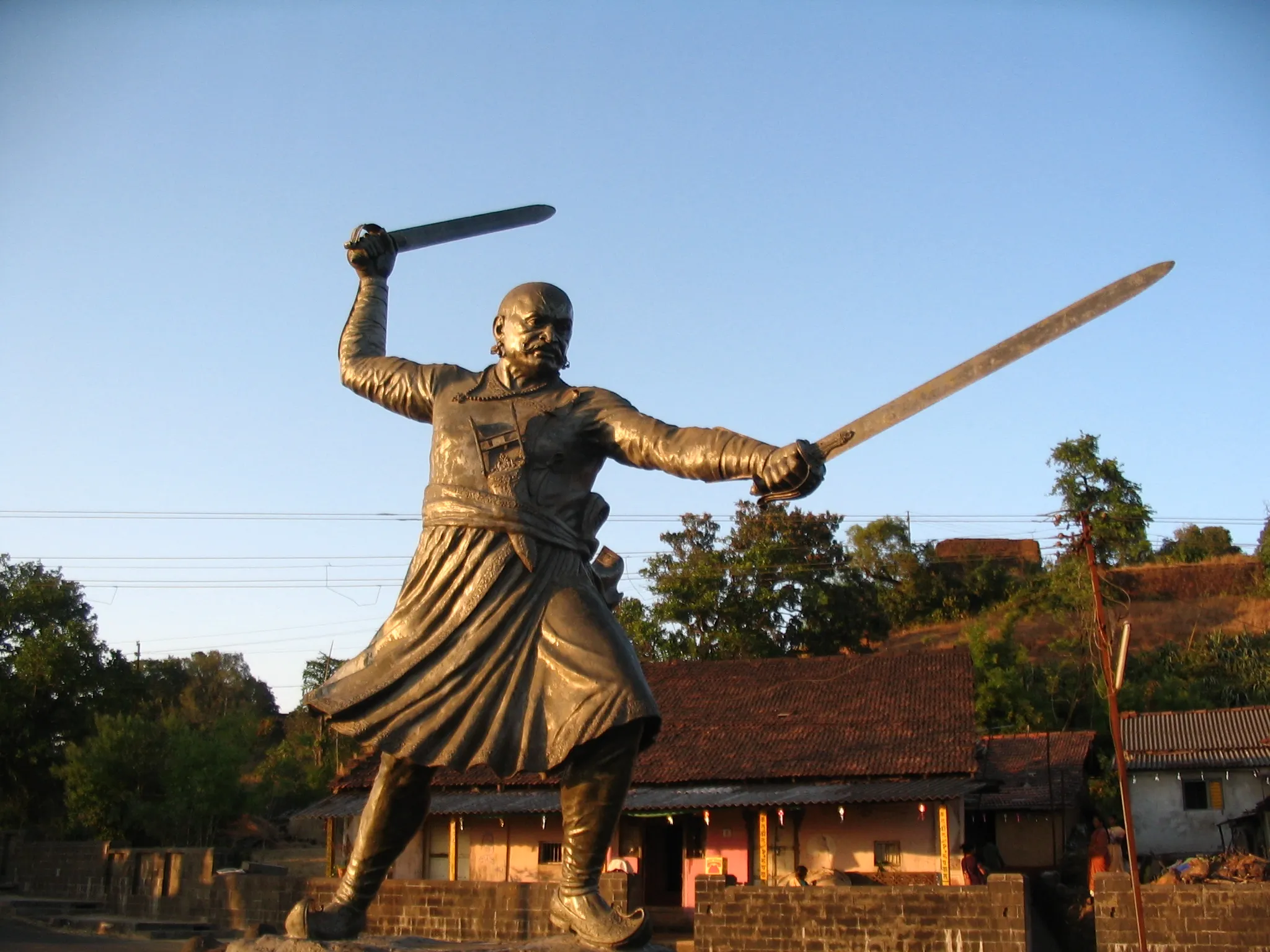
- Memorials of Baji Prabhu Deshpande and Phulaji Prabhu at Pataldari, linked to the battle of Pawankhind
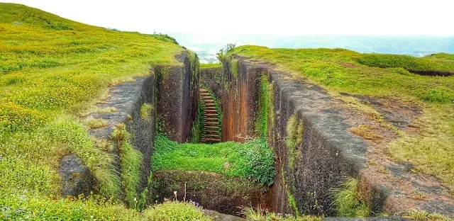
- Mundha Darwaja, Konkan Darwaja, the Pratinidhi Wada and the Ardhachandra stepped tank
Risks
- Access has been restricted at times since July 2024. On 14 July 2024 an anti-encroachment march turned violent at the base of the fort; police issued prohibitory orders under the Maharashtra Police Act for 15-29 July 2024, and the Bombay High Court later stopped further demolitions. A January 2025 report said the administration had closed the Gajapur-Vishalgad road since July 2024. We found no formal 2025-26 order closing the fort to visitors, and a Maharashtra Police team walked Panhala-Pawankhind-Vishalgad in August 2026, but the situation can change around festivals and court hearings: check with Shahuwadi police or the Kolhapur collectorate before you go.
- On 14 May 2026 the government banned animal slaughter and alcohol consumption at Vishalgad, and the district administration has refused permission for some events on the fort; respect these rules and avoid crowds on event days.
- Rock-cut steps, iron ladders and cliff edges with no railing on much of the fort; the steps and ladders turn slippery in the June-September monsoon.
- The Konkan Darwaja route from Machal is a steep 2.5-hour climb through forest; go with someone who knows the path.
- The upper part of the old stone path to the dargah is closed because of illegal construction; use the cement path.
Know before you go
Questions
Is Vishalgad open to visitors now?
We found no formal order closing the fort in 2025-26, but access has been restricted at times since the July 2024 violence during the anti-encroachment drive, and a January 2025 report said the Gajapur road had been closed. A police team reached Vishalgad on foot in August 2026. Check with Shahuwadi police or the Kolhapur collectorate before you travel.
How long does it take to climb Vishalgad?
From the parking at Gajapur the fort is about 15 minutes away on steps, a bridge and ladders. The older climb from Machal village on the Konkan side, through the Konkan Darwaja, takes about two and a half hours. Seeing the whole fort takes about six hours.
How do I reach Vishalgad from Kolhapur?
Vishalgad is about 80 km from Kolhapur via Shahuwadi, Malkapur, Pawankhind and Gajapur, or about 85 km via the Ratnagiri road and Sakharpa. Buses and private vehicles go to Malkapur and on to the base at Gajapur. Kolhapur has the nearest railway station and airport.
What is the best time to visit Vishalgad?
Maharashtra Tourism calls October to February ideal for trekking and sightseeing. June to September brings mist and waterfalls but slippery paths, and March to May is hot, so start early.
Can I stay or get food on the fort?
Basic food and lodging exist on the fort, and houses near the Bhagwanteshwar temple can arrange them if told in advance. Most visitors come as a day trip from Kolhapur.
In an emergency
Save these numbers before you lose signal. Tap to call.
- 112All emergenciesIndia’s single emergency number — works in every state
- 108Ambulance
- 1077District disaster control room
You are in
District: KolhapurMaharashtra
- Nearest hospital
- Malkapur and Shahuwadi for first care; Kolhapur city for serious cases.
- Last ATM
- Malkapur or Kolhapur; carry cash.
- Phone network
- Not confirmed by our sources; expect patchy signal on the Konkan edge.
Before you set off
- Tell someone your route and when you will be back.
- Carry a charged phone and a power bank.
- Download an offline map of the route.
- Turn back if the weather turns bad — the mountain will wait.
Questions about Vishalgad
No questions yet. Ask something and trekkers who have done it can answer.
Share your trek photo with #TreksAndTrails
I trekked this
Did Vishalgad look different from this page? Tell us what changed and we will check it.
Where this comes from
Sources
Last reviewed:
- Vishalgad Fort — Maharashtra Tourism (official)
- Vishalgad — Wikipedia
- Vishalgad — Durgbharari
- Anti-encroachment drive turns violent at Vishalgad fort; cops injured — The Week (PTI)
- Evict encroachments, restore temples and warrior memorials on Vishalgad fort — Hindu Janajagruti Samiti
- Hindu Ekta Andolan demands ban on Urs of Rehan Malik at Vishalgad — Hindu Janajagruti Samiti
- Mumbai Police team completes gruelling 65 km Panhala-Pawankhind-Vishalgad trek — Free Press Journal
Photos: Ankur P from Pune, India, CC BY-SA 2.0; Ankur P from Pune, India, CC BY-SA 2.0; Ankur P from Pune, India, CC BY-SA 2.0; Ankur P from Pune, India, CC BY-SA 2.0