Panhala to Pawankhind Trek
Kolhapur, Maharashtra
Opens without signal on this phone, with the map file and checklist. Saved for offline →
- Max altitude
- 975 m
- Days
- 2 days
- Distance
- 48 km
- Difficulty
- Moderate
Not technical, and mostly gentle descent, but two back-to-back days of about 24 km each (8-11 hours) on mud, paddy bunds, slippery forest trail and swollen monsoon streams make it an endurance test; operators rate it moderate to difficult.
Photos
On the trail
The route
Day by day
Day 1 · highest point
Panhala Fort → Karpewadi (via Masai Pathar and Khotwadi)
930 m → 975 m → 830 m
Day 2
Karpewadi → Pawankhind (via Pandharepani; drive back to Kolhapur)
830 m → 790 m
Ups and downs
Altitude profile
Where it is
Map
Trailhead and high point only — not a recorded track. Use it with a proper map.
Weather
Next 5 days on the trail
Live forecast for the trailhead and the high point. Mountain weather changes fast — check again on the morning you start.
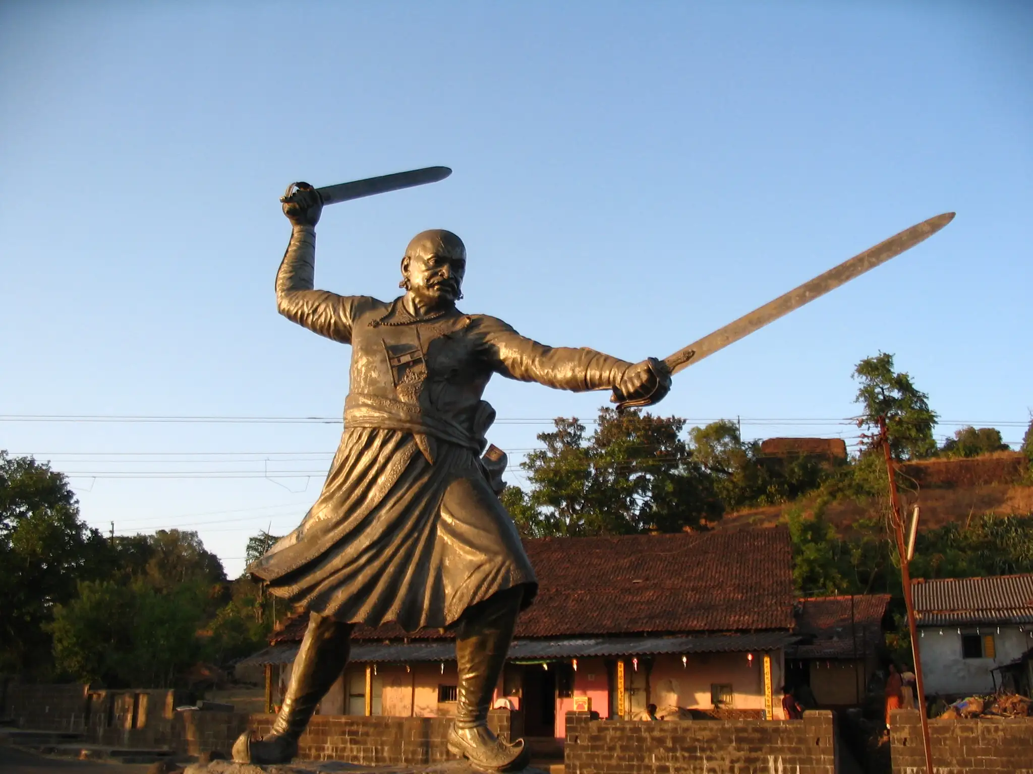
Trailhead · Panhala Fort (Baji Prabhu Deshpande statue)
at 930 mLoading forecast…
High point · Masai Pathar (Masai Plateau)
at 975 mLoading forecast…
Each day: high / low °C · rain mm and chance · snow cm · wind km/h
Weather data: Open-Meteo.comModel forecast, not an official warning. For alerts follow IMD and the local administration.
Plan the trip
How to reach
- Trailhead
- Panhala Fort (Baji Prabhu Deshpande statue)
- Nearest railway
- Kolhapur (Chhatrapati Shahu Maharaj Terminus)
- Nearest airport
- Kolhapur Airport
- By road
- Kolhapur (about 20-25 km to Panhala Fort; MSRTC buses from Kolhapur bus stand); Pune (about 236 km to Kolhapur); Mumbai (about 375 km to Kolhapur); Return: Pawankhind is about 65 km from Kolhapur; local bus or jeep to Malkapur, then bus to Kolhapur
- Drive
- About 5 h from Pune
Plan the trip
Permits and fees
We could not confirm the current permit rules and fees from an official source. Check with the local forest department or tourism office before you go.
Plan the trip
Cost
Self-guided
₹1,200–3,500
With an operator
₹2,300–3,300
Per person. Guided prices seen October 2026: Adventure Club Pune ₹2,299 base package (ex-Panhala) or ₹2,999 ex-Pune, with one homestay night and meals; Ramblers India ₹2,900 ex-Pune and ₹3,300 ex-Mumbai, including transport, meals and a village homestay. Self-guided is an estimate ex-Kolhapur: MSRTC bus to Panhala, a homestay night with dinner at Karpewadi, food on the way, and the return from Pawankhind by bus via Malkapur or a jeep (Indiahikes quotes about ₹1,000 to Malkapur or ₹3,000 to Kolhapur per jeep, shared by the group).
Gear
Top picks for this trek
The gear that matters most on this route, chosen from its altitude, season and risks.
 Ad · affiliate link
 Ad · affiliate link
 Ad · affiliate link
 Ad · affiliate link
- Ad · affiliate link
 Ad · affiliate link
 Ad · affiliate link
 Ad · affiliate link
Store buttons open a search on that store, not a product we picked. As an Amazon Associate we earn from qualifying purchases. Photos show the kind of item, not a specific product. Affiliate disclosure
Packing checklist
Matched to this trek: altitude, season, days and the risks on the route.
Packed 0 of 24
Monsoon months (Jul–Sep): pack everything in plastic or a dry bag and wear shoes with good grip.
Tick each item as it goes in the bag.
Know before you go
Good to know
- Mobile network
- Not confirmed by our sources; expect patchy signal on the plateau, in the forest sections and in the Pawankhind gorge.
- Last ATM
- Kolhapur city; carry cash for homestays and village meals.
- Nearest hospital
- Kolhapur city (about 20-25 km from Panhala); from the Pawankhind end, Malkapur is the nearest town.
- Water
- Villages along the route can give water, and in the rains there are many streams, but stream water may be muddy. Carry your own water and treat stream water.
Highlights
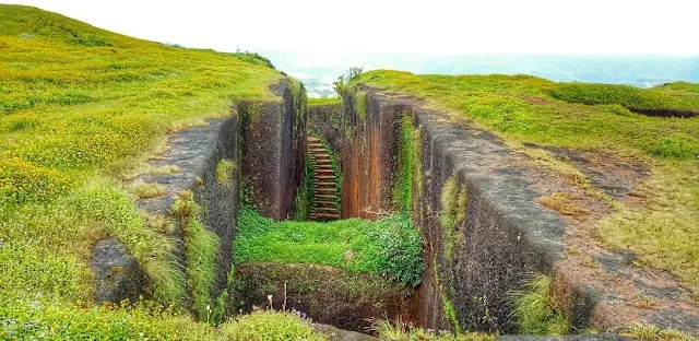
- Walk the escape route Chhatrapati Shivaji Maharaj took from besieged Panhala in July 1660, starting at the Baji Prabhu Deshpande statue on Panhala Fort
- Panhala Fort is one of the twelve forts of the Maratha Military Landscapes of India, inscribed as a UNESCO World Heritage Site in 2025
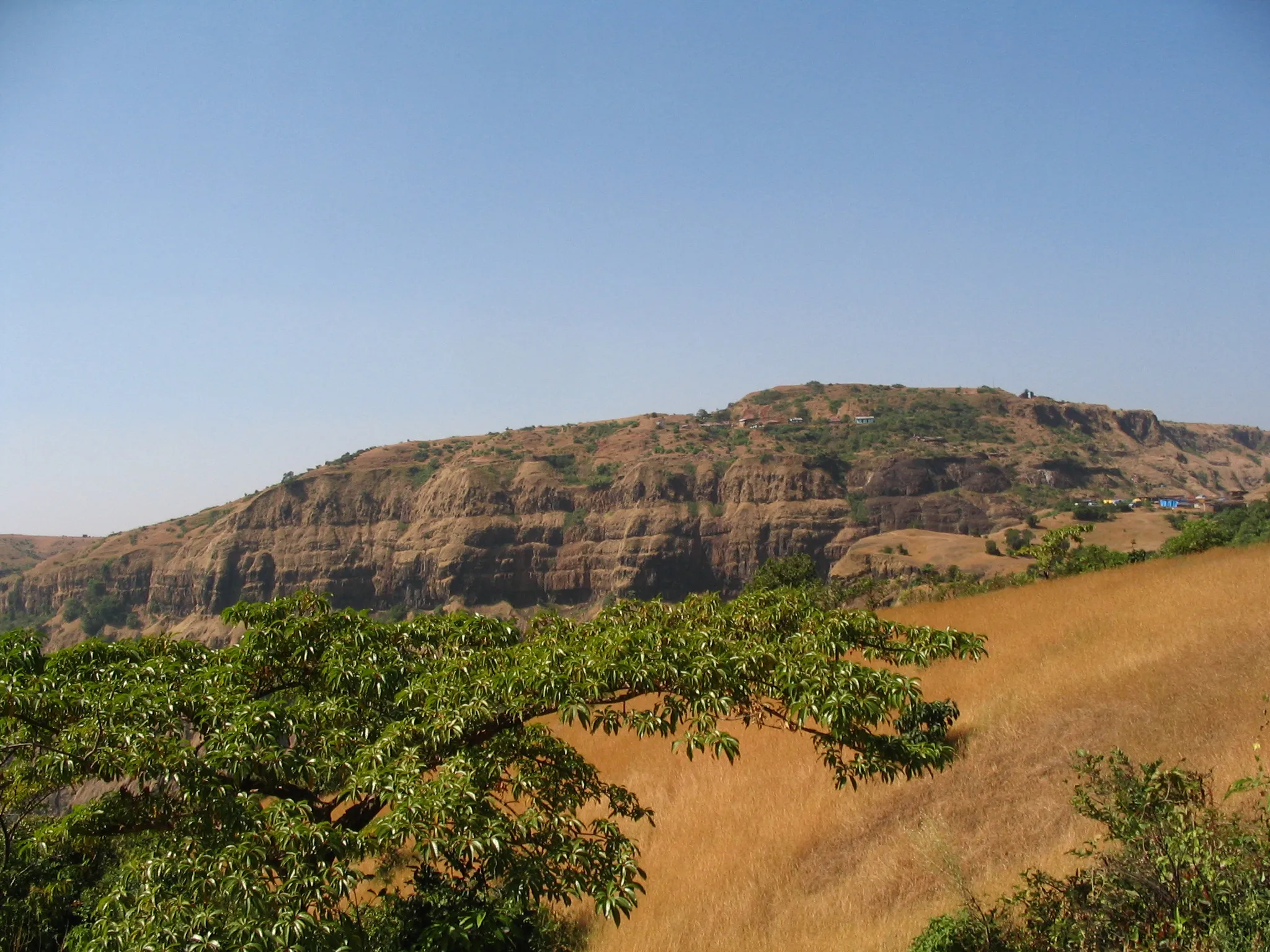
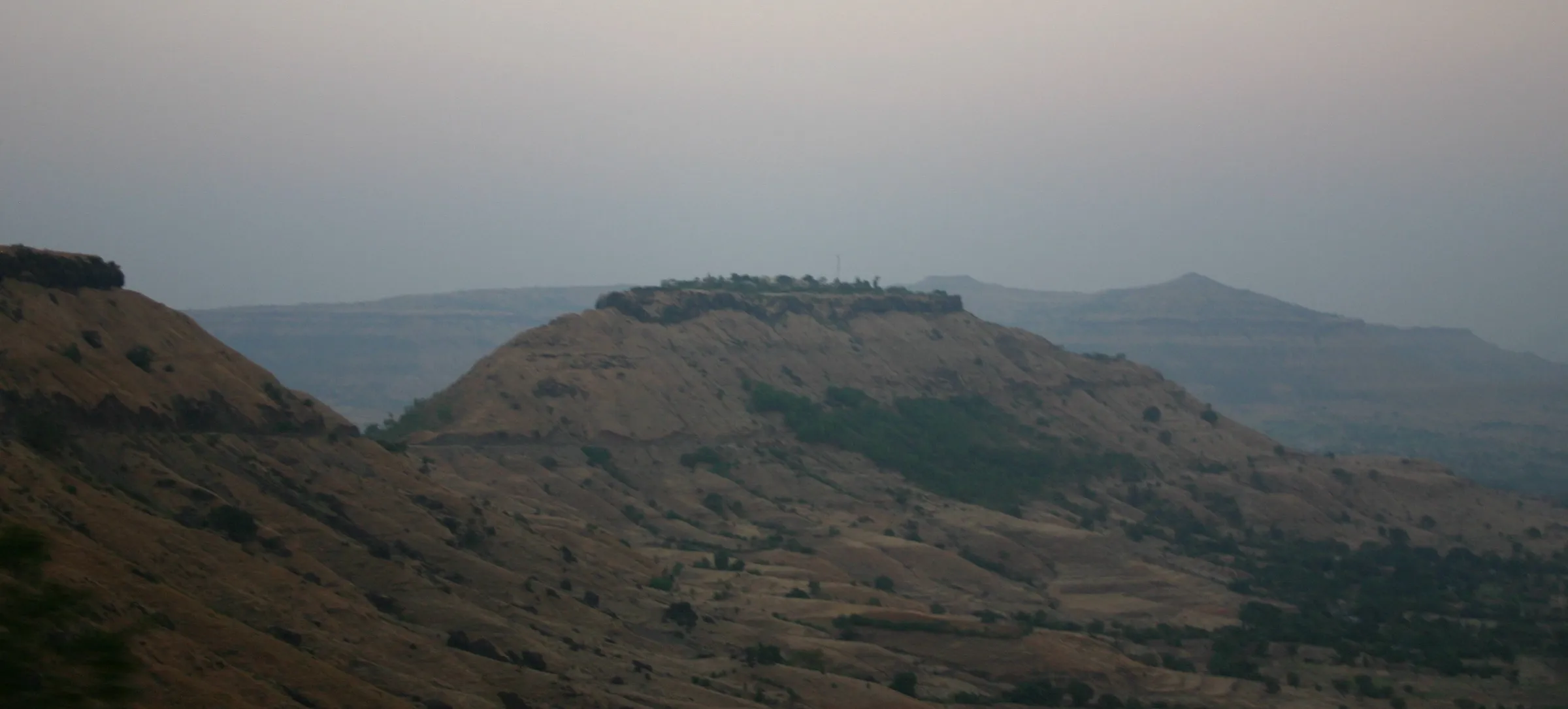
- Masai Pathar, an open plateau of about 8 km that turns green in the monsoon, with wide views across the Sahyadri
- Three forest stretches, paddy fields and small villages such as Khotwadi, Karpewadi and Pandharepani
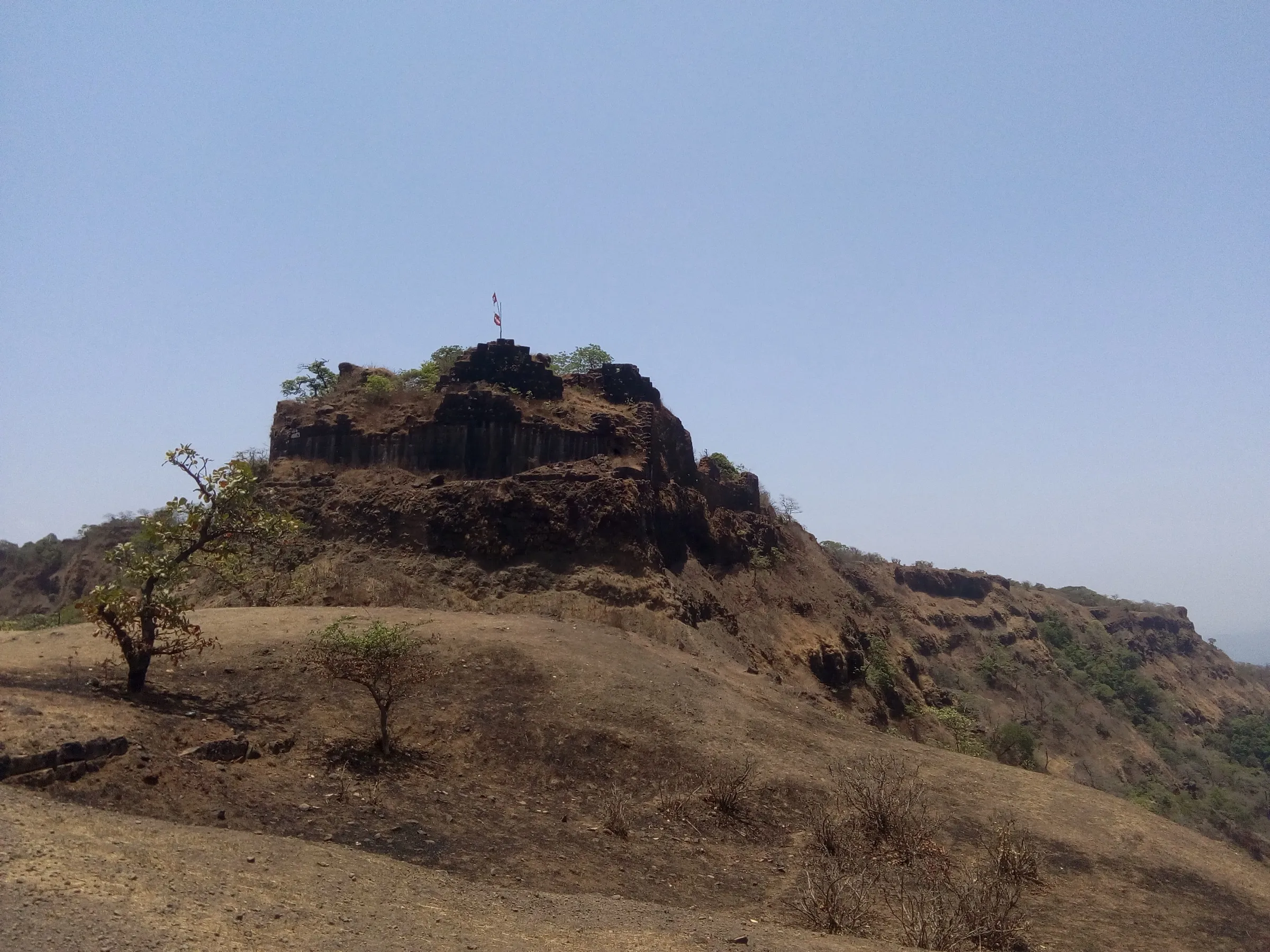
- The finish in the narrow rocky gorge of Pawankhind (Ghod Khind), where Baji Prabhu Deshpande held the pass so that Shivaji Maharaj could reach Vishalgad
Risks
- In peak monsoon some streams run in full flow and may need a rope to cross; do not cross a fast stream without one.
- Mud, paddy bunds, wet rock and the stone steps down into Pawankhind are slippery in the rain; inside the gorge the path is boulder-strewn, and a short iron ladder leads into the valley.
- Both days are long (8-11 hours). Start after sunrise and finish before dark; Indiahikes also advises this for safety from wildlife.
- After the monsoon (from about November) the open plateau has little shade and the sun is harsh over two long days.
- Maharashtra districts issue one-off monsoon orders closing forts, waterfalls or trails for safety. We found no 2025-26 Kolhapur district order covering this route, and a police team walked it in August 2026, but check with Panhala or Kolhapur police before you go.
- The trail runs through farmland and village land; markers exist but are not continuous, so carry a GPX track or go with a group.
Know before you go
Questions
How long is the Panhala to Pawankhind trek and how many days does it take?
Sources give 45 to 50 km; Indiahikes measured about 48 km. It is normally walked over two days: Panhala Fort to Karpewadi (or Patewadi) on day 1, about 24 km and 8-9 hours, and on to Pawankhind on day 2, about 24 km and 10-11 hours. Many groups ride the last 5 km of road from Pandharepani by bus.
Do I need a permit?
Indiahikes says no permit is required. One operator lists forest permissions 'if applicable' in its package, so self-guided groups should check locally.
When is the best time to do this trek?
The monsoon and just after it. Indiahikes says the route is at its best from about two weeks after the monsoon starts until November, and names June to September as the ideal months. Every July trekkers walk it as the Panhala-Pawankhind Mohim, timed to the season of the 1660 escape.
What is the history behind the route?
In 1660 Siddi Jauhar's Adilshahi army besieged Shivaji Maharaj in Panhala Fort. On the night usually dated 12-13 July 1660 he slipped out with a small force towards Vishalgad, while Shiva Kashid, dressed as the king, drew the pursuers. When Siddi Masud's cavalry caught up, Baji Prabhu Deshpande and the Bandal soldiers held the narrow Ghod Khind (Gajapur pass) until cannon fire from Vishalgad signalled that Shivaji Maharaj was safe. Baji Prabhu and many of his men were killed, and the pass became known as Pawankhind, the sacred pass. Some historians, following Jadunath Sarkar, date the escape later in 1660, and there is debate over whether the present memorial marks the exact battlefield.
Where do trekkers stay overnight?
In simple village homestays at Karpewadi or Patewadi, roughly halfway. Expect a very basic setting; dinner and breakfast are cooked by the host family.
Can I continue to Vishalgad?
The historic escape ended at Vishalgad Fort, about 15 km beyond Pawankhind, but the usual trek ends at Pawankhind. Some groups, such as a Maharashtra Police expedition in August 2026, walk the full Panhala-Pawankhind-Vishalgad route of about 65 km.
In an emergency
Save these numbers before you lose signal. Tap to call.
- 112All emergenciesIndia’s single emergency number — works in every state
- 108Ambulance
- 1077District disaster control room
You are in
District: KolhapurMaharashtra
- Nearest hospital
- Kolhapur city (about 20-25 km from Panhala); from the Pawankhind end, Malkapur is the nearest town.
- Last ATM
- Kolhapur city; carry cash for homestays and village meals.
- Phone network
- Not confirmed by our sources; expect patchy signal on the plateau, in the forest sections and in the Pawankhind gorge.
Before you set off
- Tell someone your route and when you will be back.
- Carry a charged phone and a power bank.
- Download an offline map of the route.
- Turn back if the weather turns bad — the mountain will wait.
Questions about Panhala to Pawankhind
No questions yet. Ask something and trekkers who have done it can answer.
Share your trek photo with #TreksAndTrails
I trekked this
Did Panhala to Pawankhind look different from this page? Tell us what changed and we will check it.
Where this comes from
Sources
Last reviewed:
- Panhala to Pawankhind | A Historic Two-Day Trek From Kolhapur — Indiahikes
- Panhala to Pawankhind Range Trek, Fri, Aug 21, 2026 — Ramblers India
- Panhala Fort to Pawankhind Historical Trek from Pune — Adventure Club Pune
- Pavankhind — Durg Bharari
- Panhala to Pawankhind Trek with Shikhar Vedh – A Test of Grit, Glory & Rain — Backpackers Novel
- Masai Plateau — Wikipedia
- Panhala fort — Wikipedia
- Battle of Pavan Khind — Wikipedia
- Maratha Military Landscapes of India — UNESCO World Heritage Centre
- Mumbai Police Team Completes Gruelling 65-Km Panhala–Pawankhind–Vishalgad Trek — Free Press Journal
Photos: Ankur P, CC BY-SA 2.0; N.v.petkar, CC BY-SA 3.0; Ankur P from Pune, India, CC BY-SA 2.0