Vijaygarh Fort Trek
Sonbhadra, Uttar Pradesh
Opens without signal on this phone, with the map file and checklist. Saved for offline →
- Max altitude
- 521 m
- Satellite terrain suggests about 521 m
- Days
- 1 day
- Distance
- 9 km
- Difficulty
- Moderate
A full day of 8 to 10 km over rugged Kaimur hill terrain with a river crossing and boulder sections, though the fort stands only about 500 m above sea level.
About this trek
Vijaygarh Fort
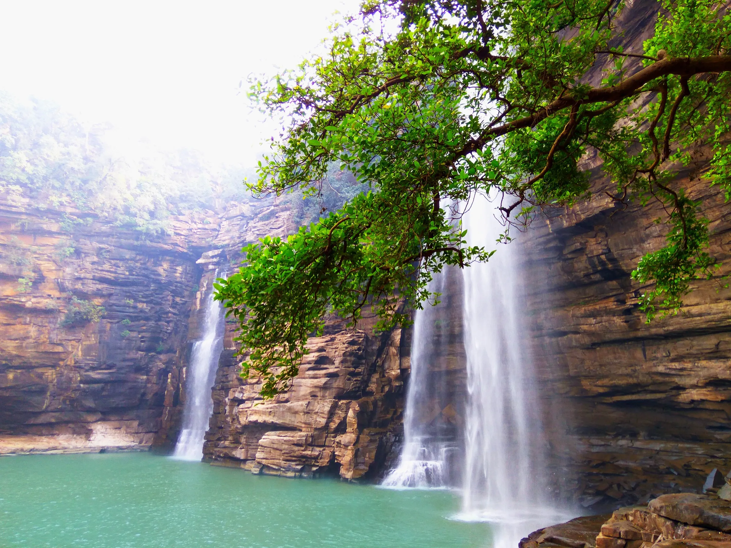
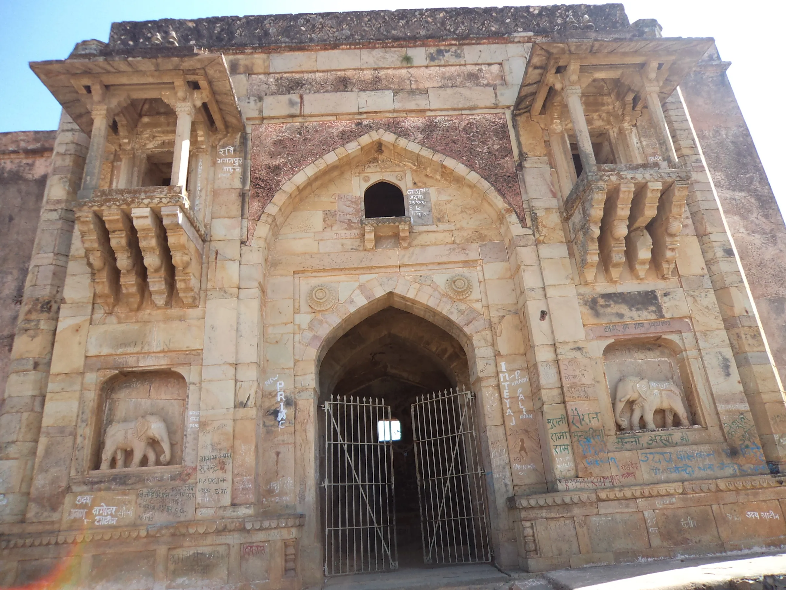
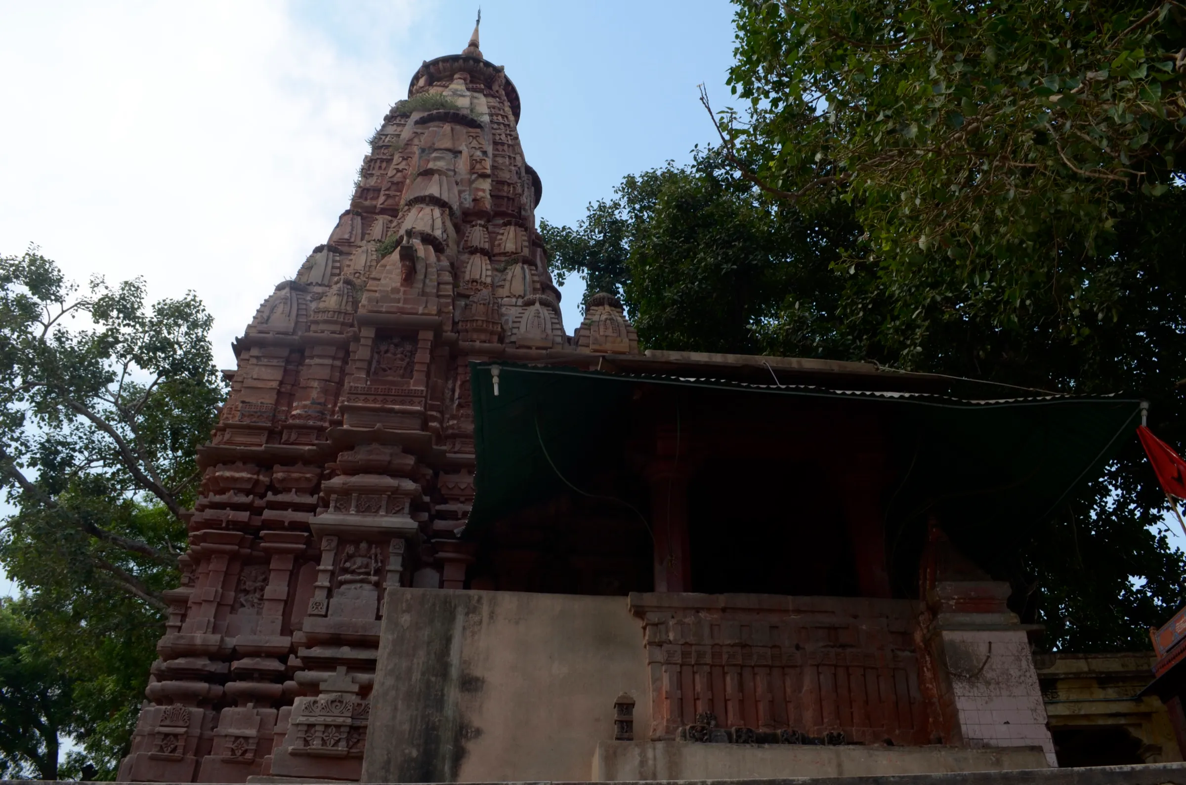
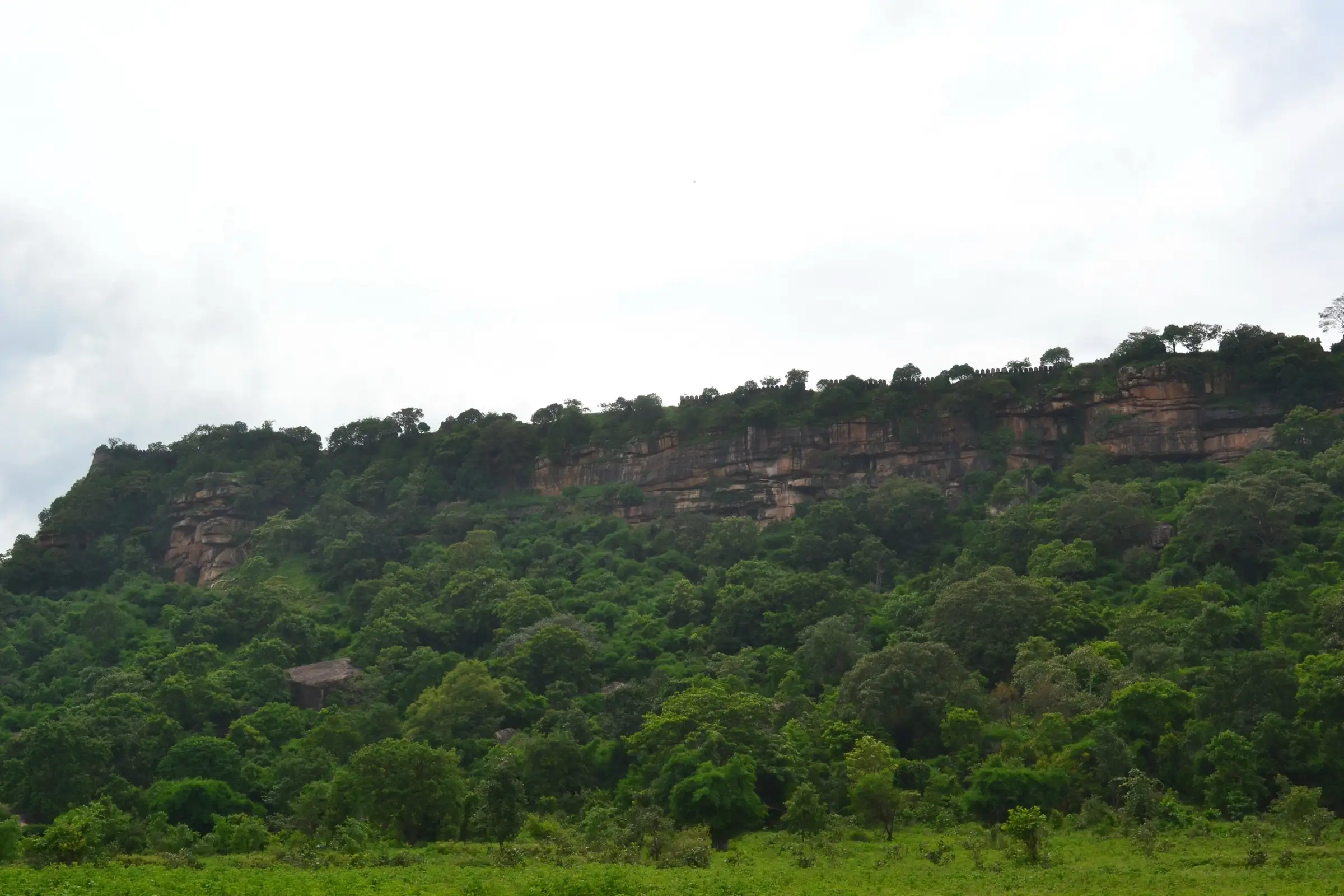
Vijaygarh Fort is a hill fort on a plateau of the Kaimur Range in Sonbhadra district, Uttar Pradesh. The UP Eco-Tourism day trek starts at the Nishogi Dak Bungalow at Dhandhraul Dam, includes a river crossing and lunch at the fort, and ends at Mau Kalan, an easy 8 to 10 km over 8 to 10 hours. The fort has walls, gateways, rock-cut structures, reservoirs and the Rang Mahal. It suits beginners, but only through the official booking.
Photos
On the trail
The route
Day by day
Day 1 · highest point
Dhandhraul Dam (Nishogi Dak Bungalow) → Mau Kalan (via Vijaygarh Fort)
330 m → 521 m → 320 m
- Reporting is at 8 am at the Nishogi Dak Bungalow, Dhandhraul Dam; the programme lists a river crossing.
- The route is listed as 8 to 10 km, easy, in 8 to 10 hours, with lunch served at the fort.
- The fort has defensive walls, gateways, rock-cut structures and reservoirs; four ponds are reported never to dry up.
- The trek ends at Mau Kalan, with dispersal listed at 6 pm.
Ups and downs
Altitude profile
Where it is
Map
Trailhead and high point only — not a recorded track. Use it with a proper map.
Weather
Next 5 days on the trail
Live forecast for the trailhead and the high point. Mountain weather changes fast — check again on the morning you start.
Trailhead · Dhandhraul Dam (Nishogi Dak Bungalow)
at 330 mLoading forecast…
High point · Vijaygarh Fort (hilltop fort; the exact top is not separately mapped)
at 521 mLoading forecast…
Each day: high / low °C · rain mm and chance · snow cm · wind km/h
Weather data: Open-Meteo.comModel forecast, not an official warning. For alerts follow IMD and the local administration.
Plan the trip
How to reach
- Trailhead
- Dhandhraul Dam (Nishogi Dak Bungalow) (nearest town: Robertsganj)
- Nearest railway
- Robertsganj (Sonbhadra) area; Mirzapur and Varanasi are the main railheads
- Nearest airport
- Lal Bahadur Shastri Airport, Varanasi
- By road
- Robertsganj (about 23 km to Dhandhraul Dam on the Robertsganj-Churk road)
- Drive
- About 3.5 h from Varanasi
Plan the trip
Permits and fees
We could not confirm the current permit rules and fees from an official source. Check with the local forest department or tourism office before you go.
Plan the trip
Cost
Self-guided
₹500–2,000
With an operator
₹999–1,500
Per person, ex-Robertsganj. The UP Eco-Tourism page lists the guided day trek at ₹999 per person. Self-guided is an estimate for local transport to Dhandhraul Dam, food and a local guide; it is not sourced.
Gear
Top picks for this trek
The gear that matters most on this route, chosen from its altitude, season and risks.
 Ad · affiliate link
 Ad · affiliate link
 Ad · affiliate link
 Ad · affiliate link
 Ad · affiliate link
 Ad · affiliate link
- Ad · affiliate link
 Ad · affiliate link
Store buttons open a search on that store, not a product we picked. As an Amazon Associate we earn from qualifying purchases. Photos show the kind of item, not a specific product. Affiliate disclosure
Packing checklist
Matched to this trek: altitude, season, days and the risks on the route.
Packed 0 of 21
Hot days in Mar–Apr: start at first light and carry extra water and ORS.
Tick each item as it goes in the bag.
Know before you go
Good to know
- Mobile network
- Not confirmed; expect patchy signal in the Kaimur hills.
- Last ATM
- Robertsganj
- Nearest hospital
- Robertsganj (district hospital, Sonbhadra)
- Water
- Not confirmed. The fort has a lake (seen in photos), but carry your own drinking water for the whole day.
Highlights
- A hill fort of the old Benares State in the Kaimur Range, with walls, gates and ruined buildings on the hilltop
- A day route from Dhandhraul Dam to Mau Kalan with a river crossing and bouldering, as run by UP Eco-Tourism
- Lunch stop inside the fort, with a lake and views over the surrounding hills
Risks
- Remote hill terrain with a river crossing; the official programme requires a medical fitness check and signed indemnity.
- Bookings need at least 15 days' notice and are first come, first served; walking in without a booking may not be allowed.
- Only one operator (UP Eco-Tourism) was found describing the route; distance, trail condition and altitude are not independently confirmed.
Know before you go
Questions
How long is the Vijaygarh Fort trek?
UP Eco-Tourism describes a one-day trek of 8 to 10 km, taking roughly 8 to 10 hours from the 8 am report time to about 6 pm dispersal.
Where does the trek start and end?
UP Eco-Tourism lists the start at Nishogi Dak Bungalow, Dhandhraul Dam, and the end at Mau Kala (Mau Kalan), with lunch at Vijaygarh Fort.
When is the best time for Vijaygarh Fort?
UP Eco-Tourism gives August to April as the trek season. We found no second source, so check current dates when booking.
What does the Vijaygarh Fort trek cost and how do I book?
The UP Eco-Tourism page lists ₹999 per person. Registration needs a medical fitness check and an indemnity, and bookings need at least 15 days' notice. Alcohol, arms and non-vegetarian food are not allowed.
In an emergency
Save these numbers before you lose signal. Tap to call.
- 112All emergenciesIndia’s single emergency number — works in every state
- 108Ambulance
- 1077District disaster control room
You are in
District: SonbhadraUttar Pradesh
- Nearest hospital
- Robertsganj (district hospital, Sonbhadra)
- Last ATM
- Robertsganj
- Phone network
- Not confirmed; expect patchy signal in the Kaimur hills.
Before you set off
- Tell someone your route and when you will be back.
- Carry a charged phone and a power bank.
- Download an offline map of the route.
- Turn back if the weather turns bad — the mountain will wait.
Questions about Vijaygarh Fort
No questions yet. Ask something and trekkers who have done it can answer.
Share your trek photo with #TreksAndTrails
I trekked this
Did Vijaygarh Fort look different from this page? Tell us what changed and we will check it.
Where this comes from
Sources
Last reviewed:
- Vijaygarh Fort Trek — UP Eco-Tourism (Uttar Pradesh Forest Department) (official)
- Vijaygarh Fort — Wikipedia
Photos: Nandanupadhyay, CC BY-SA 3.0; Nandanupadhyay, CC BY-SA 3.0; Nandanupadhyay, CC BY-SA 3.0; Nandanupadhyay, CC BY-SA 3.0