Rohtasgarh Fort Trek
Rohtas, Bihar
Opens without signal on this phone, with the map file and checklist. Saved for offline →
- Max altitude
- 457 m
- Days
- 1 day
- Distance
- 8 km
- Difficulty
- Moderate
About 2,000 limestone steps climb steeply in roughly 1.5 hours, followed by a walk of about a mile to the ruins, with no water or shade support at the top and a 7 to 8 hour round trip.
About this trek
Rohtasgarh Fort
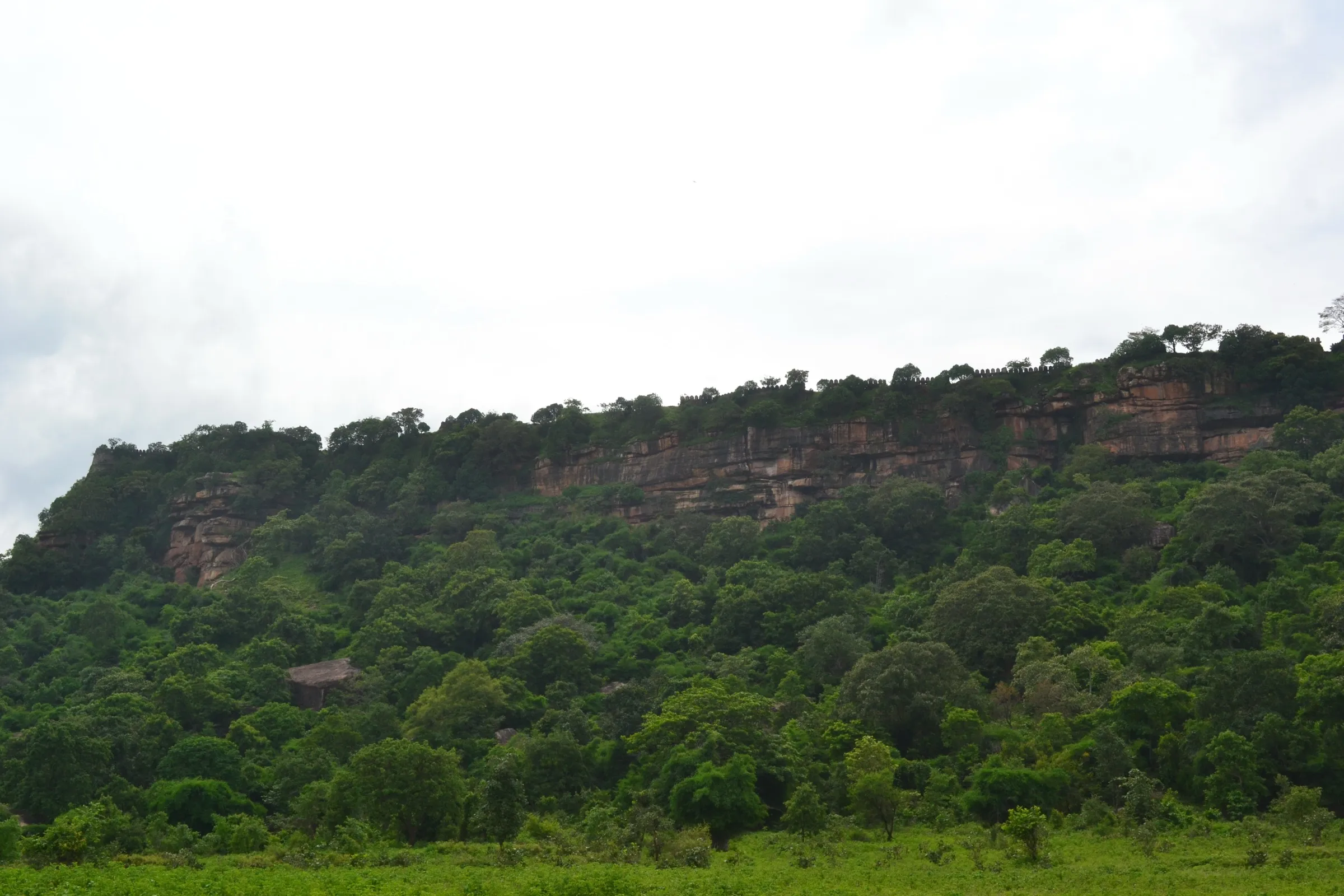
Rohtasgarh is a hill fort near Sasaram in Bihar, built on a plateau about 1,500 ft above sea level with steeply rising sides. The usual walk starts at Medha Ghat and climbs about 2,000 limestone steps, taking around an hour and a half, to the fort wall. On top are gates, palaces, temples and reservoirs in Indo-Afghan style, spread over a large area with views across the Son valley and the Kaimur range. It suits walkers in reasonable shape who start early; there is no water or phone signal on top.
Photos
On the trail
The route
Day by day
Day 1 · highest point
Foot of the steps (Medha Ghat) → Rohtasgarh Fort and back
150 m → 457 m → 150 m
- The foot of the hill is about two hours' drive from Sasaram; the main walking route starts at Medha Ghat.
- About 2,000 limestone steps are cut into the hill, and the climb takes around an hour and a half.
- At the top you reach the boundary wall and a dilapidated cupola gate; the ruins are roughly another mile on.
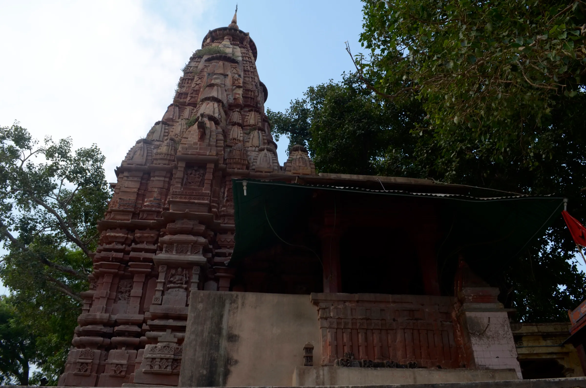
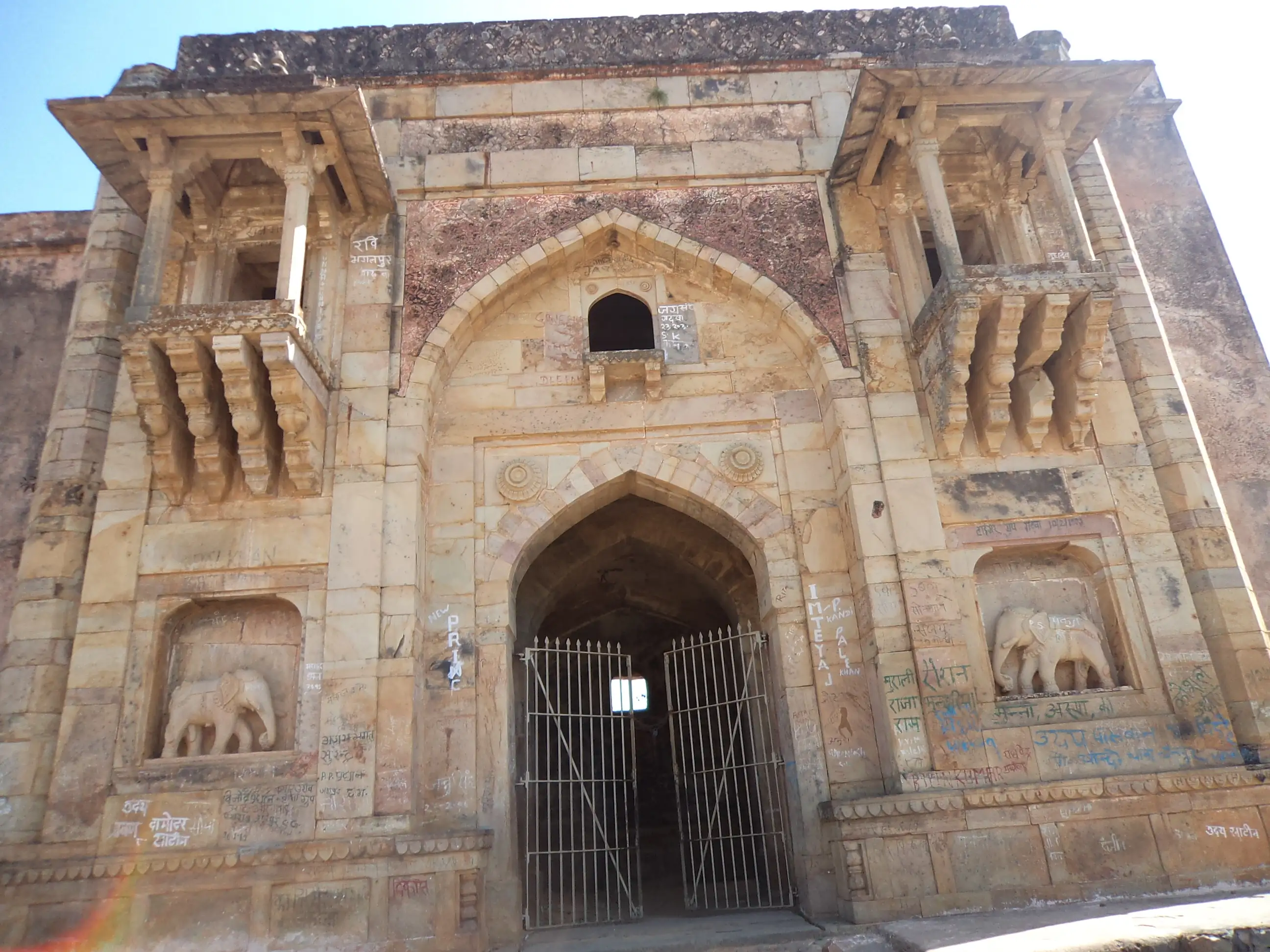
- Visitors report a mosque of 1543, the gate Hatiya Pol with two stone elephants, and side paths to Shiva and Ganesha temples.
- A 2023 visitor found no water, open shops or mobile signal on top, and advised starting about 8 am and heading back by 2 pm.
Ups and downs
Altitude profile
Where it is
Map
Trailhead and high point only — not a recorded track. Use it with a proper map.
Weather
Next 5 days on the trail
Live forecast for the trailhead and the high point. Mountain weather changes fast — check again on the morning you start.
Trailhead · Rohtas village (GeoNames position; the exact foot of the steps at Medha Ghat is not mapped)
at 150 mLoading forecast…
High point · Rohtasgarh Fort, plateau top (OpenStreetMap fort position)
at 457 mLoading forecast…
Each day: high / low °C · rain mm and chance · snow cm · wind km/h
Weather data: Open-Meteo.comModel forecast, not an official warning. For alerts follow IMD and the local administration.
Plan the trip
How to reach
- Trailhead
- Rohtas village (GeoNames position; the exact foot of the steps at Medha Ghat is not mapped) (nearest town: Dehri)
- Nearest railway
- Sasaram Junction
- Nearest airport
- Gaya Airport
- By road
- Sasaram (about two hours by road to the foot of the hill; one blogger puts it near 83 km and 3.5 to 4 hours each way); Dehri-on-Sone; Akbarpur
- Drive
- About 2 h from Sasaram
Plan the trip
Permits and fees
We could not confirm the current permit rules and fees from an official source. Check with the local forest department or tourism office before you go.
Plan the trip
Cost
Self-guided
₹800–2,500
With an operator
₹1,500–4,000
Per person, ex-Sasaram. No operator publishes a price for this walk; both ranges are our estimates for a shared or private taxi from Sasaram or Dehri plus water, food and an optional local guide. One visitor reports the fort is not a ticketed monument.
Gear
Top picks for this trek
The gear that matters most on this route, chosen from its altitude, season and risks.
 Ad · affiliate link
 Ad · affiliate link
 Ad · affiliate link
 Ad · affiliate link
 Ad · affiliate link
 Ad · affiliate link
- Ad · affiliate link
 Ad · affiliate link
Store buttons open a search on that store, not a product we picked. As an Amazon Associate we earn from qualifying purchases. Photos show the kind of item, not a specific product. Affiliate disclosure
Packing checklist
Matched to this trek: altitude, season, days and the risks on the route.
Packed 0 of 20
Hot days in Mar–Apr: start at first light and carry extra water and ORS.
Tick each item as it goes in the bag.
Know before you go
Good to know
- Mobile network
- No mobile signal reported at the fort (a September 2023 trip report); download offline maps first.
- Last ATM
- Sasaram or Dehri; carry cash
- Nearest hospital
- Dehri or Sasaram (not confirmed)
- Water
- None reported on the fort top; carry all your water. The few village shops sell only basic goods and may be shut.
Highlights
- About 2,000 old limestone steps, said to have been cut for elephants, climb the Kaimur scarp
- Hathiya Pol (Elephant Gate) of 1597, with carved elephants, and the Mahal Sarai palace compound
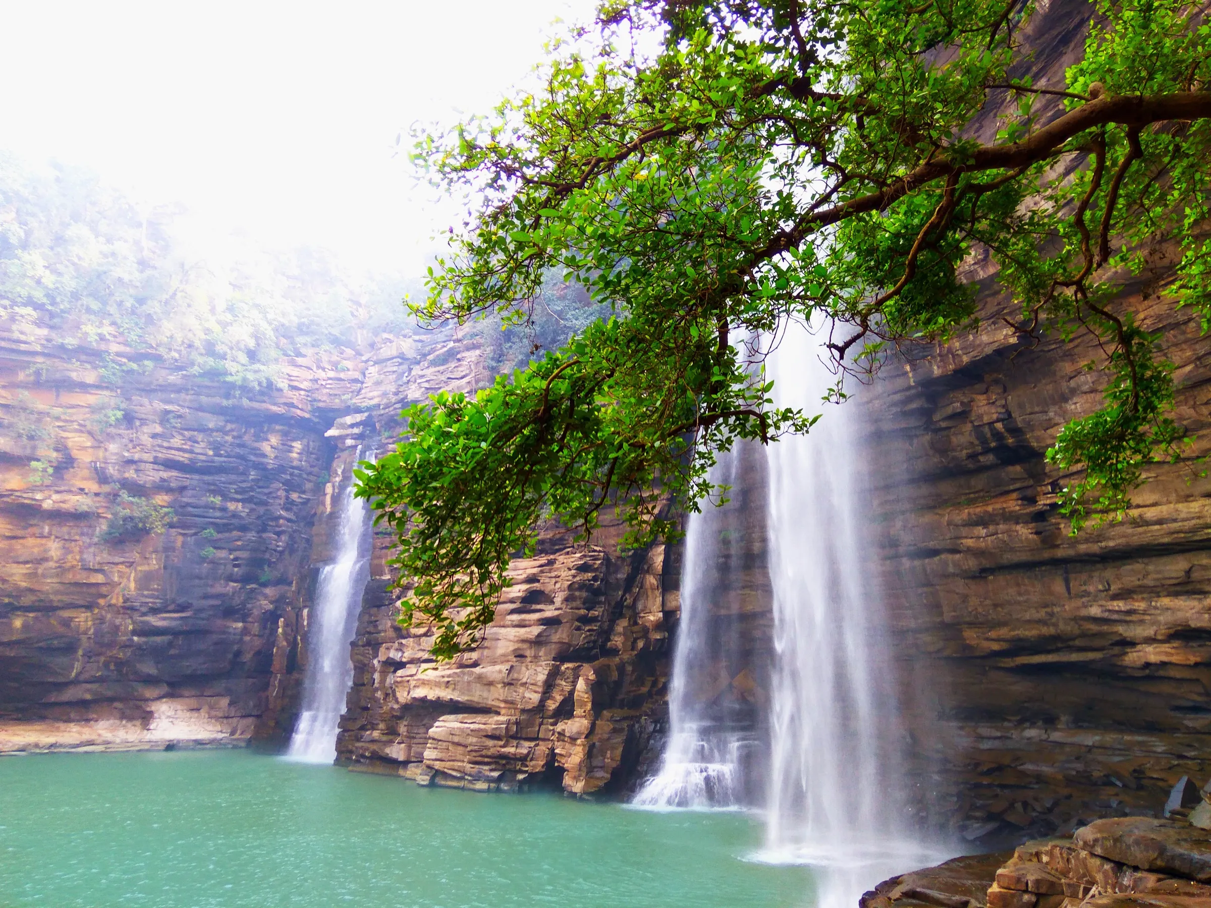
- Ruins of mosque, Baradari hall, temples and reservoirs spread over a large plateau, with a waterfall over the walls in the rains
- Hanging House lookout over a drop of about 1,500 ft
Risks
- Monsoon (the visitor in late September 2023 found slushy ground, several streams to cross and bad roads); the trail and approach are best avoided in heavy rain.
- No water, shops or mobile signal on top; the roads back to town are described as desolate, so start early (about 8 am) and return by mid-afternoon.
- The climb is strenuous in heat; wear sturdy shoes. Roads to the foot need a high-clearance vehicle.
Know before you go
Questions
How many steps are there to Rohtasgarh Fort?
Wikipedia and Bihar Tourism both say about 2,000 limestone steps, climbed in roughly 1.5 hours from Medha Ghat. After the steps you reach the boundary wall and walk about another mile to the ruins.
What is the best time to visit Rohtasgarh Fort?
Bihar Tourism lists September to April. Avoid heavy rain, when a trip report found the ground slushy and the roads poor.
How do I reach Rohtasgarh Fort?
The nearest big railway station is Sasaram Junction and the nearest airport is Gaya. It is about two hours by road from Sasaram to the foot of the hill; Dehri and Akbarpur are other approaches. Private taxis and local guides from Sasaram are the usual option.
Is there an entry fee or permit?
One trip report says the fort is not a ticketed monument, and Bihar Tourism lists no fee. We could not confirm any current official fee, so check locally.
In an emergency
Save these numbers before you lose signal. Tap to call.
- 112All emergenciesIndia’s single emergency number — works in every state
- 108Ambulance
- 1077District disaster control room
You are in
District: RohtasBihar
- Nearest hospital
- Dehri or Sasaram (not confirmed)
- Last ATM
- Sasaram or Dehri; carry cash
- Phone network
- No mobile signal reported at the fort (a September 2023 trip report); download offline maps first.
Before you set off
- Tell someone your route and when you will be back.
- Carry a charged phone and a power bank.
- Download an offline map of the route.
- Turn back if the weather turns bad — the mountain will wait.
Questions about Rohtasgarh Fort
No questions yet. Ask something and trekkers who have done it can answer.
Share your trek photo with #TreksAndTrails
I trekked this
Did Rohtasgarh Fort look different from this page? Tell us what changed and we will check it.
Where this comes from
Sources
Last reviewed:
- Rohtasgarh Fort — Bihar Tourism (official)
- Rohtas Fort, India — Wikipedia
- Rohtasgarh Fort Sasaram — Indian Vagabond
Photos: Mariyosh, CC BY-SA 3.0; Callmekaushik, CC BY-SA 4.0; Debazoti1985, CC BY-SA 4.0; Rangan Datta Wiki, CC BY-SA 4.0