Kashi Panchkroshi Yatra Trek
Varanasi, Uttar Pradesh
Opens without signal on this phone, with the map file and checklist. Saved for offline →
- Max altitude
- 86 m
- Days
- 5 days
- Distance
- 88 km
- Difficulty
- Moderate
Completely flat road and village walking, but about 16 to 23 km a day for five days, traditionally barefoot, with heat in summer and little shade between halts.
About this trek
Kashi Panchkroshi Yatra
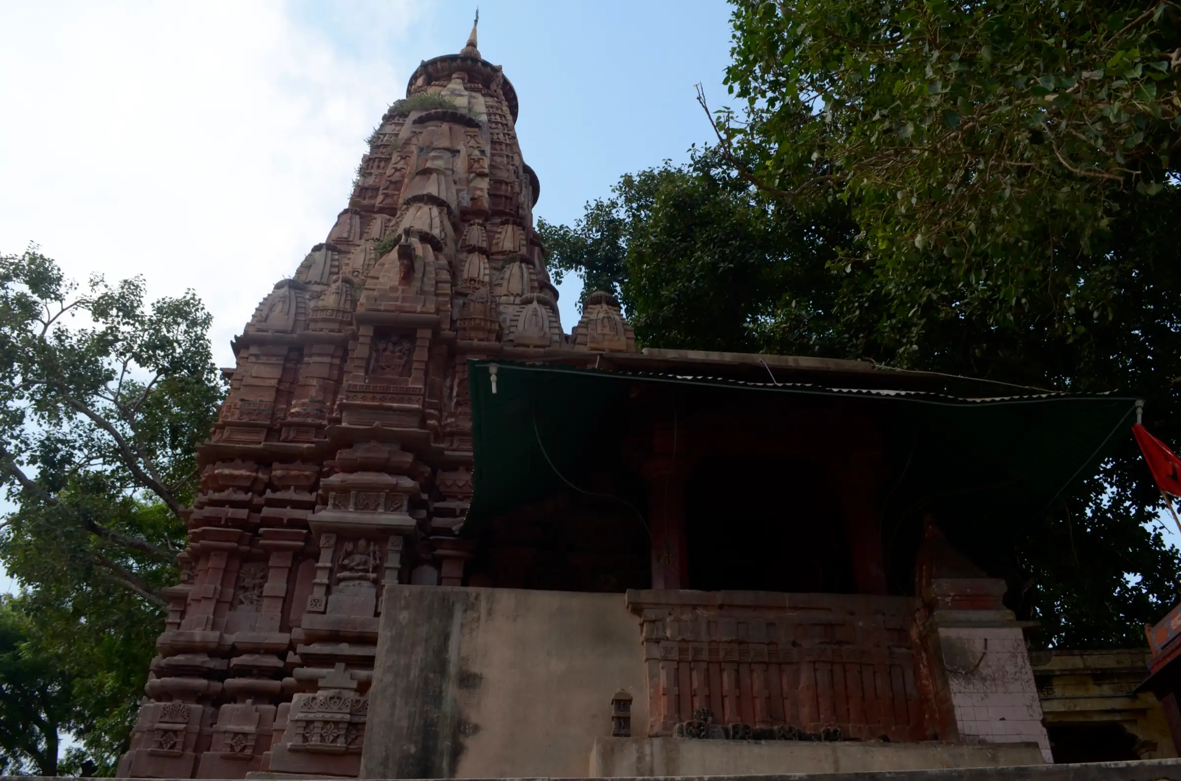
The Kashi Panchkroshi Yatra is a five-day pilgrim walk of about 88.5 km around the sacred boundary of Varanasi, past 108 shrines. Pilgrims take a sankalp at Jnanavapi, then walk through village roads and mango groves to halts at Kandawa, Bhimachandi, Rameshwar, Shivpur and Kapildhara, sleeping in dharamshalas. The path is flat and all on roads, so the effort is heat and distance. It is most popular in Adhik Maas and on Maha Shivaratri, and suits devout walkers of good fitness.
Photos
On the trail
The route
Day by day
Day 1
Manikarnika Ghat (sankalp at Jnanavapi) → Kardameshwar (Kandwa)
80 m → 85 m
- Pilgrims take the sankalp at Jnanavapi, then walk about 4 km from the BHU gate to Kandawa; the Kardameshvara temple dates from the 6th-13th century.
- The halt has a large pond built in the 18th century and pilgrim dharamshalas; five holy sites cluster here.
Day 2
Kardameshwar (Kandwa) → Bhimchandi
85 m → 82 m
- Gandharva Sagar tank and the Bhimachandi Devi temple mark the second halt, about 16 km from Kardameshvara.
- The road passes Dinadaspur, with a Langotia Hanuman shrine, and Dehli Vinayaka, a Ganesha shrine, before the next halt.
Day 3
Bhimchandi → Rameshwar
82 m → 80 m
- The longest day, about 23 km, ends at the Rameshvara temple on the Varana river, where there are six dharamshalas.
- Pilgrims offer bilva and tulsi leaves at the temple's Shiva lingas.
Day 4 · highest point
Rameshwar → Shivpur
80 m → 86 m → 86 m
- After about 16 km you reach Shivpur, a crowded city neighbourhood; many pilgrims halt at Tarana, about 4 km before it.
- Shivpur has the Pancha Pandava shrine of five lingas and the Draupadi Kupa well.
Day 5
Shivpur → Kapildhara, then Manikarnika Ghat
86 m → 80 m
- Kapildhara has the Kapileshvara Shiva temple and a sacred pool, known for ancestral rites; about 10 dharamshalas stand here.
- The yatra ends back at Manikarnika Ghat, with a thanksgiving at Jnanavapi.
Ups and downs
Altitude profile
Where it is
Map
Trailhead and high point only — not a recorded track. Use it with a proper map.
Weather
Next 5 days on the trail
Live forecast for the trailhead and the high point. Mountain weather changes fast — check again on the morning you start.
Trailhead · Manikarnika Ghat
at 80 mLoading forecast…
High point · Shivpur (on route; the highest point is not mapped, GeoNames village elevation)
at 86 mLoading forecast…
Each day: high / low °C · rain mm and chance · snow cm · wind km/h
Weather data: Open-Meteo.comModel forecast, not an official warning. For alerts follow IMD and the local administration.
Plan the trip
How to reach
- Trailhead
- Manikarnika Ghat (nearest town: Varanasi)
- Nearest railway
- Varanasi Junction
- Nearest airport
- Lal Bahadur Shastri Airport, Varanasi
- By road
- Start inside Varanasi city at Manikarnika Ghat; the route is a circuit around the city
- Drive
- About 12 h from Delhi
Plan the trip
Permits and fees
We could not confirm the current permit rules and fees from an official source. Check with the local forest department or tourism office before you go.
Plan the trip
Cost
Self-guided
₹1,500–5,000
With an operator
₹3,000–8,000
Per person, ex-Varanasi. Traditionally walked unguided; the cost is a reasoned estimate (dharamshala stays and food for four nights, or a taxi-supported version). No operator price was verified; confirm locally. Taxi-based one-day versions are sold separately.
Gear
Top picks for this trek
The gear that matters most on this route, chosen from its altitude, season and risks.
 Ad · affiliate link
 Ad · affiliate link
 Ad · affiliate link
 Ad · affiliate link
- Ad · affiliate link
 Ad · affiliate link
 Ad · affiliate link
 Ad · affiliate link
Store buttons open a search on that store, not a product we picked. As an Amazon Associate we earn from qualifying purchases. Photos show the kind of item, not a specific product. Affiliate disclosure
Packing checklist
Matched to this trek: altitude, season, days and the risks on the route.
Packed 0 of 23
Hot days in Mar–Apr: start at first light and carry extra water and ORS.
Tick each item as it goes in the bag.
Know before you go
Good to know
- Mobile network
- Mobile network is generally available along the route, which passes through villages and peri-urban Varanasi.
- Last ATM
- Available in Varanasi city before the start; carry cash for villages.
- Nearest hospital
- Varanasi city hospitals, including BHU Sir Sunderlal Hospital.
- Water
- Dharamshalas, temple tanks and roadside taps at the halts; carry bottled or treated water, as tank water is not drinking quality.
Highlights
- A traditional five-day, 25-kos parikrama of Kashi, begun with sankalp at Manikarnika and Jnanavapi and ended with darshan of Bhagwan Vishwanath
- Night halts at Kardameshwar, Bhimchandi, Rameshwar, Shivpur and Kapildhara, each with temples and a kund or tank
- Dharamshalas at every halt (about 44 in all, per one heritage source)
- Abbreviated one-day version on Maha Shivaratri
Risks
- Roads are shared with traffic around Varanasi; walking at night or in fog is unsafe.
- Heat from May to September is severe on a long barefoot walk; the trek is best in the cooler months.
- Sources disagree on halts and kilometre figures (see conflicts); confirm the route with a local pandit or dharamshala before starting.
- Crowds and dharamshala bookings are heavy in Adhik Maas (about every third year) and at Maha Shivaratri.
Know before you go
Questions
How long is the Kashi Panchkroshi Yatra?
Sources give 25 kos, about 80 to 88.5 km, traditionally walked in five days with night halts at Kardameshwar, Bhimchandi, Rameshwar, Shivpur and Kapildhara.
When is the Panchkroshi Yatra done?
The main season is Adhik Maas (malamasa), roughly every third year. Pilgrims also walk in the cooler months (Magha-Phalguna) and in Chaitra-Vaishakha, and a one-day version is done on Maha Shivaratri.
Where does the yatra start and end?
It begins with a dip and sankalp at Manikarnika Ghat and Jnanavapi, and returns to Manikarnika to leave the sankalp, then darshan of Bhagwan Vishwanath and Mata Annapurna. One source starts at the BHU gate.
Is a permit needed or where do pilgrims stay?
None of the sources mention a permit or fee. Pilgrims stay in dharamshalas at the halts; one source counts 44 of them.
In an emergency
Save these numbers before you lose signal. Tap to call.
- 112All emergenciesIndia’s single emergency number — works in every state
- 108Ambulance
- 1077District disaster control room
You are in
District: VaranasiUttar Pradesh
- Nearest hospital
- Varanasi city hospitals, including BHU Sir Sunderlal Hospital.
- Last ATM
- Available in Varanasi city before the start; carry cash for villages.
- Phone network
- Mobile network is generally available along the route, which passes through villages and peri-urban Varanasi.
Before you set off
- Tell someone your route and when you will be back.
- Carry a charged phone and a power bank.
- Download an offline map of the route.
- Turn back if the weather turns bad — the mountain will wait.
Questions about Kashi Panchkroshi Yatra
No questions yet. Ask something and trekkers who have done it can answer.
Share your trek photo with #TreksAndTrails
I trekked this
Did Kashi Panchkroshi Yatra look different from this page? Tell us what changed and we will check it.
Where this comes from
Sources
Last reviewed:
- Panchakroshi Yatra Route: The Territory and Temples — Cultural Heritage of Varanasi
- Panchkoshi Yatra 2025: Varanasi, The Five Days Holy Tour — Yatradham
- Panchkroshi Yatra - Ancient Sacred Circle Of Varanasi — Varanasi Guru
Photos: Semra kikić, CC BY-SA 3.0; Poorvaa27, CC BY-SA 4.0; Poorvaa27, CC BY-SA 4.0