Torna Fort Trek
Pune, Maharashtra
Opens without signal on this phone, with the map file and checklist. Saved for offline →
- Max altitude
- 1,403 m
- Days
- 1 day
- Distance
- 7 km
- Difficulty
- Moderate
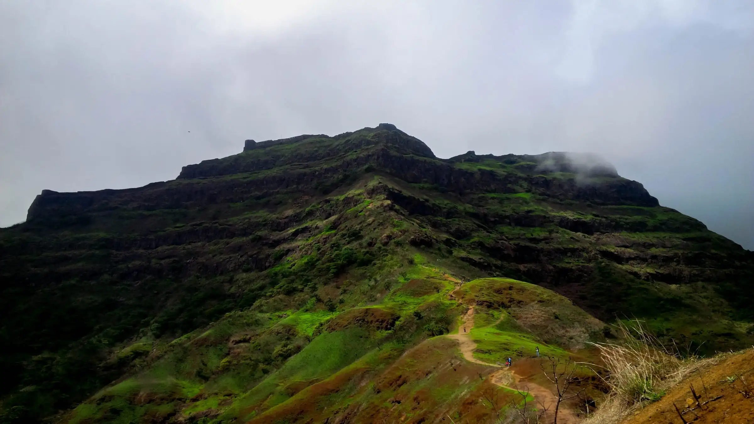
A gain of about 750 m (2,500 ft) in a day on mud and loose rock, ending in a 60-70 degree rocky wall below Bini Darwaja with old, partly broken railings; the descent to Zunjar Machi and Hattimal Buruj has exposed, slippery rock.
Photos
On the trail
The route
Day by day
Day 1 · highest point
Velhe → Velhe (via Torna Fort)
650 m → 1,403 m → 650 m
Ups and downs
Altitude profile
Where it is
Map
Trailhead and high point only — not a recorded track. Use it with a proper map.
Weather
Next 5 days on the trail
Live forecast for the trailhead and the high point. Mountain weather changes fast — check again on the morning you start.
Trailhead · Velhe
at 650 mLoading forecast…
High point · Torna Fort top
at 1,403 mLoading forecast…
Each day: high / low °C · rain mm and chance · snow cm · wind km/h
Weather data: Open-Meteo.comModel forecast, not an official warning. For alerts follow IMD and the local administration.
Plan the trip
How to reach
- Trailhead
- Velhe
- Nearest railway
- Pune Junction (about 65 km)
- Nearest airport
- Pune International Airport (about 73 km)
- By road
- Pune (about 65 km via NH48 to Nasrapur, then State Highway 65 to Velhe); Pune via Khadakwasla, Sinhagad, Ranjane and Pabe Ghat to Velhe; Pune Swargate to Velhe by direct bus (infrequent), or bus to Nasrapur and shared taxi or auto to Velhe
- Drive
- About 2 h from Pune
Plan the trip
Permits and fees
We could not confirm the current permit rules and fees from an official source. Check with the local forest department or tourism office before you go.
Plan the trip
Cost
Self-guided
₹400–1,200
With an operator
₹1,299–1,599
Per person, ex-Pune, one-day trek. Guided prices published October 2026: Treks and Trails India ₹1,299 Pune to Pune (₹1,700 ex-Mumbai); Trekhievers ₹1,399 + 5% GST Pune to Pune (₹699 from the base village); Adventure Club Pune ₹1,599 Pune to Pune (₹999 self-drive). Self-guided is an estimate: bus or shared taxi Pune-Nasrapur-Velhe and back, or a share of a hired cab (Indiahikes quotes about ₹1,500 round trip for the car), plus breakfast and lunch in Velhe.
Gear
Top picks for this trek
The gear that matters most on this route, chosen from its altitude, season and risks.
 Ad · affiliate link
 Ad · affiliate link
 Ad · affiliate link
 Ad · affiliate link
 Ad · affiliate link
 Ad · affiliate link
- Ad · affiliate link
 Ad · affiliate link
Store buttons open a search on that store, not a product we picked. As an Amazon Associate we earn from qualifying purchases. Photos show the kind of item, not a specific product. Affiliate disclosure
Packing checklist
Matched to this trek: altitude, season, days and the risks on the route.
Packed 0 of 18
Tick each item as it goes in the bag.
Know before you go
Good to know
- Mobile network
- Patchy. Indiahikes reports signal at Velhe and fluctuating Jio, Airtel and Vodafone signal on the trail and fort; Bikat reports no connectivity even in Velhe, with a few bars of Airtel and Jio at points on the trail.
- Last ATM
- Nasrapur, about 30 km before Velhe; Pune for reliable ATMs
- Nearest hospital
- Primary Health Centre, Velhe, for first care; Pune for serious cases
- Water
- No potable water on the fort; carry at least 3 litres from Velhe. In and just after the monsoon there is a stream just above the village, the last place to fill bottles.
Highlights
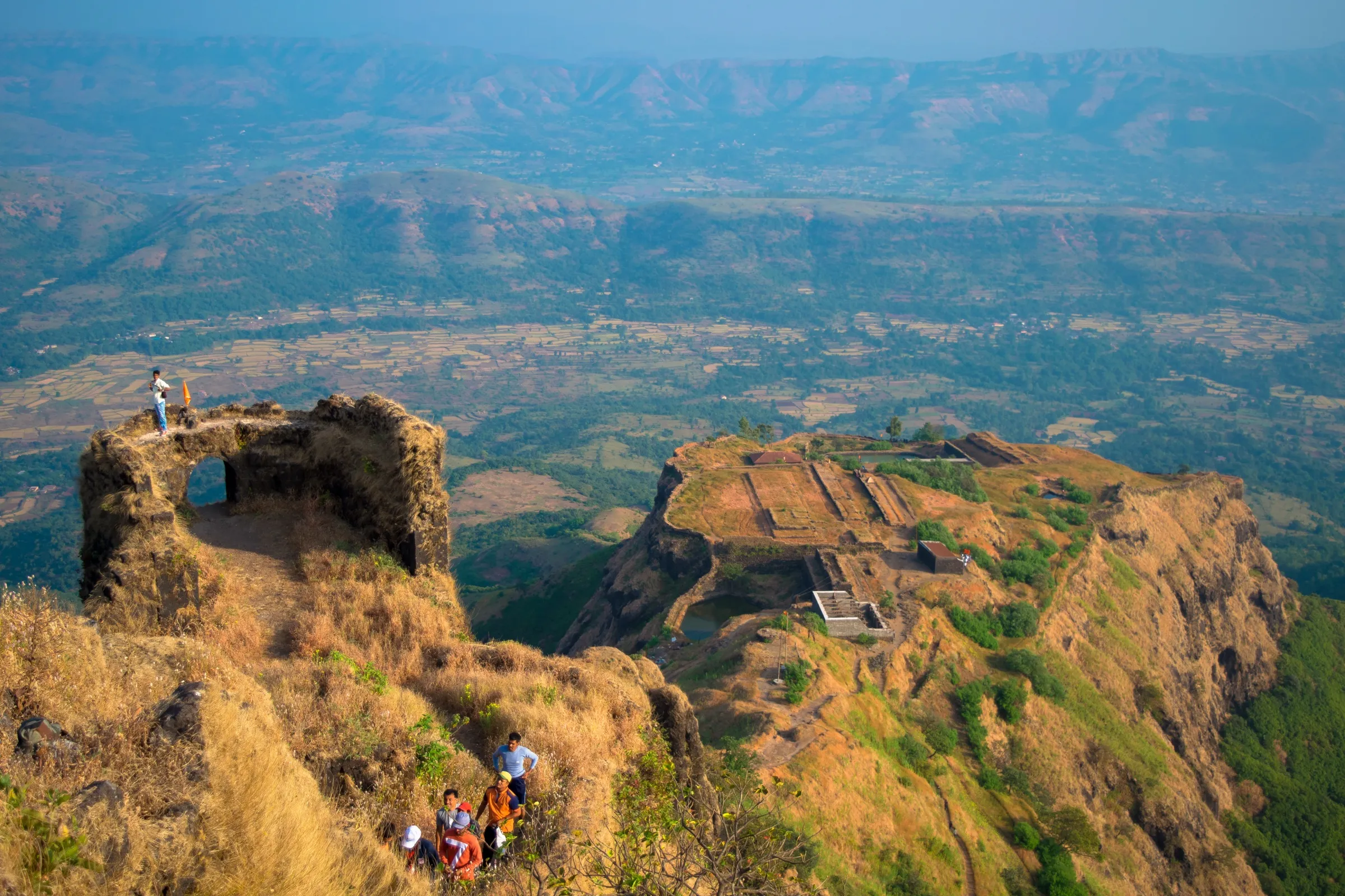
- The highest hill fort in Pune district at 1,403 m (4,603 ft), the first fort Chhatrapati Shivaji Maharaj captured, in 1646 at the age of 16
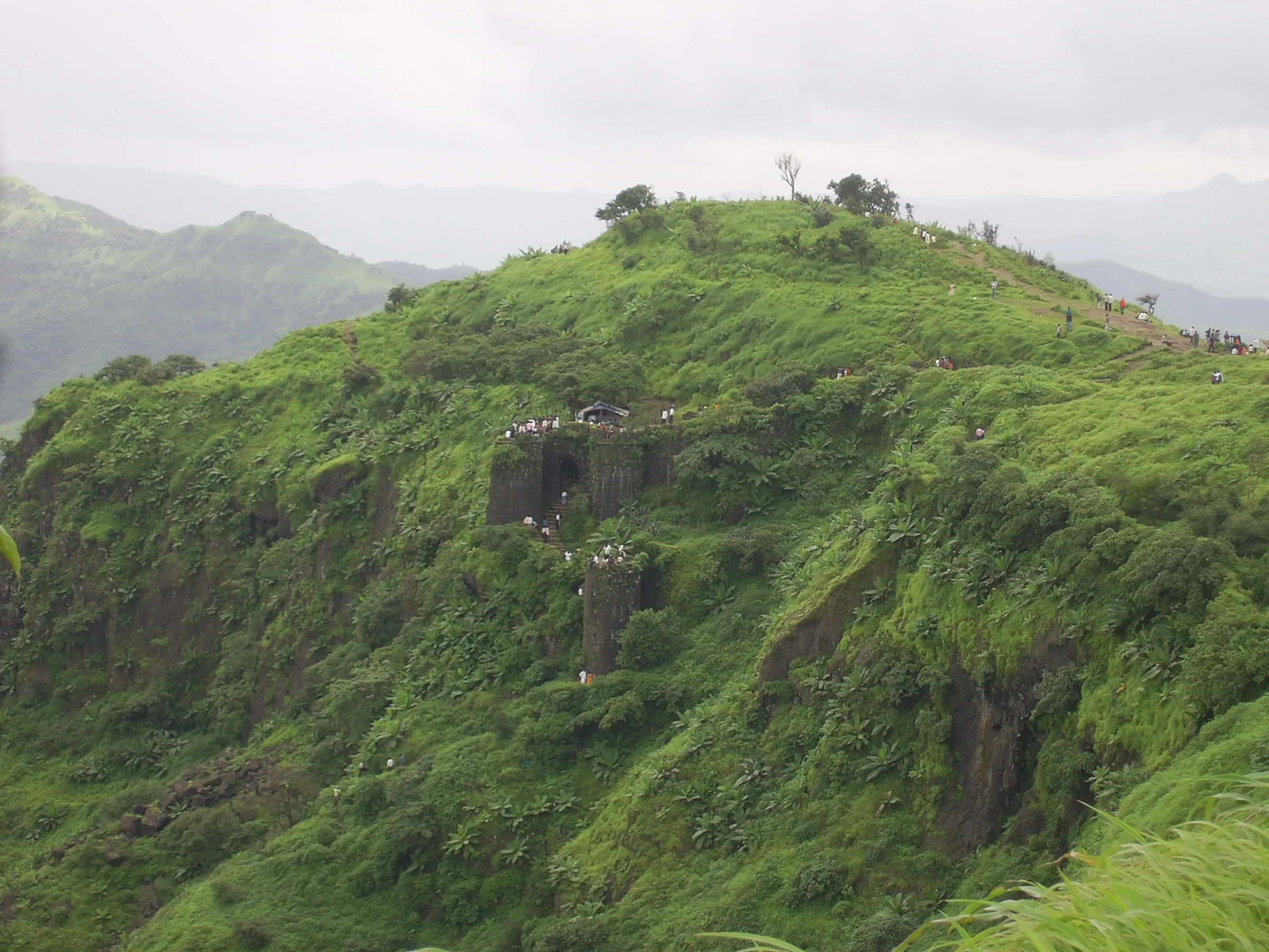
- The long Budhla Machi and the double-walled Zunjar Machi spurs, with Hattimal Buruj, Bini Darwaja, Kothi Darwaja and Konkan Darwaja
- Torneshwar Mahadev temple and Mengai Devi temple on the fort top
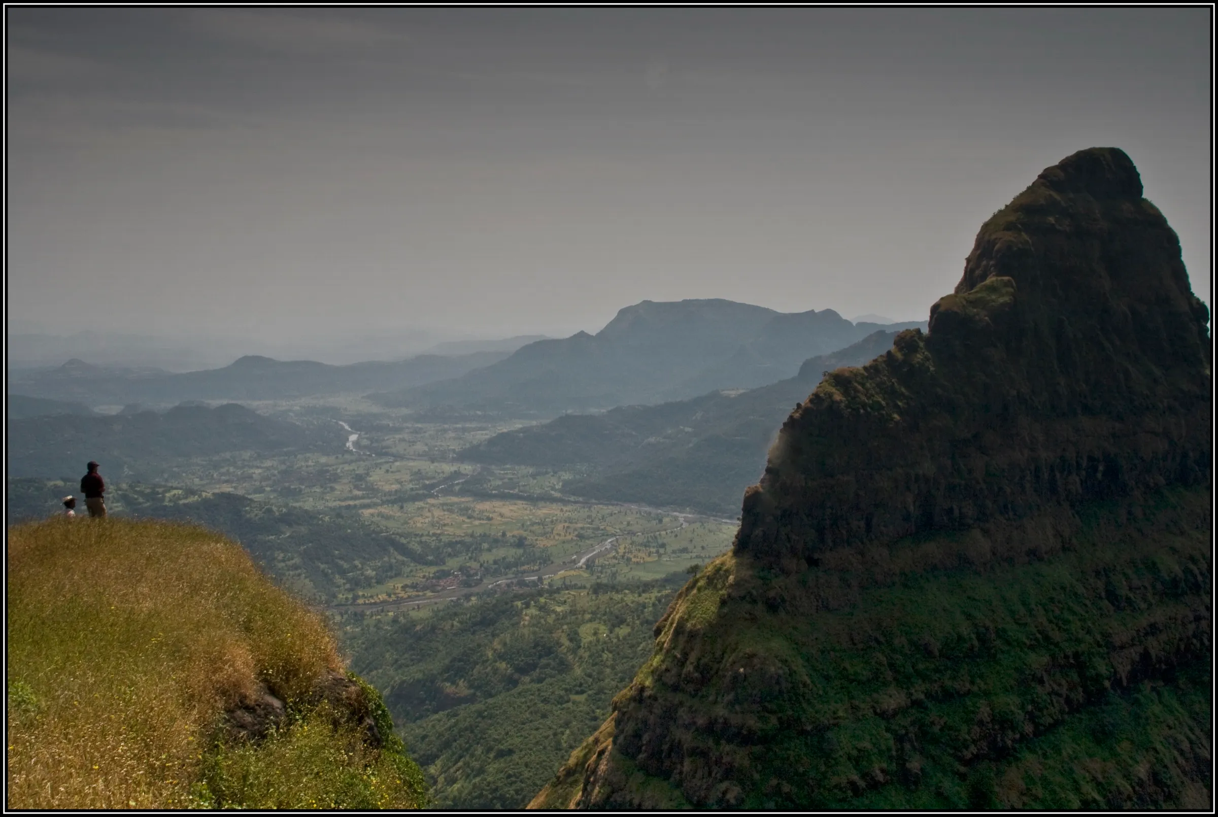
- Views of Rajgad, Raigad, Lingana, Sinhagad, Purandar, Pratapgad and the Gunjavane dam, and the ridge that links Torna to Rajgad
- Karvi, Bristly Smithia (Mickey Mouse flower), Sonki and Raan Terda flower beds along the trail in September and October
Risks
- The final climb to Bini Darwaja is a rocky wall inclined at about 60-70 degrees; the rock-cut steps have railings, but some are damaged, so do not rely on them. Keep about 10 m between people on this section.
- The descent from Hanuman Buruj to Zunjar Machi and the rock-cut steps down to Hattimal Buruj are exposed and very slippery in rain; operators advise carrying a 30-40 ft rope in the monsoon.
- The Chor Darwaja exit towards the Torna-Rajgad ridge is a steep descent on a metal ladder; go that way only if you are continuing to Rajgad.
- Monsoon: mud and loose rock make the trail slippery and fog hides the fort. In 2025 tourism at Torna was banned from 22 June to 30 September by a Bhor sub-divisional order.
- Summer (March-May): heat and humidity with little shade on the upper trail; operators suggest an early start or a night climb with a GPX track or local guide.
- Overnight stays: Wikipedia states that a District Collector order bars staying on the fort and that visitors are asked to leave by 5 pm, while Indiahikes and Bikat describe camping at Mengai Devi temple. We could not confirm the current rule, so plan to finish in a day unless the Velhe police or forest staff say otherwise.
Know before you go
Questions
How long does the Torna Fort trek take?
Most groups do it in one day. The climb from Velhe to the fort gate is about 3.4 km and takes 2.5 to 3 hours (1 km to the plateau in about 20 minutes, then 2.4 km in about 2 hours 15 minutes), and exploring the fort takes another 3-4 hours. Operator one-day trips start walking around 7-10 am and are back at Velhe by mid-afternoon.
Is Torna Fort trek difficult? Can beginners do it?
It is rated moderate (Indiahikes) or medium (Treks and Trails India). You gain about 2,500 ft in a day and the last section is a steep rock wall with damaged railings. Fit beginners manage it, but Indiahikes and Bikat advise working on stamina first.
What is the best time for the Torna Fort trek?
Indiahikes and Bikat say September to February: flower beds in September and October, clear views of the surrounding forts from November to February. Summer is hot. In 2025 the fort was closed to tourists from 22 June to 30 September by a monsoon safety order, so check whether a similar order is in force before a monsoon or early-September visit.
Do I need a permit for Torna Fort?
Indiahikes and Bikat both say no forest department permit is needed. We could not find an official source on fees, so check locally at Velhe.
How do I reach Velhe, the base village?
Velhe is about 65 km from Pune: drive NH48 to Nasrapur and turn onto State Highway 65, or go via Khadakwasla and Pabe Ghat. Direct buses from Swargate are infrequent; otherwise take a Satara or Kolhapur bus to Nasrapur and a shared taxi or auto to Velhe. Few buses run after 4 pm.
Is there water and food on the trek?
Velhe has hotels serving Maharashtrian breakfast and lunch. There is no potable water on the fort, so carry at least 3 litres, and carry your own food rather than relying on villagers at the temple.
In an emergency
Save these numbers before you lose signal. Tap to call.
- 112All emergenciesIndia’s single emergency number — works in every state
- 108Ambulance
- 1077District disaster control room
You are in
District: PuneMaharashtra
- Nearest hospital
- Primary Health Centre, Velhe, for first care; Pune for serious cases
- Last ATM
- Nasrapur, about 30 km before Velhe; Pune for reliable ATMs
- Phone network
- Patchy. Indiahikes reports signal at Velhe and fluctuating Jio, Airtel and Vodafone signal on the trail and fort; Bikat reports no connectivity even in Velhe, with a few bars of Airtel and Jio at points on the trail.
Before you set off
- Tell someone your route and when you will be back.
- Carry a charged phone and a power bank.
- Download an offline map of the route.
- Turn back if the weather turns bad — the mountain will wait.
Questions about Torna Fort
No questions yet. Ask something and trekkers who have done it can answer.
Share your trek photo with #TreksAndTrails
I trekked this
Did Torna Fort look different from this page? Tell us what changed and we will check it.
Where this comes from
Sources
Last reviewed:
- Torna Fort Trek - Trek To the Highest Hill Fort In Pune — Indiahikes
- Torna Fort Trek - Highest Trek in Pune — Bikat Adventures
- A DIY Guide to Torna Fort Trek — Bikat Adventures
- Torna Fort Trek from Pune — Treks and Trails India
- Torna Fort Trek - Highest Hill Fort of Pune — Treks and Trails India
- Torna Fort Flower Trek | Pune — Trekhievers
- Torna Fort One Day Trek — Adventure Club Pune
- Torna Fort Trek: All You Need to Know — Bajaj Finserv
- Torna Fort — Wikipedia
- Pune: Tourism Banned at Rajgad, Torna Forts, Madhe Ghat, and Dam Areas Until September 30 Due to Heavy Rainfall Risk — Punekar News
- Monsoon Safety Alert: Tourist Entry Banned at Rajgad, Torna, Madhe Ghat, and Nearby Dams Until September 30 — Pune Pulse
Photos: Sopan Patil, CC BY-SA 4.0; Pranav Lawate, CC BY-SA 4.0; Pushpak14795, CC BY-SA 4.0; Sopan Patil, CC BY-SA 4.0