Tirathgarh Trek
Bastar, Chhattisgarh
Opens without signal on this phone, with the map file and checklist. Saved for offline →
- Max altitude
- 590 m
- Days
- 1 day
- Distance
- 1 km
- Difficulty
- Easy
A short stepped descent to the foot of the falls and the same steps back up; the rock is wet and slippery, and the climb back is steep for elderly visitors.
About this trek
Tirathgarh
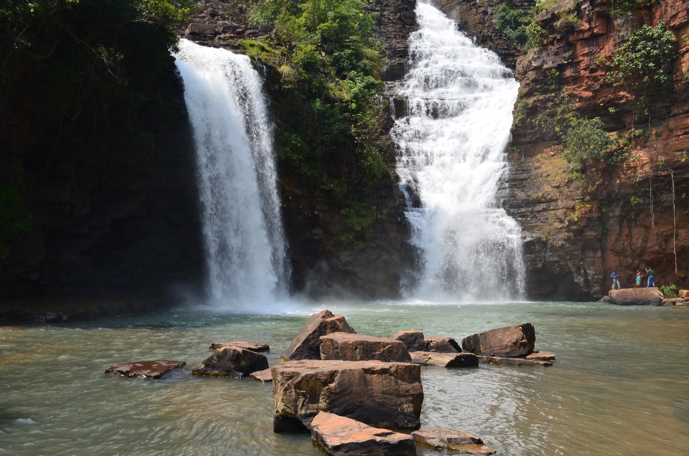
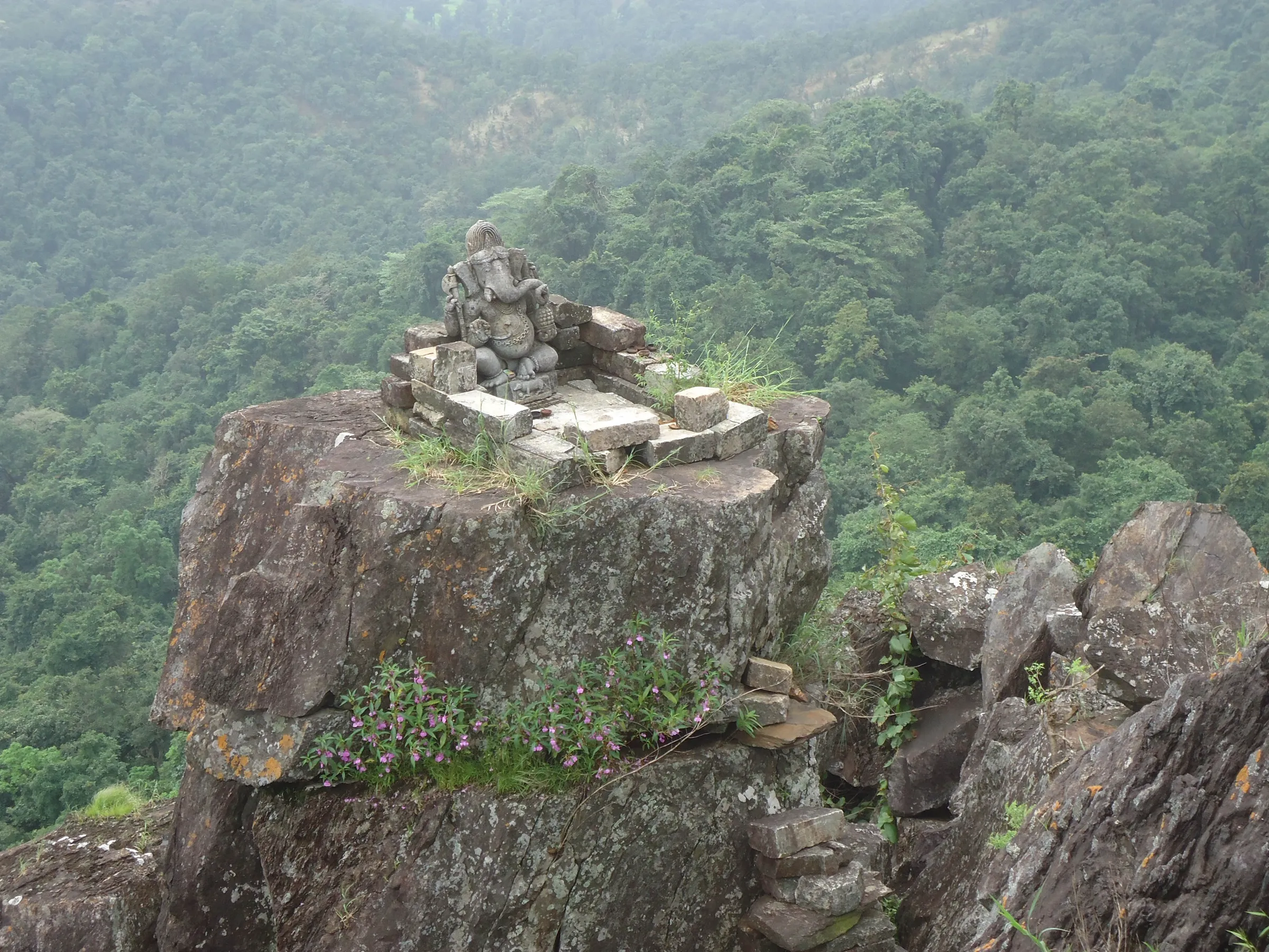
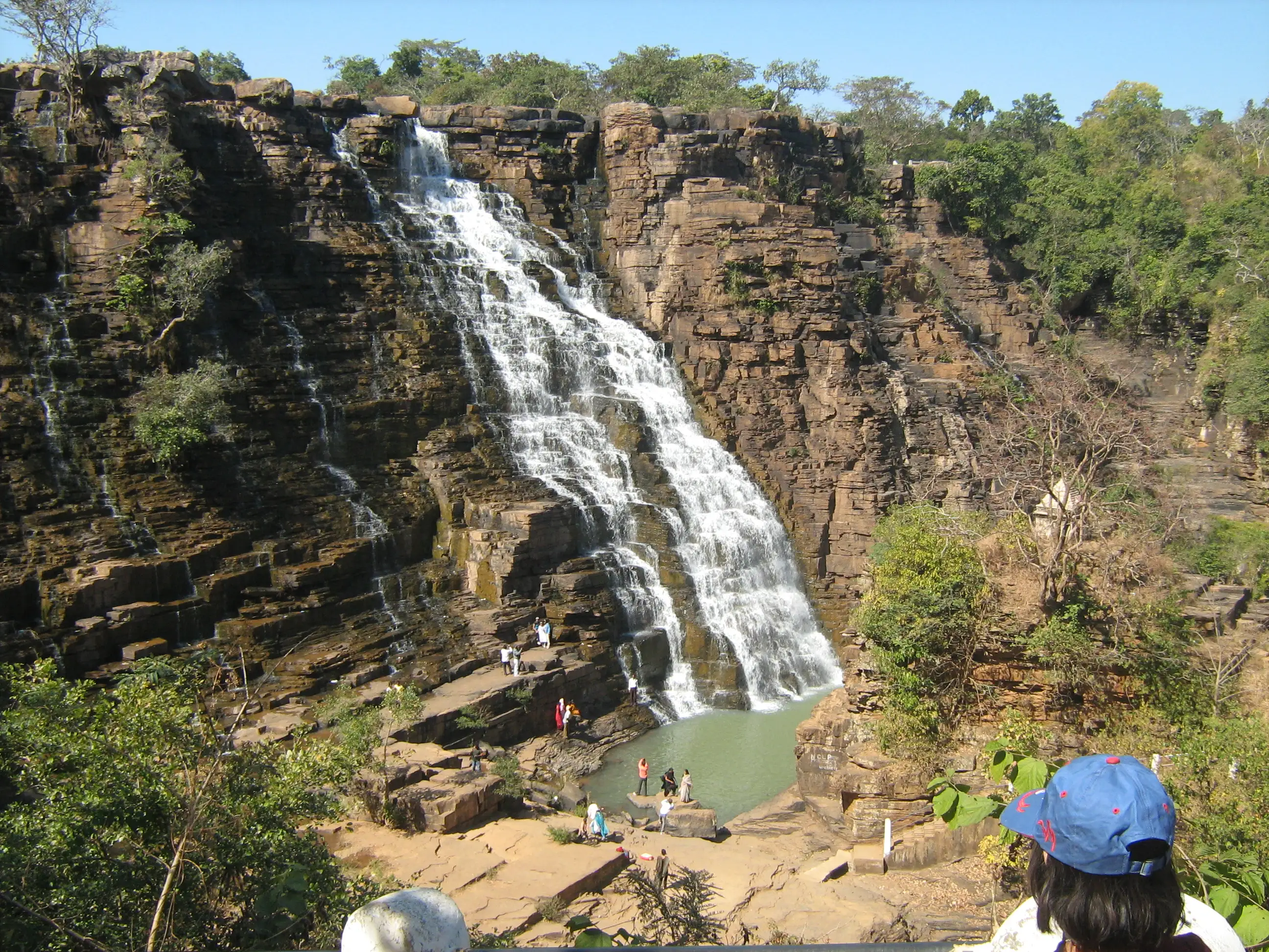
Tirathgarh is a 91 m waterfall in Kanger Valley National Park near Jagdalpur in Bastar, reached by a short walk rather than a trek. Paved paths lead from the parking area to viewing decks, and a concrete staircase of about 200 steps goes down to the canyon floor. At the bottom the rock terraces are wet and slippery, and a Shiva-Parvati shrine sits on a boulder facing the cascade. Wear shoes with a deep non-slip tread.
Photos
On the trail
The route
Day by day
Day 1 · highest point
Tirathgarh Falls viewpoint → Foot of the falls and back
590 m → 590 m
- Paved paths from the parking area lead to elevated viewing decks along the cliff edge, with a frontal view of the 91 m drop.
- A concrete staircase of about 200 steps descends into the canyon floor.
- Wet sandstone terraces and submerged rocks are coated in algae and very slippery; shoes with deep non-slip tread are advised.
- A Shiva-Parvati shrine sits on a boulder facing the central cascade, with shallow rock pools on the canyon floor.
- The park is open 8 am to 5 pm with entry closing at 4:30 pm; the lower steps may be closed from July to September.
Ups and downs
Altitude profile
Where it is
Map
Trailhead and high point only — not a recorded track. Use it with a proper map.
Weather
Next 5 days on the trail
Live forecast for the trailhead and the high point. Mountain weather changes fast — check again on the morning you start.
Trailhead · Tirathgarh Falls viewpoint area (position of the falls; parking is close by)
at 590 mLoading forecast…
High point · Tirathgarh Falls (the waterfall itself; there is no summit)
at 590 mLoading forecast…
Each day: high / low °C · rain mm and chance · snow cm · wind km/h
Weather data: Open-Meteo.comModel forecast, not an official warning. For alerts follow IMD and the local administration.
Plan the trip
How to reach
- Trailhead
- Tirathgarh Falls viewpoint area (position of the falls; parking is close by) (nearest town: Jagdalpur)
- Nearest railway
- Jagdalpur
- Nearest airport
- Jagdalpur airport (Maa Danteshwari Airport)
- By road
- Jagdalpur (about 35 km, roughly 45 minutes on the highway towards Sukma, then a forest road from the Kanger Valley National Park gate)
- Drive
- About 0.75 h from Jagdalpur
Plan the trip
Permits and fees
We could not confirm the current permit rules and fees from an official source. Check with the local forest department or tourism office before you go.
Plan the trip
Cost
Self-guided
₹500–1,500
With an operator
₹1,500–3,500
Per person, ex-Jagdalpur. Self-guided is an estimate: shared or hired vehicle for the half-day plus the park entry charge (about ₹50 per adult per one travel guide, not an official notice). Guided is an estimate from the Bastar day tours that include Tirathgarh; the only operator price found was a 3-day Bastar tour from ₹13,500 (Unexplored Bastar, Aug 2026), which is not a Tirathgarh-only price.
Gear
Top picks for this trek
The gear that matters most on this route, chosen from its altitude, season and risks.
 Ad · affiliate link
 Ad · affiliate link
 Ad · affiliate link
 Ad · affiliate link
 Ad · affiliate link
 Ad · affiliate link
- Ad · affiliate link
 Ad · affiliate link
Store buttons open a search on that store, not a product we picked. As an Amazon Associate we earn from qualifying purchases. Photos show the kind of item, not a specific product. Affiliate disclosure
Packing checklist
Matched to this trek: altitude, season, days and the risks on the route.
Packed 0 of 16
Tick each item as it goes in the bag.
Know before you go
Good to know
- Mobile network
- Jio generally works around Bastar; Airtel is weak in some areas (Unexplored Bastar). Signal at the falls itself is not confirmed.
- Last ATM
- Jagdalpur
- Nearest hospital
- Jagdalpur
- Water
- Carry your own drinking water; the pool at the foot of the falls is not a drinking source.
Highlights
- A 91 m plunge on the Kanger River inside Kanger Valley National Park, called the Milky Fall for its white water
- A stepped staircase from the viewpoints down to the rock pools at the foot of the falls
- A Shiva and Parvati temple near the falls (as described on Wikipedia)
- Combines easily with Kotumsar Cave and Kailash Gufa in the same park
Risks
- Security: Bastar division has had Left-wing extremist activity. A search on 26 Oct 2026 found no current advisory or closure order for Tirathgarh, but no official notice confirming it is open either. Check with the Bastar district administration or the park office before going, travel in daylight, and use a registered local guide.
- The rock and steps are wet and very slippery, especially from July to September when the lower steps may be closed for safety (Hidden Routes). Reviewers disagree on whether bathing in the pool is allowed; follow the notices on site.
- Seasonal access: Wikipedia says Kotumsar Cave in the park is closed 15 June to 31 October and the park is best visited November to June; Unexplored Bastar notes park access depends on it reopening. Confirm the park is open on your dates.
Know before you go
Questions
How tall is Tirathgarh Falls?
Wikipedia and Hidden Routes both give 91 m (299 ft), though Wikipedia's infobox lists three drops and an older source quotes about 100 feet. Unexplored Bastar says nearly 300 feet.
How many steps to reach the bottom of Tirathgarh?
Sources differ. Hidden Routes describes a concrete staircase of about 200 steps from the viewpoints to the canyon floor; visitor reviews mention roughly 50 steps to the first viewpoint and 30-40 more below. Expect a short but steep climb back.
What is the best time to visit Tirathgarh Falls?
October to February per Wikipedia, and October to December per Hidden Routes. From July to September the flow is strongest but the lower steps may be closed. Unexplored Bastar also calls October to March ideal.
How far is Tirathgarh from Jagdalpur?
About 35 km south-west of Jagdalpur, roughly 45 minutes by road. Reach it from the Darbha junction on the Jagdalpur-Sukma highway, through the Kanger Valley National Park gate.
Is Tirathgarh safe to visit?
It is a regular tourist site, but Bastar has had Left-wing extremist activity. We found no advisory or closure for it on 26 Oct 2026; still check locally, visit in daylight and go with a registered guide.
In an emergency
Save these numbers before you lose signal. Tap to call.
- 112All emergenciesIndia’s single emergency number — works in every state
- 108Ambulance
- 1077District disaster control room
You are in
District: BastarChhattisgarh
- Nearest hospital
- Jagdalpur
- Last ATM
- Jagdalpur
- Phone network
- Jio generally works around Bastar; Airtel is weak in some areas (Unexplored Bastar). Signal at the falls itself is not confirmed.
Before you set off
- Tell someone your route and when you will be back.
- Carry a charged phone and a power bank.
- Download an offline map of the route.
- Turn back if the weather turns bad — the mountain will wait.
Questions about Tirathgarh
No questions yet. Ask something and trekkers who have done it can answer.
Share your trek photo with #TreksAndTrails
I trekked this
Did Tirathgarh look different from this page? Tell us what changed and we will check it.
Where this comes from
Sources
Last reviewed:
- Tirathgarh Falls Travel Guide — Hidden Routes
- Teerathgarh Falls — Wikipedia
- Kanger Valley National Park — Wikipedia (Kanger Valley National Park article)
- Chhattisgarh Freedom Trek 2026 — Unexplored Bastar
Photos: Mashooque14, CC BY-SA 4.0; Jitendranakka1986, CC BY-SA 4.0; Pateldushyant, CC BY-SA 4.0; Gsrinivasarao4, CC BY-SA 4.0