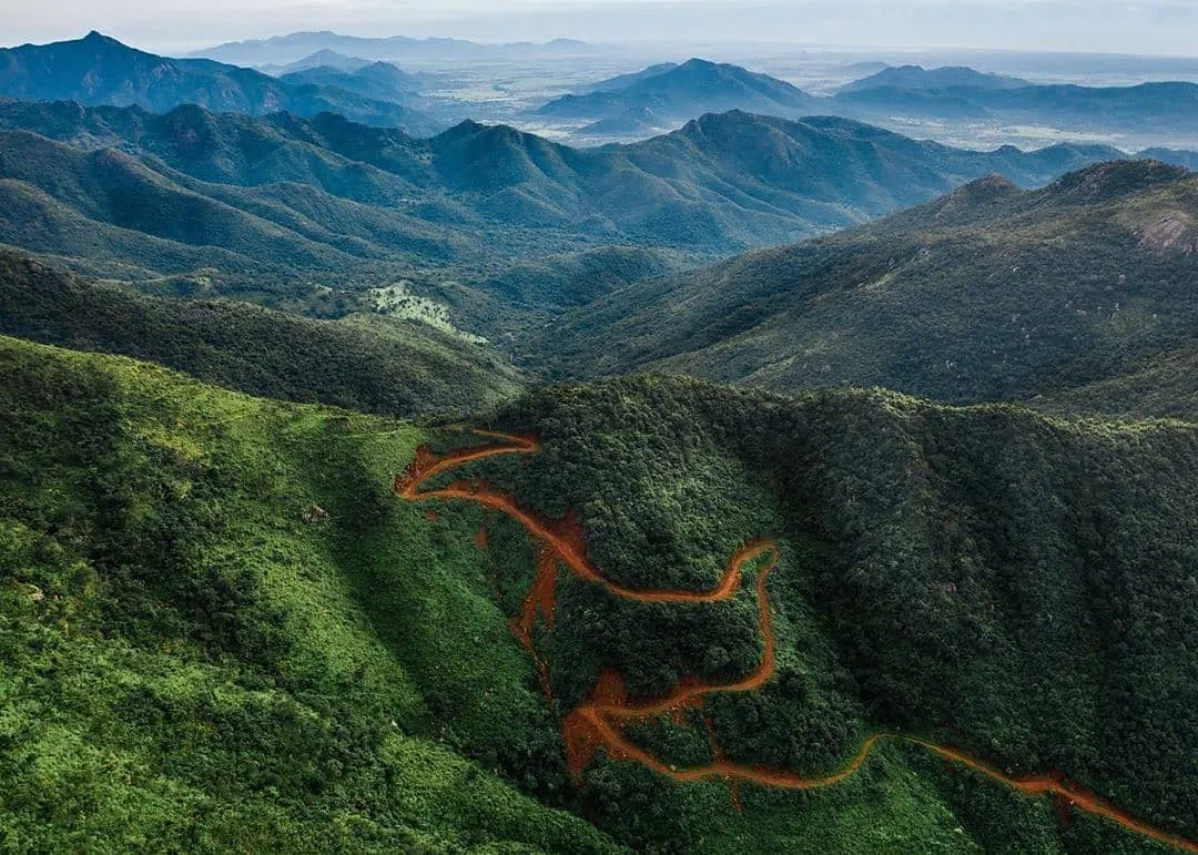
Deomali Trek
Koraput, Odisha
Opens without signal on this phone, with the map file and checklist. Saved for offline →
- Max altitude
- 1,672 m
- Days
- 1 day
- Distance
- 2.5 km
- Difficulty
- Easy
A tarred road climbs most of the way; from the road-head a grassy footpath of about 1.2 km gains roughly 240 m to the summit, which is short but slippery and foggy in the rains.
Photos
On the trail
The route
Day by day
Day 1 · highest point
Deomali road-head → Deomali road-head (via Deomali summit)
1,430 m → 1,672 m → 1,430 m
Ups and downs
Altitude profile
Where it is
Map
Trailhead and high point only — not a recorded track. Use it with a proper map.
Weather
Next 5 days on the trail
Live forecast for the trailhead and the high point. Mountain weather changes fast — check again on the morning you start.
Trailhead · Deomali road-head (end of the hill road above Barabandha)
at 1,430 mLoading forecast…
High point · Deomali summit
at 1,672 mLoading forecast…
Each day: high / low °C · rain mm and chance · snow cm · wind km/h
Weather data: Open-Meteo.comModel forecast, not an official warning. For alerts follow IMD and the local administration.
Plan the trip
How to reach
- Trailhead
- Deomali road-head (end of the hill road above Barabandha) (nearest town: Pottangi)
- Nearest railway
- Koraput (KRPU)
- Nearest airport
- Jeypore airport (about 80 km); Visakhapatnam International Airport (about 190 km) for most flights
- By road
- Koraput (about 60–70 km via Semiliguda and Pottangi); Jeypore (about 60–80 km); Visakhapatnam (about 190 km via Salur and Pottangi)
- Drive
- About 5 h from Visakhapatnam
Plan the trip
Permits and fees
We could not confirm the current permit rules and fees from an official source. Check with the local forest department or tourism office before you go.
Plan the trip
Cost
Self-guided
₹800–2,500
With an operator
₹2,000–6,200
Per person, ex-Koraput. No trek operator publishes a Deomali package price, so both ranges are estimates. Self-guided covers a share of a hired taxi from Koraput or Semiliguda (about 130 km round trip) and food. The guided upper end is the Forest Department cottage at Deomali (₹6,190 per night with meals, per Orissa Post); local guides can be arranged in Pottangi.
Gear
Top picks for this trek
The gear that matters most on this route, chosen from its altitude, season and risks.
 Ad · affiliate link
 Ad · affiliate link
 Ad · affiliate link
 Ad · affiliate link
 Ad · affiliate link
 Ad · affiliate link
 Ad · affiliate link
 Ad · affiliate link
Store buttons open a search on that store, not a product we picked. As an Amazon Associate we earn from qualifying purchases. Photos show the kind of item, not a specific product. Affiliate disclosure
Packing checklist
Matched to this trek: altitude, season, days and the risks on the route.
Packed 0 of 19
Tick each item as it goes in the bag.
Know before you go
Good to know
- Mobile network
- Not confirmed by any source; expect patchy signal on the hilltop
- Last ATM
- Not confirmed; carry cash from Koraput or Semiliguda
- Nearest hospital
- Koraput (about 60–70 km); confirm the nearest health centre at Pottangi locally
- Water
- None confirmed on the trail or summit; carry water and food from Pottangi or Semiliguda
Highlights
- Highest peak in Odisha at about 1,672 m, in the Chandragiri–Pottangi range of the Eastern Ghats
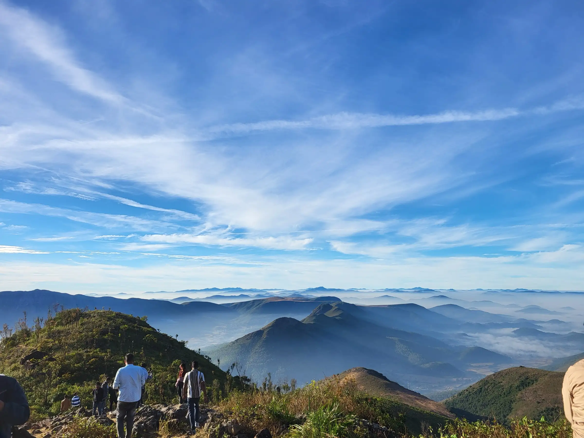
- Sunrise over valleys filled with cloud and rows of Eastern Ghats ridges
- Rolling grassland on a long flat hilltop, with an M-shaped summit ridge
- Tribal villages of the Kotia–Pottangi area on the drive up
- Option of a longer walk up from Putsil village for those who want a real climb
Risks
- Heavy rain, fog and possible landslides on the hill road in the July–September monsoon; several sources say to avoid these months
- Grassy slopes and the descent turn slippery when wet
- No confirmed shops, water or toilets on the hilltop
- Cold, windy mornings in winter; carry a warm layer for sunrise
Know before you go
Questions
How high is Deomali?
About 1,672 m, which makes it the highest peak in Odisha. The Koraput district website prints 1,762 m, but Wikipedia, Incredible India, Orissa Post and a GPS reading of 1,674 m at the summit all agree on about 1,672 m.
What is the best time to visit Deomali?
October to March, when the weather is pleasant and clear; November to March is the peak season. Avoid July to September, when heavy rain, fog and landslides affect the road and trail.
How do I reach Deomali?
Drive from Koraput (about 60–70 km) via Semiliguda and Pottangi, or from Jeypore. A tarred road climbs close to the top, and you can walk the last stretch to the summit. Koraput is the nearest railway station; Visakhapatnam is about 190 km away.
Can I stay at Deomali?
Yes. Orissa Post reports 10 Forest Department cottages at about ₹6,190 a night including meals, and tents arranged by the Pottangi block administration in the tourist season.
In an emergency
Save these numbers before you lose signal. Tap to call.
- 112All emergenciesIndia’s single emergency number — works in every state
- 108Ambulance
- 1077District disaster control room
You are in
District: KoraputOdisha
- Nearest hospital
- Koraput (about 60–70 km); confirm the nearest health centre at Pottangi locally
- Last ATM
- Not confirmed; carry cash from Koraput or Semiliguda
- Phone network
- Not confirmed by any source; expect patchy signal on the hilltop
Before you set off
- Tell someone your route and when you will be back.
- Carry a charged phone and a power bank.
- Download an offline map of the route.
- Turn back if the weather turns bad — the mountain will wait.
Questions about Deomali
No questions yet. Ask something and trekkers who have done it can answer.
Share your trek photo with #TreksAndTrails
I trekked this
Did Deomali look different from this page? Tell us what changed and we will check it.
Where this comes from
Sources
Last reviewed:
- DEOMALI — Koraput District Administration, Government of Odisha (official)
- Deomali (mountain) — Wikipedia
- Deomali Hills — Incredible India (Ministry of Tourism) (official)
- Deomali: A paradise for nature enthusiasts — Orissa Post
- Deomali FAQs — TravelSetu
- 18°N 83°E visit narrative (Deomali) — Degree Confluence Project
- Deomali Peaks: The Highest of the Eastern Ghats — Odisha Lifestyle
- Deomali - The Triund of Odisha — Tripoto (traveller trip report)
Photos: Shubsclicks, CC BY 4.0; BubunTalk, CC BY-SA 4.0; Praptipanigrahi, CC BY-SA 3.0