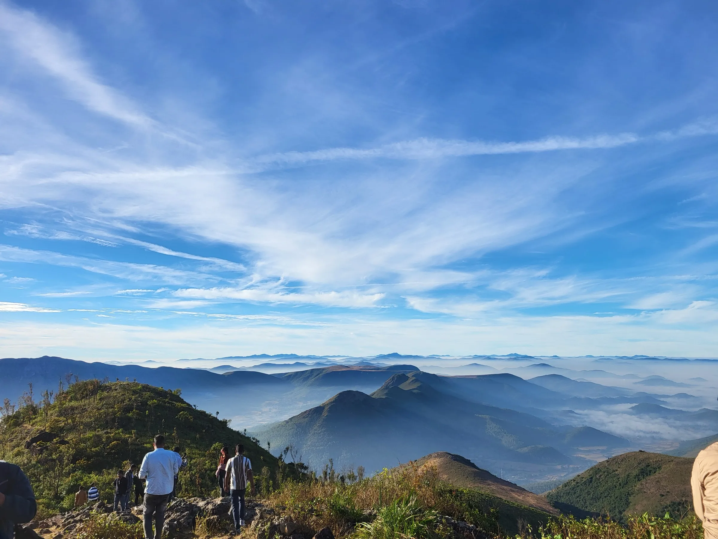
Mahendragiri Trek
Gajapati, Odisha
Opens without signal on this phone, with the map file and checklist. Saved for offline →
- Max altitude
- 1,501 m
- Days
- 2 days
- Distance
- 14 km
- Difficulty
- Moderate
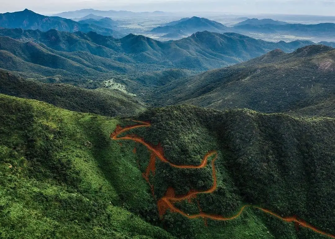
About 6 km each way on a steep, landslide-damaged jeep road with roughly 500 m of climbing, then an unmarked boulder scramble from the Yudhishthira temple to the Bhima temple and Arjuna's cave on the summit ridge.
Photos
On the trail
The route
Day by day
Day 1
Burakhat Pass (Hanuman temple) → Hilltop ashram and Kunti temple
990 m → 1,350 m
Day 2 · highest point
Hilltop ashram → Burakhat Pass (via Yudhishthira temple, Bhima temple and summit)
1,350 m → 1,501 m → 990 m
Ups and downs
Altitude profile
Where it is
Map
Trailhead and high point only — not a recorded track. Use it with a proper map.
Weather
Next 5 days on the trail
Live forecast for the trailhead and the high point. Mountain weather changes fast — check again on the morning you start.
Trailhead · Burakhat Pass (Barakhat / Burukhat)
at 990 mLoading forecast…
High point · Mahendragiri summit (near Bhima temple)
at 1,501 mLoading forecast…
Each day: high / low °C · rain mm and chance · snow cm · wind km/h
Weather data: Open-Meteo.comModel forecast, not an official warning. For alerts follow IMD and the local administration.
Plan the trip
How to reach
- Trailhead
- Burakhat Pass (Barakhat / Burukhat) (nearest town: Paralakhemundi)
- Nearest railway
- Palasa (Andhra Pradesh), about an hour's drive via Mandasa; Paralakhemundi has a smaller station
- Nearest airport
- Visakhapatnam, or Biju Patnaik International Airport, Bhubaneswar
- By road
- Brahmapur (Berhampur) to Paralakhemundi, 115 km via Ichhapur and Palasa, then about 40 km to Burakhat Pass; Mandasa (Srikakulam district, Andhra Pradesh), about 30 km to the hill
- Drive
- About 4 h from Brahmapur
Plan the trip
Permits and fees
We could not confirm the current permit rules and fees from an official source. Check with the local forest department or tourism office before you go.
Plan the trip
Cost
Self-guided
₹1,500–4,000
With an operator
₹2,500–6,000
Per person, ex-Paralakhemundi. No trek operator publishes a Mahendragiri price, so both ranges are estimates: self-guided covers a bus or shared jeep to Burakhat, food and a donation for a room at the hilltop ashram; guided adds a local guide (Outlook Traveller advises trekking with one) and an optional jeep ride from Burakhat to the hilltop.
Gear
Top picks for this trek
The gear that matters most on this route, chosen from its altitude, season and risks.
 Ad · affiliate link
 Ad · affiliate link
 Ad · affiliate link
 Ad · affiliate link
 Ad · affiliate link
 Ad · affiliate link
 Ad · affiliate link
 Ad · affiliate link
Store buttons open a search on that store, not a product we picked. As an Amazon Associate we earn from qualifying purchases. Photos show the kind of item, not a specific product. Affiliate disclosure
Packing checklist
Matched to this trek: altitude, season, days and the risks on the route.
Packed 0 of 25
Tick each item as it goes in the bag.
Know before you go
Good to know
- Mobile network
- Not confirmed by any source; expect patchy mobile signal on the hill.
- Last ATM
- Paralakhemundi (district headquarters)
- Nearest hospital
- District Headquarters Hospital, Paralakhemundi; MKCG Medical College, Brahmapur for serious cases
- Water
- No confirmed water source on the road from Burakhat; carry at least 3 litres. The hilltop ashram feeds pilgrims, but ask there before relying on it. Treat all water.
Highlights
- Sunrise from the 1,501 m summit, with the Mahendratanaya river and the Bay of Bengal on the horizon on clear mornings
- Ancient Shiva temples linked to the Pandavas: Kunti, Yudhishthira and the massive 18-block Bhima (Gokarneswar) temple
- Arjuna's cave, a two-level shelter formed by giant boulders, and the 'musical' rocks that ring when struck
- A biodiversity hotspot of the Eastern Ghats with over 600 flowering plants, the second biodiversity heritage site of Odisha
Risks
- Summer heat and dehydration: the road climb is largely exposed, so start early and carry plenty of water.
- The road from Burakhat was badly damaged by landslides after Cyclone Titli (October 2018) and is steep and loose in places.
- There is no marked path from the Yudhishthira temple to the Bhima temple and Arjuna's cave; expect boulder scrambling and go with a local guide.
- Elephants, leopards and other wildlife live in the surrounding forest; do not walk the road after dark.
- Huge crowds and traffic on the night before Maha Shivaratri, when pilgrims walk up and stay on the hilltop.
Know before you go
Questions
Where does the Mahendragiri trek start?
At Burakhat (also spelt Barakhat or Burukhat) Pass, where there is a Hanuman temple. Vehicles park here; you can walk about 6 km up the hill road to the ashram and Kunti temple, or hire one of the jeeps that ferry visitors to the top.
How high is Mahendragiri?
1,501 metres, according to the Gajapati district administration. It is in Rayagada block of Gajapati district, Odisha, in the Eastern Ghats.
Can I stay overnight on Mahendragiri?
Yes. The ashram on the hilltop gives pilgrims simple one-room concrete quarters (no attached toilet) and food; leave a donation. Staying the night lets you see the sunrise over the Bay of Bengal.
When is the best time to visit Mahendragiri?
Winter (October to February) is the comfortable season. On the night before Maha Shivaratri thousands of pilgrims walk the 6 km up and keep vigil on the hilltop, so expect crowds then. Summer climbs are hot and dehydrating.
Do I need a guide?
The road to the ashram is easy to follow, but the climb to the Bhima temple and Arjuna's cave has no marked path. Outlook Traveller advises trekking with a guide; ask at Burakhat or the ashram.
In an emergency
Save these numbers before you lose signal. Tap to call.
- 112All emergenciesIndia’s single emergency number — works in every state
- 108Ambulance
- 1077District disaster control room
You are in
District: GajapatiOdisha
- Nearest hospital
- District Headquarters Hospital, Paralakhemundi; MKCG Medical College, Brahmapur for serious cases
- Last ATM
- Paralakhemundi (district headquarters)
- Phone network
- Not confirmed by any source; expect patchy mobile signal on the hill.
Before you set off
- Tell someone your route and when you will be back.
- Carry a charged phone and a power bank.
- Download an offline map of the route.
- Turn back if the weather turns bad — the mountain will wait.
Questions about Mahendragiri
No questions yet. Ask something and trekkers who have done it can answer.
Share your trek photo with #TreksAndTrails
I trekked this
Did Mahendragiri look different from this page? Tell us what changed and we will check it.
Where this comes from
Sources
Last reviewed:
- Mahendragiri | Gajapati — Gajapati District Administration, Government of Odisha (official)
- Trek to Mahendragiri -- The Second Highest Peak In Odisha — Indiahikes
- Mahendragiri – Odisha's Second Highest Peak! — Odisha Lifestyle
- Exploring the Enchanting Gems of Gajapati District: Top 10 Travel Destinations — Odisha Lifestyle
- Paralakhemundi: Off The Beaten Track In Odisha — Outlook Traveller
- Maha Shivaratri At Mahendragiri (visitor blog, 15 Mar 2021) — Odisha Tourism visitor blog
- Mahendragiri (Odisha) — Wikipedia
Photos: Subhamsahoo2008, CC BY-SA 4.0; Kpvirus, CC0; Vsvlss, CC BY-SA 4.0