Dholkal Trek
Dantewada, Chhattisgarh
Opens without signal on this phone, with the map file and checklist. Saved for offline →
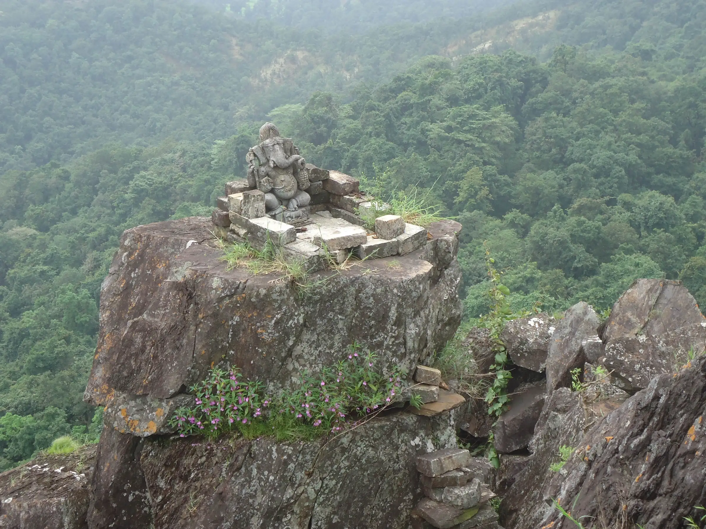 900 mhighest point
- Max altitude
- 900 m
- Days
- 1 day
- Distance
- 8 km
- Difficulty
- Moderate
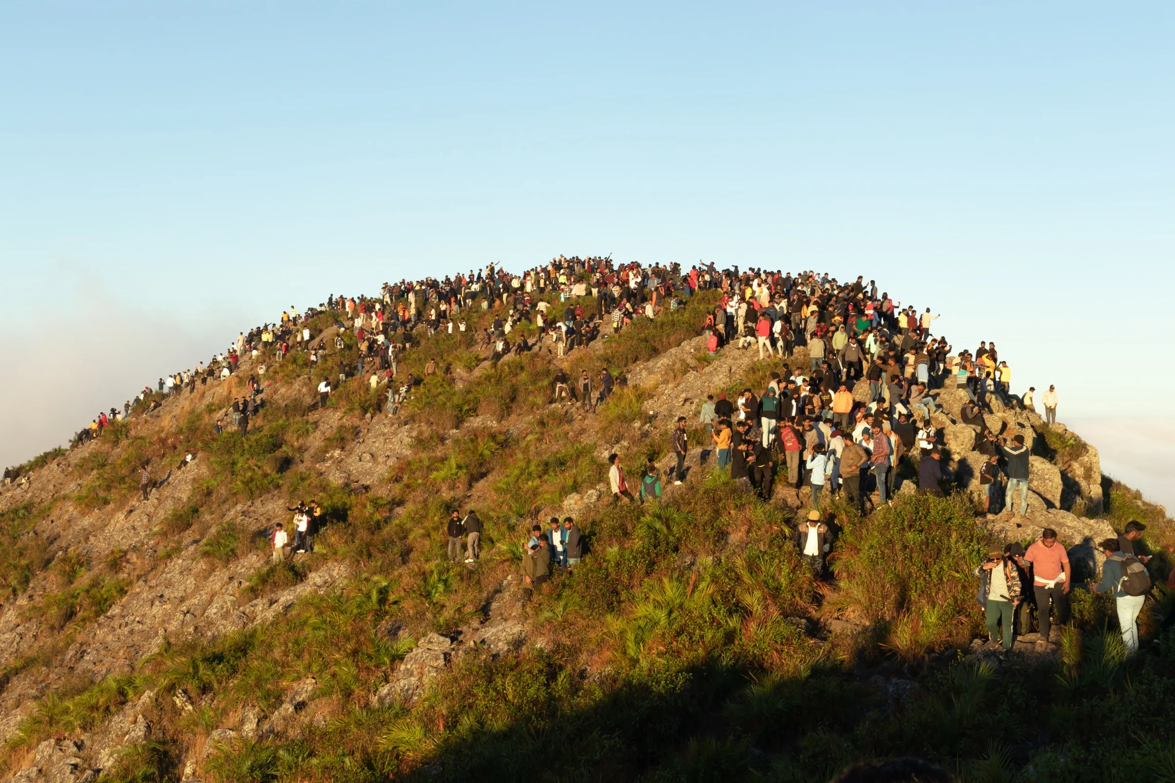
A gradual forest walk of about 3-4 km followed by a steep climb of roughly 300 m with a boulder scramble at the end, where one side drops away to the plains; the final section has no clear route.
About this trek
Dholkal
Dholkal is a day trek in Dantewada district, Chhattisgarh, to a stone Ganesha idol of about 1,000 years sitting in the open at around 3,000 ft on a hill of the Bailadila range. The walk starts at Faraspal village and runs through forest, past a spring and big anthills, over rocky ground to a final boulder scramble. Published lengths range from 4-5 km one way to 16 km round trip. Go with a registered local guide, and confirm the security situation locally first.
The route
Day by day
Day 1 · highest point
Faraspal (Pharsapal) village → Dholkal Ganesh idol and back
360 m → 900 m → 360 m
- Operators describe forest trail with a spring called Doh or Khassa, large anthills and rocky ground on the way up.
- Published length runs from 4-5 km one way to 16 km round trip; an operator allows about 8 hours in all.
- The last 100-200 m is a steep scramble over boulders with a drop on one side; use hands and feet.
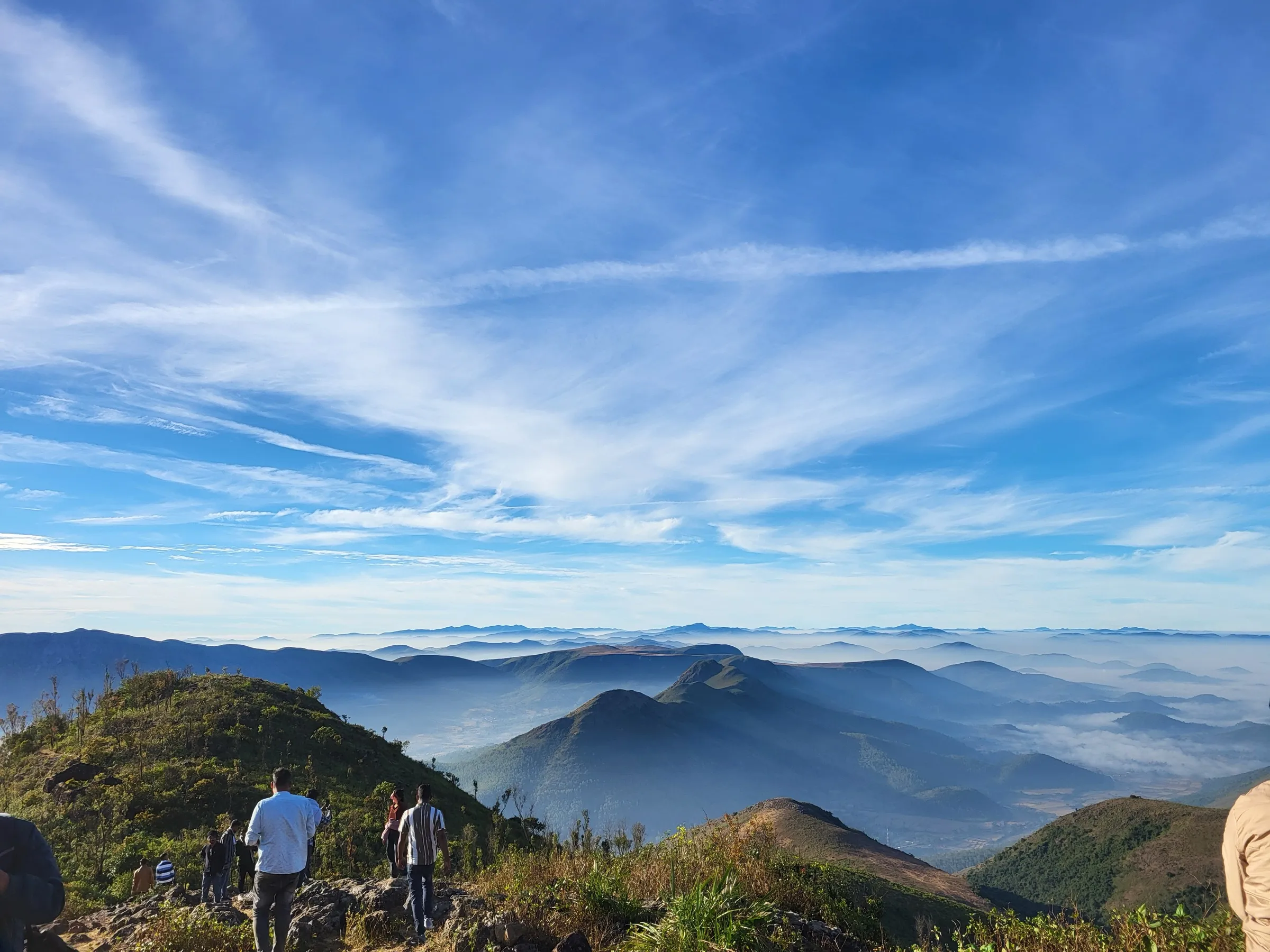
- At the top a 3 ft stone Ganesha stands in the open, with wide views of the forested Bailadila range.
- A registered guide is recommended from the Dholkal base because the forest is dense.
Ups and downs
Altitude profile
Where it is
Map
Trailhead and high point only — not a recorded track. Use it with a proper map.
Weather
Next 5 days on the trail
Live forecast for the trailhead and the high point. Mountain weather changes fast — check again on the morning you start.
Trailhead · Faraspal (Pharsapal) village
at 360 mLoading forecast…
High point · Dholkal Ganesh idol (coordinates from the Dantewada district site)
at 900 mLoading forecast…
Each day: high / low °C · rain mm and chance · snow cm · wind km/h
Weather data: Open-Meteo.comModel forecast, not an official warning. For alerts follow IMD and the local administration.
Plan the trip
How to reach
- Trailhead
- Faraspal (Pharsapal) village (nearest town: Dantewada)
- Nearest railway
- Dantewada (daily Visakhapatnam-Dantewada trains)
- Nearest airport
- Jagdalpur (small airport, flights to Raipur); Raipur and Visakhapatnam are the larger airports
- By road
- Dantewada to Faraspal village (about 14-16 km by road, per different sources); Jagdalpur to Dantewada is the main approach
- Drive
- About 9 h from Raipur
Plan the trip
Permits and fees
We could not confirm the current permit rules and fees from an official source. Check with the local forest department or tourism office before you go.
Plan the trip
Cost
Self-guided
₹500–2,500
With an operator
₹12,500
Per person, ex-Jagdalpur. Guided: the only published price found is Unexplored Bastar's 3-day Bastar Monsoon Getaway 2026 at ₹12,500, which includes the Dholkal trek plus Tirathgarh, Chitrakote and Danteshwari temple, so it is a package, not a trek-only price. Self-guided is a rough estimate (unconfirmed): bus or hired bike from Dantewada to Faraspal, a local guide, and an entry or camping charge collected by local community workers at the start (amount not published).
Gear
Top picks for this trek
The gear that matters most on this route, chosen from its altitude, season and risks.
 Ad · affiliate link
 Ad · affiliate link
 Ad · affiliate link
 Ad · affiliate link
 Ad · affiliate link
 Ad · affiliate link
 Ad · affiliate link
- Ad · affiliate link
Store buttons open a search on that store, not a product we picked. As an Amazon Associate we earn from qualifying purchases. Photos show the kind of item, not a specific product. Affiliate disclosure
Packing checklist
Matched to this trek: altitude, season, days and the risks on the route.
Packed 0 of 19
Tick each item as it goes in the bag.
Know before you go
Good to know
- Mobile network
- Not stated by sources; expect patchy or no mobile signal on the hill.
- Last ATM
- Dantewada
- Nearest hospital
- Dantewada district hospital
- Water
- Not stated by sources; carry your own water for the climb.
Highlights
- Darshan of a roughly 1,000-year-old, 3-foot stone idol of Bhagwan Ganesha, linked to the Chhindak Nagvanshi kings, set open to the sky on a rock summit
- Forest trail on the Bailadila range with canopy shade for most of the walk
- A steep final boulder climb with views over the forested plains
- Local community-run camping and guiding at the foot of the hill
Risks
- Security (checked 26 Oct 2026): Bastar division has had Left-wing extremist activity. Wikipedia describes the insurgency as ongoing but low-level, with the affected districts reduced to 3 by early 2026, but no official advisory for Dholkal was found. Dantewada district's tourism pages do not mention security. Ask the district administration or police before going, and go with a registered local guide from Faraspal.
- The final climb is a boulder scramble with an unprotected drop on one side; use hands and feet, and take a local guide as the last section has no clear route.
- Rain makes the trail slippery and the district tourism site says the site is visitable except in the rainy season; start early to avoid afternoon rain and midday heat.
- Wildlife: guides have reported a bear visiting the campsite; do not leave food out.
- Sources disagree on trek length (5 km to 16 km round trip), so allow a full day and confirm the route with the guide.
Know before you go
Questions
How long is the Dholkal Ganesh trek?
A trip report describes 3-4 km of gradual walking from the campsite plus a steep 300 m climb, about 7-8 km round trip and 4 hours. ETV Bharat quotes about 3 hours on foot from Pharsapal to the peak, and Dynamite News gives about 16 km as a round trip. Allow most of a day.
How high is Dholkal Ganesh?
Dantewada district tourism and several news and travel pages give about 3,000 feet (about 900 m) on the Bailadila range; ETV Bharat gives about 2,500 feet. The idol is about 3 feet high and believed to date from the 10th-11th century.
When is the best time to visit Dholkal?
November to February is described as the most pleasant; Dynamite News says September to February. Late July to early October is lush but rainy, and March to June is hot. Dantewada district tourism says the site is open year-round except in the rainy season.
Do I need a guide for Dholkal?
Yes, the district tourism site advises hiring guides from Faraspal village, and a trip report notes the last section has no clear route. Camping and guiding are arranged by a local community group.
Is Dholkal safe to visit given the Naxal history of Dantewada?
No official closure of Dholkal was found. Bastar has had Left-wing extremist activity, which Wikipedia describes as low-level and shrinking by 2026. Check with the Dantewada administration or police before travelling and use a local guide.
In an emergency
Save these numbers before you lose signal. Tap to call.
- 112All emergenciesIndia’s single emergency number — works in every state
- 108Ambulance
- 1077District disaster control room
You are in
District: DantewadaChhattisgarh
- Nearest hospital
- Dantewada district hospital
- Last ATM
- Dantewada
- Phone network
- Not stated by sources; expect patchy or no mobile signal on the hill.
Before you set off
- Tell someone your route and when you will be back.
- Carry a charged phone and a power bank.
- Download an offline map of the route.
- Turn back if the weather turns bad — the mountain will wait.
Questions about Dholkal
No questions yet. Ask something and trekkers who have done it can answer.
Share your trek photo with #TreksAndTrails
I trekked this
Did Dholkal look different from this page? Tell us what changed and we will check it.
Where this comes from
Sources
Last reviewed:
- Dholkal Ganesh - Dantewada district website — Dantewada District Administration (official)
- Dholkal Ganesh - Tourism Sites Details — Dantewada Tourism (official)
- Dholkal Ganesh: The Best Trek in Bastar, Chattisgarh — Travelling Slacker
- Ganesh Chaturthi 2026: Dholkal Ganesh Temple hidden in Bastar's dense forests — Dynamite News
- This 11th century 'Dholkal Ganesha' sits atop hill in Chhattisgarh — ETV Bharat
- Naxalite-Maoist insurgency (security context only) — Wikipedia
- Trekking - Unexplored Bastar (Bastar Monsoon Getaway 2026, 3 days, ₹12,500) — Unexplored Bastar
- A Complete Travel Guide to the Mysterious Dholkal — Tripoto
- Dholkal Trek - A Mesmerising Experience — Unexplored Bastar
Photos: PUNAM CHAND YADAV, CC BY-SA 4.0