Siddhagad Trek
Thane, Maharashtra
Opens without signal on this phone, with the map file and checklist. Saved for offline →
- Max altitude
- 980 m
- Days
- 1 day
- Distance
- 18.5 km
- Difficulty
- Difficult
A long day of about 18 km with roughly 1,200 m of climbing from a base village at about 145 m; the last 1.5 hours from the machi to the Balekilla are steep and little-used, and a trekker died in a fall here in June 2025.
Photos
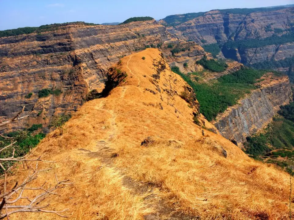
On the trail
The route
Day by day
Day 1 · highest point
Narivali → Narivali (via Siddhagad Wadi and the Balekilla)
145 m → 980 m → 145 m
Ups and downs
Altitude profile
Where it is
Map
Trailhead and high point only — not a recorded track. Use it with a proper map.
Weather
Next 5 days on the trail
Live forecast for the trailhead and the high point. Mountain weather changes fast — check again on the morning you start.
Trailhead · Narivali
at 145 mLoading forecast…
High point · Siddhagad Balekilla (top plateau)
at 980 mLoading forecast…
Each day: high / low °C · rain mm and chance · snow cm · wind km/h
Weather data: Open-Meteo.comModel forecast, not an official warning. For alerts follow IMD and the local administration.
Plan the trip
How to reach
- Trailhead
- Narivali (nearest town: Murbad)
- Nearest railway
- Kalyan Junction (Neral is about 33 km from Narivali)
- Nearest airport
- Chhatrapati Shivaji Maharaj International Airport, Mumbai
- By road
- Kalyan to Murbad by ST bus, then an ST bus from Murbad to Narivali (about 16 km); a 2018 trip report gives the first bus at 5.30 am and the last return bus from Narivali at about 8.30 pm; Mumbai to Narivali by road via Kalyan and Murbad (about 120 km); operator buses leave Dadar at 6 am and reach Narivali about 9.30 am; A private jeep can go on to Dhaparpada (Dhaptapada) via Uchale, saving about an hour of walking
- Drive
- About 3.5 h from Mumbai
Plan the trip
Permits and fees
We could not confirm the current permit rules and fees from an official source. Check with the local forest department or tourism office before you go.
Plan the trip
Cost
Self-guided
₹300–1,200
With an operator
₹1,000–1,200
Per person, ex-Mumbai. Only one operator price found (October 2026): Treks and Trails India lists ₹1,000 for the Siddhagad day trek ex-Dadar (non-AC transport, breakfast and tea; lunch not included) and ₹1,200 for its Siddhgad-Bhimashankar listing. Self-guided is an estimate: local train to Kalyan, ST buses via Murbad to Narivali and back, plus food; a local guide from Narivali or Siddhagad Wadi, which sources recommend for the Balekilla, costs extra. No sanctuary fee was confirmed; check locally.
Gear
Top picks for this trek
The gear that matters most on this route, chosen from its altitude, season and risks.
 Ad · affiliate link
 Ad · affiliate link
 Ad · affiliate link
 Ad · affiliate link
 Ad · affiliate link
 Ad · affiliate link
 Ad · affiliate link
- Ad · affiliate link
Store buttons open a search on that store, not a product we picked. As an Amazon Associate we earn from qualifying purchases. Photos show the kind of item, not a specific product. Affiliate disclosure
Packing checklist
Matched to this trek: altitude, season, days and the risks on the route.
Packed 0 of 18
Tick each item as it goes in the bag.
Know before you go
Good to know
- Mobile network
- Not confirmed by our sources; expect patchy signal in the forest below the fort.
- Last ATM
- Murbad (about 16 km before Narivali)
- Nearest hospital
- Murbad for first care; Kalyan for serious cases
- Water
- Wells and a rainwater reservoir at Siddhagad Wadi (the machi village) and a drinkable cistern in the rock-cut cave on the Balekilla route; there is no potable water on the final climb, and the Balekilla cisterns are silted or unfit to drink. Streams on the lower trail dry up in summer.
Highlights
- One of the biggest climbs among Sahyadri forts: from about 145 m at Narivali to about 980 m on the Balekilla
- Siddhagad Wadi, a hamlet of a dozen or so houses on the fort's machi, with mango trees and a small school
- Memorial to freedom fighters Veer Bhai Kotwal and Hiraji Patil, shot by the British in the Siddhagad jungle on 2 January 1943
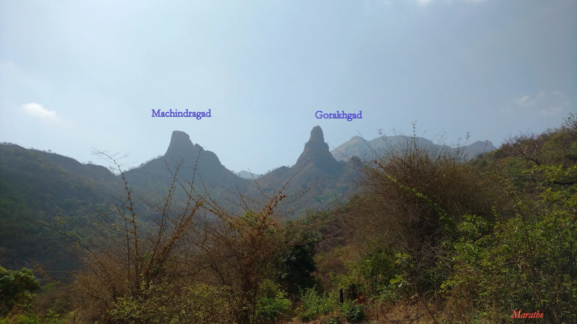
- Monsoon waterfalls on the fort walls and views of Gorakhgad, Machindragad, Damdamia and Bhimashankar from the top
- Forest that is part of the Bhimashankar Wildlife Sanctuary range
Risks
- The final climb from the machi to the Balekilla is steep, tiring and little-used; Durgbharari advises confirming the route with villagers or taking a local guide.
- In June 2025 a 22-year-old trekker slipped off a Siddhagad cliff in rain and fog and died; rescue took two days (reported by Hindustan Times and ABP Majha). Rock patches and steps become very slippery in the monsoon.
- Thane district bans entry to forts and water bodies during heavy-rain warnings: the Collector issued such an order 'until further notice' in July 2026. Check for a current district order before a monsoon visit.
- Waterfall side-paths on the Dhaparpada route confuse trekkers in the monsoon, and fog can hide the trail on the plateau; carry a GPS track.
- It is a very long day (about 11 hours in a 2018 GPS record); start early, because the last bus from Narivali leaves in the evening and summer heat on the upper section is intense.
Know before you go
Questions
How difficult is the Siddhagad trek?
It is one of the harder day treks near Mumbai. Treks and Trails India rates it medium, but Durgbharari rates it hard and a 2018 GPS record shows about 18.6 km and roughly 1,200 m of climbing from Narivali, with about 5 hours to the top and more than 3 hours back down. The final climb to the Balekilla is steep.
How do I reach Siddhagad base village from Mumbai?
Take a local train to Kalyan and an ST bus to Murbad, then an ST bus to Narivali, the base village about 16 km from Murbad. By road it is about 120 km from Mumbai; operator buses take about 3.5 hours from Dadar.
How high is Siddhagad?
Most sources put the top at about 980 m (3,215 ft); Treks and Trails India says 3,232 ft and a GPS record shows 975 m. The machi with Siddhagad Wadi village is at about 625 m.
Can I continue from Siddhagad to Bhimashankar?
Yes. Indiahikes documents a two-day Siddhgad-Bhimashankar range trek from Borwadi via Siddhagad Wadi and a forest col to Kondwal village (night at the school or temple), then on to the Bhimashankar Jyotirlinga. The forest section is easy to get lost in, so go with someone who knows the route.
Do I need a permit for Siddhagad?
We found no official permit or fee for the fort. The area is part of the Bhimashankar Wildlife Sanctuary range, so check locally, and in the monsoon check whether a Thane district order has closed forts that day.
Can I stay overnight on Siddhagad?
Durgbharari says the school at Siddhagad Wadi and the rock-cut cave on the Balekilla route can each hold 15-20 people, and villagers arrange food and camping on request.
In an emergency
Save these numbers before you lose signal. Tap to call.
- 112All emergenciesIndia’s single emergency number — works in every state
- 108Ambulance
- 1077District disaster control room
You are in
District: ThaneMaharashtra
- Nearest hospital
- Murbad for first care; Kalyan for serious cases
- Last ATM
- Murbad (about 16 km before Narivali)
- Phone network
- Not confirmed by our sources; expect patchy signal in the forest below the fort.
Before you set off
- Tell someone your route and when you will be back.
- Carry a charged phone and a power bank.
- Download an offline map of the route.
- Turn back if the weather turns bad — the mountain will wait.
Questions about Siddhagad
No questions yet. Ask something and trekkers who have done it can answer.
Share your trek photo with #TreksAndTrails
I trekked this
Did Siddhagad look different from this page? Tell us what changed and we will check it.
Where this comes from
Sources
Last reviewed:
- Siddhagad Fort Trek — Treks and Trails India
- Siddhgad Bhimashankar Trek — Treks and Trails India
- Siddhagad Fort Trek | Bhimashankar Wildlife Sanctuary | Murbad | 2018 April 15 — Wikiloc (GPS trip report)
- Siddhgad | Durgbharari — Durgbharari
- Siddhagad — Wikipedia
- Siddhgad-Bhimashankar Trek — Indiahikes
- Siddhagadh Lingi, Kakadmaal, Padar Treks & Climb — Bhramanti (trip reports)
- Thane bans entry to tourist spots, forts, and water bodies amid heavy rain forecasts (7 July 2026) — Deccan Herald
Photos: Sanketdhalape, CC BY-SA 4.0; Sanketdhalape, CC BY-SA 4.0; Sanketdhalape, CC BY-SA 4.0