Bhimashankar Trek
Raigad (Khandas base) and Pune (Bhimashankar), Maharashtra
Opens without signal on this phone, with the map file and checklist. Saved for offline →
- Max altitude
- 991 m
- Days
- 1 day
- Distance
- 14 km
- Difficulty
- Moderate
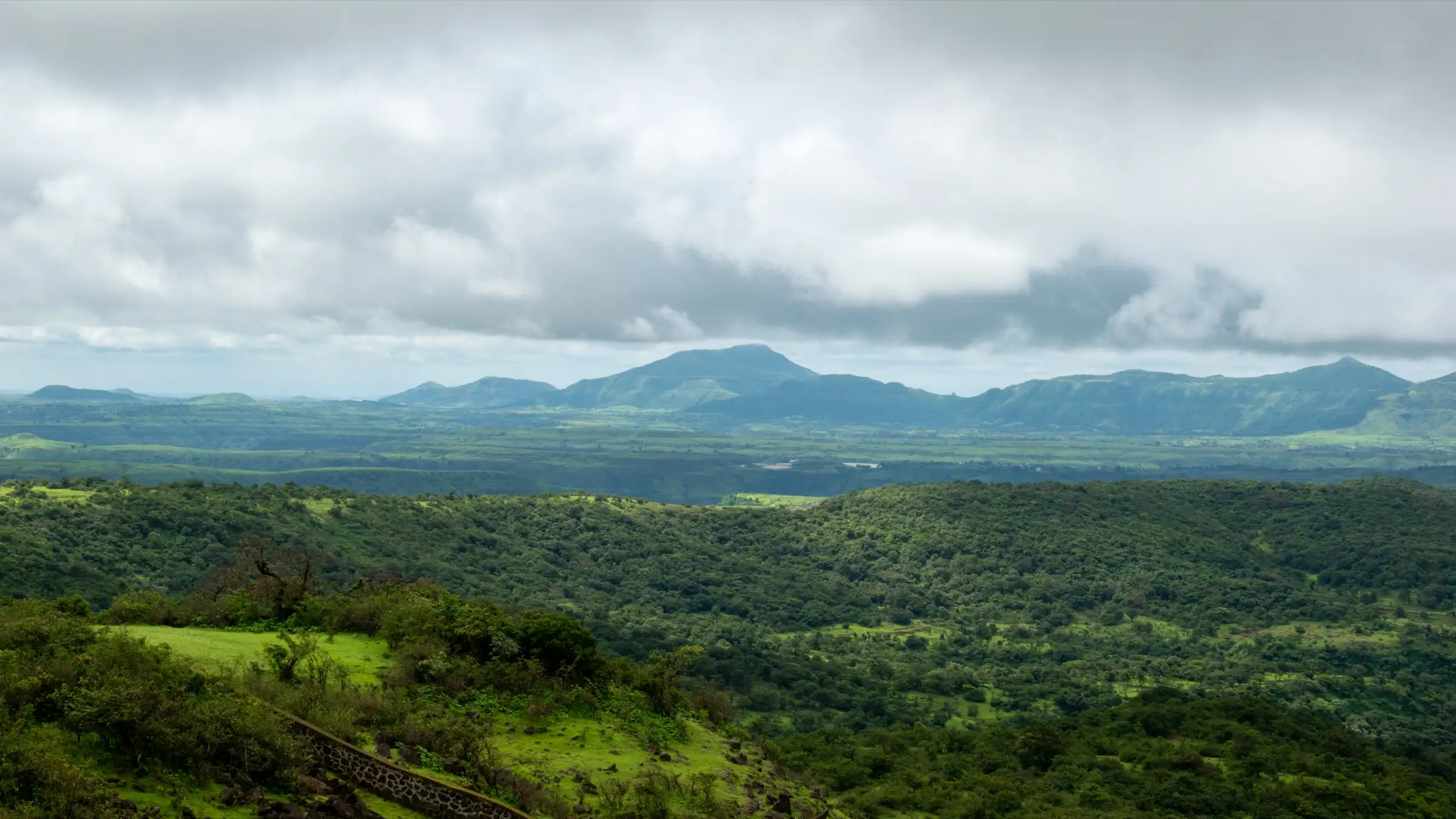
A climb of about 800 m in a single day through dense forest, about 7 km each way on the Ganesh Ghat route. The Shidi Ghat alternative adds three iron ladders and a rocky boulder patch, so operators rate it moderate to difficult. Both routes turn slippery in the monsoon.
Photos
On the trail
The route
Day by day
Day 1 · highest point
Khandas village → Khandas village (via Bhimashankar Jyotirlinga temple)
165 m → 991 m → 165 m
Ups and downs
Altitude profile
Where it is
Map
Trailhead and high point only — not a recorded track. Use it with a proper map.
Weather
Next 5 days on the trail
Live forecast for the trailhead and the high point. Mountain weather changes fast — check again on the morning you start.
Trailhead · Khandas village
at 165 mLoading forecast…
High point · Bhimashankar plateau (Jyotirlinga temple area)
at 991 mLoading forecast…
Each day: high / low °C · rain mm and chance · snow cm · wind km/h
Weather data: Open-Meteo.comModel forecast, not an official warning. For alerts follow IMD and the local administration.
Plan the trip
How to reach
- Trailhead
- Khandas village (nearest town: Karjat)
- Nearest railway
- Karjat (about 30 km); Neral (about 29 km)
- Nearest airport
- Chhatrapati Shivaji Maharaj International Airport, Mumbai
- By road
- Karjat station to Kashele by shared auto or jeep (about 20 km), then a shared auto to Khandas; Mumbai to Khandas via the Mumbai–Pune Expressway, Khopoli and Karjat (about 90 km); Pune to Khandas via Karjat (about 130–140 km). The MSRTC bus from Pune goes to the temple at the top, not to Khandas
- Drive
- About 2.5 h from Mumbai
Plan the trip
Permits and fees
We could not confirm the current permit rules and fees from an official source. Check with the local forest department or tourism office before you go.
Plan the trip
Cost
Self-guided
₹300–800
With an operator
₹1,299–1,599
Per person, ex-Karjat. Operators quote about Rs 1,299 (Adventure Club Pune) to Rs 1,599 (Treks and Trails India) for a Karjat-to-Karjat day trek with local transport, breakfast, lunch and a trek leader. Pune or Mumbai pick-up packages cost about Rs 1,499–1,799. The self-guided estimate covers shared autos from Karjat via Kashele to Khandas and back, plus meals at Khandas and the halfway stalls. Train fares are extra. Any sanctuary or village charges should be checked locally.
Gear
Top picks for this trek
The gear that matters most on this route, chosen from its altitude, season and risks.
 Ad · affiliate link
 Ad · affiliate link
 Ad · affiliate link
 Ad · affiliate link
 Ad · affiliate link
- Ad · affiliate link
 Ad · affiliate link
 Ad · affiliate link
Store buttons open a search on that store, not a product we picked. As an Amazon Associate we earn from qualifying purchases. Photos show the kind of item, not a specific product. Affiliate disclosure
Packing checklist
Matched to this trek: altitude, season, days and the risks on the route.
Packed 0 of 23
Monsoon months (Jun–Sep): pack everything in plastic or a dry bag and wear shoes with good grip.
Tick each item as it goes in the bag.
Know before you go
Good to know
- Mobile network
- Indiahikes reports mobile network on most of the route
- Last ATM
- Neral or Karjat. Indiahikes also notes an SBI ATM near the Bhimashankar temple at the top
- Nearest hospital
- Sub District Hospital, Karjat (about 30 km from Khandas)
- Water
- No reliable water on the trail outside the monsoon; carry 2–3 litres. Seasonal streams in the monsoon, and stalls at the halfway huts and near the temple
Highlights
- Darshan of Bhagwan Shiva at the Bhimashankar Jyotirlinga, one of the twelve Jyotirlingas, at the head of the climb
- Two classic routes from Khandas: the gradual Ganesh Ghat past a small Ganesh mandir, or the steep Shidi Ghat with its three iron ladders
- Dense forest of the Bhimashankar Wildlife Sanctuary, home of the Shekru (Malabar giant squirrel), Maharashtra's state animal
- An open meadow about an hour up the Ganesh Ghat route, vivid green in the monsoon
- Side walk of about 1.5 hours round trip from the temple to Gupt Bhimashankar, a Shivling beneath a rock overhang in a forest stream, passing the Sakshi Vinayak mandir
Risks
- The Maharashtra Forest Department has closed monsoon trails in the sanctuary in past seasons: in 2024 the paths from Khandas to Bhimashankar, including Shidi Ghat from Padarwadi, were closed until 30 September, and in July 2026 dangerous spots in the sanctuary were closed until further orders. Check with the Bhimashankar sanctuary range office or Khandas hosts before a monsoon trek
- Shidi Ghat ladders need repair after some monsoons; ask locals in Khandas about their condition before attempting that route, and consider a local guide
- Slippery rock, mud and swollen streams in heavy rain; landslide risk on steep sections
- Leopards and snakes live in the sanctuary; stay in a group and watch where you step
- Heat and dehydration on the exposed upper sections in March to May; start early and carry extra water
- Very long queues for darshan at the temple, especially in Shravan and on Mahashivratri; a day trek may not leave time for darshan
Know before you go
Questions
Which route is easier, Ganesh Ghat or Shidi Ghat?
Ganesh Ghat is longer (about 7 km one way) but gradual, with no technical sections, and suits fit beginners. Shidi Ghat is shorter (about 5 km one way) but steeper, with three iron ladders and a rocky boulder patch, and suits trekkers with some experience. The two routes meet at the halfway huts below the temple. Many trekkers climb by Shidi Ghat and descend by Ganesh Ghat.
Do I need a permit for the Bhimashankar trek?
Indiahikes says no permit is needed to trek from Khandas. The route runs through the Bhimashankar Wildlife Sanctuary, and the Forest Department has closed some sanctuary trails during past monsoons, so check the current status and any charges locally.
How long does the Bhimashankar trek take?
Operators quote about 3 to 3.5 hours up Shidi Ghat or about 4 to 5 hours up Ganesh Ghat, and 2 to 4 hours down. Add about 1.5 hours if you walk to Gupt Bhimashankar. Plan for a full day from Khandas.
When is the best time for the Bhimashankar trek?
The monsoon (June to September) is the most popular season, when the forest is green and the streams are full, but the trail is slippery and the Forest Department may close sanctuary trails. October and November are cooler and drier, with clear views. Indiahikes says the trek can be done all year; March to May is hot.
How do I reach Khandas by public transport?
Take a local train to Karjat (or Neral) on the Central Line. From Karjat take a shared auto or jeep to Kashele, then another shared auto to Khandas. The direct MSRTC bus from Pune goes to the temple at the top and does not pass Khandas.
Can I do darshan at the Bhimashankar Jyotirlinga on the trek day?
You reach the temple area at the top, but queues for darshan can take several hours. Treks and Trails India does not include darshan in its day trek for this reason. If darshan is your main aim, stay overnight near the temple or plan a separate visit.
In an emergency
Save these numbers before you lose signal. Tap to call.
- 112All emergenciesIndia’s single emergency number — works in every state
- 108Ambulance
- 1077District disaster control room
You are in
District: Raigad (Khandas base) and Pune (Bhimashankar)Maharashtra
- Nearest hospital
- Sub District Hospital, Karjat (about 30 km from Khandas)
- Last ATM
- Neral or Karjat. Indiahikes also notes an SBI ATM near the Bhimashankar temple at the top
- Phone network
- Indiahikes reports mobile network on most of the route
Before you set off
- Tell someone your route and when you will be back.
- Carry a charged phone and a power bank.
- Download an offline map of the route.
- Turn back if the weather turns bad — the mountain will wait.
Questions about Bhimashankar
No questions yet. Ask something and trekkers who have done it can answer.
Share your trek photo with #TreksAndTrails
I trekked this
Did Bhimashankar look different from this page? Tell us what changed and we will check it.
Where this comes from
Sources
Last reviewed:
- The Complete Guide to Bhimashankar Trek — Indiahikes
- Bhimashankar Trek via Ganesh Ghat from Karjat (tour listing by the operator Treks and Trails India, treksandtrails.org; not this site) — Treks and Trails India
- Bhimashankar Trek — Bikat Adventures
- Bhimashankar Trek | Best Trekking Route, Difficulty & Travel Guide — TrekUp India
- Bhimashankar Trek via Ganesh Ghat from Pune / Mumbai — Adventure Club Pune
- Pune: Bhimashankar closed for two months for tourists (5 Aug 2024, reporting a Forest Department closure until 30 Sep 2024) — Pune Pulse
- Bhimashankar Update: dangerous tourist spots in Bhimashankar sanctuary closed until further orders (7 Jul 2026) — eSakal
Photos: Rohit Sharma, CC BY-SA 4.0; charu_raut, CC BY 3.0; Rupelh, CC BY-SA 4.0