Shivagange Trek
Bengaluru Rural (Bengaluru North), Nelamangala taluk, Karnataka
Opens without signal on this phone, with the map file and checklist. Saved for offline →
- Max altitude
- 1,368 m
- Days
- 1 day
- Distance
- 5.5 km
- Difficulty
- Moderate
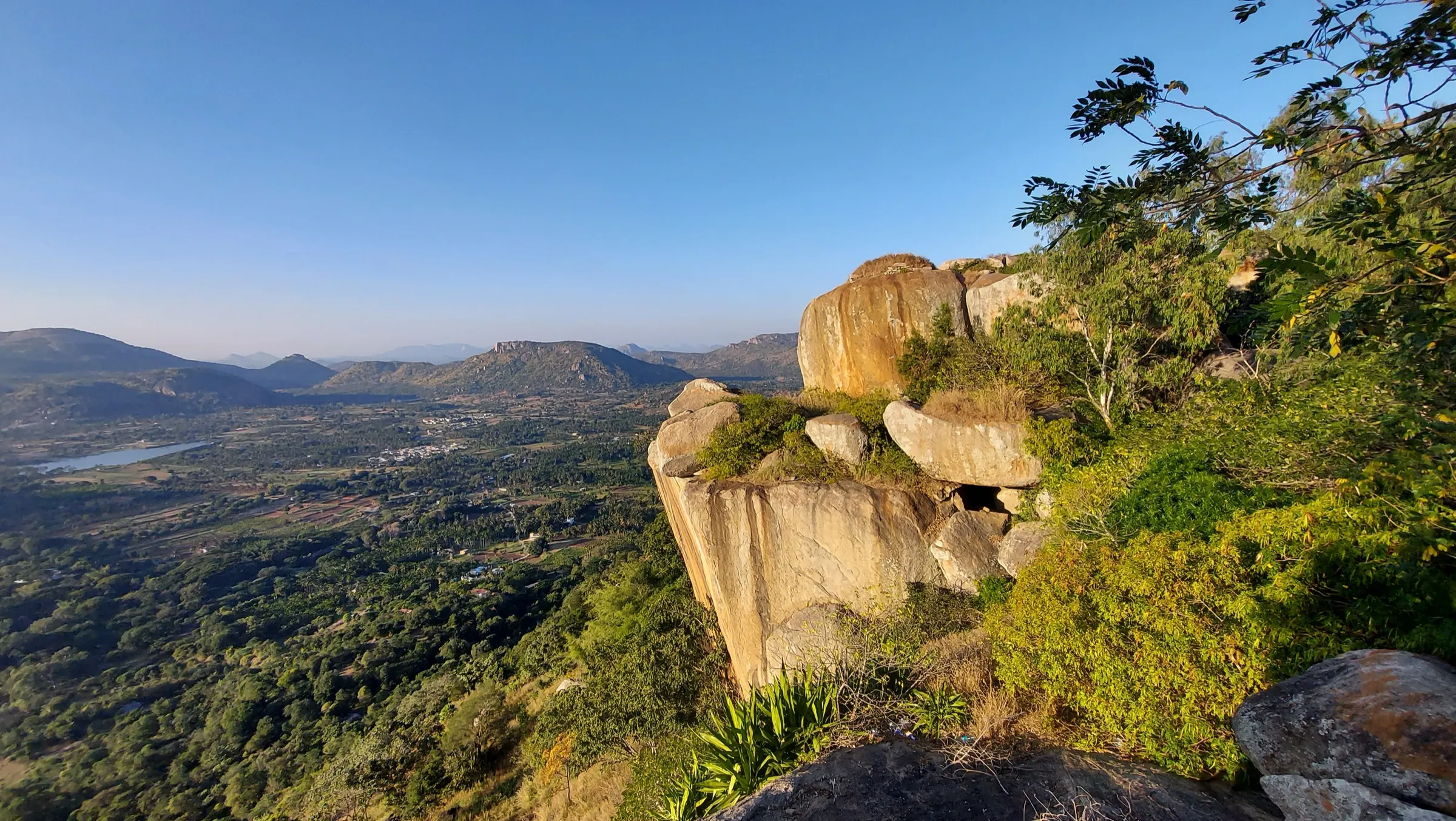
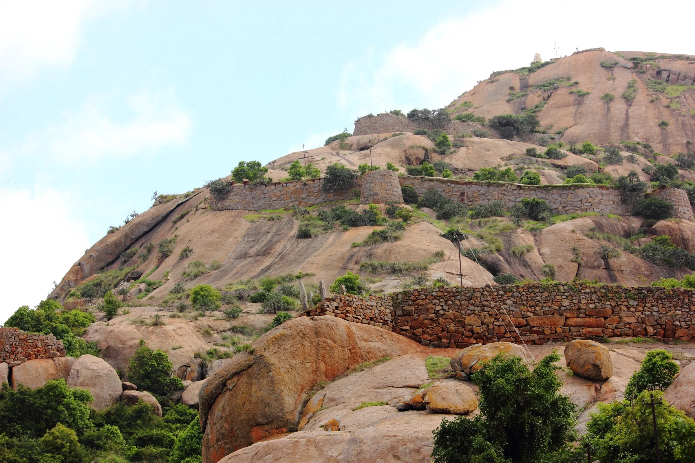
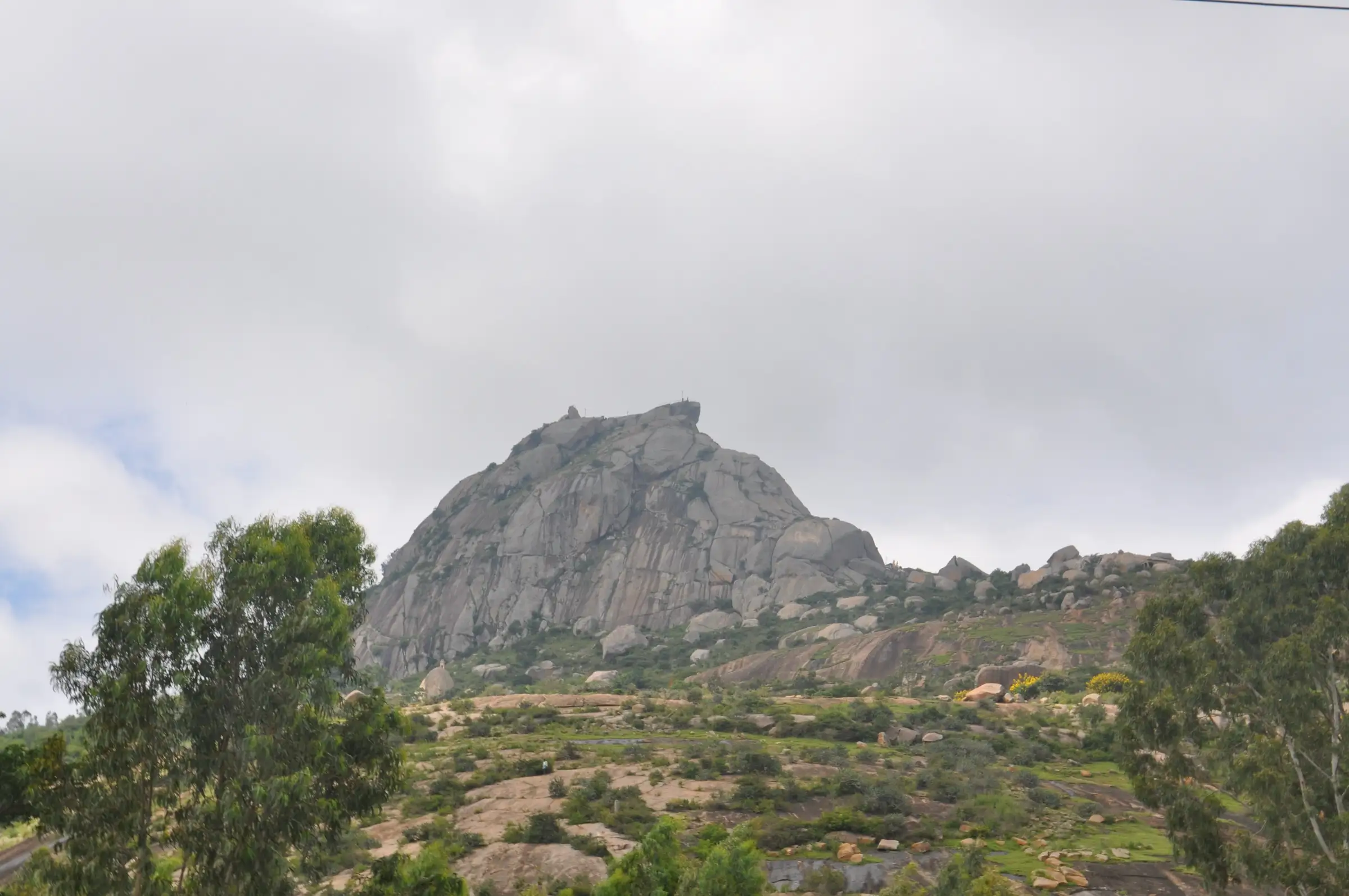
A climb of about 430 m on stone steps and bare granite from the village to the summit. The lower half is easy steps past temples; above Olakal Teertha the rock becomes steep and narrow and you climb holding the iron railings, which is tiring and exposed for young children and the elderly.
Photos
On the trail
The route
Day by day
Day 1 · highest point
Shivagange village → Shivagange village (via Olakal Teertha and the summit Nandi)
940 m → 1,368 m → 940 m
Ups and downs
Altitude profile
Where it is
Map
Trailhead and high point only — not a recorded track. Use it with a proper map.
Weather
Next 5 days on the trail
Live forecast for the trailhead and the high point. Mountain weather changes fast — check again on the morning you start.
Trailhead · Shivagange village (steps beside the Gavi Gangadhareshwara temple)
at 940 mLoading forecast…
High point · Shivagange Betta summit (Nandi rock)
at 1,368 mLoading forecast…
Each day: high / low °C · rain mm and chance · snow cm · wind km/h
Weather data: Open-Meteo.comModel forecast, not an official warning. For alerts follow IMD and the local administration.
Plan the trip
How to reach
- Trailhead
- Shivagange village (steps beside the Gavi Gangadhareshwara temple) (nearest town: Dobbaspet)
- Nearest railway
- Dobbaspet (about 8 km); Tumakuru for more trains
- Nearest airport
- Kempegowda International Airport, Bengaluru (about 60–70 km)
- By road
- Bengaluru (about 55–60 km: NH 48 Tumakuru road via Nelamangala to Dobbaspet, then left about 6–9 km to Shivagange); Dobbaspet (KSRTC buses from Bengaluru Majestic; then private bus or auto to Shivagange village); Tumakuru (about 25 km)
- Drive
- About 2 h from Bengaluru
Plan the trip
Permits and fees
We could not confirm the current permit rules and fees from an official source. Check with the local forest department or tourism office before you go.
Plan the trip
Cost
Self-guided
₹250–800
With an operator
₹650–900
Per person, ex-Bengaluru, day trip. Guided prices seen October 2026: Namma Trip's Shivagange Sunrise Trek ₹649–749 with non-AC transport, breakfast, entry tickets and a guide (₹99–189 without transport); Thrillophilia's Shivgange Trek about US$10.5 (about ₹900) with shared transport, breakfast and a guide; Escape2Explore/Aqua Escape runs a night-start sunrise trek but showed no price. Self-guided is an estimate: KSRTC bus Bengaluru–Dobbaspet and back, a bus or auto to Shivagange village, water and food. Operators list 'entry tickets' or 'permission charges'; we could not find an official fee, so check at the hill.
Gear
Top picks for this trek
The gear that matters most on this route, chosen from its altitude, season and risks.
 Ad · affiliate link
 Ad · affiliate link
 Ad · affiliate link
 Ad · affiliate link
 Ad · affiliate link
 Ad · affiliate link
 Ad · affiliate link
- Ad · affiliate link
Store buttons open a search on that store, not a product we picked. As an Amazon Associate we earn from qualifying purchases. Photos show the kind of item, not a specific product. Affiliate disclosure
Packing checklist
Matched to this trek: altitude, season, days and the risks on the route.
Packed 0 of 19
Tick each item as it goes in the bag.
Know before you go
Good to know
- Mobile network
- Not confirmed by our sources; the hill is close to the NH 48 corridor, but do not rely on signal behind the rocks.
- Last ATM
- Dobbaspet (about 8 km) or Nelamangala
- Nearest hospital
- Dobbaspet and Nelamangala for first care; Tumakuru or Bengaluru for serious cases
- Water
- Small stalls along the steps sell water, buttermilk, cucumber and fruit (busiest on weekends); the springs (theerthas) on the hill are sacred, not drinking points. Carry about 2 litres.
Highlights
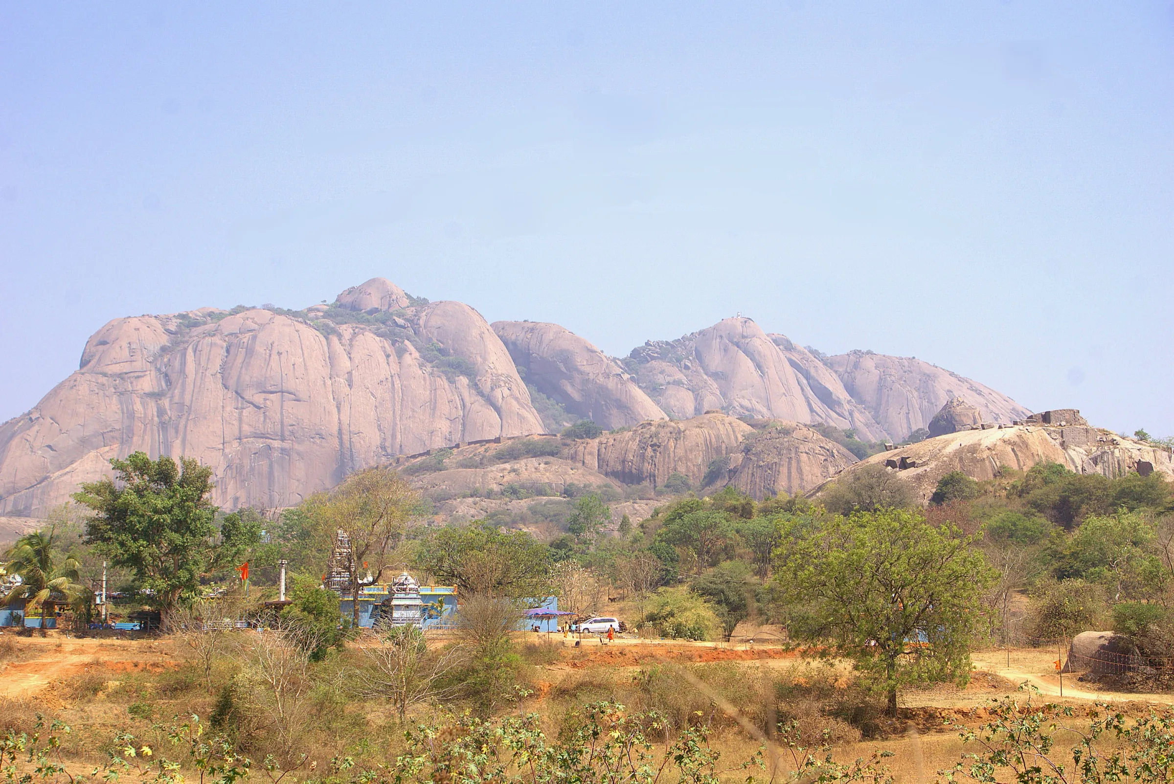
- Darshan at the Gavi Gangadhareshwara cave temple at the foot of the climb, where devotees offer ghee abhisheka to Bhagwan Shiva, and at the Sri Honnadevi (Honnammadevi) temple of Devi Parvati
- Called Dakshina Kashi: the hill looks like a Shiva linga from one side, and climbing it is honoured as a pilgrimage equal to Kashi
- Olakal Teertha, the sacred spring in a rock cleft, and Patala Gange, reached by crawling into the rock
- The monolithic Nandi on the summit rock and the sheer Shantala drop, with wide views over the Kumudvathi valley, villages and granite hills
- Sunrise walks from Bengaluru, about 60 km away, with a few hours of steps and rock climbing
Risks
- Bonnet macaques are everywhere on the hill and snatch food, bags and bottles; keep food packed away and carry a stick as locals advise.
- Above Olakal Teertha the path climbs steep, smooth rock using iron railings; it is slippery in rain (June–September) and dangerous near the Shantala drop and around the summit Nandi, where the drop is sheer.
- March to May is very hot on the bare granite; start at dawn and carry water.
- Huge crowds on Sundays, Maha Shivaratri and during Makara Sankranti (mid-January), when the jatre and cattle fair are held.
- This is a temple hill, not an Aranya Vihaara forest trek. Karnataka's Chief Wildlife Warden suspended forest trekking paths in leopard, tiger, elephant and bear areas on 11 May 2026; stay on the temple steps and do not wander into the surrounding scrub after dark.
- Our sources give the height wrongly in places (805 m) and the distance anywhere from 1 km to 6 km each way; the figures here come from OpenStreetMap and terrain data.
Know before you go
Questions
How long does the Shivagange trek take?
Most people take 2–2.5 hours up and 1–1.5 hours down. Namma Trip's sunrise group starts climbing at 3:30 am and reaches the summit by about 5:30 am; Escape2Explore plans about 1.5 hours up. Allow 4–5 hours with temple darshan.
How long is the Shivagange trek?
Operators quote about 5–6 km up and down (Namma Trip about 6 km; a 2006 trip report about 5 km). On OpenStreetMap the stepped path from the Gavi Gangadhareshwara temple to the summit is about 1.8 km each way, plus the walk through the village, with about 430 m of climb.
How high is Shivagange?
About 1,368 m above sea level (Wikipedia, Citizen Matters and OpenStreetMap; SRTM terrain about 1,330 m). Some operators print 2,640 ft (805 m), but the village at the foot of the hill already stands at about 940 m, so that figure cannot be right.
What is the best time to visit Shivagange?
October to February, when the mornings are cool and the views clear. In the monsoon the rock gets slippery, and summer afternoons are very hot. Avoid Sundays and Maha Shivaratri if you want a quiet climb.
How do I reach Shivagange from Bengaluru?
Take a KSRTC bus from Majestic towards Tumakuru and get off at Dobbaspet; from there Shivagange is 6–9 km by private bus or auto. By car, follow NH 48 via Nelamangala to Dobbaspet and turn left; the drive takes about 1.5–2 hours.
Is Shivagange safe for children and older people?
The lower steps to Gangadhareshwara and Olakal Teertha are fine for families. Above Olakal Teertha the climb gets steep, and Citizen Matters advises against it for children under seven and elderly people.
In an emergency
Save these numbers before you lose signal. Tap to call.
- 112All emergenciesIndia’s single emergency number — works in every state
- 108Ambulance
- 1077District disaster control room
You are in
District: Bengaluru Rural (Bengaluru North), Nelamangala talukKarnataka
- Nearest hospital
- Dobbaspet and Nelamangala for first care; Tumakuru or Bengaluru for serious cases
- Last ATM
- Dobbaspet (about 8 km) or Nelamangala
- Phone network
- Not confirmed by our sources; the hill is close to the NH 48 corridor, but do not rely on signal behind the rocks.
Before you set off
- Tell someone your route and when you will be back.
- Carry a charged phone and a power bank.
- Download an offline map of the route.
- Turn back if the weather turns bad — the mountain will wait.
Questions about Shivagange
No questions yet. Ask something and trekkers who have done it can answer.
Share your trek photo with #TreksAndTrails
I trekked this
Did Shivagange look different from this page? Tell us what changed and we will check it.
Where this comes from
Sources
Last reviewed:
- Shivagange — Wikipedia
- Solitude and breathtaking views beckon trekkers — Citizen Matters
- Shivagange Betta (peak, ele 1368) — OpenStreetMap
- Shivagange Sunrise Trek | Namma Trip — Namma Trip
- Ride And Trek To Shivagange — Payaniga
- Shivgange Trek Tumkur — Thrillophilia
- Shivagange Sunrise Trek (Aqua Escape / Escape2Explore) — Escape2Explore Adventures
- Shivagange | Sightseeing in Shivagange | Temples in Shivagange — Karnataka.com
Photos: Manjeshpv, CC BY-SA 3.0; Sreejithk2000, CC BY-SA 3.0; Sreejithk2000, CC BY-SA 3.0; Dineshkannambadi, CC BY-SA 4.0