Bidirukatte Trek
Ramanagara, renamed Bengaluru South (Magadi taluk), Karnataka
Opens without signal on this phone, with the map file and checklist. Saved for offline →
 975 mhighest point
- Max altitude
- 975 m
- Days
- 1 day
- Distance
- 3.4 km
- Difficulty
- Easy
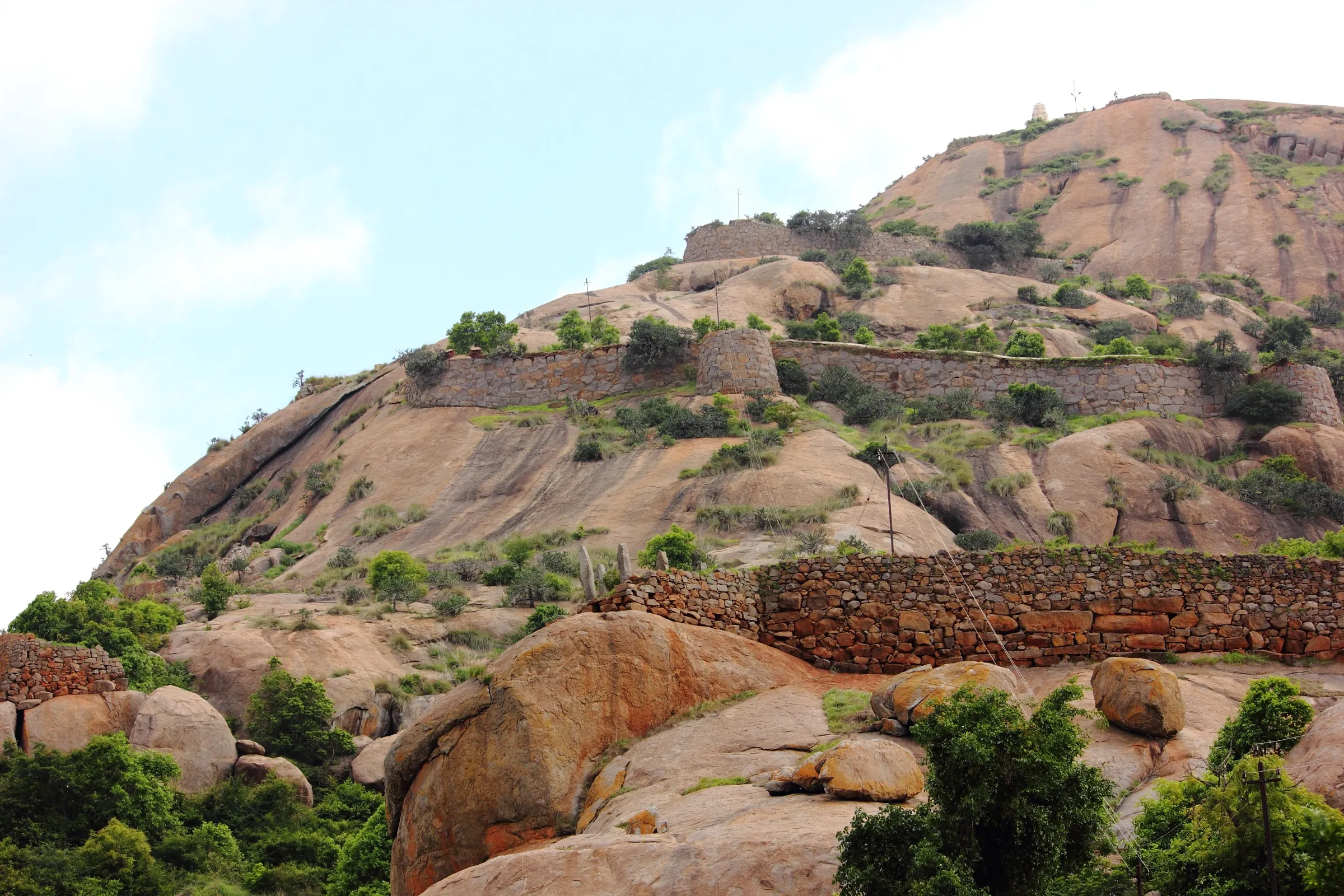
Short (about 3.4 km in all) with only one real climb: a steep, smooth black rock slab of about 150 m up to the Kempammane Sone pond, slippery when wet. After that the trail is mostly level through fort ruins and scrub; Indiahikes rates it a beginner and family trek, and the Forest Department lists it as an easier trail than Savandurga.
The route
Day by day
Day 1 · highest point
Kempegowda Tree Park gate, Savandurga → Kempegowda Tree Park gate (via Bidirukatte Lake, Kempammane Sone, the fort hilltop and the Basavanna temple ruins)
870 m → 975 m → 870 m
Ups and downs
Altitude profile
Where it is
Map
Trailhead and high point only — not a recorded track. Use it with a proper map.
Weather
Next 5 days on the trail
Live forecast for the trailhead and the high point. Mountain weather changes fast — check again on the morning you start.
Trailhead · Kempegowda Tree Park gate and forest checkpoint, Savandurga
at 870 mLoading forecast…
High point · Bidirukatte hilltop and fort watchtower (first hilltop), south-west of Savandurga
at 975 mLoading forecast…
Each day: high / low °C · rain mm and chance · snow cm · wind km/h
Weather data: Open-Meteo.comModel forecast, not an official warning. For alerts follow IMD and the local administration.
Plan the trip
How to reach
- Trailhead
- Kempegowda Tree Park gate and forest checkpoint, Savandurga (nearest town: Magadi)
- Nearest railway
- Ramanagara (trains from KSR Bengaluru take 1–1½ hours; then a Ramanagara–Magadi bus to Savandurga Cross)
- Nearest airport
- Kempegowda International Airport, Bengaluru (about 90 km)
- By road
- Bengaluru (about 60–65 km via Magadi Road to Magadi town, then left to Savandurga Cross; or via Mysuru Road, Dodda Alada Mara and Manchanabele Dam); Savandurga Cross (3 km to the trailhead on foot or by shared auto, about ₹20 a seat or ₹100 for the whole auto); Magadi (about 12 km)
- Drive
- About 1.5 h from Bengaluru
Plan the trip
Permits and fees
We could not confirm the current permit rules and fees from an official source. Check with the local forest department or tourism office before you go.
Plan the trip
Cost
Self-guided
₹300–1,200
With an operator
₹1,300–1,500
Per person, ex-Bengaluru, day trip. We found no operator selling a fixed Bidirukatte departure; the guided range is what Bengaluru operators charged in October 2026 for the Savandurga day trek from the same gate (Treks and Trails India ₹1,300, BMC Adventures ₹1,400, transport and meals included). Self-guided is an estimate: bus or train to Ramanagara/Magadi, an auto from Savandurga Cross (₹100–300 return), food, and the Aranya Vihaara booking fee, which we could not confirm from a dated official notice; check the portal.
Gear
Top picks for this trek
The gear that matters most on this route, chosen from its altitude, season and risks.
 Ad · affiliate link
 Ad · affiliate link
 Ad · affiliate link
 Ad · affiliate link
- Ad · affiliate link
 Ad · affiliate link
 Ad · affiliate link
 Ad · affiliate link
Store buttons open a search on that store, not a product we picked. As an Amazon Associate we earn from qualifying purchases. Photos show the kind of item, not a specific product. Affiliate disclosure
Packing checklist
Matched to this trek: altitude, season, days and the risks on the route.
Packed 0 of 21
Monsoon months (Sep): pack everything in plastic or a dry bag and wear shoes with good grip.
Tick each item as it goes in the bag.
Know before you go
Good to know
- Mobile network
- Not confirmed for this trail. On neighbouring Savandurga, Indiahikes reports BSNL, Airtel and Jio at the base and patchy coverage higher up.
- Last ATM
- Magadi town (no ATM at Savandurga village)
- Nearest hospital
- Sri Dharmasthala Manjunatha Hospital, Magadi, about 13 km
- Water
- A drinking-water station at the start point only (Indiahikes). The seven ponds on the trail are stagnant and not safe to drink; carry 2 litres per person.
Highlights
- Long stretches of fort wall and the Kailasa Dwara gateway of a hilltop fort that Indiahikes dates to the Vijayanagara period
- Ruins of a 12th-century Hoysala-period Nandi (Basavanna) temple with carved sculptures still intact on its shikhara; the murti of Nandi is now kept in a nearby village
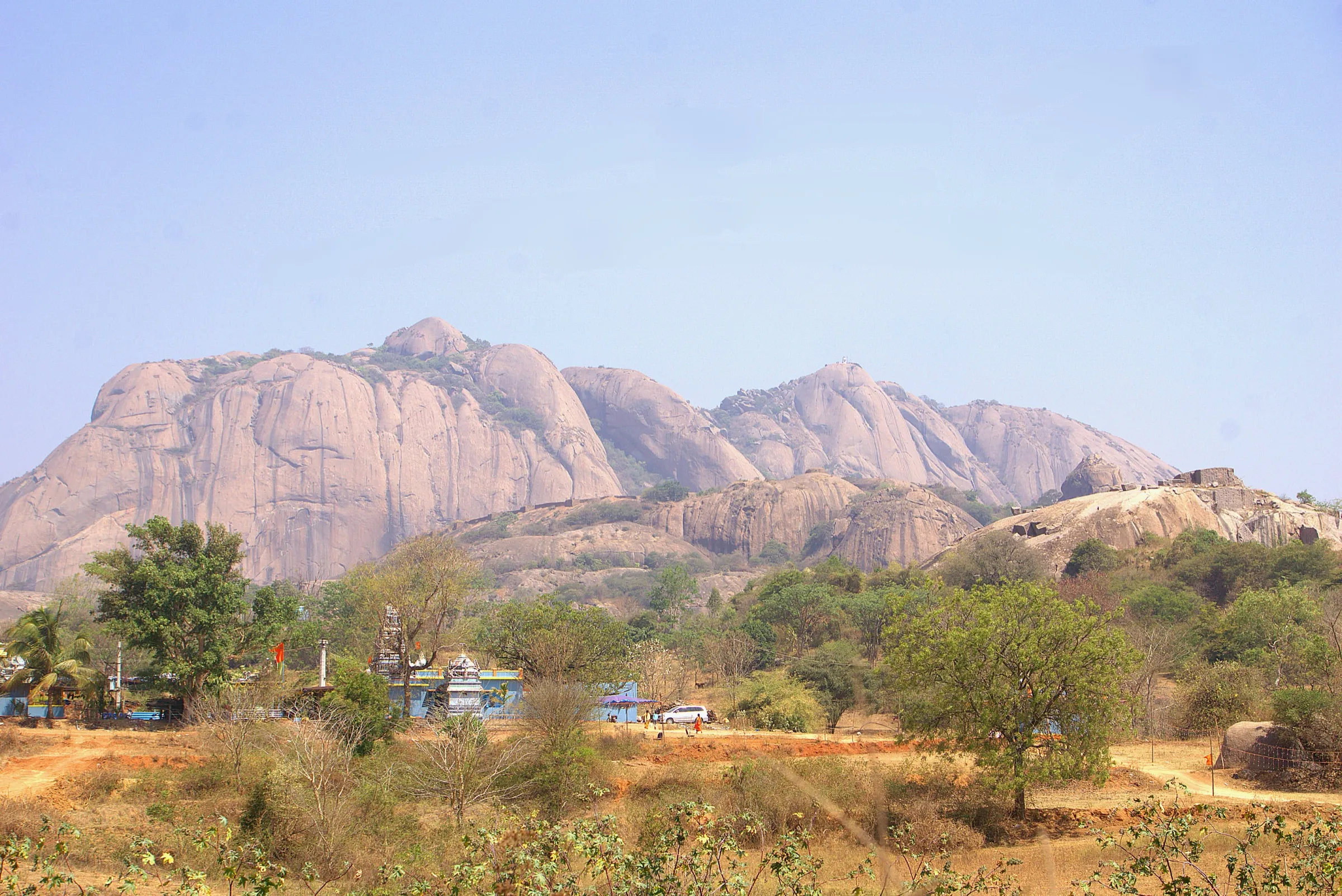
- Seven ponds along the way, from Bidirukatte Lake at the start to Kempammane Sone and lily-filled Basavanna Sone, with the granite domes of Savandurga reflected in them
- Views over Ramanagara town, Nayakanapalya Lake and Huthridurga, with Savandurga towering behind you
- Good birding for a short trail: the Forest Department names the endangered Yellow-throated Bulbul and the Sirkeer Malkoha, and Indiahikes counted nearly 20 species
Risks
- The steep black rock slab below Kempammane Sone is slippery in the rains; go slowly on the way down.
- The ponds are deceptively deep and locals say people have drowned in Basavanna Sone; do not swim or wade.
- Keep back from the edge of the deep, steep valley just before the first hilltop.
- No shade on the open rock in summer; start at 6:00 AM, the only time guides are available.
- Sloth bears and leopards live in Savandurga State Forest and elephants pass through once a year. On 11 May 2026 Karnataka's Chief Wildlife Warden suspended trekking on routes with leopard, tiger, elephant or bear movement until each route is certified safe; book only if the portal is taking bookings for Bidirukatte.
- The second hill beyond the fort is usually off-limits (thorny scrub, animal movement); climb it only if your Forest Department guide agrees.
- In 2026 the portal blocked all Savandurga bookings from mid-May to 31 August for the monsoon; we could not confirm whether Bidirukatte dates were also blocked, so check the calendar before planning a monsoon visit.
- Unauthorised trekking is an offence under the Karnataka Forest Act; walk only with a portal booking and the forest guide.
Know before you go
Questions
Do I need a permit or booking for the Bidirukatte trek?
Yes. Book online on the Karnataka Forest Department's Aranya Vihaara portal (aranyavihaara.karnataka.gov.in, Ramanagara district, 'Bidirukatte Trekking'). Indiahikes advises booking at least two days ahead; on-the-spot entry is not allowed. Show the booking at the forest office by the entrance gate. Check the portal for the current fee.
Can I do the Bidirukatte trek alone?
No. A Forest Department guide is mandatory and joins each group at the start point. Guides start at 6:00 AM, so you cannot begin earlier.
Is Bidirukatte the same trek as Savandurga?
No. Both start from the Kempegowda Tree Park gate, but Savandurga climbs the big granite monolith to the Nandi Mantapa at about 1,226 m, while Bidirukatte turns off at Bidirukatte Lake and climbs a lower hill to the south-west (about 975 m) with fort ruins, ponds and a Hoysala-period temple. They are booked separately on the portal.
Is the Bidirukatte trek good for beginners and children?
Yes. Indiahikes calls it one of the best family treks near Bengaluru: one short steep rock climb, then mostly level walking, and most groups finish in under four hours. Hold children's hands near the ponds and the valley edge.
When is the best time for the Bidirukatte trek?
September to February, when the forest is green and the weather cool. Indiahikes says the trail is open all year and the Forest Department calls the monsoon an amazing time for greenery, but the rock is slippery in the rains and summer is hot on the open rock.
Is there water or food on the trail?
There is a drinking-water station at the start point and nothing after that; carry 2 litres and snacks. The ponds on the trail are not safe to drink.
In an emergency
Save these numbers before you lose signal. Tap to call.
- 112All emergenciesIndia’s single emergency number — works in every state
- 108Ambulance
- 1077District disaster control room
You are in
District: Ramanagara, renamed Bengaluru South (Magadi taluk)Karnataka
- Nearest hospital
- Sri Dharmasthala Manjunatha Hospital, Magadi, about 13 km
- Last ATM
- Magadi town (no ATM at Savandurga village)
- Phone network
- Not confirmed for this trail. On neighbouring Savandurga, Indiahikes reports BSNL, Airtel and Jio at the base and patchy coverage higher up.
Before you set off
- Tell someone your route and when you will be back.
- Carry a charged phone and a power bank.
- Download an offline map of the route.
- Turn back if the weather turns bad — the mountain will wait.
Questions about Bidirukatte
No questions yet. Ask something and trekkers who have done it can answer.
Share your trek photo with #TreksAndTrails
I trekked this
Did Bidirukatte look different from this page? Tell us what changed and we will check it.
Where this comes from
Sources
Last reviewed:
- Aranya Vihaara – Bidirukatte Trekking (Ramanagara, trek id 131) — Karnataka Forest Department (official)
- A Complete Guide to the Bidirukatte Trek — Indiahikes
- Karnataka suspends all trekking, trail activities in forest areas with wildlife — Green Minute
Photos: Pravega, CC BY-SA 4.0