Devarayanadurga Trek
Tumakuru, Karnataka
Opens without signal on this phone, with the map file and checklist. Saved for offline →
- Max altitude
- 1,204 m
- Days
- 1 day
- Distance
- 3 km
- Difficulty
- Easy
A short pilgrimage climb of roughly 1–1.5 km each way and about 130 m of ascent from the Bhoga Narasimha temple to the Yoga Narasimha temple, much of it on old stone steps through rocks and scrub. Fine for families; the steps are steep in places and slippery when wet.
Photos
On the trail
The route
Day by day
Day 1 · highest point
Bhoga Narasimha Swamy Temple, Devarayanadurga village → Bhoga Narasimha Swamy Temple (via Yoga Narasimha Swamy Temple on the hilltop)
1,076 m → 1,204 m → 1,076 m
Ups and downs
Altitude profile
Where it is
Map
Trailhead and high point only — not a recorded track. Use it with a proper map.
Weather
Next 5 days on the trail
Live forecast for the trailhead and the high point. Mountain weather changes fast — check again on the morning you start.
Trailhead · Bhoga Narasimha Swamy Temple, Devarayanadurga village
at 1,076 mLoading forecast…
High point · Yoga Narasimha Swamy Temple, Devarayanadurga hilltop
at 1,204 mLoading forecast…
Each day: high / low °C · rain mm and chance · snow cm · wind km/h
Weather data: Open-Meteo.comModel forecast, not an official warning. For alerts follow IMD and the local administration.
Plan the trip
How to reach
- Trailhead
- Bhoga Narasimha Swamy Temple, Devarayanadurga village (nearest town: Tumakuru)
- Nearest railway
- Tumakuru (Tumkur) railway station, about 15–20 km, with frequent trains from Bengaluru
- Nearest airport
- Kempegowda International Airport, Bengaluru (about 90–100 km)
- By road
- Bengaluru (about 70 km on NH 48 towards Tumakuru, turning off at Dobbspet/Urdigere road towards Devarayanadurga); Tumakuru city (about 15 km; buses and taxis to Devarayanadurga village)
- Drive
- About 1.5 h from Bengaluru
Plan the trip
Permits and fees
We could not confirm the current permit rules and fees from an official source. Check with the local forest department or tourism office before you go.
Plan the trip
Cost
Self-guided
₹400–1,500
With an operator
₹5,400–7,800
Per person, ex-Bengaluru, day trip. Guided prices are thin: the only priced listing we found (October 2026) is a private 'Trek, Temples and Thotas in Devarayanadurga' day tour sold through Viator/AAA from about US$64–93 (about ₹5,400–7,800) per booking, with private car and breakfast; e2e's group day trip (Mandaragiri, Basadi Betta and Devarayanadurga) shows no price. Self-guided is an estimate: KSRTC bus or train Bengaluru–Tumakuru and back, a bus or shared taxi to Devarayanadurga village, and food. The temple walk needs no forest booking; a ₹250 adult fee quoted by a travel blog applies to the forest-department trail, which is not bookable now.
Gear
Top picks for this trek
The gear that matters most on this route, chosen from its altitude, season and risks.
 Ad · affiliate link
 Ad · affiliate link
 Ad · affiliate link
 Ad · affiliate link
- Ad · affiliate link
 Ad · affiliate link
 Ad · affiliate link
 Ad · affiliate link
Store buttons open a search on that store, not a product we picked. As an Amazon Associate we earn from qualifying purchases. Photos show the kind of item, not a specific product. Affiliate disclosure
Packing checklist
Matched to this trek: altitude, season, days and the risks on the route.
Packed 0 of 18
Hot days in Mar: start at first light and carry extra water and ORS.
Tick each item as it goes in the bag.
Know before you go
Good to know
- Mobile network
- Not confirmed by our sources; Devarayanadurga is close to Tumakuru city, but do not rely on signal on the forested slopes.
- Last ATM
- Tumakuru city, about 15 km away
- Nearest hospital
- Tumakuru (district hospital, about 15 km) for first care; Bengaluru for serious cases
- Water
- Small shops and the temple near Bhoga Narasimha in the village; carry your own water for the climb (Karnataka Tourism advises water and light refreshments).
Highlights
- Darshan of Bhagwan Yoga Narasimha Swamy and Lakshmi on the hilltop and of Bhoga Narasimha Swamy at the foot of the climb, two temples linked with the Mysore Wodeyars
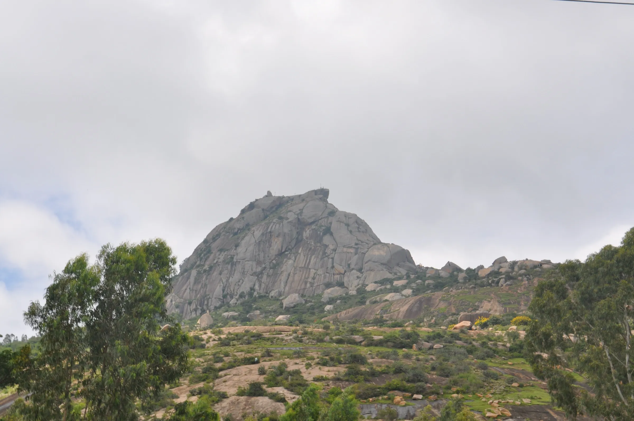
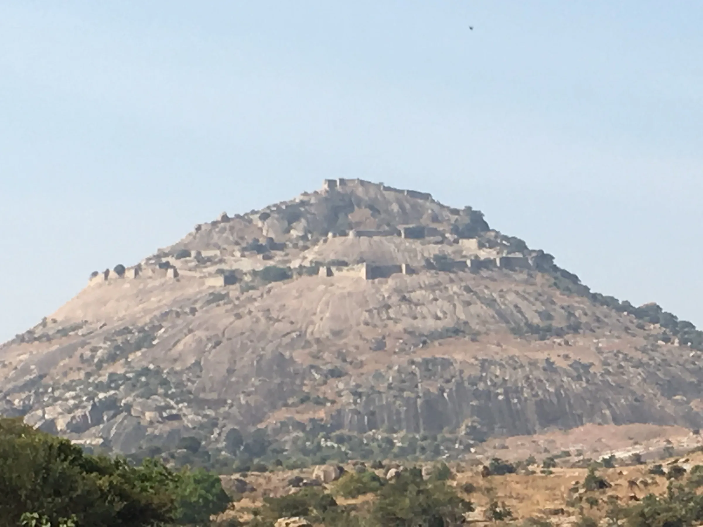
- Old stone staircases winding through granite boulders and scrub forest to the hilltop
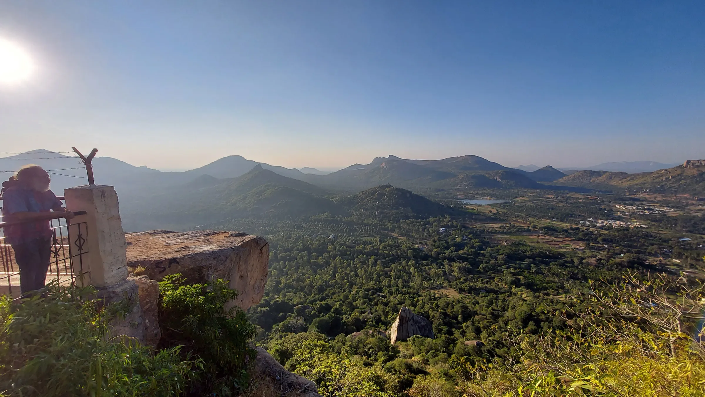
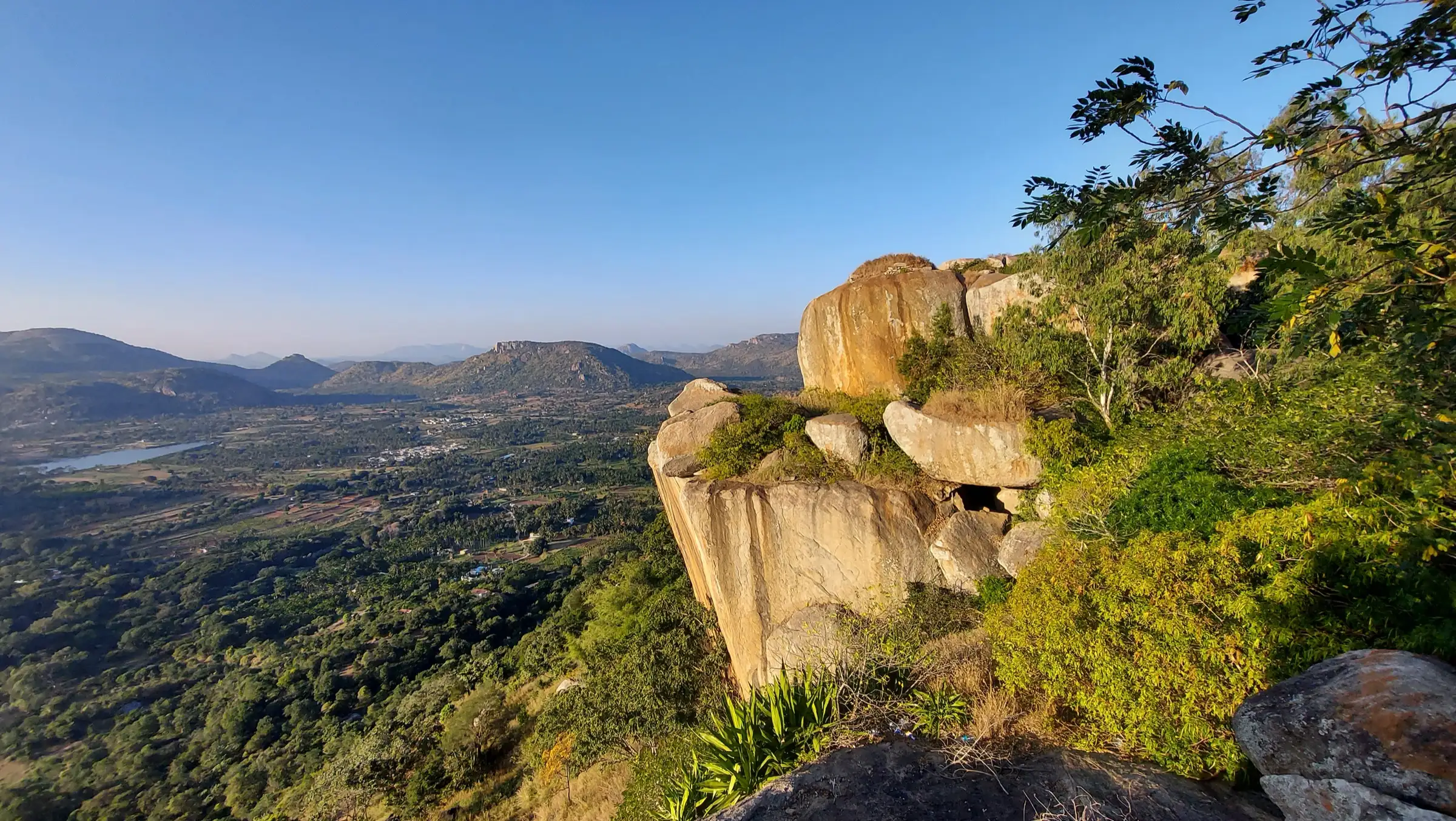
- Wide views over the Tumakuru plains and the rocky hills of the Devarayanadurga reserved forest, best at sunrise and sunset
- Namada Chilume, the sacred spring at the foot of the hill, linked in the katha with Bhagwan Shri Rama
- One of the easiest temple-hill walks from Bengaluru, about 70 km away
Risks
- Only the temple stairway between Bhoga Narasimha and Yoga Narasimha is covered here. The Forest Department's Devarayanadurga trek (Namada Chilume forest IB to Siddha Sanjeevini Vana and the sunrise trail) was once bookable on Aranya Vihaara but is not listed on the portal in October 2026; do not walk forest trails without a booking.
- On 11 May 2026 Karnataka's Chief Wildlife Warden suspended all trekking paths in forest areas with leopard, tiger, elephant or bear movement until each trail is certified under the new trekking SOP. Devarayanadurga reserved forest has leopards and sloth bears, so stay on the temple steps and road, and avoid dusk and dark.
- A motor road reaches the Yoga Narasimha temple, so expect vehicles and crowds at the top on weekends and festival days.
- Monkeys around the temples snatch food and bags; keep food packed away.
- Stone steps get slippery in the monsoon (June–September); little shade from March to May, so start early and carry water.
Know before you go
Questions
Can you drive to the top of Devarayanadurga?
Yes. A winding motor road goes up to the Yoga Narasimha Swamy temple, and from the parking you climb only a few stairs for darshan. Walkers instead climb the old stone steps from the Bhoga Narasimha temple in the village, which is the route described here.
How long is the Devarayanadurga trek?
Sources quote about 1.5–2 km each way (Karnataka Tourism) or about 3.2 km round trip (TravelTriangle). Mapped on OpenStreetMap, the stepped path from the Bhoga Narasimha temple to the Yoga Narasimha temple is a little over 1 km each way with about 130 m of climb. Allow 2–3 hours with darshan and time at the viewpoints.
Do I need forest permission or a booking for Devarayanadurga?
Not for the temple steps: Karnataka Tourism says no forest permission is required for the hike to the temples. The separate Forest Department trek through the reserved forest was listed on Aranya Vihaara earlier but is not bookable in October 2026, and forest trails in leopard and bear areas are suspended under the May 2026 order, so do not enter them.
What is the best time to visit Devarayanadurga?
October to March, when it is cool and the views are clear. The temples are open all year; go early in the morning for sunrise and to beat the heat and weekend crowds.
Which temples are on Devarayanadurga hill?
Bhoga Narasimha Swamy temple stands at the foot of the climb, beside the Manikyadhara spring and temple tank, and Yoga Narasimha Swamy temple, dedicated to Bhagwan Narasimha and Lakshmi, stands at the top. Namada Chilume spring is a few kilometres away at the foot of the hill.
In an emergency
Save these numbers before you lose signal. Tap to call.
- 112All emergenciesIndia’s single emergency number — works in every state
- 108Ambulance
- 1077District disaster control room
You are in
District: TumakuruKarnataka
- Nearest hospital
- Tumakuru (district hospital, about 15 km) for first care; Bengaluru for serious cases
- Last ATM
- Tumakuru city, about 15 km away
- Phone network
- Not confirmed by our sources; Devarayanadurga is close to Tumakuru city, but do not rely on signal on the forested slopes.
Before you set off
- Tell someone your route and when you will be back.
- Carry a charged phone and a power bank.
- Download an offline map of the route.
- Turn back if the weather turns bad — the mountain will wait.
Questions about Devarayanadurga
No questions yet. Ask something and trekkers who have done it can answer.
Share your trek photo with #TreksAndTrails
I trekked this
Did Devarayanadurga look different from this page? Tell us what changed and we will check it.
Where this comes from
Sources
Last reviewed:
- Trekking to Devarayanadurga — Karnataka Tourism (official)
- Devarayana Durga — Tumakuru District Administration (NIC) (official)
- Ultimate Guide To Devarayanadurga Trek in Karnataka, India 2026 — TravelTriangle
- Devarayanadurga — Wikipedia
- Devarayanadurga — C.P.R. Environmental Education Centre (Eco-Heritage)
- Devarayanadurga, Tumkur (Sahyadri e-news biodiversity hotspot) — Indian Institute of Science, Energy & Wetlands Research Group
- Trek, Temples and Thotas in Devarayanadurga — AAA TripCanvas (Viator listing)
- Mandaragiri & DD Hills Day Trip by e2e — e2e (District by Zomato listing)
- Karnataka treks permit process (Aranya Vihaara list includes Tumakuru – Devrayanadurga) — Indiahikes
- Steps from Bhoga Narasimha to Yoga Narasimha Swamy Temple (OSM ways 362450983, 362450979, 362450978, 362450984) — OpenStreetMap
- Karnataka suspends trekking on forest paths with wildlife movement (May 2026) — Green Minute
Photos: Psubhashish, CC BY-SA 4.0; Srinivasa83, CC BY-SA 3.0; Aniket Suryavanshi from Solapur, India, CC BY 2.0