Sandhan Valley Trek
Ahilyanagar (Ahmednagar); the exit at Dehene is in Thane district, Maharashtra
Opens without signal on this phone, with the map file and checklist. Saved for offline →
- Max altitude
- 750 m
- Days
- 2 days
- Distance
- 12 km
- Difficulty
- Difficult
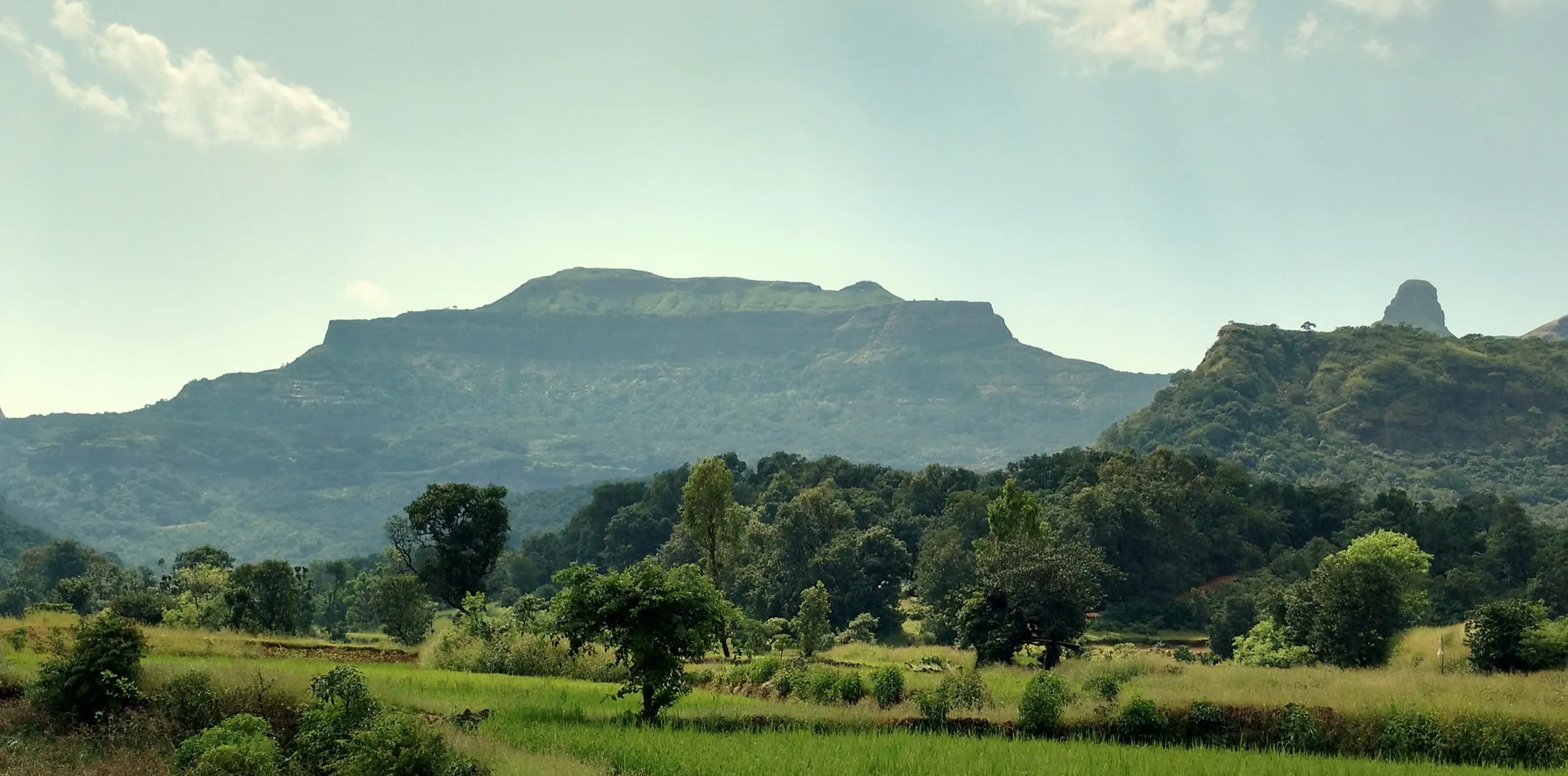
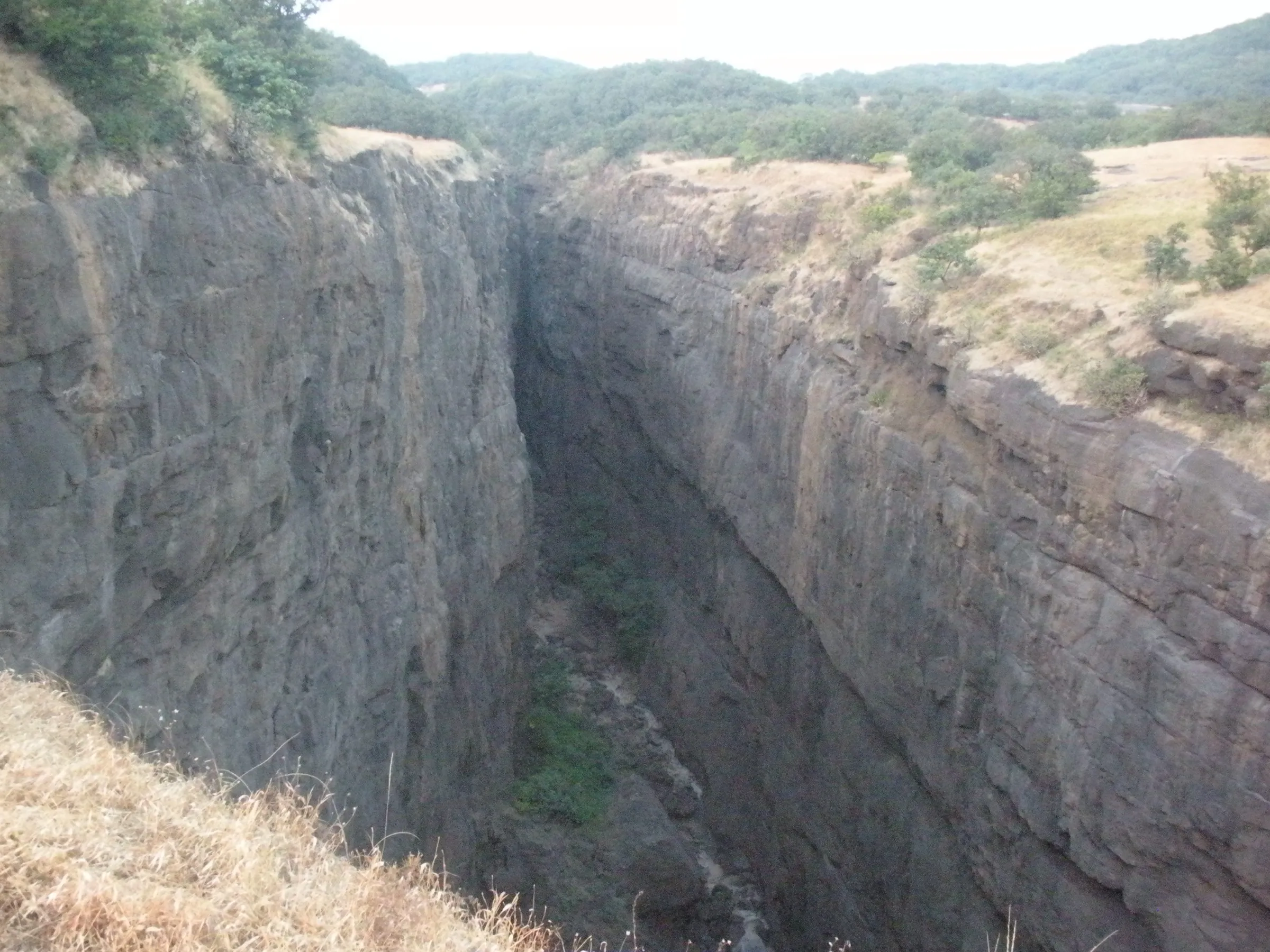
A one-way descent down a narrow water-cut canyon: boulder-hopping, pools that are knee- to waist-deep or deeper, and two to four rappels of roughly 12 to 25 feet (some routes up to about 100 feet), which need ropes, harnesses and a trained guide.
Photos
On the trail
The route
Day by day
Day 1 · highest point
Samrad village → Campsite on the valley floor below the gorge
750 m → 350 m
Day 2
Campsite on the valley floor → Dehene village (drive to Asangaon or Kasara)
350 m → 190 m
Ups and downs
Altitude profile
Where it is
Map
Trailhead and high point only — not a recorded track. Use it with a proper map.
Weather
Next 5 days on the trail
Live forecast for the trailhead and the high point. Mountain weather changes fast — check again on the morning you start.
Trailhead · Samrad (Samrud) village
at 750 mLoading forecast…
High point · Head of the Sandhan gorge, below Samrad village
at 750 mLoading forecast…
Each day: high / low °C · rain mm and chance · snow cm · wind km/h
Weather data: Open-Meteo.comModel forecast, not an official warning. For alerts follow IMD and the local administration.
Plan the trip
How to reach
- Trailhead
- Samrad (Samrud) village (nearest town: Bhandardara)
- Nearest railway
- Kasara for the start at Samrad; Asangaon for the exit at Dehene
- Nearest airport
- Mumbai (Chhatrapati Shivaji Maharaj International), about 180 km
- By road
- Mumbai via Kalyan, Kasara, Igatpuri, Bhandardara and Ghatghar dam to Samrad (about 181 km); Pune via Narayangaon, Alephata, Bota, Kotul, Rajur and Bhandardara to Samrad (about 200 km); Nashik via Ghoti and Bhandardara to Samrad (about 93 km); Kasara station to Samrad by hired or shared jeep, about 4 hours at night
- Drive
- About 5 h from Mumbai
Plan the trip
Permits and fees
We could not confirm the current permit rules and fees from an official source. Check with the local forest department or tourism office before you go.
Plan the trip
Cost
Self-guided
₹1,500–3,500
With an operator
₹2,700–3,200
Per person, ex-Kasara. Guided full-descent prices published October 2026: Bikat Adventures ₹3,000 + 5% GST (Kasara to Kasara, tents, meals, forest/camping charges); Treks and Trails India ₹2,699-2,999 (Kasara to Asangaon). Half-trek rappelling day trips from Pune are cheaper (Treks and Trails India lists ₹1,299-1,899) but do not descend the whole valley. Self-guided is an estimate: local train to Kasara, a jeep to Samrad, a local guide with ropes from Samrad (needed for the rappels), food, and transport from Dehene back to Asangaon; any sanctuary entry fee is extra and should be checked locally.
Gear
Top picks for this trek
The gear that matters most on this route, chosen from its altitude, season and risks.
 Ad · affiliate link
 Ad · affiliate link
 Ad · affiliate link
 Ad · affiliate link
- Ad · affiliate link
 Ad · affiliate link
 Ad · affiliate link
 Ad · affiliate link
Store buttons open a search on that store, not a product we picked. As an Amazon Associate we earn from qualifying purchases. Photos show the kind of item, not a specific product. Affiliate disclosure
Packing checklist
Matched to this trek: altitude, season, days and the risks on the route.
Packed 0 of 25
Hot days in Mar: start at first light and carry extra water and ORS.
Tick each item as it goes in the bag.
Know before you go
Good to know
- Mobile network
- Poor; operators warn of weak or no mobile signal in the region, and none inside the gorge.
- Last ATM
- Not confirmed; carry cash from Kasara, Igatpuri or Akole before heading to Samrad.
- Nearest hospital
- Not confirmed; the nearest larger hospitals are in Igatpuri, Shahapur and Nashik, so carry a first-aid kit.
- Water
- Pools and streams inside the gorge; carry 2-3 litres from Samrad and treat any water you refill.
Highlights
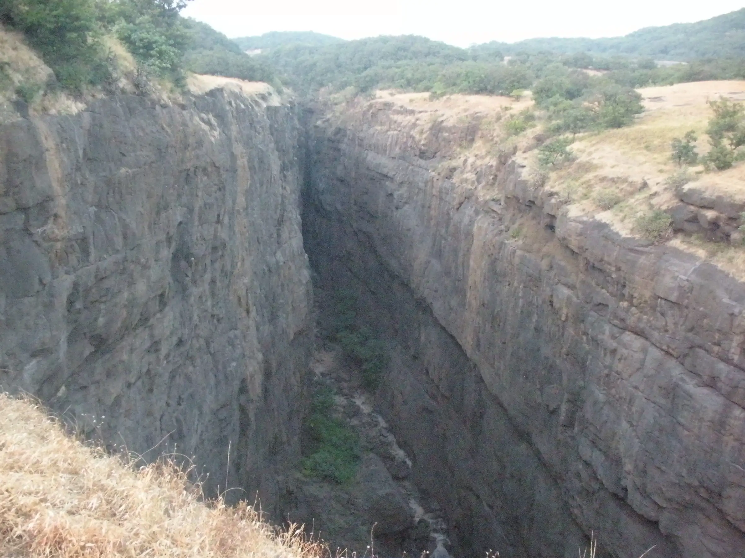
- Walking a water-cut basalt canyon about 1.5-2 km long and around 200 feet deep, only about 3 metres wide in places, where sunlight barely reaches the floor
- Rappels down rock steps and dry or seasonal waterfalls inside the gorge
- Wading and swimming through pools, and scrambling over boulders the size of a room
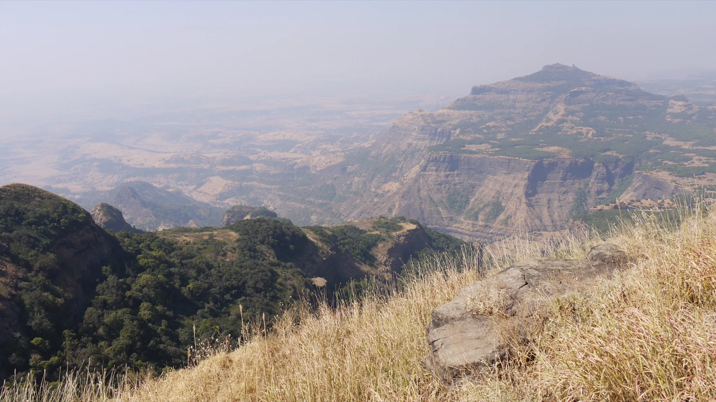
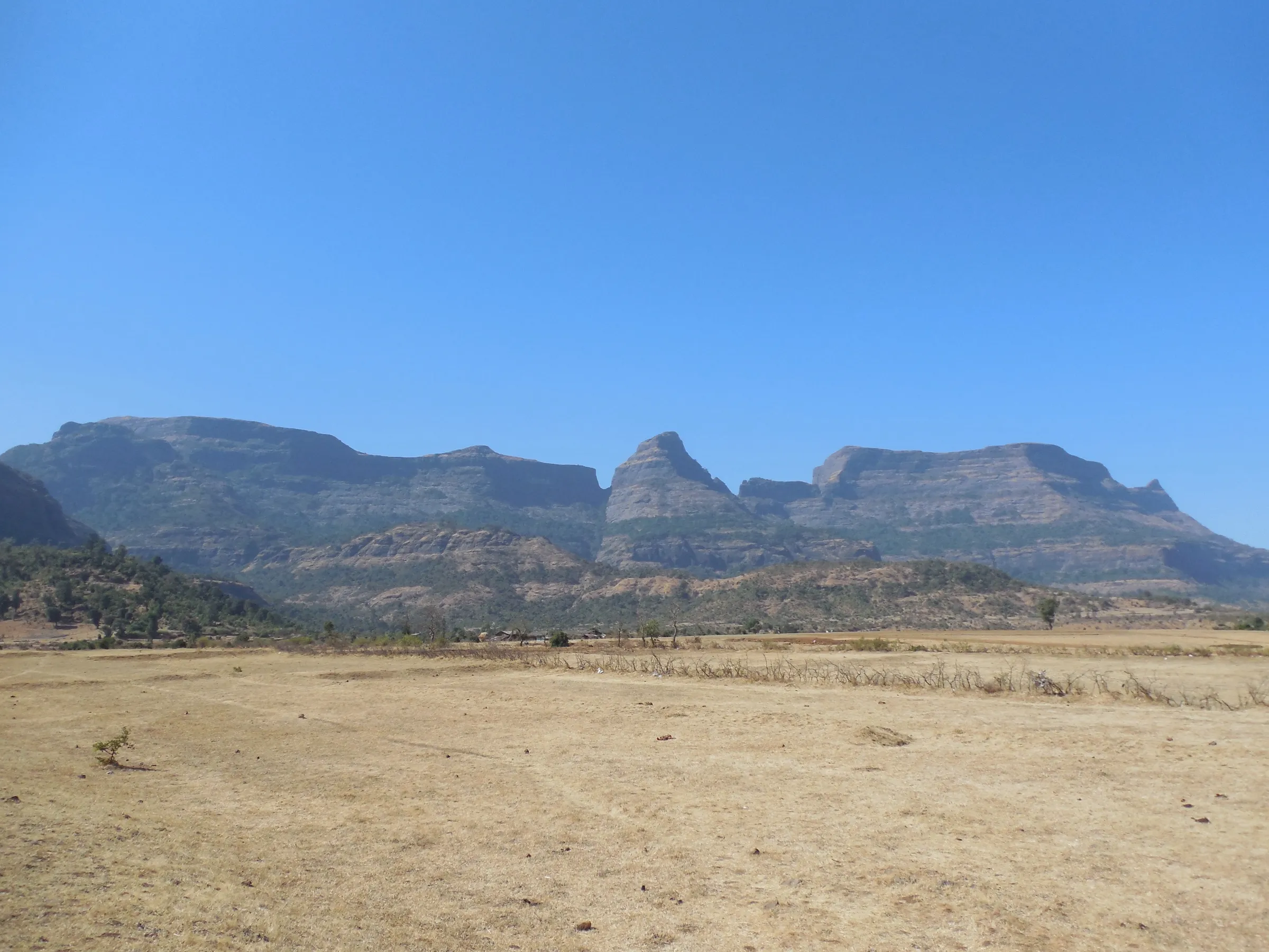
- Night camp under the open sky below the gorge, with the Sahyadri giants Alang, Madan, Kulang, Ratangad, Ajoba and Kalsubai around the valley
Risks
- Flash floods: the narrow gorge fills fast in rain. The valley is formally closed in the monsoon; do not enter if rain is forecast.
- October is uncertain: some operators sell trips from October, others say the route reopens only in early November. Check with the Bhandardara/Kalsubai-Harishchandragad sanctuary office or Samrad villagers before going.
- Rappels of about 12-25 feet (up to about 100 feet on some routes) need ropes, harnesses, helmets and a trained guide; do not attempt them without equipment.
- Wet basalt boulders are slippery and pools can be waist- to shoulder-deep; carry valuables in dry bags and wear trekking shoes with good grip (operators turn away people in sports shoes or sandals).
- Samrad and Dehene are about three hours apart by road, so self-drivers must arrange for the car to be moved to the exit.
- Rockfall from the gorge walls; keep helmets on inside the canyon.
Know before you go
Questions
Is Sandhan Valley open in the monsoon?
No. The Kalsubai-Harishchandragad Wildlife Sanctuary closed the valley until the end of the monsoon in 2024 because of flash floods and rockfall, and in 2025 the Forest Department banned entry until 10 August. Operators say trips restart around November and run until March.
Do I need to know rappelling for Sandhan Valley?
No prior experience is needed if you go with a group or a local guide, but the full descent includes two to four rappels of about 12-25 feet (Outlook Traveller mentions walls up to about 100-120 feet on some routes). Guides provide the ropes, harnesses and helmets.
Where does the Sandhan Valley trek start and end?
It is a one-way trek: it starts at Samrad village near Bhandardara and ends at Dehene village on the Konkan side. The two villages are about three hours apart by road, so groups use separate vehicles at the start and the exit.
How long does the Sandhan Valley trek take?
The full descent takes two days with a night camp: one long day of about 7-9 hours through the gorge to the campsite, then an easy 2-3 hour walk to Dehene. Shorter one-day 'half trek' trips go only as far as the first rappel and return to Samrad.
Is Sandhan Valley suitable for beginners?
Opinions differ. Bikat Adventures calls it a beginner's trek that needs stamina, while Treks and Trails India and Thrillophilia rate it moderate to difficult and not ideal for first-timers because of the water crossings, boulders and rappels. Fit beginners manage it with a guided group.
In an emergency
Save these numbers before you lose signal. Tap to call.
- 112All emergenciesIndia’s single emergency number — works in every state
- 108Ambulance
- 1077District disaster control room
You are in
District: Ahilyanagar (Ahmednagar); the exit at Dehene is in Thane districtMaharashtra
- Nearest hospital
- Not confirmed; the nearest larger hospitals are in Igatpuri, Shahapur and Nashik, so carry a first-aid kit.
- Last ATM
- Not confirmed; carry cash from Kasara, Igatpuri or Akole before heading to Samrad.
- Phone network
- Poor; operators warn of weak or no mobile signal in the region, and none inside the gorge.
Before you set off
- Tell someone your route and when you will be back.
- Carry a charged phone and a power bank.
- Download an offline map of the route.
- Turn back if the weather turns bad — the mountain will wait.
Questions about Sandhan Valley
No questions yet. Ask something and trekkers who have done it can answer.
Share your trek photo with #TreksAndTrails
I trekked this
Did Sandhan Valley look different from this page? Tell us what changed and we will check it.
Where this comes from
Sources
Last reviewed:
- Sandhan Valley Trek - Best Canyon Trek — Bikat Adventures
- Sandhan Valley Trek and Camping — Treks and Trails India
- Sandhan Valley Trek from Pune | Half Trek and Rappelling — Treks and Trails India
- Sandhan Valley Trek Blog — Treks and Trails India
- Sandhan Valley Trek and Camping with Rappelling, Igatpuri — Thrillophilia
- Sandhan Valley: Maharashtra's Thrilling Canyon Trek Through The Valley Of Shadows — Outlook Traveller
- Entry Banned At Popular Maharashtra Trekking Spots Till August 10 (25 June 2025) — Pune Pulse
- Sandhan Valley closed for tourists during monsoon season (20 June 2024) — Pune Pulse
Photos: Dr.sachin23, CC BY-SA 4.0; Benchmark3, CC BY-SA 4.0