Rohida Trek
Pune, Maharashtra
Opens without signal on this phone, with the map file and checklist. Saved for offline →
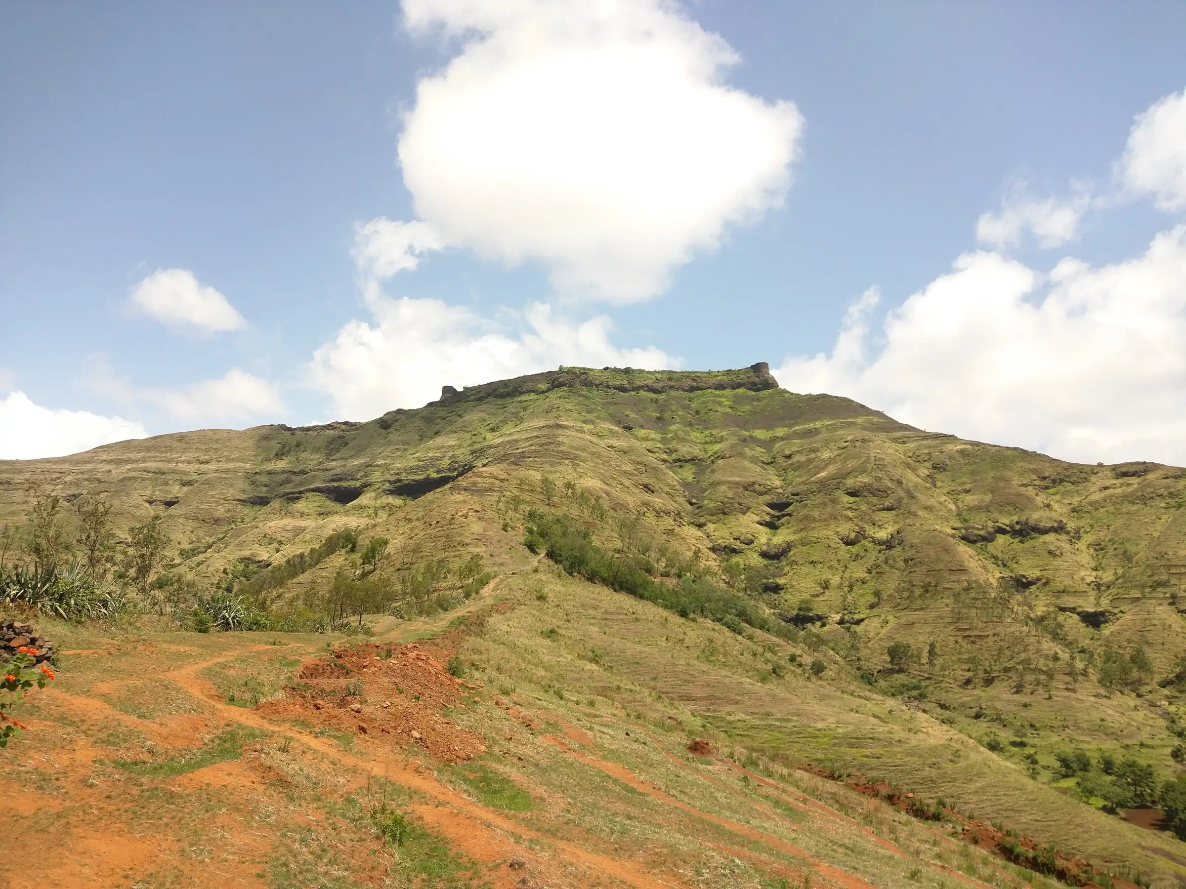
- Max altitude
- 1,097 m
- Days
- 1 day
- Distance
- 5 km
- Difficulty
- Easy
A well-marked, treeless trail of about an hour to the first gate, followed by about 70 rock-cut steps through three gates; operators rate it easy to moderate. The very strong wind on the ridge and bastions is the main difficulty.
Photos
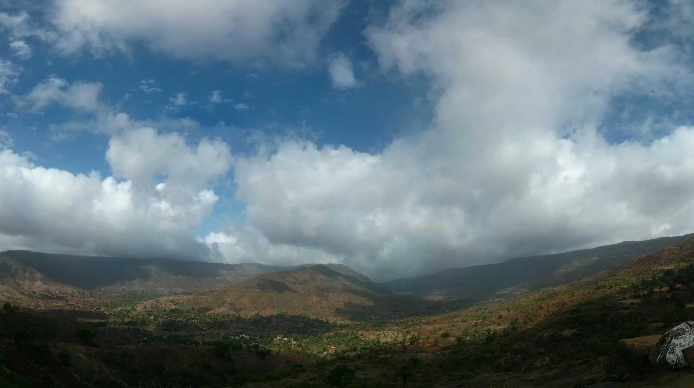
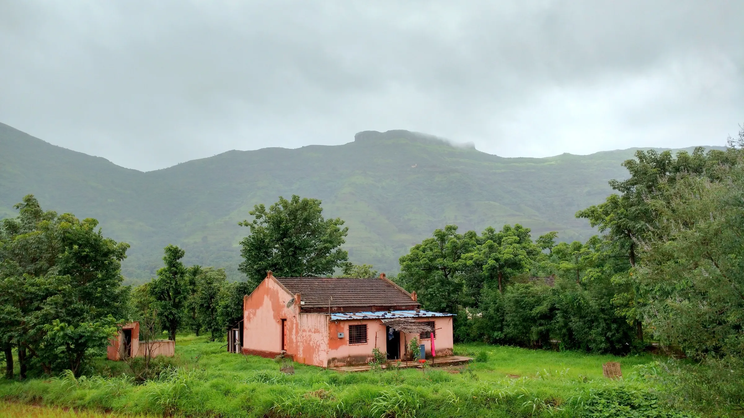
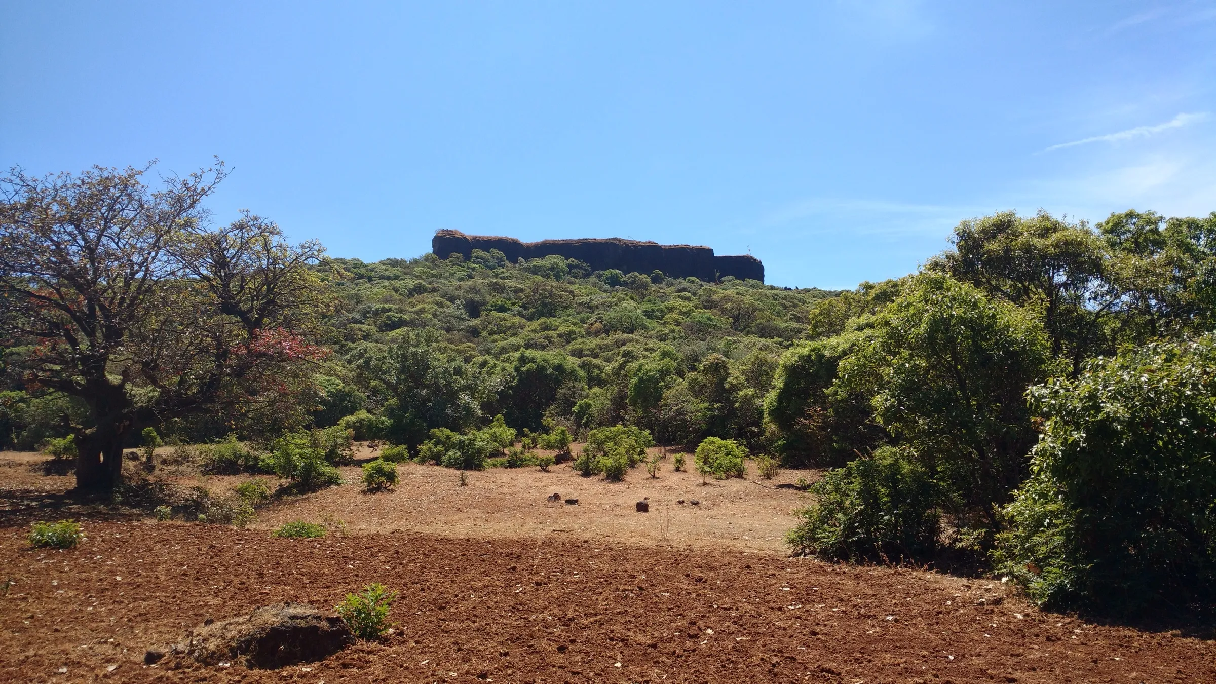
On the trail
The route
Day by day
Day 1 · highest point
Bajarwadi → Bajarwadi (via Rohida Fort, Rohidmalla Mandir and the bastion circuit)
760 m → 1,097 m → 760 m
Ups and downs
Altitude profile
Where it is
Map
Trailhead and high point only — not a recorded track. Use it with a proper map.
Weather
Next 5 days on the trail
Live forecast for the trailhead and the high point. Mountain weather changes fast — check again on the morning you start.
Trailhead · Bajarwadi
at 760 mLoading forecast…
High point · Rohida Fort (Vichitragad) top
at 1,097 mLoading forecast…
Each day: high / low °C · rain mm and chance · snow cm · wind km/h
Weather data: Open-Meteo.comModel forecast, not an official warning. For alerts follow IMD and the local administration.
Plan the trip
How to reach
- Trailhead
- Bajarwadi (nearest town: Bhor)
- Nearest railway
- Pune Junction
- Nearest airport
- Pune Airport
- By road
- Pune to Bhor (about 61 km) and on to Bajarwadi (about 7 km south of Bhor); S.T. buses run Pune-Bhor and Bhor-Bajarwadi; Mumbai or Nashik via Pune
- Drive
- About 2 h from Pune
Plan the trip
Permits and fees
We could not confirm the current permit rules and fees from an official source. Check with the local forest department or tourism office before you go.
Plan the trip
Cost
Self-guided
₹300–1,500
With an operator
₹1,000–1,400
Per person, ex-Pune, one-day trips. Guided prices as listed by operators (no current departure dates shown, so check before booking): Foliage Outdoors ₹1,000 + GST; Treks and Trails India (treksandtrails.org) ₹1,300, and ₹1,399 on its Pune page (Pune-Pune non-AC vehicle, veg breakfast and lunch). Self-guided is an estimate: S.T. bus Pune-Bhor-Bajarwadi and back plus food at the low end; a shared private car at the high end (Indiahikes quotes about ₹4,200 for an Innova from Pune). A blog reports ₹40 parking per vehicle at Bajarwadi.
Gear
Top picks for this trek
The gear that matters most on this route, chosen from its altitude, season and risks.
 Ad · affiliate link
 Ad · affiliate link
 Ad · affiliate link
 Ad · affiliate link
- Ad · affiliate link
 Ad · affiliate link
 Ad · affiliate link
 Ad · affiliate link
Store buttons open a search on that store, not a product we picked. As an Amazon Associate we earn from qualifying purchases. Photos show the kind of item, not a specific product. Affiliate disclosure
Packing checklist
Matched to this trek: altitude, season, days and the risks on the route.
Packed 0 of 21
Monsoon months (Aug–Sep): pack everything in plastic or a dry bag and wear shoes with good grip.
Tick each item as it goes in the bag.
Know before you go
Good to know
- Mobile network
- Not confirmed by our sources; expect usable signal near Bajarwadi and Bhor.
- Last ATM
- Bhor town (not confirmed by our sources; carry cash)
- Nearest hospital
- Bhor for first care; Pune for serious cases
- Water
- Rock-cut cisterns on the fort; Wikipedia says the cistern water is drunk all year, but Indiahikes says the cistern at the second gate is not potable. Carry 2-3 litres from the base and treat any fort water.
Highlights
- A short, open ridge walk from Bajarwadi to a Yadava-era hill fort that Chhatrapati Shivaji Maharaj took into Swarajya
- Famous for its fierce wind: in the monsoon, waterfalls on the ridge are blown back upwards
- Three gates on the entrance path, with a Ganesh patti on the first and Persian and Marathi inscriptions on the third
- The Rohidmalla (Bhairoba) Mandir on top, with murtis of Bhairoba, Bhairavi and Bhagwan Ganesh, and a line of rock-cut cisterns
- Six bastions, including Shirvale, Patane, Damgude and Waghjai, with views to Purandar, Rajgad, Torna, Raireshwar, Kamalgad and Kenjalgad on a clear day
Risks
- The wind on the ridge and along the bastion edge is very strong and can knock you off balance; keep well back from the walls and edges, especially with children.
- The rock-cut steps through the three gates are tall and partly broken; they are slippery in rain.
- Monsoon (June-September) makes parts of the trail slushy, with fog over the fort.
- Pune district has issued monsoon prohibitory orders in past years (for example July 2024) covering fort areas in Bhor and Velha tehsils; check for a current order before a monsoon visit.
- There is no shade on the trail; carry water, a cap and sunscreen outside the monsoon.
Know before you go
Questions
How long does the Rohida fort trek take?
About an hour to an hour and a half from Bajarwadi to the first gate at an easy pace, and about an hour to walk around the fort. Operators plan roughly five hours from the base and back.
What is the height of Rohida fort?
Operators give about 3,560-3,660 ft. Foliage Outdoors says about 3,600 ft (about 1,097 m), which also matches terrain data for the fort top.
How do I reach Rohida fort from Pune?
Go to Bhor (about 61 km from Pune) and then to Bajarwadi, about 7 km south of Bhor. S.T. buses run Pune-Bhor and Bhor-Bajarwadi, but a private vehicle saves waiting. The trail starts near the Bajarwadi school.
Why is Rohida called the windy fort?
The ridge and the bastions catch very strong wind. Indiahikes describes monsoon waterfalls on the ridge being blown upwards, and trekkers report having to brace against cross-winds on the flat section and along the fort edge.
Can I stay overnight on Rohida fort?
Wikipedia says a night stay can be made in the Rohidmalla Mandir on the fort, and the local fort committee in Bajarwadi can arrange stay and food at reasonable cost. Ask in the village first.
When is the best time to visit Rohida?
Late monsoon and winter. Foliage Outdoors recommends late monsoon and winter, and Treks and Trails India calls the post-monsoon season the best time; Indiahikes notes many flowers in winter.
In an emergency
Save these numbers before you lose signal. Tap to call.
- 112All emergenciesIndia’s single emergency number — works in every state
- 108Ambulance
- 1077District disaster control room
You are in
District: PuneMaharashtra
- Nearest hospital
- Bhor for first care; Pune for serious cases
- Last ATM
- Bhor town (not confirmed by our sources; carry cash)
- Phone network
- Not confirmed by our sources; expect usable signal near Bajarwadi and Bhor.
Before you set off
- Tell someone your route and when you will be back.
- Carry a charged phone and a power bank.
- Download an offline map of the route.
- Turn back if the weather turns bad — the mountain will wait.
Questions about Rohida
No questions yet. Ask something and trekkers who have done it can answer.
Share your trek photo with #TreksAndTrails
I trekked this
Did Rohida look different from this page? Tell us what changed and we will check it.
Where this comes from
Sources
Last reviewed:
- Rohida (Vichitragad) Trek — Indiahikes
- Rohida Fort Trek Pune — Treks and Trails India (treksandtrails.org)
- Rohida Fort Trek — Treks and Trails India (treksandtrails.org)
- Trek to Fort Rohida — Foliage Outdoors
- Rohida — Foliage Outdoors
- Rohida / Vichitragad — Durgbharari
- Rohida fort — Wikipedia
- Trek to Rohida Fort – the windy fort — Places near Pune and Mumbai
Photos: Pranav Lawate, CC BY-SA 4.0; Pranav Lawate, CC BY-SA 4.0; Pranav Lawate, CC BY-SA 4.0; Ccmarathe, CC BY-SA 4.0