Palitana Shatrunjaya Trek
Bhavnagar, Gujarat
Opens without signal on this phone, with the map file and checklist. Saved for offline →
- Max altitude
- 603 m
- Days
- 1 day
- Distance
- 7 km
- Difficulty
- Moderate
A single stone staircase of roughly 3,500 to 3,800 steps climbs about 3.5 km to the temples; it is steady rather than technical, but long in heat, and everyone must be down before dark.
About this trek
Palitana Shatrunjaya
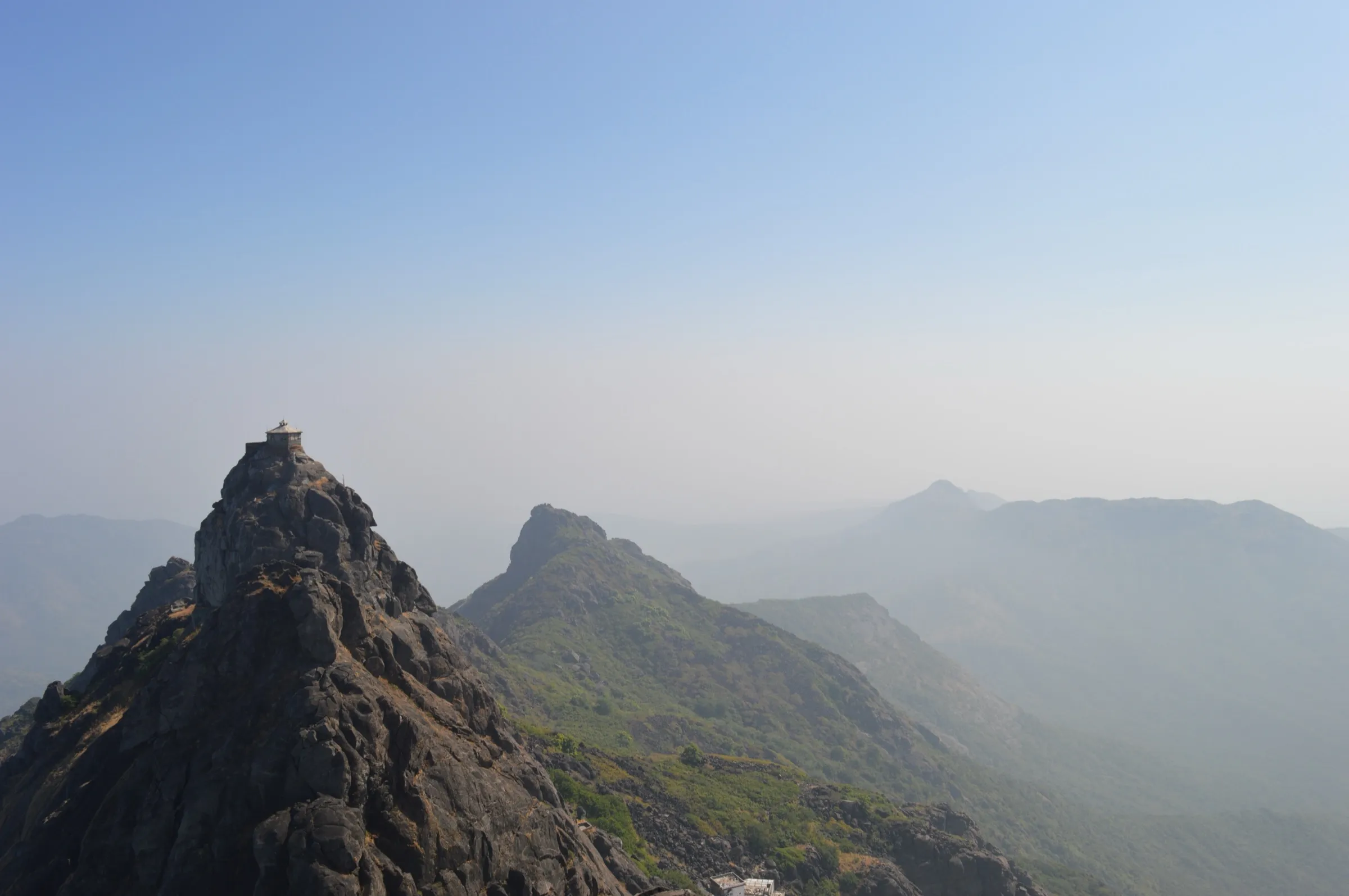
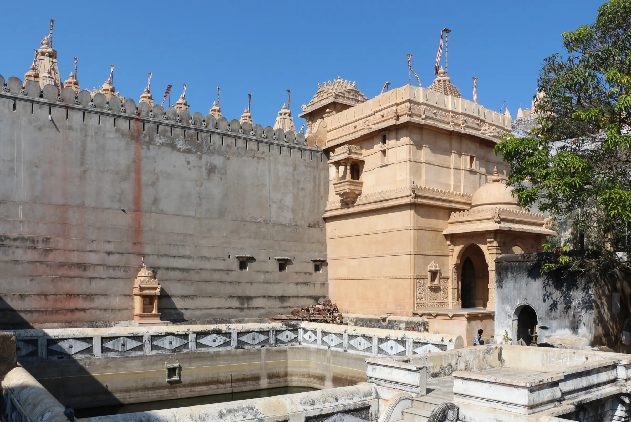
A pilgrim climb up the stone steps of Shatrunjaya hill at Palitana in Gujarat to a summit crowded with Jain temples, over 850 by one count, grouped in walled clusters called tuks around the main Adinath shrine. Sources give about 3,572 to 3,800 steps and roughly 600 m of ascent. It suits fit walkers who can start before dawn, and it is closed in the monsoon retreat, so confirm dates locally.
Photos
On the trail
The route
Day by day
Day 1 · highest point
Taleti (Palitana) → Shatrunjaya temples and back
60 m → 603 m → 60 m
- The climb is by stone steps; sources give about 3,572 to 3,800 steps and around 600 m of height gain.
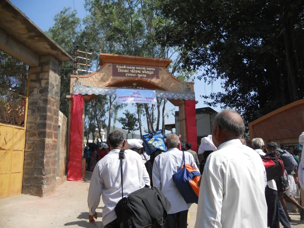
- Most pilgrims take two to three hours to reach the top, starting in the dark to be there at sunrise.
- At the top the temples stand in walled clusters called tuks, with the main shrine to Adinath as the focal point.
- Those who cannot walk can hire a carried seat (doli); agree the price beforehand.
- No one may stay on the hill overnight, so descend before sunset; April to June is very hard going in the heat.
Ups and downs
Altitude profile
Where it is
Map
Trailhead and high point only — not a recorded track. Use it with a proper map.
Weather
Next 5 days on the trail
Live forecast for the trailhead and the high point. Mountain weather changes fast — check again on the morning you start.
Trailhead · Jay Taleti, Palitana (base of the steps)
at 60 mLoading forecast…
High point · Shatrunjaya temple complex (Wikipedia coordinates)
at 603 mLoading forecast…
Each day: high / low °C · rain mm and chance · snow cm · wind km/h
Weather data: Open-Meteo.comModel forecast, not an official warning. For alerts follow IMD and the local administration.
Plan the trip
How to reach
- Trailhead
- Jay Taleti, Palitana (base of the steps)
- Nearest railway
- Palitana (branch line, connects only to Bhavnagar); Bhavnagar is the usual railhead
- Nearest airport
- Bhavnagar (about 51 km, flights mainly to Mumbai); Ahmedabad is the main alternative
- By road
- Bhavnagar to Palitana by road, about 51-56 km; Buses from Ahmedabad, Talaja, Una, Diu and Mumbai; Taxis from Bhavnagar, Ahmedabad or Vadodara
- Drive
- About 1.5 h from Bhavnagar
Plan the trip
Permits and fees
We could not confirm the current permit rules and fees from an official source. Check with the local forest department or tourism office before you go.
Plan the trip
Cost
Self-guided
₹500–2,500
With an operator
₹3,000–8,000
ex-Bhavnagar. Climbing is free; the range is a reasoned estimate for transport, dharamshala or hotel stay, a doli if wanted (rate agreed beforehand) and satvik meals. No operator price list was checked; guided means a pilgrimage tour package.
Gear
Top picks for this trek
The gear that matters most on this route, chosen from its altitude, season and risks.
 Ad · affiliate link
 Ad · affiliate link
 Ad · affiliate link
 Ad · affiliate link
 Ad · affiliate link
 Ad · affiliate link
- Ad · affiliate link
 Ad · affiliate link
Store buttons open a search on that store, not a product we picked. As an Amazon Associate we earn from qualifying purchases. Photos show the kind of item, not a specific product. Affiliate disclosure
Packing checklist
Matched to this trek: altitude, season, days and the risks on the route.
Packed 0 of 16
Tick each item as it goes in the bag.
Know before you go
Good to know
- Mobile network
- Not confirmed from sources
- Last ATM
- Palitana town (not confirmed from sources)
- Nearest hospital
- Palitana town; Bhavnagar for a major hospital (not confirmed from sources)
- Water
- Water points exist part-way up, but carry your own (one source suggests at least 1.5 litres); no food or water is permitted to be consumed on the hill by pilgrim rule
Highlights
- Almost 900 Jain shrines on the Shatrunjaya hill, among the holiest tirthas of Jainism, with the Adinath (Adishwar) temple at its heart
- A stone staircase of about 3,500 to 3,800 steps, climbed at dawn by pilgrims, many barefoot
- Dolis (palanquins) carried by porters for those who cannot climb
- Walled temple clusters (tuks) with carved sandstone spires and wide views over the plain
Risks
- The hill is closed during the monsoon (Chaturmas); the exact dates are not fixed in sources, so check before travelling.
- No one, including priests, may stay on the hill overnight; descend before sunset.
- Sources say food must not be eaten or carried up, and leather items are not permitted; modest dress is expected.
- March to May is hot (up to about 40 C); start before dawn and carry water.
- Step counts and timings differ between sources; confirm hours locally.
Know before you go
Questions
How many steps are there to the Palitana temples?
Sources give about 3,500 steps (Wikipedia, Travel Roach), 3,572 (Wikivoyage), 3,750-3,800 (Wikipedia Shatrunjaya, Namamitra, Gujarat Explorers). The climb is about 3.5 km one way.
How long does the Shatrunjaya climb take?
About 1.5 to 3 hours up, depending on source and pace; Travel Roach puts the whole round trip with time at the top at 3 to 6 hours. Most pilgrims start before dawn.
Is the Palitana hill open in the monsoon?
No. The hill is closed to pilgrims for four months of the monsoon (Chaturmas) and reopens around Kartik Purnima in October-November. One source names July-August; check locally.
Can I stay overnight on Shatrunjaya hill or carry food up?
No one, including the priests, may stay overnight, and everyone must descend before evening. Wikipedia says food must neither be eaten nor carried on the way.
What should I wear and carry?
Modest clothing covering shoulders and legs; leather shoes, belts and bags are not permitted, and many Jains climb barefoot. Carry water and wear sun protection.
Is there an entry fee or a way to be carried up?
One source states there is no entry fee for climbing or visiting. Dolis carried by porters are available; agree the rate beforehand. Wikivoyage lists photography at Rs 40 (seek permission inside temples).
In an emergency
Save these numbers before you lose signal. Tap to call.
- 112All emergenciesIndia’s single emergency number — works in every state
- 108Ambulance
- 1077District disaster control room
You are in
District: BhavnagarGujarat
- Nearest hospital
- Palitana town; Bhavnagar for a major hospital (not confirmed from sources)
- Last ATM
- Palitana town (not confirmed from sources)
- Phone network
- Not confirmed from sources
Before you set off
- Tell someone your route and when you will be back.
- Carry a charged phone and a power bank.
- Download an offline map of the route.
- Turn back if the weather turns bad — the mountain will wait.
Questions about Palitana Shatrunjaya
No questions yet. Ask something and trekkers who have done it can answer.
Share your trek photo with #TreksAndTrails
I trekked this
Did Palitana Shatrunjaya look different from this page? Tell us what changed and we will check it.
Where this comes from
Sources
Last reviewed:
- Palitana temples — Wikipedia
- Shatrunjaya — Wikipedia (Shatrunjaya article)
- Palitana — Wikivoyage
- Palitana and Shatrunjaya Hill, Bhavnagar: Complete Pilgrimage Guide — Travel Roach
- Palitana Temples Guide — Gujarat Explorers
- Palitana Jain Temples - Shatrunjaya Tirth Official Guide — Namamitra
Photos: Bernard Gagnon, CC BY-SA 3.0; Arian Zwegers from Brussels, Belgium, CC BY 2.0; Trinidade, CC BY-SA 3.0; Bernard Gagnon, CC BY-SA 3.0