Girnar Trek
Junagadh, Gujarat
Opens without signal on this phone, with the map file and checklist. Saved for offline →
- Max altitude
- 1,117 m
- Satellite terrain suggests about 1,041 m
- Days
- 1 day
- Distance
- 12 km
- Difficulty
- Difficult
About 9,999 uneven stone steps and roughly 800 m of climbing; fit walkers need 5 to 6 hours up, others 7 to 8, and the last stretch past Ambaji is steep with some bare rock and a descent into a gorge.
About this trek
Girnar
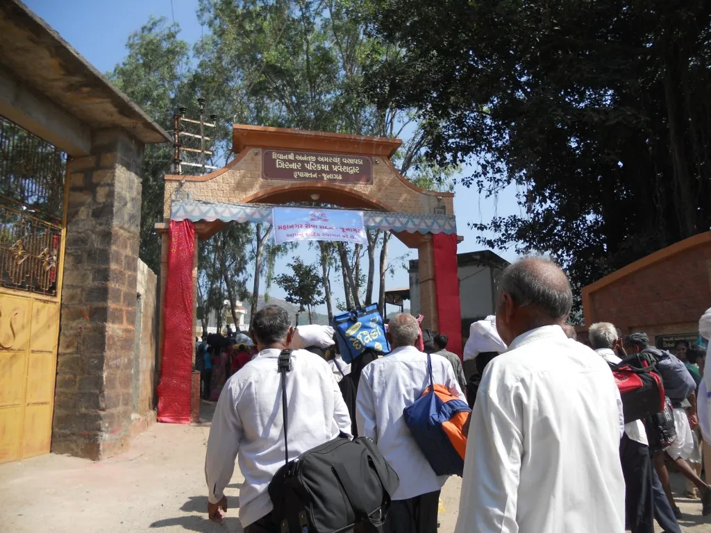
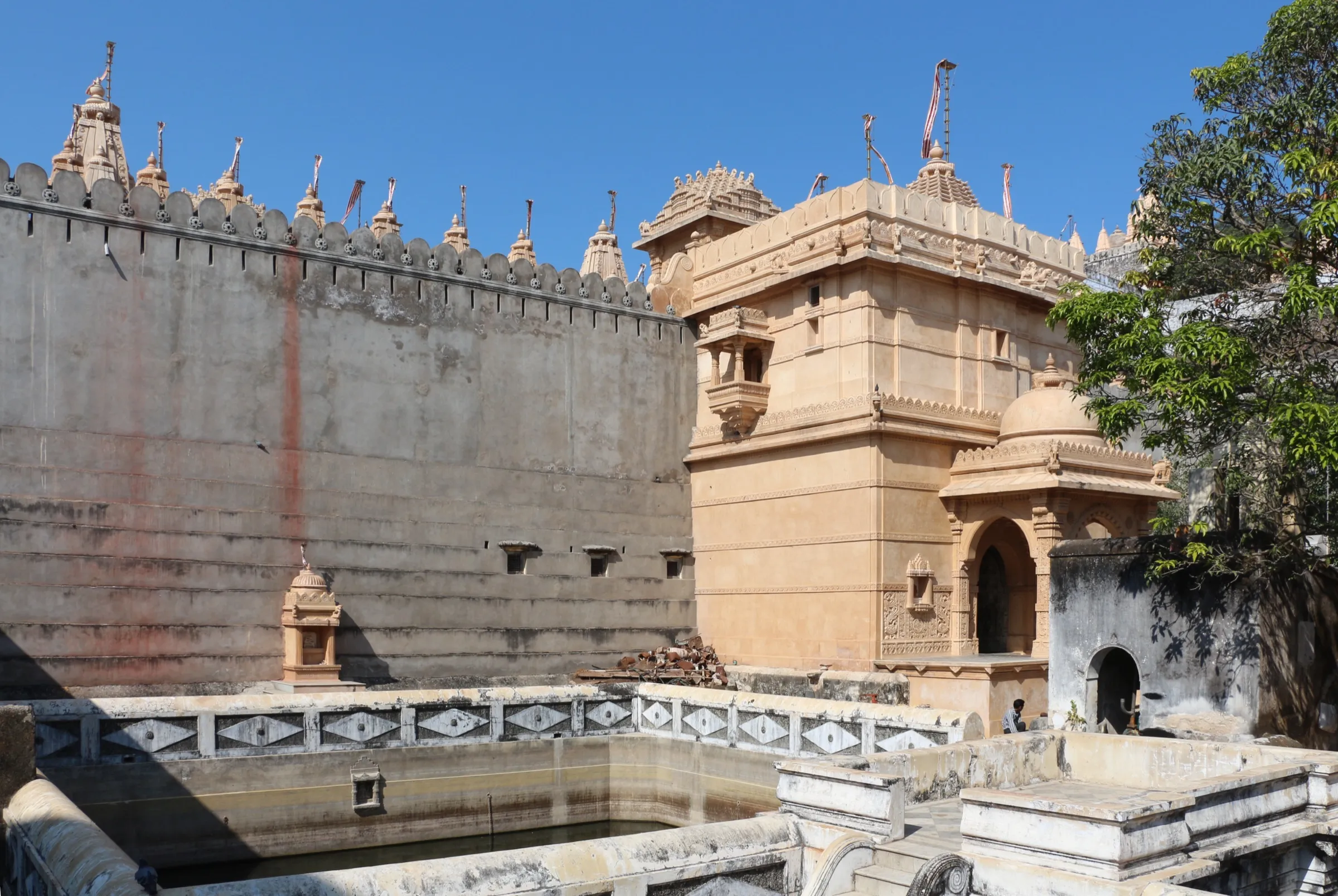
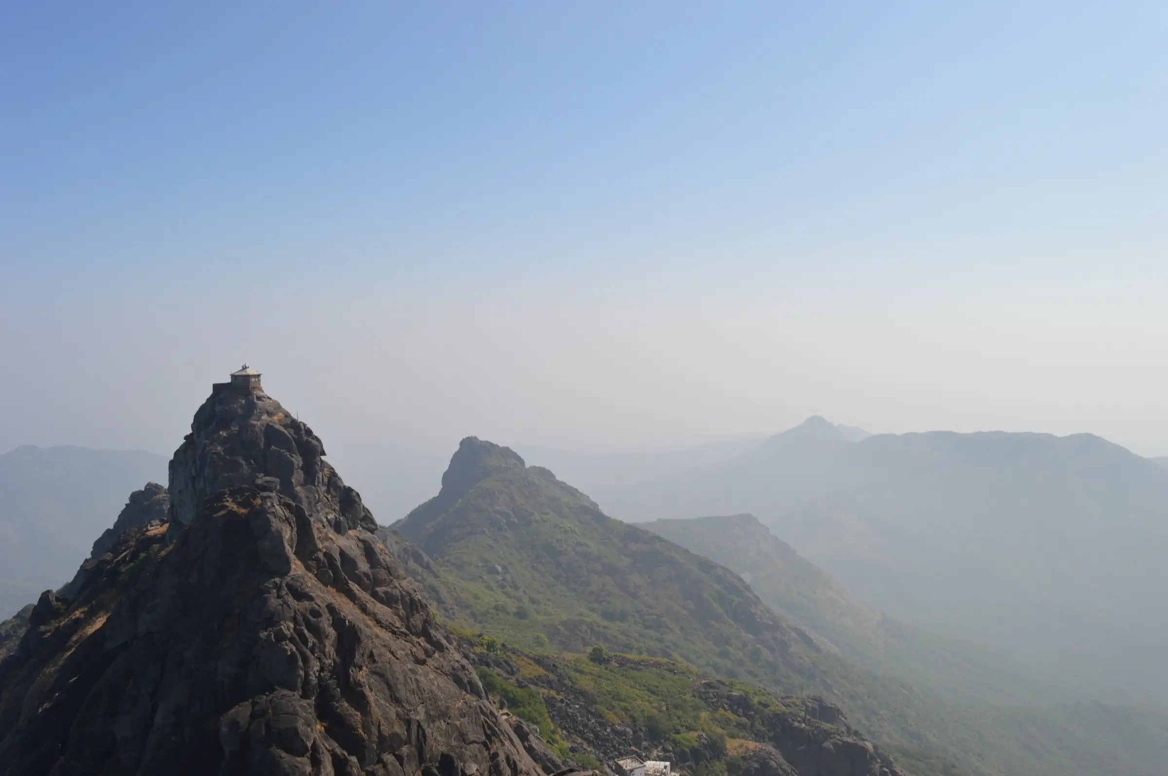
Girnar is Gujarat's highest hill, rising above Junagadh and sacred to both Hindus and Jains. The trek follows about 9,999 stone steps from Girnar Taleti past the Jain temple cluster to the Ambaji temple, then on rock-cut steps to Gorakhnath peak and the Dattatreya shrine. Early on the steps are well kept with tea stalls; beyond Ambaji they cut into bare rock and some sections need hands. Pilgrims and trekkers share the path. It suits fit walkers who start before dawn and are ready for a hard descent.
Photos
On the trail
The route
Day by day
Day 1 · highest point
Girnar Taleti → Gorakhnath peak and Dattatreya shrine, then back to Girnar Taleti
305 m → 1,117 m → 305 m
- Start at Girnar Taleti by about 4:30 a.m. with a tested torch; the first 2,000 steps are well kept, with chai and coconut-water stalls.
- About 4,000 steps up, a plateau holds the Jain temple cluster, including the 12th-century Neminath temple.
- Steps near Ambaji temple (around step 4,500) get crowded on weekends and festivals; the ropeway ends near here.
- Beyond Ambaji the steps cut into bare rock to Gorakhnath peak, then the steepest stretch leads to the Dattatreya shrine.
- Water gets scarce and costly above about step 5,000; carry 2 to 3 litres, and expect knee strain on the way down.
Ups and downs
Altitude profile
Where it is
Map
Trailhead and high point only — not a recorded track. Use it with a proper map.
Weather
Next 5 days on the trail
Live forecast for the trailhead and the high point. Mountain weather changes fast — check again on the morning you start.
Trailhead · Girnar Taleti (foot of the Girnar steps)
at 305 mLoading forecast…
High point · Gorakhnath peak (Guru Gorakhnath Temple)
at 1,117 mLoading forecast…
Each day: high / low °C · rain mm and chance · snow cm · wind km/h
Weather data: Open-Meteo.comModel forecast, not an official warning. For alerts follow IMD and the local administration.
Plan the trip
How to reach
- Trailhead
- Girnar Taleti (foot of the Girnar steps) (nearest town: Junagadh)
- Nearest railway
- Junagadh Junction
- Nearest airport
- Keshod Airport (about 40 km); Rajkot (about 2.5 hours by road) has more flights
- By road
- Junagadh city (about 4 to 5 km by auto-rickshaw or taxi to Girnar Taleti); Ahmedabad (about 336 km, 6 h 40 min by road)
- Drive
- About 6.7 h from Ahmedabad
Plan the trip
Permits and fees
We could not confirm the current permit rules and fees from an official source. Check with the local forest department or tourism office before you go.
Plan the trip
Cost
Self-guided
₹300–2,000
With an operator
Free
Per person, ex-Junagadh. No trek operator selling a guided Girnar package was found, and the climb is normally done independently, so no guided price is quoted. Entry to the steps is free (donations at temples). Self-guided is our estimate: auto or taxi to Girnar Taleti, water and snacks, plus an optional ropeway ticket to the Ambaji temple (about Rs 400 one way or Rs 700 return as published by travel guides; check the official booking site) or a doli, which we could not price.
Gear
Top picks for this trek
The gear that matters most on this route, chosen from its altitude, season and risks.
 Ad · affiliate link
 Ad · affiliate link
 Ad · affiliate link
 Ad · affiliate link
 Ad · affiliate link
 Ad · affiliate link
 Ad · affiliate link
 Ad · affiliate link
Store buttons open a search on that store, not a product we picked. As an Amazon Associate we earn from qualifying purchases. Photos show the kind of item, not a specific product. Affiliate disclosure
Packing checklist
Matched to this trek: altitude, season, days and the risks on the route.
Packed 0 of 19
Tick each item as it goes in the bag.
Know before you go
Good to know
- Mobile network
- Not confirmed by our sources.
- Last ATM
- Junagadh city, about 4 to 5 km from Girnar Taleti
- Nearest hospital
- Junagadh city; a Times Life report mentions medical posts at the base on busy weekends
- Water
- Vendors sell water, chai and coconut water along the steps but become scarce above about step 5,000 and cost more; carry 2 to 3 litres.
Highlights
- The 9,999-step stone staircase to Gujarat's highest mountain, a sacred climb for Hindus and Jains alike
- The Girnar Jain temple complex, including the black granite Neminath temple, and the Amba Mata (Ambaji) temple on the way up
- Gorakhnath peak, the highest point, and the Guru Dattatreya Paduka shrine at the end of the route
- Long views over Junagadh and the surrounding plain from the ridge, with Ashoka's Major Rock Edicts and Damodar Kund near the base
Risks
- Start before first light (Times Life advises about 4:30 a.m.): the stone steps radiate heat from morning in warm months, and the steps between about step 4,000 and Ambaji become a single-file crush at weekends and festivals.
- The ropeway stops near the Ambaji temple; Gorakhnath and Dattatreya must be climbed on foot. Past Ambaji the steps cut into bare rock, some sections need hands, and the final approach is the steepest part.
- Rolled ankles and knee strain on the descent are the commonest problems; wear shoes with lateral support, carry 2 to 3 litres of water, and take trekking poles if you have knee trouble.
- The Dattatreya shrine on the top peak is the subject of a legal dispute between Jain and Hindu communities pending in the Gujarat High Court (Wikipedia). It is not a closure of the route; follow instructions at the shrine and respect both traditions.
- Very heavy crowds at the Girnar Parikrama (around Kartik, November) and the Maha Shivaratri fair (a million or more pilgrims); plan around them.
Know before you go
Questions
How many steps are there on Girnar and how long does the climb take?
Guides quote about 9,999 to 10,000 stone steps from Girnar Taleti to the Dattatreya shrine, though some sources say the true count differs. Wikivoyage says to allow a minimum of 5 to 6 hours on foot to the top; Times Life puts it at five to six hours for a fit climber and seven to eight for someone who does not train regularly.
What is the best time to climb Girnar?
November to February, when winter temperatures suit the long climb (Travelroach). Start before dawn in any season. Expect very large crowds around the Girnar Parikrama in Kartik (around November) and at Maha Shivaratri.
Can I take the ropeway to the top of Girnar?
Only part of the way. The Girnar ropeway, opened in October 2020, runs from Girnar Taleti to near the Ambaji temple in under 10 minutes. The stretch to Gorakhnath peak and the Dattatreya shrine must still be climbed on foot. Travel guides quote about Rs 400 one way and Rs 700 return; check current rates and last-ride time (about 5 pm) before you go.
Which is the highest peak of Girnar?
Sources differ on the name but agree on the height of about 1,117 m (3,666 to 3,672 ft). Travelroach calls Gorakhnath (1,116 m) the highest of the five peaks; Times Life calls the Dattatreya peak the summit at 3,666 ft. The two shrines are only a few hundred metres apart. Wikipedia's infobox lists 1,145 m.
Do I need a permit or ticket to climb Girnar?
Travelroach says entry to the steps is free, with donations at temples. We found no official page confirming a permit rule either way, so check locally at Girnar Taleti.
In an emergency
Save these numbers before you lose signal. Tap to call.
- 112All emergenciesIndia’s single emergency number — works in every state
- 108Ambulance
- 1077District disaster control room
You are in
District: JunagadhGujarat
- Nearest hospital
- Junagadh city; a Times Life report mentions medical posts at the base on busy weekends
- Last ATM
- Junagadh city, about 4 to 5 km from Girnar Taleti
- Phone network
- Not confirmed by our sources.
Before you set off
- Tell someone your route and when you will be back.
- Carry a charged phone and a power bank.
- Download an offline map of the route.
- Turn back if the weather turns bad — the mountain will wait.
Questions about Girnar
No questions yet. Ask something and trekkers who have done it can answer.
Share your trek photo with #TreksAndTrails
I trekked this
Did Girnar look different from this page? Tell us what changed and we will check it.
Where this comes from
Sources
Last reviewed:
- Girnar — Wikipedia
- Junagadh — Wikivoyage
- Girnar Hills — Gir National Park (private tourism site)
- Girnar's 9999 Steps: What the Climb Actually Takes and the Hour You Must Start By — Times Life
- Girnar Hill, Junagadh: Trek, Ropeway & Guide — Travelroach
Photos: Thymitesh, CC BY-SA 4.0; Emmanuel DYAN from Paris, France, CC BY 2.0; Sachinvenga, CC BY-SA 4.0; Sachinvenga, CC BY-SA 4.0