Pavagadh Trek
Panchmahal, Gujarat
Opens without signal on this phone, with the map file and checklist. Saved for offline →
- Max altitude
- 800 m
- Days
- 1 day
- Distance
- 5 km
- Difficulty
- Moderate
A short pilgrim climb of roughly 2,000 stone steps from Machi (about 300 m of gain) with little shade, which feels hard in summer heat and on festival days when the stairway is crowded.
About this trek
Pavagadh
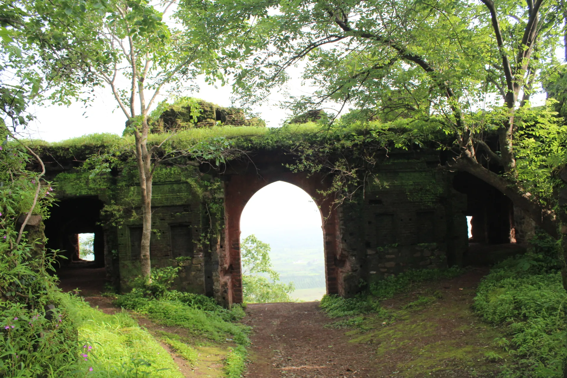
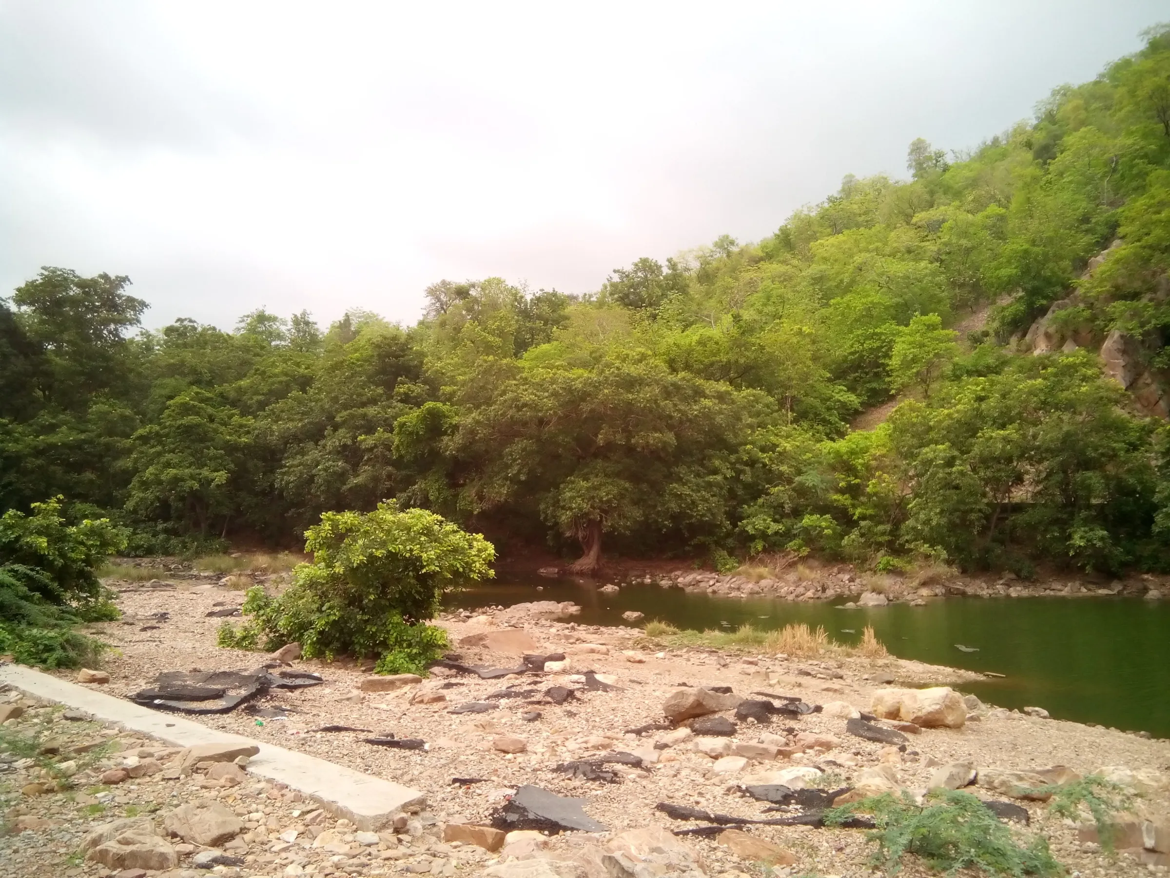
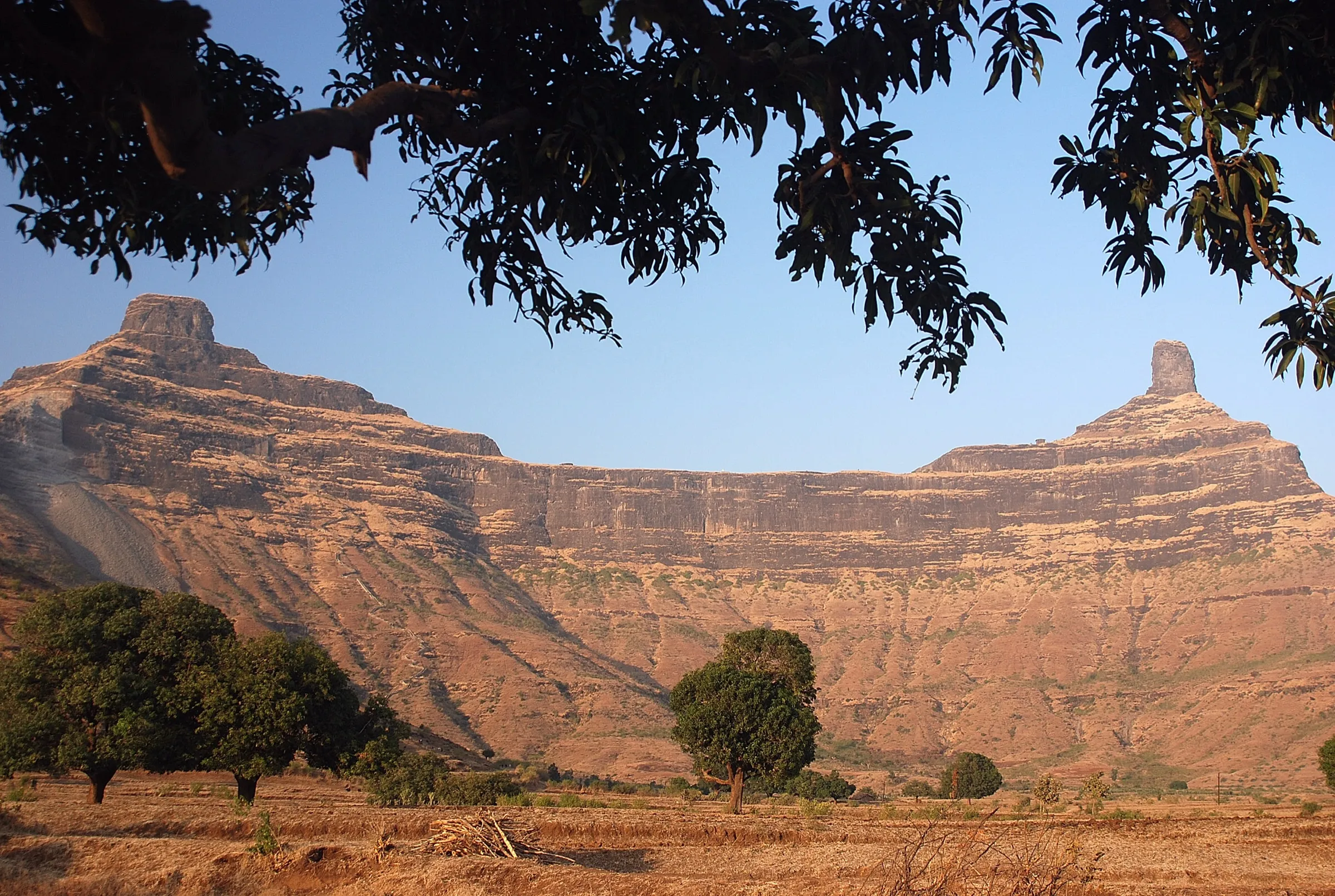
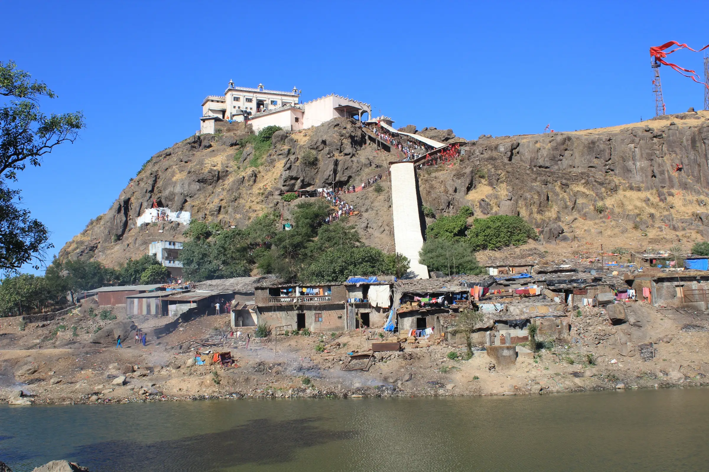
Pavagadh is a hill about 822 m high in Panchmahal district, Gujarat, part of the Champaner-Pavagadh Archaeological Park, a UNESCO World Heritage Site. A stairway and path climb from the Machi plateau to the Kalika Mata temple, which stands on a cliff in dense forest and is held to be one of the 51 Shakti Peeths. Jain temples and old gateways lie on and around the hill. It suits anyone who can climb for one to three hours, and a ropeway is the alternative.
Photos
On the trail
The route
Day by day
Day 1 · highest point
Machi (Manchi Haveli) → Kalika Mata Temple and back
490 m → 800 m → 490 m
- Buses run up to Machi, a plateau at about 490 m, where the climb begins.
- The steep climb on foot takes over an hour by one source; other sources give up to about 3 hours, so allow time.
- A ropeway, running since 1986, takes about 6 minutes from Machi to the hilltop, then about 250 steps lead to the temple.
- Steps on the way up hold fragments of a destroyed Neminatha temple, and Jain temple groups lie near the Naqqarkhana gate and on the southeast cliff.
- The Kalika Mata temple stands on a cliff in dense forest, a small plain shrine with fortifications and an open yard in front.
Ups and downs
Altitude profile
Where it is
Map
Trailhead and high point only — not a recorded track. Use it with a proper map.
Weather
Next 5 days on the trail
Live forecast for the trailhead and the high point. Mountain weather changes fast — check again on the morning you start.
Trailhead · Machi (Manchi Haveli, ropeway base)
at 490 mLoading forecast…
High point · Kalika Mata Temple, Pavagadh hilltop (Wikipedia coordinates)
at 800 mLoading forecast…
Each day: high / low °C · rain mm and chance · snow cm · wind km/h
Weather data: Open-Meteo.comModel forecast, not an official warning. For alerts follow IMD and the local administration.
Plan the trip
How to reach
- Trailhead
- Machi (Manchi Haveli, ropeway base) (nearest town: Champaner)
- Nearest railway
- Champaner Road (Pavagadh Road) station, about 1 km from Champaner town; few trains stop there, so most visitors use Vadodara Junction
- Nearest airport
- Vadodara Airport
- By road
- Vadodara (about 46-54 km, depending on the source) via Halol or Champaner; cab or state/private bus to Champaner, then onward to Machi, where buses run up the hill
- Drive
- About 1.5 h from Vadodara
Plan the trip
Permits and fees
We could not confirm the current permit rules and fees from an official source. Check with the local forest department or tourism office before you go.
Plan the trip
Cost
Self-guided
₹300–1,500
With an operator
Free
Per person, ex-Vadodara. No operators sell this as a guided trek; pilgrims walk it independently, so the guided figure is zero. Self-guided is an estimate: shared bus or cab to Champaner and Machi, plus food and offerings. The optional ropeway cost Rs 150 per adult and Rs 80 per child in 2025 (Wikipedia, Yatradham); confirm current fares locally. Entry to the Champaner-Pavagadh archaeological sites is ticketed separately by the Archaeological Survey of India; check at the gate.
Gear
Top picks for this trek
The gear that matters most on this route, chosen from its altitude, season and risks.
 Ad · affiliate link
 Ad · affiliate link
 Ad · affiliate link
 Ad · affiliate link
 Ad · affiliate link
 Ad · affiliate link
 Ad · affiliate link
- Ad · affiliate link
Store buttons open a search on that store, not a product we picked. As an Amazon Associate we earn from qualifying purchases. Photos show the kind of item, not a specific product. Affiliate disclosure
Packing checklist
Matched to this trek: altitude, season, days and the risks on the route.
Packed 0 of 18
Tick each item as it goes in the bag.
Know before you go
Good to know
- Mobile network
- Not confirmed by the sources; the hill sits within a busy pilgrim area, but check coverage locally.
- Last ATM
- Not confirmed; use ATMs in Champaner or Halol before the climb.
- Nearest hospital
- Not confirmed; Halol and Vadodara are the nearest larger towns for serious care.
- Water
- Not confirmed by the sources. Stalls and rest areas are reported along the route; carry your own water bottle, especially in summer.
Highlights
- Darshan of Kalika Mata (Mahakali), a Shakti Peetha shrine on top of Pavagadh hill
- The old stone stairway climbing past the gates and ruins of the Champaner-Pavagadh hill fort
- Champaner-Pavagadh Archaeological Park, a UNESCO World Heritage Site, below the hill
- Jain temples on the hill (Navalakka group and the Dudhia tank group), dated to the 14th-15th centuries
- Views over the Gujarat plains; the monsoon brings green slopes and seasonal waterfalls
Risks
- Navratri (September-October) and Chaitra Ashtami fairs bring very large crowds on the stairway and at the temple; expect long queues and slow movement.
- Little shade on the climb; summer heat is a real risk, so carry water and start at first light.
- Sources disagree on the step count (about 1,800 to 2,250) and walking time (about 1 to 3 hours), so plan generously.
- Ropeway hours and temple timings are reported differently by different sources, and the ropeway has had maintenance closures (for example 28 July to 1 August 2025); confirm locally.
Know before you go
Questions
How many steps are there to Pavagadh Kalika Mata temple?
Sources give different counts. Yatradham says about 2,000 steps to the temple on foot; Bharat Varsha Yatra says more than 1,800 steps from the base. If you take the ropeway, about 250 steps remain from the upper station to the temple.
How long does the Pavagadh climb take?
Wikipedia says the steep walk from Machi takes over one hour, against about 6 minutes by ropeway. Visitors' own reports vary more, so allow 1 to 3 hours up depending on crowds and fitness, and 1 to 2 hours for the temple visit.
Is there a ropeway to Pavagadh temple and what does it cost?
Yes. The Pavagadh ropeway, running since 1986, takes about 6 minutes from Machi to the hilltop. Fares in 2025 were Rs 150 for adults and Rs 80 for children, and it is reported to run from about 6 am to between 6 and 6:45 pm. You still walk about 250 steps from the upper station to the temple.
How do I reach Pavagadh from Vadodara?
Pavagadh is about 46 to 54 km from Vadodara. Take a cab or bus to Champaner, then continue to Machi at the foot of the stairway, where buses and the ropeway start. The nearest railway station is Champaner Road and the nearest airport is Vadodara.
In an emergency
Save these numbers before you lose signal. Tap to call.
- 112All emergenciesIndia’s single emergency number — works in every state
- 108Ambulance
- 1077District disaster control room
You are in
District: PanchmahalGujarat
- Nearest hospital
- Not confirmed; Halol and Vadodara are the nearest larger towns for serious care.
- Last ATM
- Not confirmed; use ATMs in Champaner or Halol before the climb.
- Phone network
- Not confirmed by the sources; the hill sits within a busy pilgrim area, but check coverage locally.
Before you set off
- Tell someone your route and when you will be back.
- Carry a charged phone and a power bank.
- Download an offline map of the route.
- Turn back if the weather turns bad — the mountain will wait.
Questions about Pavagadh
No questions yet. Ask something and trekkers who have done it can answer.
Share your trek photo with #TreksAndTrails
I trekked this
Did Pavagadh look different from this page? Tell us what changed and we will check it.
Where this comes from
Sources
Last reviewed:
- Pavagadh — Wikipedia
- Champaner-Pavagadh Archaeological Park — Wikipedia
- Kalika Mata Temple, Pavagadh — Wikipedia
- Pavagadh ropeway — Wikipedia
- Pavagadh Temple Timings and Ropeway Ticket Booking — Yatradham
- Pavagadh Kalika Mata Temple: Ropeway, Steps & History — Bharat Varsha Yatra
Photos: Arian Zwegers from Brussels, Belgium, CC BY 2.0; Arian Zwegers from Brussels, Belgium, CC BY 2.0; Anupamg, CC BY-SA 3.0; Sagar Parmar, CC BY-SA 4.0