Mangi Tungi Trek
Nashik, Maharashtra
Opens without signal on this phone, with the map file and checklist. Saved for offline →
- Max altitude
- 1,331 m
- Satellite terrain suggests about 1,195 m
- Days
- 1 day
- Distance
- 6 km
- Difficulty
- Moderate
A single long day on about 2,500-3,500 rock-cut steps (sources differ) that gain roughly 400 m to the stone arch below the pinnacles, then side walks and more steps to the caves of each pinnacle; about 6 hours for both pinnacles, in strong heat by midday.
Photos
On the trail
The route
Day by day
Day 1 · highest point
Bhilwadi → Bhilwadi (via the Mangi and Tungi pinnacle caves)
740 m → 1,331 m → 740 m
Ups and downs
Altitude profile
Where it is
Map
Trailhead and high point only — not a recorded track. Use it with a proper map.
Weather
Next 5 days on the trail
Live forecast for the trailhead and the high point. Mountain weather changes fast — check again on the morning you start.
Trailhead · Bhilwadi (Bhilwad)
at 740 mLoading forecast…
High point · Tungi pinnacle
at 1,331 mLoading forecast…
Each day: high / low °C · rain mm and chance · snow cm · wind km/h
Weather data: Open-Meteo.comModel forecast, not an official warning. For alerts follow IMD and the local administration.
Plan the trip
How to reach
- Trailhead
- Bhilwadi (Bhilwad) (nearest town: Taharabad)
- Nearest railway
- Nashik Road (about 130 km)
- Nearest airport
- Ozar Airport, Nashik
- By road
- Nashik (about 125-150 km via Satana and Taharabad to Bhilwadi); Mumbai and Pune (overnight drive; group trips leave about 7:45-9 pm and reach the base village about 4 am)
- Drive
- About 3.5 h from Nashik
Plan the trip
Permits and fees
We could not confirm the current permit rules and fees from an official source. Check with the local forest department or tourism office before you go.
Plan the trip
Cost
Self-guided
₹800–2,500
With an operator
₹999–1,999
Per person, ex-Mumbai/Pune for guided trips. Prices published October 2026: Treks and Trails India (treksandtrails.org) ₹1,999 ex-Mumbai/Pune with non-AC transport, breakfast, lunch and trek leader; Adventure Club Pune ₹1,999 Pune-to-Pune or ₹999 self-drive (its itinerary matches the first operator's, so it may not be independent). Self-guided is an estimate ex-Nashik: bus to Satana and Taharabad, local transport to Bhilwadi, a meal and a night at the Jain dharamshala in Bhilwadi, and the trust's ₹100 donation if you take its 4x4 to the Mahavir idol (Durgbharari).
Gear
Top picks for this trek
The gear that matters most on this route, chosen from its altitude, season and risks.
 Ad · affiliate link
 Ad · affiliate link
 Ad · affiliate link
 Ad · affiliate link
 Ad · affiliate link
 Ad · affiliate link
 Ad · affiliate link
- Ad · affiliate link
Store buttons open a search on that store, not a product we picked. As an Amazon Associate we earn from qualifying purchases. Photos show the kind of item, not a specific product. Affiliate disclosure
Packing checklist
Matched to this trek: altitude, season, days and the risks on the route.
Packed 0 of 19
Tick each item as it goes in the bag.
Know before you go
Good to know
- Mobile network
- Not confirmed; mobile signal on the hill is reported as patchy, so download offline maps.
- Last ATM
- Not confirmed; Satana is the nearest large town, so carry cash from there or Nashik.
- Nearest hospital
- Not confirmed; Satana for first care, Nashik (about 125 km) for serious cases.
- Water
- No potable water on the route or at the pinnacles; the rock cisterns at the caves are not for drinking. Carry water from Bhilwadi or refill at the Mahavir idol site (Durgbharari).
Highlights
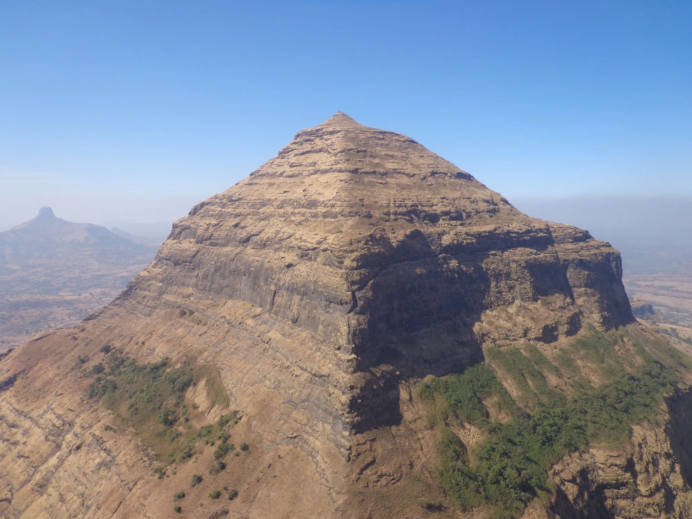
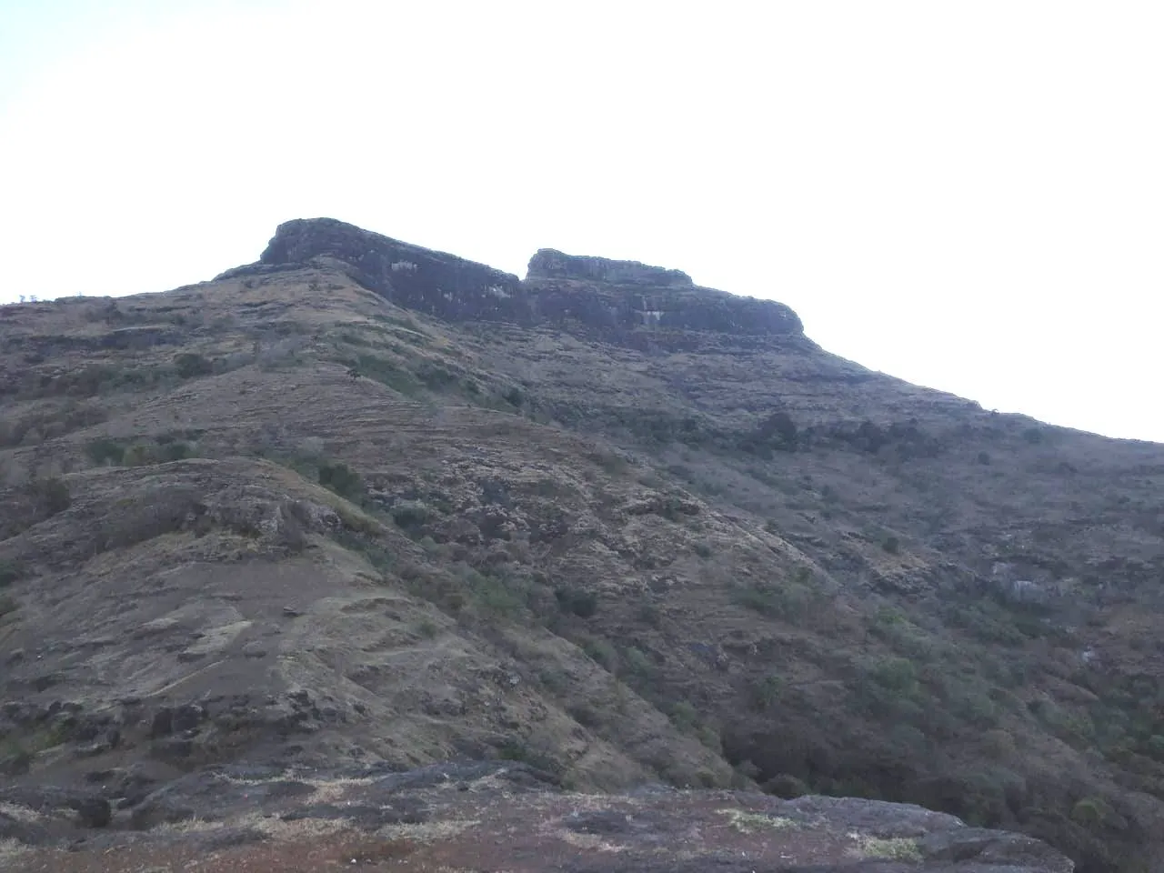
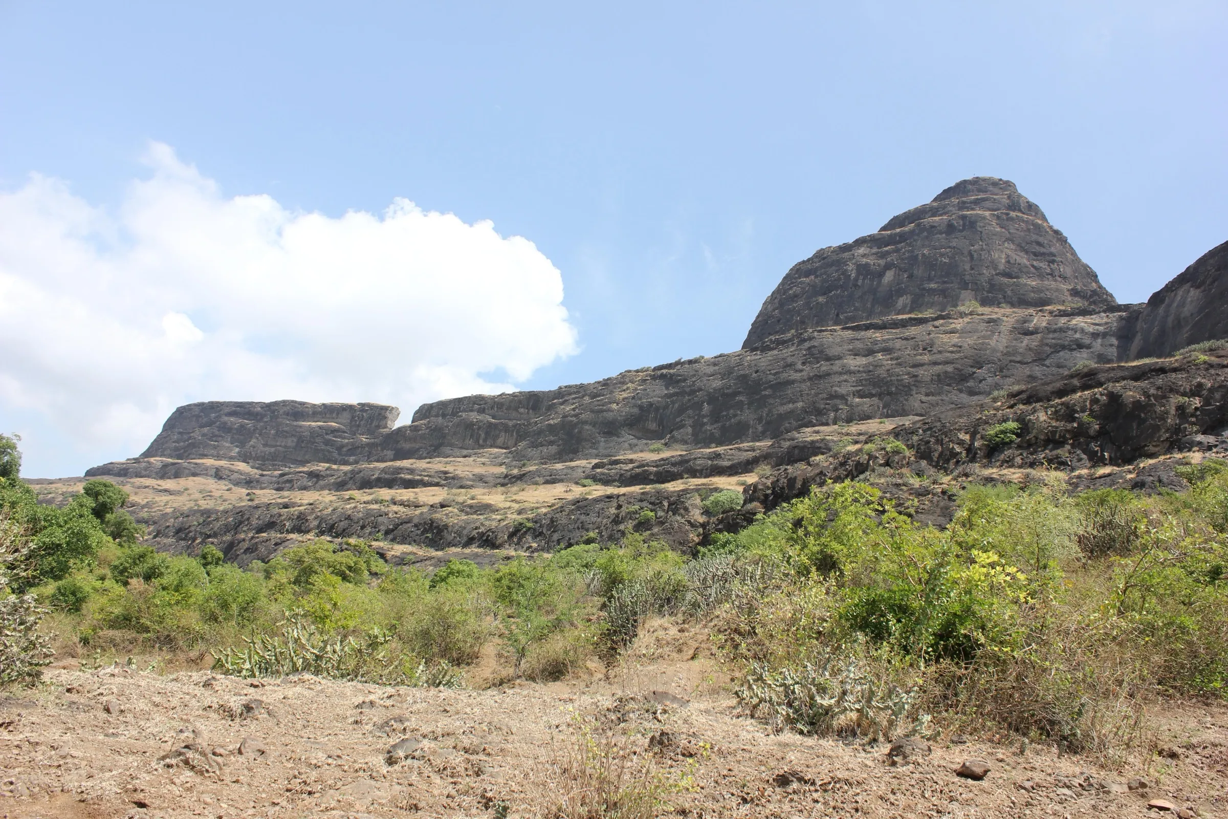
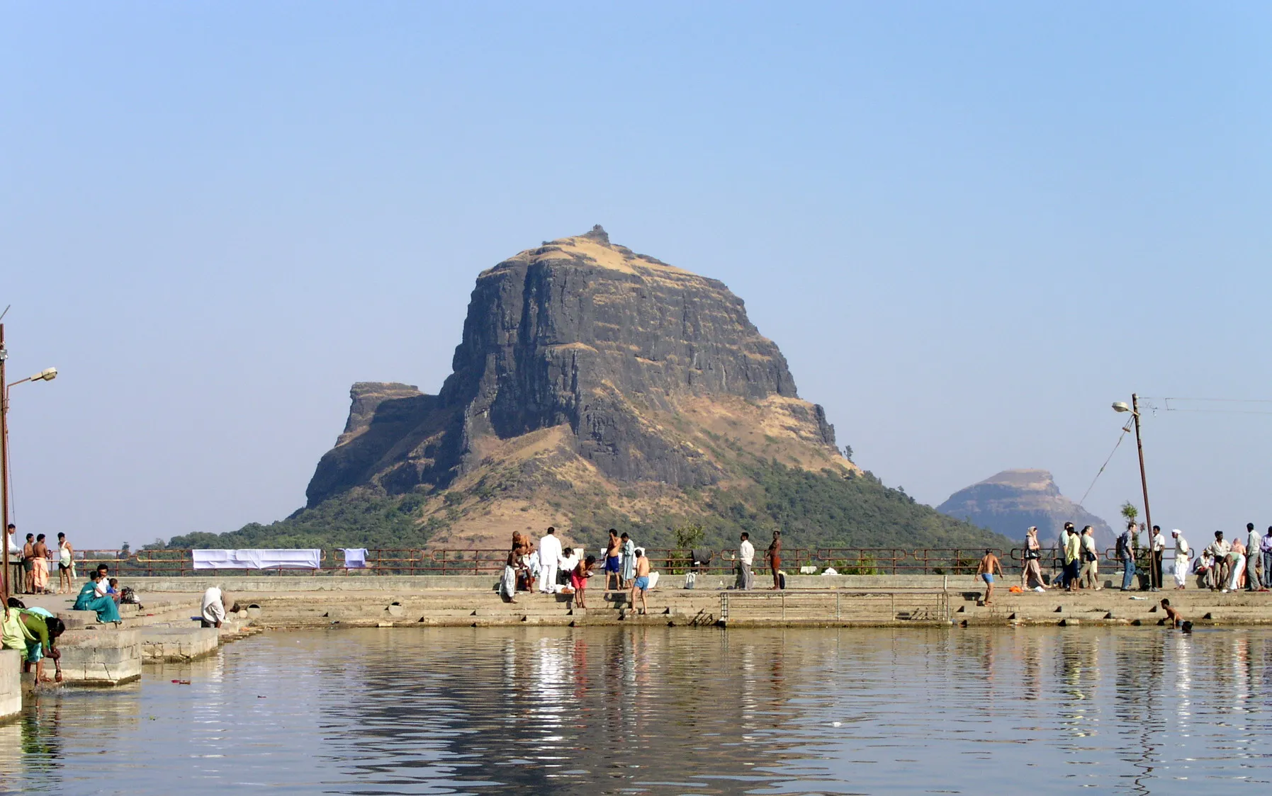
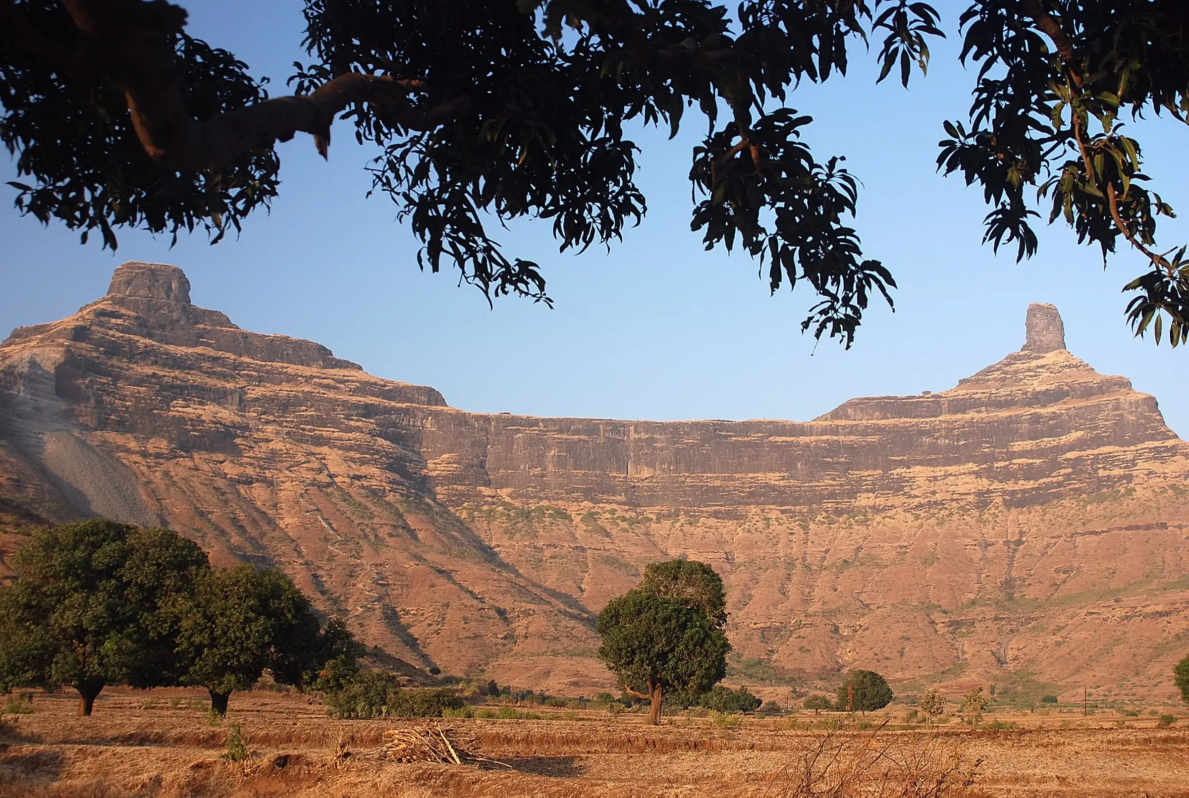
- Twin rock pinnacles, Mangi (west) and Tungi (east), rising above a long basalt ridge in Baglan, an important Digambar Jain tirth
- Rock-cut Jain caves on the way and at both pinnacles, with images of Tirthankaras including Bhagwan Mahavir, Adinath, Shantinath, Parshvanath and Chandraprabhu
- The 108 ft Statue of Ahimsa of Bhagwan Rishabhdev (Adinath), the first Tirthankara, carved from the hill's rock and consecrated in February 2016
- Wide early-morning views over the Baglan hills from the stone arch and the pinnacle bases
Risks
- Thousands of steep rock-cut steps with exposed edges near the pinnacles; take it slowly on the way down.
- In the monsoon the steps become slippery and gusty winds blow on the ridge (Free Press Journal); some rock patches need care.
- No drinking water on the route or at the top and strong heat after mid-morning; start at dawn and carry 2-3 litres.
- The road to the Mahavir idol is steep; only the trust's 4x4 vehicles may use it and private vehicles are not allowed (Durgbharari).
Know before you go
Questions
How many steps are there on the Mangi Tungi trek?
Sources differ: Durgbharari counts about 2,500 steps from the foothills to the pinnacles (about 2,000 to the stone arch), Wikipedia and Outlook Traveller say about 3,500, and Free Press Journal and Bajaj Finserv about 4,500 for the full visit. Taking the trust's 4x4 to the Mahavir idol saves about 1,800 steps.
How long does it take to climb Mangi Tungi?
About two hours from the base to the stone arch, then about an hour each to go round Mangi and to visit Tungi; both pinnacles and back take about 6 hours (Durgbharari). Group trips start at 5 am and are back at the base village by about 2 pm.
Do you climb to the very top of the pinnacles?
No. The steps lead to the caves and shrines at the base of each pinnacle and a path goes round them; the sheer rock towers themselves (about 1,324 m and 1,331 m) are not part of the pilgrim route.
What is the best time to visit Mangi Tungi?
October to February, when it is cool (Bajaj Finserv); Free Press Journal calls winter the best time. The site is open all year, but the steps are slippery in the monsoon and summer middays are very hot.
Where is the base village and how do I reach it?
The base village is Bhilwadi (Bhilwad) in Satana (Baglan) taluka, about 125-150 km from Nashik via Satana and Taharabad; Taharabad is about 12 km away. The nearest railway station is Nashik Road and the nearest airport is Ozar, Nashik. A Jain dharamshala in Bhilwadi offers rooms and meals.
In an emergency
Save these numbers before you lose signal. Tap to call.
- 112All emergenciesIndia’s single emergency number — works in every state
- 108Ambulance
- 1077District disaster control room
You are in
District: NashikMaharashtra
- Nearest hospital
- Not confirmed; Satana for first care, Nashik (about 125 km) for serious cases.
- Last ATM
- Not confirmed; Satana is the nearest large town, so carry cash from there or Nashik.
- Phone network
- Not confirmed; mobile signal on the hill is reported as patchy, so download offline maps.
Before you set off
- Tell someone your route and when you will be back.
- Carry a charged phone and a power bank.
- Download an offline map of the route.
- Turn back if the weather turns bad — the mountain will wait.
Questions about Mangi Tungi
No questions yet. Ask something and trekkers who have done it can answer.
Share your trek photo with #TreksAndTrails
I trekked this
Did Mangi Tungi look different from this page? Tell us what changed and we will check it.
Where this comes from
Sources
Last reviewed:
- Mangi Tungi Temple — Nashik District Administration (official)
- Mangi-Tungi — Wikipedia
- Mangi — Durgbharari
- Tungi — Durgbharari
- Exploring Nashik's Hidden Treasures: Mangi Tungi — Free Press Journal
- These 5 Trails Near Nashik Offer Spectacular Landscape Views — Outlook Traveller
- Mangi Tungi Trek — Treks and Trails India (treksandtrails.org)
- Mangi Tungi Trek from Pune — Adventure Club Pune
- Mangi Tungi Trek: All You Need to Know — Bajaj Finserv
Photos: Deepan Choudhary, CC BY-SA 2.0; Prashant Kharote, CC BY 4.0; Jainvaibhav1307, CC BY-SA 4.0; Anandbora72, CC BY-SA 4.0