Chaulher Fort Trek
Nashik, Maharashtra
Opens without signal on this phone, with the map file and checklist. Saved for offline →
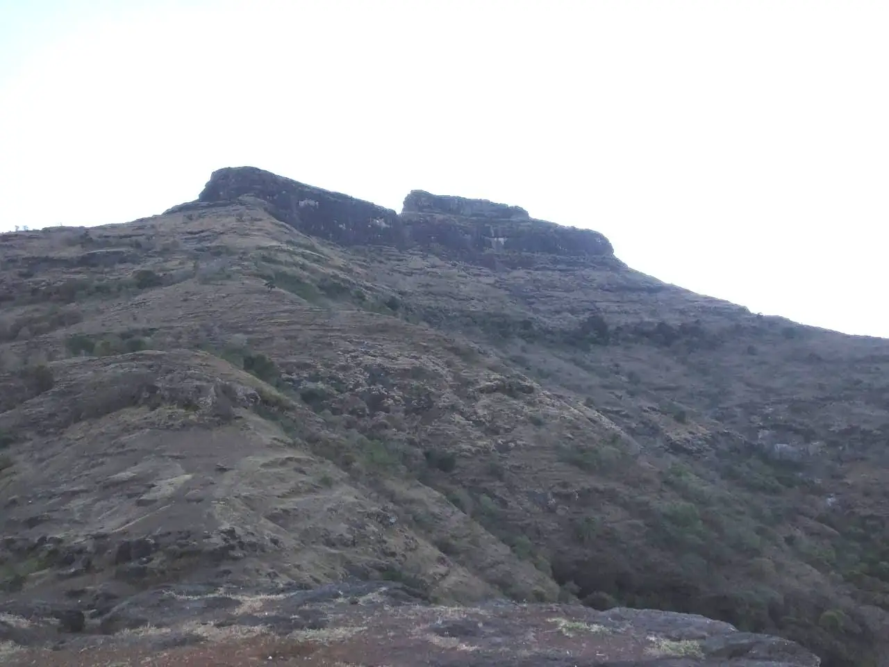 1,128 mhighest point
- Max altitude
- 1,128 m
- Days
- 1 day
- Distance
- 6 km
- Difficulty
- Moderate
A short climb of about 520 m over two hills from Wadi Chaulher, then a scree-covered slope, a railed exposed section and rock-cut steps through a tunnel-like gate complex; Treks and Trails India grades it easy, while Trekshitiz and Durgbharari grade it medium.
The route
Day by day
Day 1 · highest point
Wadi Chaulher → Wadi Chaulher (via the gates, machi and citadel of Chaulher Fort)
606 m → 1,128 m → 606 m
Ups and downs
Altitude profile
Where it is
Map
Trailhead and high point only — not a recorded track. Use it with a proper map.
Weather
Next 5 days on the trail
Live forecast for the trailhead and the high point. Mountain weather changes fast — check again on the morning you start.
Trailhead · Wadi Chaulher
at 606 mLoading forecast…
High point · Chaulher Fort citadel (balekilla, flagpole)
at 1,128 mLoading forecast…
Each day: high / low °C · rain mm and chance · snow cm · wind km/h
Weather data: Open-Meteo.comModel forecast, not an official warning. For alerts follow IMD and the local administration.
Plan the trip
How to reach
- Trailhead
- Wadi Chaulher (nearest town: Satana)
- Nearest railway
- Nashik Road
- Nearest airport
- Nashik (Ozar) Airport; Mumbai or Pune for most travellers
- By road
- Mumbai (about 270 km, 6-8 hours by road); Pune (about 310 km, 6-8 hours by road); Nashik (about 95 km to Satana, then about 15 km to Tilwan and 20-30 minutes on to Wadi Chaulher); Public transport: train to Nashik, bus to Satana, ST bus from Satana to Tilwan, then local transport to Wadi Chaulher
- Drive
- About 7 h from Mumbai
Plan the trip
Permits and fees
We could not confirm the current permit rules and fees from an official source. Check with the local forest department or tourism office before you go.
Plan the trip
Cost
Self-guided
₹500–1,500
With an operator
₹1,300–2,500
Per person, ex-Nashik (self-guided) and ex-Mumbai (guided). Only one operator price could be found: Treks and Trails India lists ₹1,300 for its Chaulher Fort trek (page undated, inclusions not stated, departures 'available on request'); the guided range is an estimate around that figure. Self-guided is an estimate: state bus Nashik-Satana and Satana-Tilwan each way, local transport to Wadi Chaulher, plus your own food and water, or more with a hired car from Nashik shared by a group.
Gear
Top picks for this trek
The gear that matters most on this route, chosen from its altitude, season and risks.
 Ad · affiliate link
 Ad · affiliate link
 Ad · affiliate link
 Ad · affiliate link
- Ad · affiliate link
 Ad · affiliate link
 Ad · affiliate link
 Ad · affiliate link
Store buttons open a search on that store, not a product we picked. As an Amazon Associate we earn from qualifying purchases. Photos show the kind of item, not a specific product. Affiliate disclosure
Packing checklist
Matched to this trek: altitude, season, days and the risks on the route.
Packed 0 of 21
Monsoon months (Sep): pack everything in plastic or a dry bag and wear shoes with good grip.
Tick each item as it goes in the bag.
Know before you go
Good to know
- Mobile network
- Not reported by our sources; expect coverage in Satana and patchy signal in Wadi Chaulher and on the fort.
- Last ATM
- Satana (about 15-20 km from Wadi Chaulher)
- Nearest hospital
- Satana town; Nashik (about 95 km) for serious cases
- Water
- Carry water from Wadi Chaulher. On the fort, the Moti Take (Moti cistern) below the citadel has drinkable water; the other cisterns, including those on the citadel, are mossy and not fit to drink.
Highlights
- A dim, tunnel-like gate complex of three to four doorways cut and built into the rock, each turning at a right angle, one of the finest fort entrances in the Baglan region
- The small temple of Shri Chaurangi Nath with a murti of Bhagwan Hanuman, where a jatra is held every year on Pithori Amavasya
- Rock-cut cisterns with names such as Moti Take, Shewale Take and Khekda Take, and a large rock-cut granary on the citadel
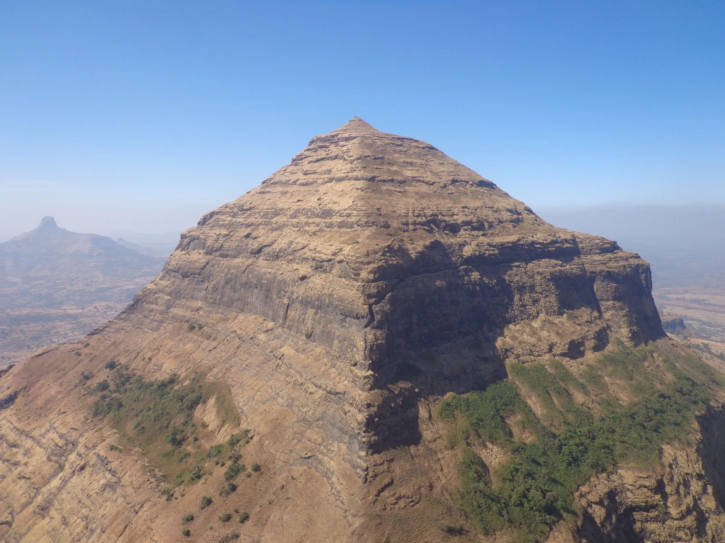
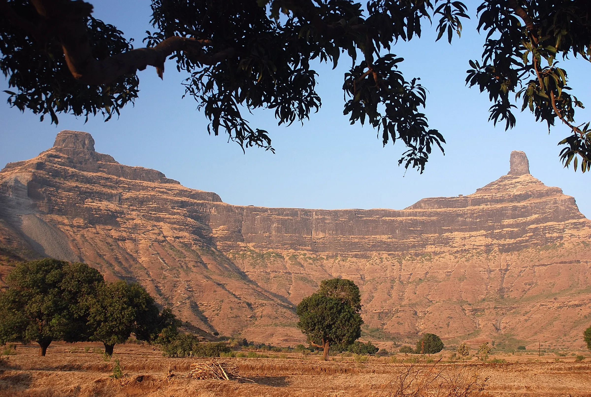
- A quiet fort with few visitors, the shape of which closely resembles Salher, the highest fort in Maharashtra
- From the flagpole on the citadel: the Selbari-Dolbari range with Salher, Salota, Mulher, Mora and Hargad, and the Satmala range with Dhodap, Rajdher and Indrai
Risks
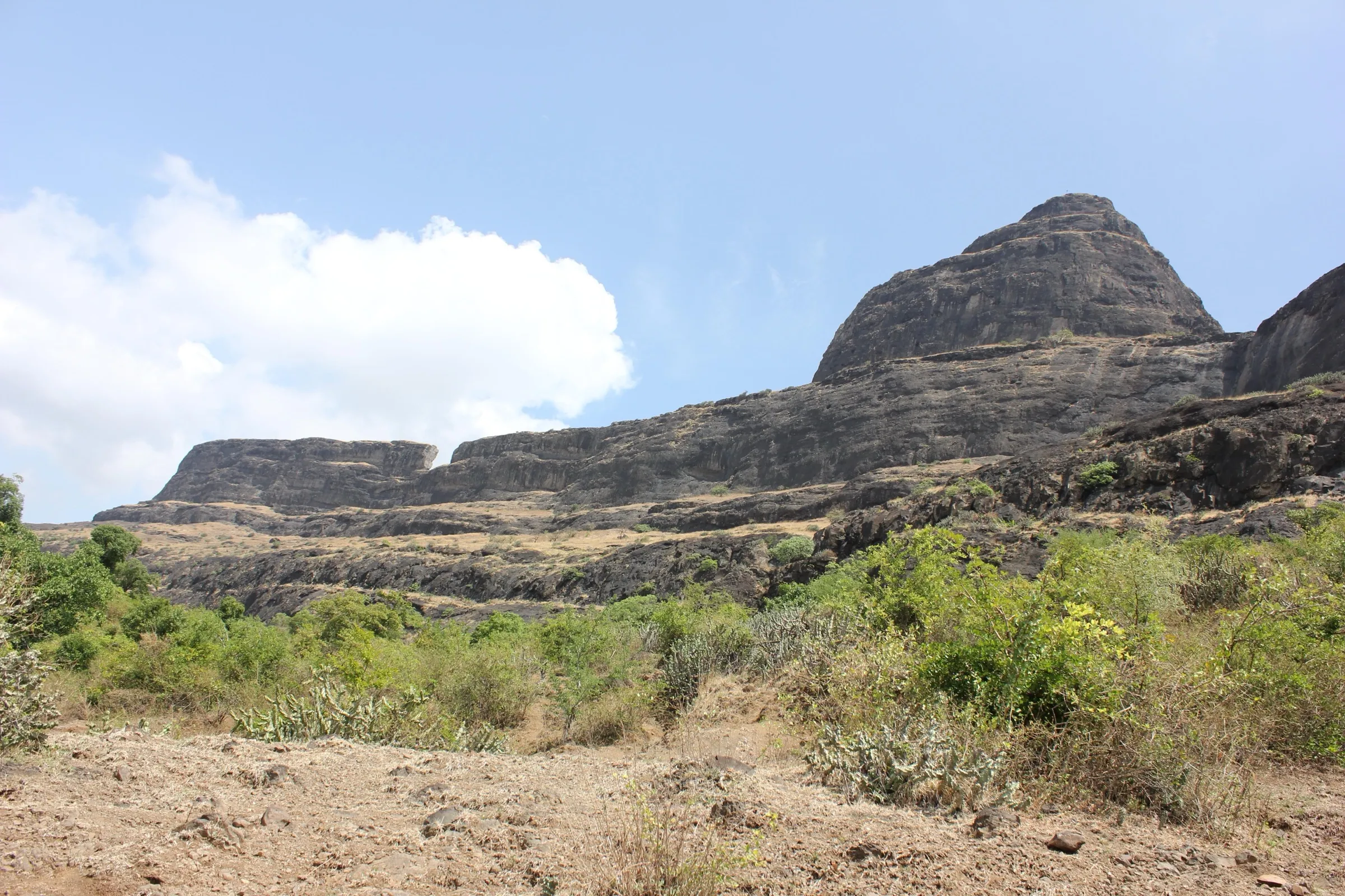
- Loose scree on the slope below the fort and rock-cut steps up to the first gate; a stretch beside the valley is protected only by a railing installed by the Forest Department. Take it slowly, especially when wet.
- Parts of the fort are in ruins: the secret door below the citadel has collapsed and filled with soil, and the path beyond the big cistern under the summit rock has crumbled. Do not climb these sections; return to the Chaurangi Nath temple and use the main path.
- Monsoon (June-September): rock and steps turn slippery. We found no formal closure order for Chaulher, but in recent monsoons the Nashik Forest Department has advised tourists to avoid forts, hilltops and waterfalls during heavy-rain alerts and has restricted entry to other forts such as Harihar. Check with the Satana forest range office before a monsoon visit.
- No food or shelter on the fort; carry lunch and enough water for the climb.
- Overgrown ruins and cactus on the citadel; wear full trousers and watch your step.
Know before you go
Questions
How long does the Chaulher Fort trek take?
About 1.5 hours (up to 2 hours) from Wadi Chaulher to the fort, and about two hours to explore the whole fort. Treks and Trails India puts the trail at about 3 km one way.
How high is Chaulher Fort?
Most sources give about 3,700 ft (1,128 m). The base village, Wadi Chaulher, is at about 1,989 ft (606 m), so the climb is roughly 520 m.
Is drinking water available on Chaulher Fort?
Yes, but only at the Moti Take, a rock-cut cistern whose water is drinkable. The other cisterns are mossy. Carry your own water and a packed lunch, as there is no food on the fort.
Can you stay overnight on Chaulher Fort?
There is no place to stay on the fort. Stay in Satana town or in Nashik.
How do I reach Wadi Chaulher by public transport?
Take a train to Nashik and a bus to Satana (about 95 km). From Satana an ST bus goes to Tilwan (about 15 km), and Wadi Chaulher is 20-30 minutes from Tilwan.
What is the best time to visit Chaulher Fort?
Treks and Trails India recommends September to February, after the monsoon. The monsoon makes the scree and rock-cut steps slippery.
In an emergency
Save these numbers before you lose signal. Tap to call.
- 112All emergenciesIndia’s single emergency number — works in every state
- 108Ambulance
- 1077District disaster control room
You are in
District: NashikMaharashtra
- Nearest hospital
- Satana town; Nashik (about 95 km) for serious cases
- Last ATM
- Satana (about 15-20 km from Wadi Chaulher)
- Phone network
- Not reported by our sources; expect coverage in Satana and patchy signal in Wadi Chaulher and on the fort.
Before you set off
- Tell someone your route and when you will be back.
- Carry a charged phone and a power bank.
- Download an offline map of the route.
- Turn back if the weather turns bad — the mountain will wait.
Questions about Chaulher Fort
No questions yet. Ask something and trekkers who have done it can answer.
Share your trek photo with #TreksAndTrails
I trekked this
Did Chaulher Fort look different from this page? Tell us what changed and we will check it.
Where this comes from
Sources
Last reviewed:
- Chaulher Fort Trek | Treks and Trails India — Treks and Trails India
- CHAULHER | Durgbharari — Durgbharari
- चौल्हेर किल्ला (Marathi Wikipedia, text from Trekshitiz) — Wikipedia
- Chauler Fort — Wikipedia
Photos: Ccmarathe, CC BY 4.0