Nag Thatch Trek
Tehri Garhwal, Uttarakhand
Opens without signal on this phone, with the map file and checklist. Saved for offline →
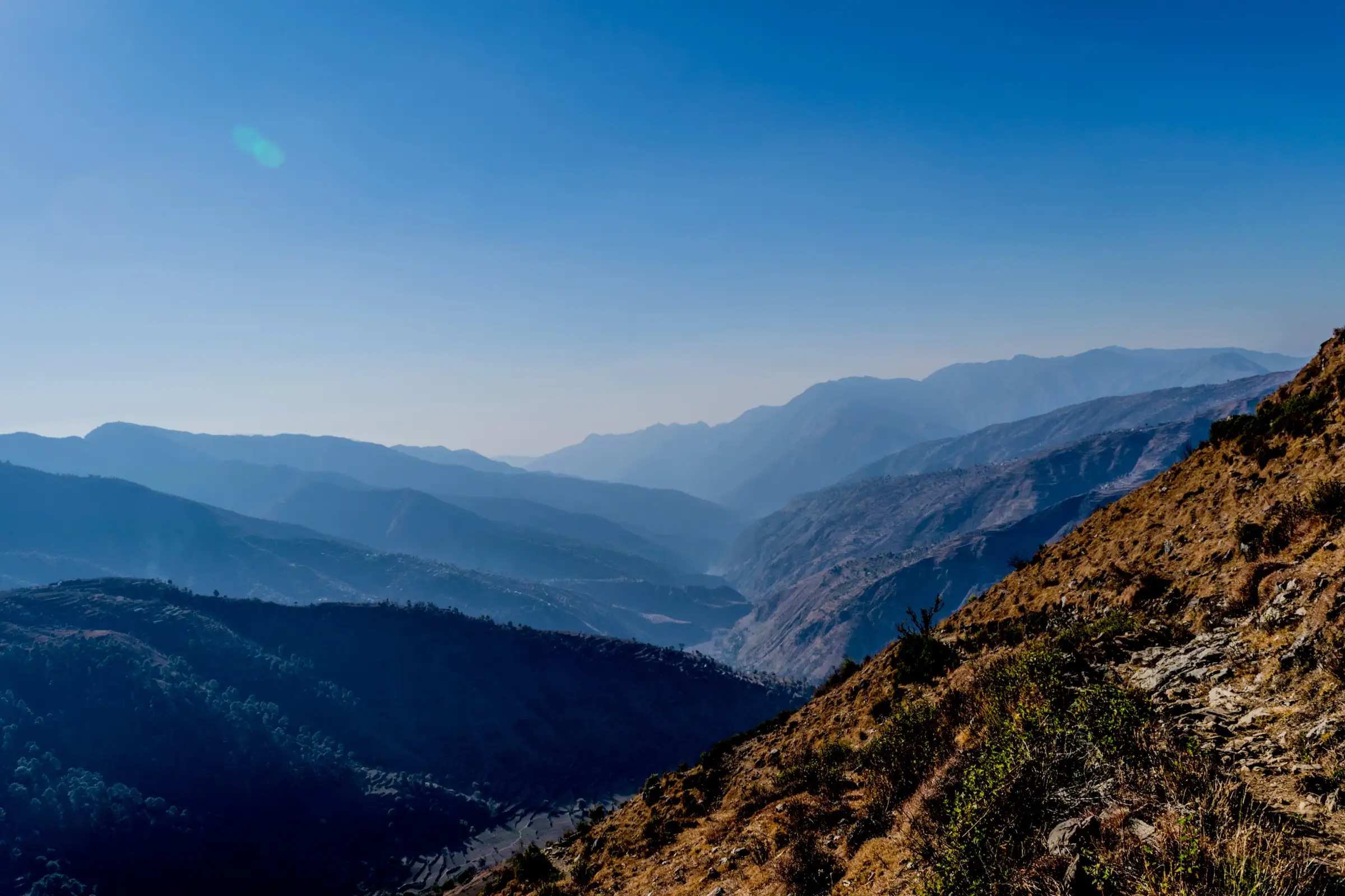 2,076 mhighest point
- Max altitude
- 2,076 m
- Days
- 2 days
- Distance
- 5 km
- Difficulty
- Easy
A short half-day walk of about 5 km return with roughly 450 m of gain on a gradual trail, with one steep half-kilometre just below the meadow and no technical sections. The optional extension to Sur Thatch makes it a 12 km, moderate day.
The route
Day by day
Day 1
Dehradun → Saindul village (via Mussoorie and Nainbagh)
640 m → 1,628 m
Day 2 · highest point
Saindul village → Saindul village (via Nag Thatch meadow; drive back to Dehradun)
1,628 m → 2,076 m → 1,628 m
Ups and downs
Altitude profile
Where it is
Map
Trailhead and high point only — not a recorded track. Use it with a proper map.
Weather
Next 5 days on the trail
Live forecast for the trailhead and the high point. Mountain weather changes fast — check again on the morning you start.
Trailhead · Saindul (Sendul)
at 1,628 mLoading forecast…
High point · Nag Thatch meadow (Nag Devta mandir)
at 2,076 mLoading forecast…
Each day: high / low °C · rain mm and chance · snow cm · wind km/h
Weather data: Open-Meteo.comModel forecast, not an official warning. For alerts follow IMD and the local administration.
Plan the trip
How to reach
- Trailhead
- Saindul (Sendul) (nearest town: Nainbagh)
- Nearest railway
- Dehradun
- Nearest airport
- Jolly Grant Airport, Dehradun
- By road
- Dehradun (about 100 km, roughly 4 hours by car via Mussoorie and the Yamuna valley to Nainbagh, then on to Saindul, west of Pantwari); By public transport: bus from Dehradun to Nainbagh (about ₹100), then a shared taxi to Saindul (about ₹50); about 6 hours in all
- Drive
- About 4 h from Dehradun
Plan the trip
Permits and fees
We could not confirm the current permit rules and fees from an official source. Check with the local forest department or tourism office before you go.
Plan the trip
Cost
Self-guided
₹1,500–4,000
With an operator
₹3,000–7,000
Per person, ex-Dehradun. No trek operator publishes a guided price for Nag Thatch, so both ranges are estimates. Self-guided: Indiahikes quotes about ₹100 for the bus to Nainbagh and ₹50 for the shared taxi to Saindul (each way), plus a night at the village homestay with meals. The guided range assumes a private cab from Dehradun (Indiahikes says above ₹5,000 per vehicle) shared by a small group, a homestay night and a local guide from Saindul.
Gear
Top picks for this trek
The gear that matters most on this route, chosen from its altitude, season and risks.
 Ad · affiliate link
 Ad · affiliate link
 Ad · affiliate link
 Ad · affiliate link
 Ad · affiliate link
 Ad · affiliate link
 Ad · affiliate link
 Ad · affiliate link
Store buttons open a search on that store, not a product we picked. As an Amazon Associate we earn from qualifying purchases. Photos show the kind of item, not a specific product. Affiliate disclosure
Packing checklist
Matched to this trek: altitude, season, days and the risks on the route.
Packed 0 of 30
Snow on the trail in Jan–Mar: microspikes, gaiters and a warm layer are not optional.
Tick each item as it goes in the bag.
Know before you go
Good to know
- Mobile network
- Not confirmed by any source; expect patchy mobile signal in the village and on the ridge, and check with your homestay.
- Last ATM
- Not confirmed; carry cash from Dehradun or Mussoorie. Nainbagh is the last market town on the road.
- Nearest hospital
- Mussoorie (closest hospital named by Indiahikes); Dehradun for serious care.
- Water
- Only one water source on the trail, and it dries up in autumn and winter. Carry at least 2 litres per person from Saindul.
Highlights
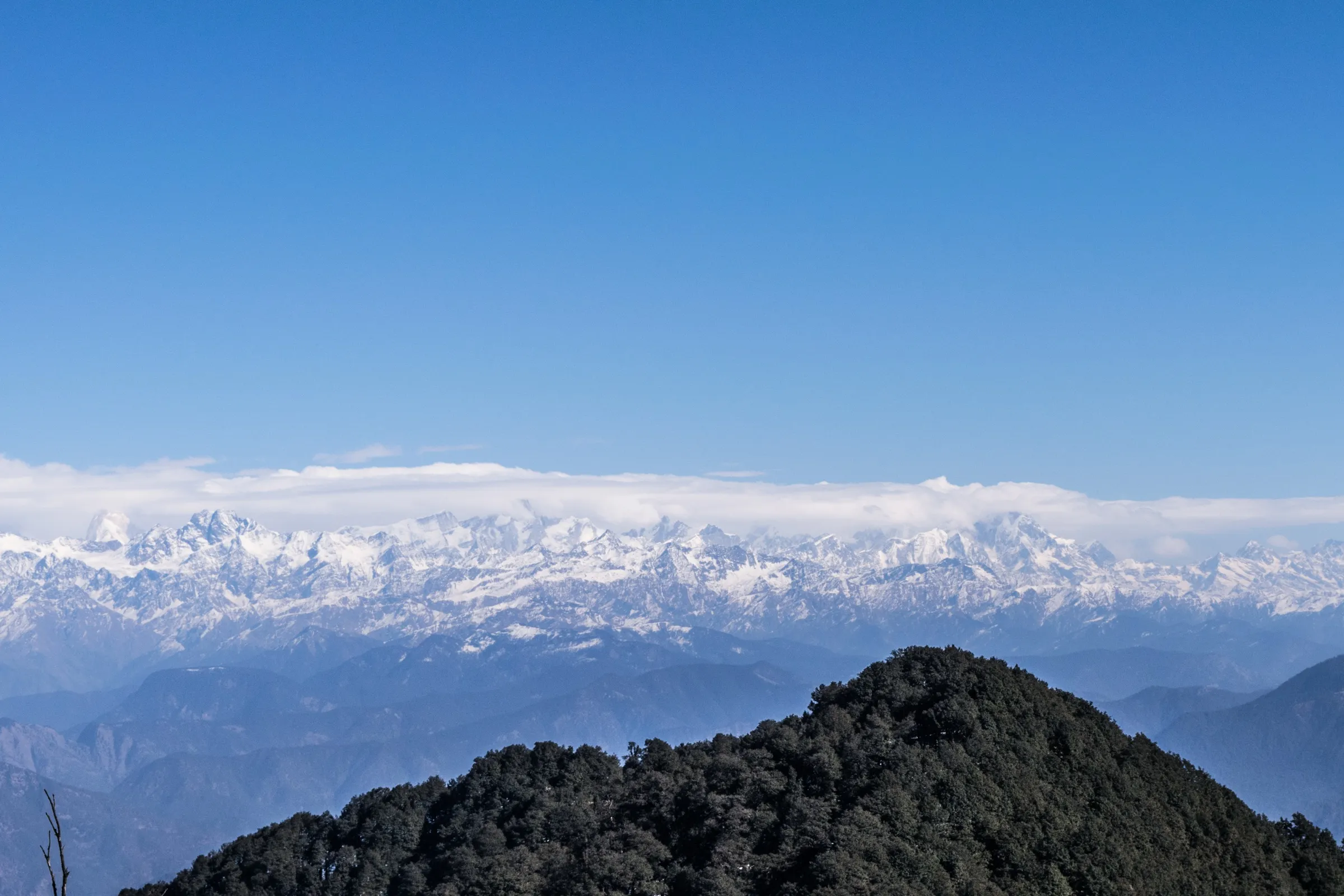
- A wide panorama of Garhwal peaks (Swargarohini, Bandarpoonch, Kalanag, Srikanth, Jaonli, Thalay Sagar, Kedarnath and Chaukhamba) for very little effort
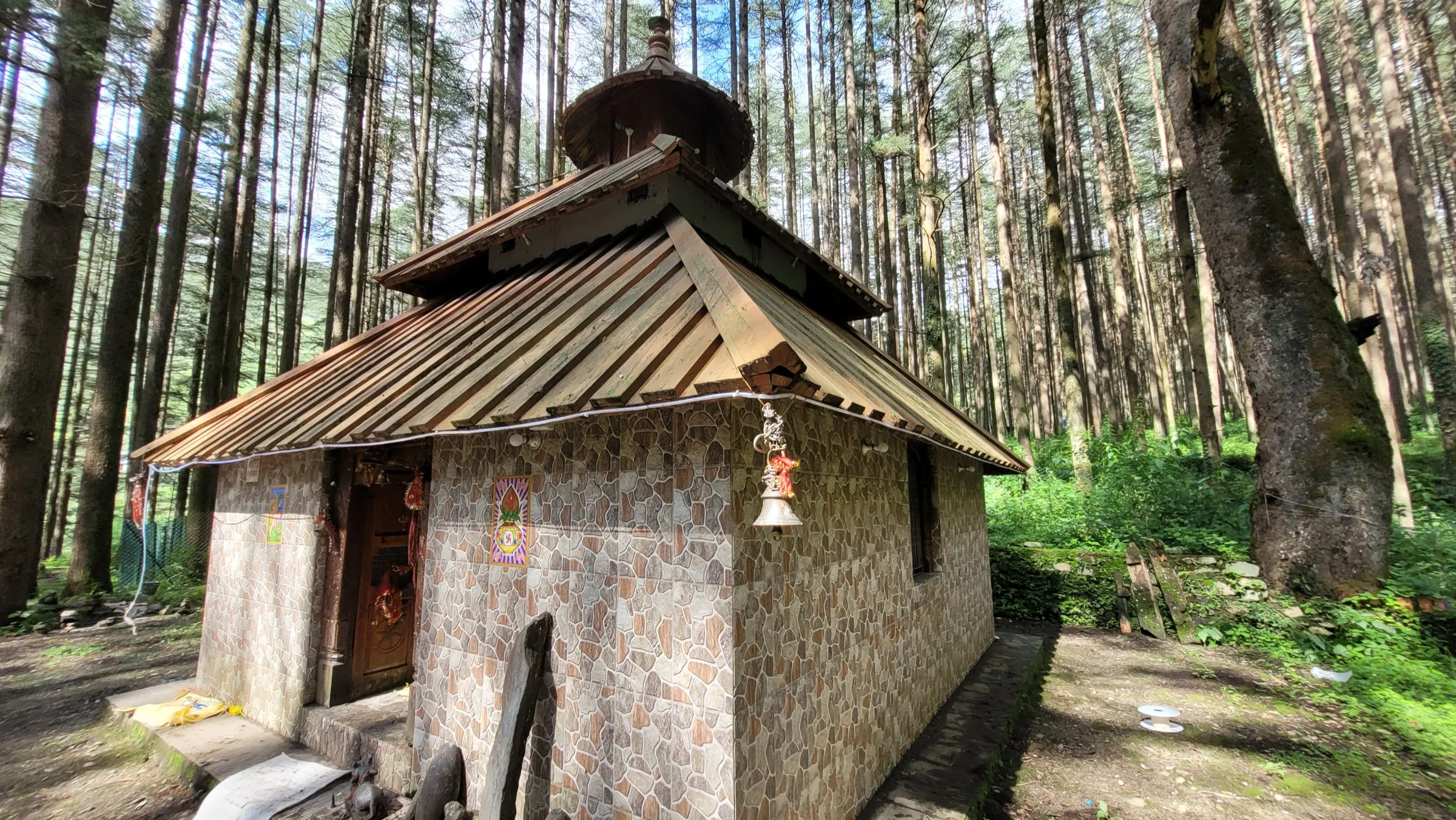
- The small Nag Devta mandir on the flat Nag Thatch meadow, with Nag Tibba straight ahead to the east
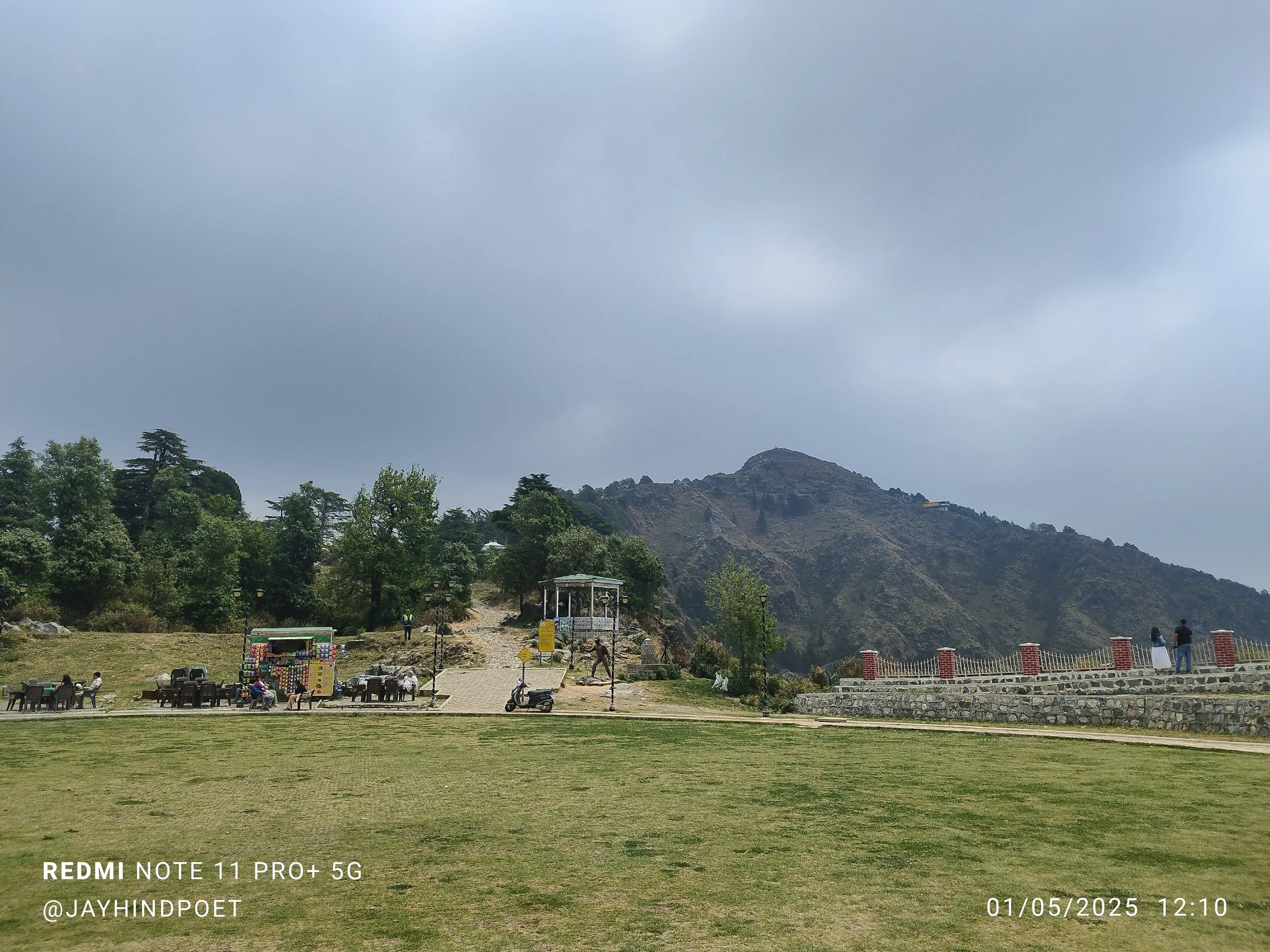
- Meadows that are green in spring and summer, golden brown after the monsoon and often snow-covered in winter
- An optional 3.5 km ridge walk on to Sur Thatch meadow and its Raghunath mandir (about 2,280 m), making a 12 km day
- A homestay night in Saindul, a small Jaunpur village, with local Garhwali food
Risks
- Monsoon (July to September): Indiahikes does not recommend the trek. The trail is open with no shelter from heavy rain and turns very slushy.
- Camping is not allowed on the meadows or anywhere on the trail; stay in Saindul and book the homestay a few days ahead.
- Water is scarce: only one source on the way, and it is dry from autumn through winter.
- Winter snow can make the steep half-kilometre below the meadow slippery, and clouds often hide the peaks in winter.
- Only one source documents this route; check the trail and conditions with the village before you go.
Know before you go
Questions
Can beginners do the Nag Thatch trek?
Yes. Indiahikes rates it easy and says it suits beginners, families with young children and walkers over 65. The walk to Nag Thatch is about 5 km return with roughly 450 m of climbing.
How long is the Nag Thatch trek?
About 5 km return from Saindul to Nag Thatch, which takes about 3 hours. If you continue along the ridge to Sur Thatch and back, the day becomes about 12 km and 7 hours.
Where is Nag Thatch and how do I reach it?
It is above Saindul village in the Jaunpur area of Tehri Garhwal, west of Pantwari and about 100 km (4 hours) from Dehradun. By public transport, take a bus from Dehradun to Nainbagh and a shared taxi from there to Saindul.
When is the best time for Nag Thatch?
October to June. Autumn gives the clearest mountain views, January to March can bring snow, and April to June is green with wildflowers. Indiahikes advises against the monsoon months.
Can I camp at Nag Thatch?
No. Indiahikes reports that the Forest Department does not allow camping on the meadows or the trail. Stay at the homestay in Saindul instead.
In an emergency
Save these numbers before you lose signal. Tap to call.
- 112All emergenciesIndia’s single emergency number — works in every state
- 108Ambulance
- 1077District disaster control room
You are in
District: Tehri GarhwalUttarakhand
- Nearest hospital
- Mussoorie (closest hospital named by Indiahikes); Dehradun for serious care.
- Last ATM
- Not confirmed; carry cash from Dehradun or Mussoorie. Nainbagh is the last market town on the road.
- Phone network
- Not confirmed by any source; expect patchy mobile signal in the village and on the ridge, and check with your homestay.
Before you set off
- Tell someone your route and when you will be back.
- Carry a charged phone and a power bank.
- Download an offline map of the route.
- Turn back if the weather turns bad — the mountain will wait.
Questions about Nag Thatch
No questions yet. Ask something and trekkers who have done it can answer.
Share your trek photo with #TreksAndTrails
I trekked this
Did Nag Thatch look different from this page? Tell us what changed and we will check it.
Where this comes from
Sources
Last reviewed:
- Nag Thatch Trek – The Complete Guide — Indiahikes
Photos: Ashish Gupta from Noida, India, CC BY 2.0