Mahuli Fort Trek
Thane, Maharashtra
Opens without signal on this phone, with the map file and checklist. Saved for offline →
- Max altitude
- 858 m
- Days
- 1 day
- Distance
- 8 km
- Difficulty
- Moderate
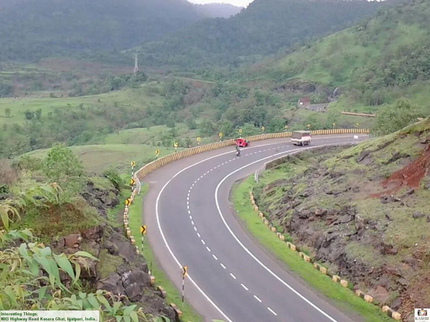
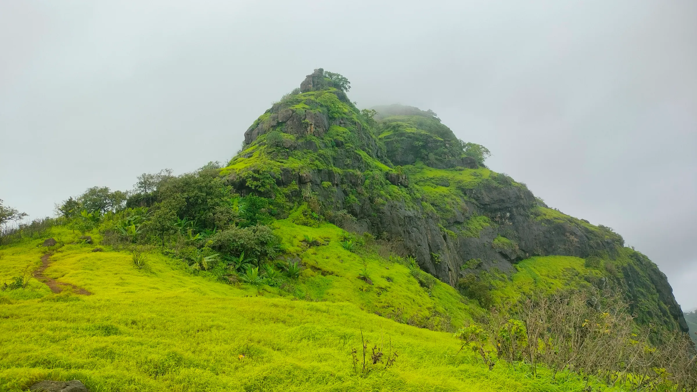
A climb of about 730 m from the base village on a well-marked forest trail: two gradual ascents of 30–40 minutes each, then a steep, slippery final section with an iron ladder below the fort. Operators grade it from easy to medium, and the continuous climb is tiring for unfit walkers.
Photos
On the trail
The route
Day by day
Day 1 · highest point
Mahuli Fort base, Mahuli village → Mahuli Fort base, Mahuli village (via Mahuli Fort)
123 m → 858 m → 123 m
Ups and downs
Altitude profile
Where it is
Map
Trailhead and high point only — not a recorded track. Use it with a proper map.
Weather
Next 5 days on the trail
Live forecast for the trailhead and the high point. Mountain weather changes fast — check again on the morning you start.
Trailhead · Mahuli Fort base, Mahuli village
at 123 mLoading forecast…
High point · Mahuli Fort top
at 858 mLoading forecast…
Each day: high / low °C · rain mm and chance · snow cm · wind km/h
Weather data: Open-Meteo.comModel forecast, not an official warning. For alerts follow IMD and the local administration.
Plan the trip
How to reach
- Trailhead
- Mahuli Fort base, Mahuli village (nearest town: Shahapur)
- Nearest railway
- Asangaon (Central Railway suburban line towards Kasara), about 2 hours by local train from Mumbai CSMT
- Nearest airport
- Chhatrapati Shivaji Maharaj International Airport, Mumbai
- By road
- Asangaon station (short auto ride, or bus via Shahapur, to Mahuli village); Shahapur (ST bus to Mahuli village); Mumbai (about 70 km by the Mumbai–Nashik highway; turn off near Manas Mandir); Pune (about 135 km)
- Drive
- About 1.75 h from Mumbai
Plan the trip
Permits and fees
We could not confirm the current permit rules and fees from an official source. Check with the local forest department or tourism office before you go.
Plan the trip
Cost
Self-guided
₹200–600
With an operator
₹650
Per person, ex-Asangaon. Guided: Treks and Trails India (treksandtrails.org) lists ₹650 including a veg breakfast, shared autos Asangaon–base–Asangaon and the trek leader (train fare and lunch extra); Bikat Adventures runs the trek but its page shows no price, so no second operator's current price was found. Self-guided estimate: a shared auto from Asangaon (Indiahikes quotes about ₹250 for three people each way) or the Shahapur bus, the forest entry fee (reported as ₹20, not confirmed from an official source), and a meal in the village, plus the local train fare from Mumbai.
Gear
Top picks for this trek
The gear that matters most on this route, chosen from its altitude, season and risks.
 Ad · affiliate link
 Ad · affiliate link
 Ad · affiliate link
 Ad · affiliate link
- Ad · affiliate link
 Ad · affiliate link
 Ad · affiliate link
 Ad · affiliate link
Store buttons open a search on that store, not a product we picked. As an Amazon Associate we earn from qualifying purchases. Photos show the kind of item, not a specific product. Affiliate disclosure
Packing checklist
Matched to this trek: altitude, season, days and the risks on the route.
Packed 0 of 22
Monsoon months (Jun–Sep): pack everything in plastic or a dry bag and wear shoes with good grip.
Tick each item as it goes in the bag.
Know before you go
Good to know
- Mobile network
- Not confirmed; expect signal near the village and highway, patchy in the forest
- Last ATM
- On the Mumbai–Nashik highway, about 10 km from the fort (Shahapur / Asangaon)
- Nearest hospital
- Sub District Hospital, Shahapur, about 9 km from the base
- Water
- None on the trail; carry 2–3 litres. Water is available in the base village, and a rock-cut cistern on top holds water all year (treat before drinking)
Highlights
- The highest point in Thane district, at about 2,815 ft (858 m)
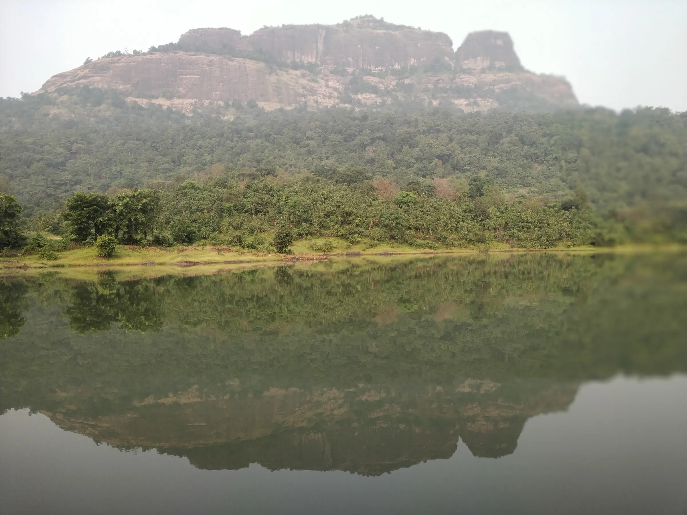
- Three forts on one massif: Palasgad to the north, Mahuli in the centre and Bhandargad to the south
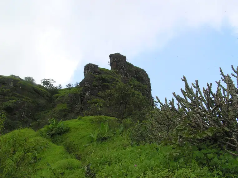
- The Navra, Navri and Karavli (Vazir) pinnacles between Mahuli and Bhandargad, famous with rock climbers
- An open Shivling and a small Shiv mandir under a large tree on top, a rock-cut water cistern, caves and the broken Kalyan Darwaja arch
- Forest trail through Tansa Wildlife Sanctuary, with wildflowers in the monsoon and views over Tansa lake
- Fort history from the Nizam Shahi era to Chhatrapati Shivaji Maharaj, who took Mahuli in 1658 and again in 1670
Risks
- Monsoon ban: on 6 July 2026 the Thane Collector closed all tourist spots in the district, including forts, 'until further notice'. Confirm the current status before going between June and September
- The final climb is steep, with an iron ladder and slippery, loose-pebble patches, especially on the descent in the monsoon
- A stream crossing near the start can run strong in heavy rain (a bridge was built in 2019)
- Do not go near the waterfall by Mahuli Fort in the monsoon: Treks and Trails India reports several fatal accidents there
- Leopards live in the surrounding sanctuary; sightings have led to trekking restrictions in the past. Do not trek after dark
- Going on to the pinnacles or Bhandargad needs a rock-climbing pitch of about 20 ft; this is for equipped climbers only
- No water on the trail and little shade near the top outside the monsoon; camping on the fort is not allowed, per Indiahikes
Know before you go
Questions
How long does the Mahuli Fort trek take?
About 2 hours up and 45 minutes down from the base, per Indiahikes. Group itineraries allow a full day, starting around 8:30 am and back at the base by 5 pm.
How do I reach Mahuli Fort from Mumbai?
Take a Kasara-bound local train to Asangaon (about 2 hours from CSMT), then an auto to Mahuli village, or a bus to Shahapur and another bus to Mahuli. By road it is about 70 km from Mumbai on the Mumbai–Nashik highway.
Is Mahuli Fort good for beginners?
Yes, if you are reasonably fit. The trail is well marked, but Indiahikes grades it easy-moderate and the last section is steep and slippery, so beginners should start early and wear shoes with good grip.
Do I need a permit or entry fee for Mahuli?
No trekking permit is needed. Indiahikes reports an entry fee of about ₹20 per person at the forest counter after the temple at the base; we could not confirm the current amount from an official source.
Can I trek Mahuli in the monsoon?
Mahuli is a popular monsoon trek, but in July 2026 the Thane Collector banned entry to all forts and tourist spots in the district during heavy rain. Check whether an order is in force before you go, and avoid the waterfall near the fort.
Can I camp on Mahuli Fort?
Indiahikes says camping on the trek is not allowed, so overnight groups pitch tents near Bhakt Niwas at the base. Climbers going to the pinnacles sometimes use the caves on top.
In an emergency
Save these numbers before you lose signal. Tap to call.
- 112All emergenciesIndia’s single emergency number — works in every state
- 108Ambulance
- 1077District disaster control room
You are in
District: ThaneMaharashtra
- Nearest hospital
- Sub District Hospital, Shahapur, about 9 km from the base
- Last ATM
- On the Mumbai–Nashik highway, about 10 km from the fort (Shahapur / Asangaon)
- Phone network
- Not confirmed; expect signal near the village and highway, patchy in the forest
Before you set off
- Tell someone your route and when you will be back.
- Carry a charged phone and a power bank.
- Download an offline map of the route.
- Turn back if the weather turns bad — the mountain will wait.
Questions about Mahuli Fort
No questions yet. Ask something and trekkers who have done it can answer.
Share your trek photo with #TreksAndTrails
I trekked this
Did Mahuli Fort look different from this page? Tell us what changed and we will check it.
Where this comes from
Sources
Last reviewed:
- Mahuli Trek - A paradise for rock climbers (documented trek) — Indiahikes
- Mahuli Fort Trek — Treks and Trails India (treksandtrails.org)
- Mahuli Fort Trek my Favourite (blog) — Treks and Trails India (treksandtrails.org)
- Mahuli Fort Trek — Bikat Adventures
- Mahuli — Wikipedia
- MAHULI | Durgbharari — Durgbharari
- Trekking in the Sahyadri (2013) — ixigo
- Thane bans entry to tourist spots, forts, and water bodies amid heavy rain forecasts (7 Jul 2026) — Deccan Herald (PTI)
Photos: Elroy Serrao, via Wikimedia Commons, CC BY-SA 2.0; Dinesh Valke from Thane, India, via Wikimedia Commons, CC BY-SA 2.0; Seemakori, via Wikimedia Commons, CC BY-SA 4.0