Kelshi to Ladghar Beach Trek
Ratnagiri, Maharashtra
Opens without signal on this phone, with the map file and checklist. Saved for offline →
- Max altitude
- 100 m
- Days
- 2 days
- Distance
- 26 km
- Difficulty
- Easy
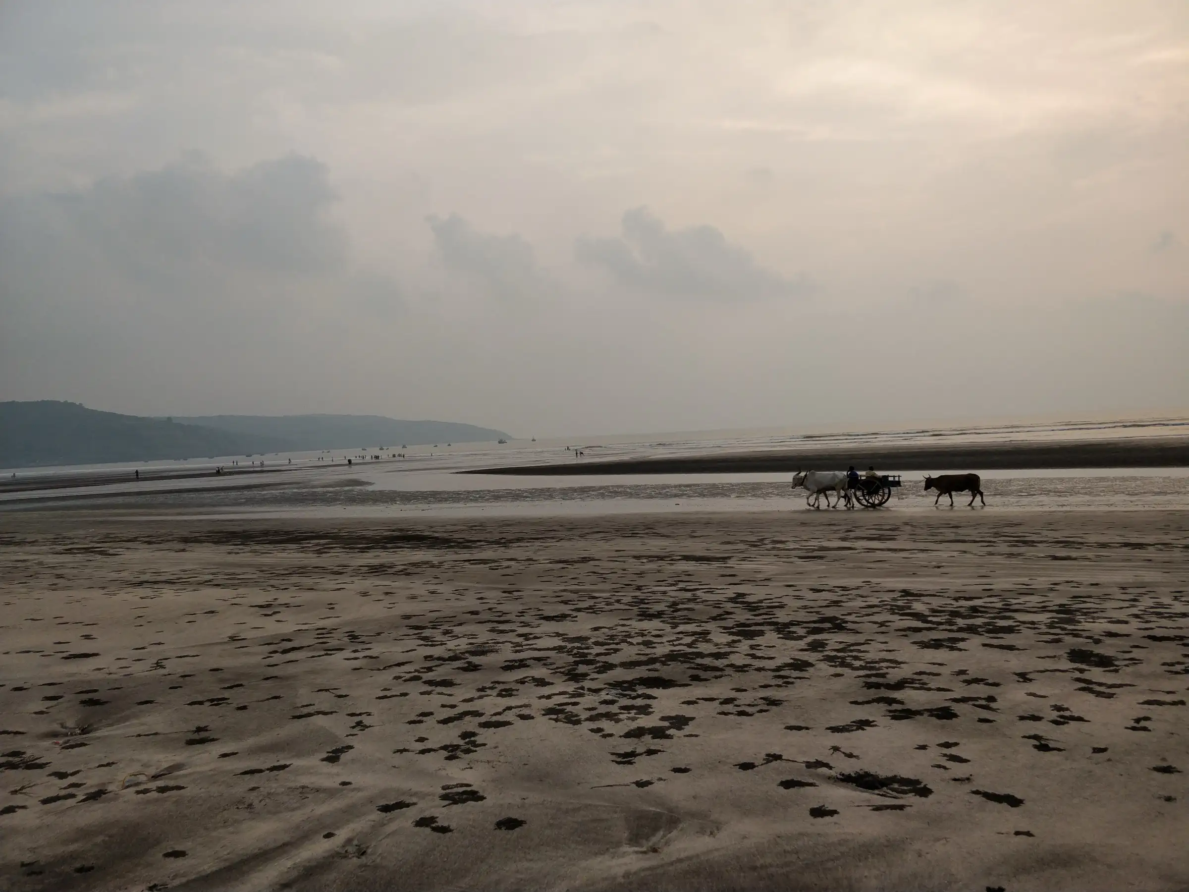
Almost all walking is on flat sand and village lanes at sea level, with one short climb over the headland north of Aade; the hard parts are the length of day one on soft sand, the heat, and planning the creek mouths around the tide.
Photos
On the trail
The route
Day by day
Day 1 · highest point
Kelshi Beach → Murud Beach (Dapoli)
5 m → 100 m → 5 m
Day 2
Murud Beach (Dapoli) → Ladghar Beach
5 m → 5 m
Ups and downs
Altitude profile
Where it is
Map
Trailhead and high point only — not a recorded track. Use it with a proper map.
Weather
Next 5 days on the trail
Live forecast for the trailhead and the high point. Mountain weather changes fast — check again on the morning you start.
Trailhead · Kelshi Beach
at 5 mLoading forecast…
High point · Headland between Kelshi and Aade (Utambar side)
at 100 mLoading forecast…
Each day: high / low °C · rain mm and chance · snow cm · wind km/h
Weather data: Open-Meteo.comModel forecast, not an official warning. For alerts follow IMD and the local administration.
Plan the trip
How to reach
- Trailhead
- Kelshi Beach (nearest town: Dapoli)
- Nearest railway
- Khed (Konkan Railway); sources quote about 29 to 60 km by road to Kelshi depending on the route
- Nearest airport
- Mumbai (Chhatrapati Shivaji Maharaj International Airport)
- By road
- Mumbai (about 220 km) via the Mumbai–Goa highway (NH66) and Mandangad to Kelshi; Pune (about 190 km) to Kelshi; Ladghar to Dapoli town by auto-rickshaw or local bus for the return
- Drive
- About 6 h from Mumbai
Plan the trip
Permits and fees
We could not confirm the current permit rules and fees from an official source. Check with the local forest department or tourism office before you go.
Plan the trip
Cost
Self-guided
₹2,500–4,500
With an operator
₹3,500
Ex-Mumbai. Guided: Treks and Trails India (treksandtrails.org, not related to this site) lists ₹3,500 with a non-AC bus from Dadar, meals and one night in a resort or homestay on sharing; no second operator with a current price was found. Self-guided estimate: state-transport bus Mumbai–Dapoli/Kelshi and back, one night in a Murud or Harnai homestay, meals, and a local boat or auto-rickshaw where a creek or the return needs it.
Gear
Top picks for this trek
The gear that matters most on this route, chosen from its altitude, season and risks.
 Ad · affiliate link
 Ad · affiliate link
 Ad · affiliate link
 Ad · affiliate link
 Ad · affiliate link
 Ad · affiliate link
 Ad · affiliate link
 Ad · affiliate link
Store buttons open a search on that store, not a product we picked. As an Amazon Associate we earn from qualifying purchases. Photos show the kind of item, not a specific product. Affiliate disclosure
Packing checklist
Matched to this trek: altitude, season, days and the risks on the route.
Packed 0 of 21
Tick each item as it goes in the bag.
Know before you go
Good to know
- Mobile network
- Mobile signal in the villages along the coast (Kelshi, Anjarle, Harnai, Murud, Ladghar); can drop on the headlands between them.
- Last ATM
- Dapoli town; the small beach villages may have none, so carry cash for homestays, food and boats.
- Nearest hospital
- Government sub-district hospital at Dapoli; serious cases go to Ratnagiri.
- Water
- No natural drinking water on the sand; refill at village shops, eateries and homestays at Anjarle, Harnai and Murud. Carry 2–3 litres for the long first day.
Highlights
- A two-day walk down the Dapoli coast, linking Kelshi, Utambar, Aade, Padale, Savane, Anjarle, Paj Pandhari, Harnai, Palande, Murud, Karde and Ladghar beaches.
- Harnai port's evening fish auction and views of the sea fort Suvarnadurg and the land fort Kanakdurg; local boats run out to Suvarnadurg.
- Kelshi's Shri Mahalakshmi Mandir from the Peshwa period and the Kadyavarcha Ganpati mandir on the cliff above Anjarle.
- Olive ridley turtle nesting and hatching season at Anjarle and Kelshi from about February to May.
- Karde is known for water sports and dolphin-spotting boat rides; the walk ends at Ladghar, where local resorts line the shore.
Risks
- Tides and creeks: the coast is cut by tidal creeks and river mouths, such as the Utambar river mouth near Kelshi and the Jog river creek at Anjarle. At high tide a creek mouth cannot be waded, and the outgoing tide pulls hard. Check the day's tide table, cross at low tide only, use the road bridge (Anjarle has one) or a local boat, and never swim across a creek mouth.
- Rocky points between beaches can only be walked round at low tide; on a rising tide you can be cut off against the cliffs. If in doubt, take the road over the headland.
- The sea is rough and unsafe for swimming from June to September; districts usually stop sea bathing on Konkan beaches in the monsoon. Swim only where locals do, in calm water, and never alone.
- Day one is long (about 20 km, much of it on soft sand) with little shade; start early, carry water and sun protection, and expect blisters.
- Turtle nests are fenced at Anjarle and Kelshi in season; keep away from them and from the hatchery, and use no torches on the beach at night.
- Distances, the high point and the exact route over the headlands are our estimates from the operator's day plan and map terrain; no published GPS track was found.
Know before you go
Questions
How long is the Kelshi to Ladghar beach trek?
Operators run it over two days from Mumbai: day one from Kelshi past Utambar, Aade, Padale, Savane, Anjarle, Paj Pandhari, Harnai and Palande to Murud, and day two from Murud past Karde to Ladghar, which takes about three hours. By the map it is roughly 25 km in all; no operator publishes a distance.
Do I need to worry about the tide on this walk?
Yes. Several creeks and river mouths reach the sea between Kelshi and Ladghar, and some rocky points can only be passed at low tide. Plan each crossing with a tide table, use road bridges or a local boat at high tide, and never wade or swim a creek mouth when the tide is coming in.
What is the best time for the Kelshi–Ladghar trek?
November to February, when the Konkan coast is cool and dry. From February to May the olive ridley turtle season runs at Anjarle and Kelshi. Avoid June to September: the sea is rough and beach access is often restricted in the monsoon.
How do I reach Kelshi from Mumbai?
Kelshi is about 220 km from Mumbai and 190 km from Pune by road, via the Mumbai–Goa highway. Group trips take an overnight bus from Dadar and reach Kelshi around 5 am. The nearest railway station is Khed on the Konkan Railway, and you can return from Ladghar via Dapoli.
Where do trekkers stay overnight?
In a resort or homestay at Murud or Harnai at the end of day one. The Dapoli coast has many beach homestays, so walking it on your own is easy to arrange.
In an emergency
Save these numbers before you lose signal. Tap to call.
- 112All emergenciesIndia’s single emergency number — works in every state
- 108Ambulance
- 1077District disaster control room
You are in
District: RatnagiriMaharashtra
- Nearest hospital
- Government sub-district hospital at Dapoli; serious cases go to Ratnagiri.
- Last ATM
- Dapoli town; the small beach villages may have none, so carry cash for homestays, food and boats.
- Phone network
- Mobile signal in the villages along the coast (Kelshi, Anjarle, Harnai, Murud, Ladghar); can drop on the headlands between them.
Before you set off
- Tell someone your route and when you will be back.
- Carry a charged phone and a power bank.
- Download an offline map of the route.
- Turn back if the weather turns bad — the mountain will wait.
Questions about Kelshi to Ladghar Beach
No questions yet. Ask something and trekkers who have done it can answer.
Share your trek photo with #TreksAndTrails
I trekked this
Did Kelshi to Ladghar Beach look different from this page? Tell us what changed and we will check it.
Where this comes from
Sources
Last reviewed:
- Beach-Trek-Kelshi-Ladghar-Dapoli | Treks and Trails India — Treks and Trails India
- Kelashi Beach and Village – A Hidden Gem of Konkan — Department of Tourism, Government of Maharashtra (official)
- Discover Kelshi: Pristine Beaches And Cultural Heritage In Maharashtra — Outlook Traveller
- Anjarle — Wikipedia
Photos: Vardhanjp, CC BY-SA 3.0; Altafalvi, CC BY-SA 3.0; Vardhanjp, CC BY-SA 3.0; Amit Patekar, CC BY-SA 3.0