Kedarnath Trek
Rudraprayag, Uttarakhand
Opens without signal on this phone, with the map file and checklist. Saved for offline →
- Max altitude
- 3,583 m
- Days
- 4 days
- Distance
- 32 km
- Difficulty
- Moderate
A paved but long 16 km climb of about 1,600 m from Gaurikund (1,982 m) to the temple at 3,583 m, 6-10 hours up and 4-6 hours down, at an altitude where breathlessness is common, often in heavy crowds and pony traffic; ponies, pithus, dandis, palkis and helicopters are available for those who cannot walk.
Photos
On the trail
The route
Day by day
Day 1
Haridwar → Guptkashi
314 m → 1,319 m
Day 2 · highest point
Gaurikund → Kedarnath
1,982 m → 3,583 m
Day 3
Kedarnath → Guptkashi (walk down to Gaurikund, then drive)
3,583 m → 1,319 m
Day 4
Guptkashi → Haridwar
1,319 m → 314 m
Ups and downs
Altitude profile
Where it is
Map
Trailhead and high point only — not a recorded track. Use it with a proper map.
Weather
Next 5 days on the trail
Live forecast for the trailhead and the high point. Mountain weather changes fast — check again on the morning you start.
Trailhead · Gaurikund
at 1,982 mLoading forecast…
High point · Shri Kedarnath Dham (temple of Bhagwan Kedarnath)
at 3,583 mLoading forecast…
Each day: high / low °C · rain mm and chance · snow cm · wind km/h
Weather data: Open-Meteo.comModel forecast, not an official warning. For alerts follow IMD and the local administration.
Plan the trip
How to reach
- Trailhead
- Gaurikund (nearest town: Guptkashi)
- Nearest railway
- Rishikesh, Haridwar or Dehradun
- Nearest airport
- Jolly Grant Airport, Dehradun
- By road
- Haridwar (about 240 km); Rishikesh (about 220 km); Dehradun (about 250 km); Guptkashi to Sonprayag by road, then the government shared taxi from Sonprayag to Gaurikund
- Drive
- About 9 h from Haridwar
Plan the trip
Permits and fees
We could not confirm the current permit rules and fees from an official source. Check with the local forest department or tourism office before you go.
Plan the trip
Cost
Self-guided
₹4,000–9,000
With an operator
₹9,450–11,550
Per person. Guided prices are 4-day packages: Himalayan Hikers ₹9,000 + 5% GST (+ ₹160 insurance) ex-Haridwar/Rishikesh, breakfast and dinner, Guptkashi and Kedarnath stays; Trekkers of India ₹11,000 + 5% GST ex-Delhi, quad sharing. Indiantreks quotes ₹10,499 + 5% GST ex-Haridwar/Rishikesh on a longer itinerary with a night at Kedarnath. Ponies, pithus, palkis and helicopter tickets are extra in all of them; Himalayan Hikers gives government-regulated pony/palki costs of about ₹3,000-10,000. Self-guided is an estimate ex-Haridwar: bus or shared jeep to Guptkashi/Sonprayag and back, the Sonprayag-Gaurikund shared taxi, two to three nights in guesthouses (Kedarnath rooms cost more in May-June), and food.
Gear
Top picks for this trek
The gear that matters most on this route, chosen from its altitude, season and risks.
 Ad · affiliate link
 Ad · affiliate link
 Ad · affiliate link
 Ad · affiliate link
 Ad · affiliate link
 Ad · affiliate link
 Ad · affiliate link
- Ad · affiliate link
Store buttons open a search on that store, not a product we picked. As an Amazon Associate we earn from qualifying purchases. Photos show the kind of item, not a specific product. Affiliate disclosure
Packing checklist
Matched to this trek: altitude, season, days and the risks on the route.
Packed 0 of 32
Nights near 3,583 m can drop close to freezing even in summer. Pack one more warm layer than you think.
Tick each item as it goes in the bag.
Know before you go
Good to know
- Mobile network
- Jio and Airtel work best at the base and near the temple; the signal is unreliable along the trail.
- Last ATM
- There is no working ATM at Kedarnath; carry enough cash from the down-valley towns (Guptkashi and below), and check locally.
- Nearest hospital
- Medical relief points work on the route and at Kedarnath during the yatra, and staff at Sonprayag may check pilgrims' fitness. For serious cases, Rudraprayag district hospital, then Rishikesh or Dehradun.
- Water
- Water points, tea stalls and dhabas along the paved path during the yatra season; carry a bottle and treat stream water.
Highlights
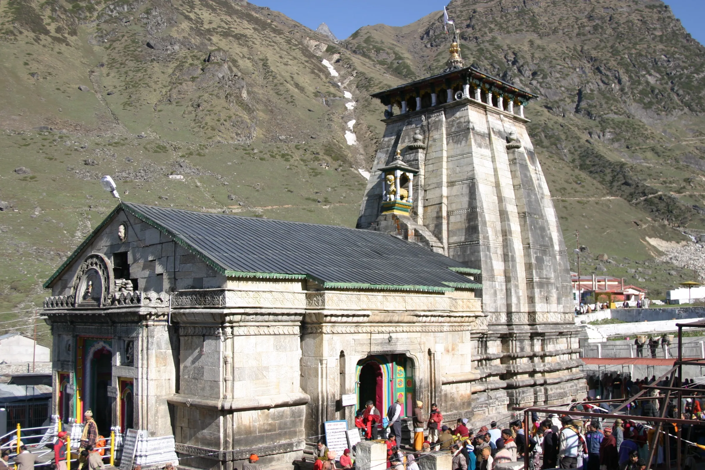
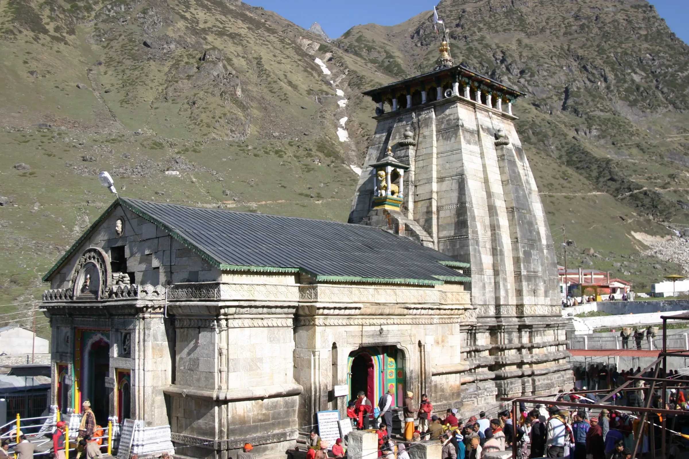
- Darshan of Bhagwan Kedarnath at Shri Kedarnath Dham (3,583 m), one of the twelve Jyotirlingas of Bhagwan Shiva and the first of the Panch Kedar
- The samadhi sthal of Adi Shankaracharya behind the temple
- The great boulder behind the temple that turned the 2013 floodwaters aside, leaving the temple standing
- An early-morning climb of about 500 m to Bhairav Nath temple above Kedarnath, with views over the temple and the snow peaks behind it
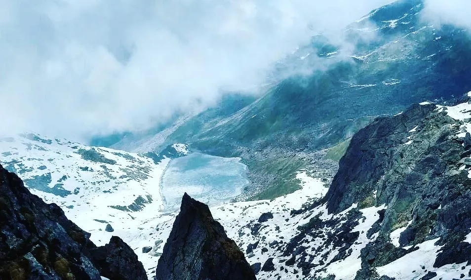
- Walking up the Mandakini valley from Gaurikund, with waterfalls, forest and then open alpine slopes below the Kedarnath peaks
Risks
- Char Dham Yatra registration is mandatory and free; register online at registrationandtouristcare.uk.gov.in or through the Tourist Care Uttarakhand app (or at counters in Haridwar, Rishikesh, Guptkashi and Sonprayag), and carry the registration and a government photo ID.
- Temple entry: on 10 March 2026 the Badri-Kedar Temple Committee (BKTC) passed a resolution that only followers of Sanatan Dharma may enter the sanctum and premises of the 47 temples it manages, including Shri Kedarnath Dham (as reported by Organiser and Curly Tales). The reports describe no restriction on the Gaurikund-Kedarnath walking path itself; check the current rule with BKTC before travelling.
- July-August monsoon rain brings landslides on the path and on the Rudraprayag-Gaurikund road; operators do not recommend these months and the yatra can be halted, so check conditions before going.
- Altitude: the temple stands at 3,583 m, reached in a single 16 km day from 1,982 m. Walk slowly, drink water, and descend if you get a severe headache, vomiting or breathlessness at rest. Medical checks may be done at Sonprayag.
- Peak season (May-June) brings very large crowds, pony traffic and full lodges; book rooms in advance and start the walk early.
- Helicopter tickets are sold only through the official IRCTC HeliYatra website; tickets offered elsewhere may be fraudulent.
Know before you go
Questions
How long is the walk from Gaurikund to Kedarnath?
About 16 km one way on a paved path (Wikipedia gives about 17 km), so about 32 km there and back. Most pilgrims take 6-10 hours up and 4-6 hours down. Vehicles stop at Sonprayag; a government shared taxi runs the last stretch to Gaurikund, where the walk begins.
When are the Kedarnath temple doors open?
The kapat opened on 22 April 2026 and closed for winter on Bhai Dooj, 23 October 2025, the year before. The temple committee fixes the dates each year from the panchang; the 2026 closing is expected around Bhai Dooj in November. In winter Baba Kedar's doli is worshipped at the Omkareshwar Temple in Ukhimath. The best months to go are May-June and September-October.
Do I need a registration or permit for Kedarnath?
Yes. Char Dham Yatra registration is mandatory and free, online at registrationandtouristcare.uk.gov.in or through the Tourist Care Uttarakhand app, with offline counters in Haridwar, Rishikesh, Guptkashi and Sonprayag. Carry a government photo ID. We found no separate trekking permit or fee for the temple path; check locally if unsure.
Who may enter the Kedarnath temple?
On 10 March 2026 the Badri-Kedar Temple Committee (BKTC), which manages the temple, passed a resolution that entry to the sanctum and temple premises of its 47 temples, including Shri Kedarnath Dham, is for followers of Sanatan Dharma who have faith in Baba Kedarnath and Badri Vishal; non-Hindus may not enter. The reports describe no restriction on the 16 km walking path from Gaurikund, and Char Dham Yatra registration still applies to everyone. Check the current rule with BKTC before you go.
Can I go to Kedarnath without walking?
Yes. Ponies, pithus (porters with a seat on their back), dandis and palkis are available at Gaurikund at government-regulated rates (about ₹3,000-10,000), and helicopters fly from Guptkashi, Sirsi and Phata. Book helicopter tickets only through the official IRCTC HeliYatra website.
Where can I stay at Kedarnath?
GMVN cottages, tents and private guesthouses near the temple. Rooms fill up in May and June, so book ahead. Many pilgrims stay at Guptkashi or Sonprayag the night before the walk.
In an emergency
Save these numbers before you lose signal. Tap to call.
- 112All emergenciesIndia’s single emergency number — works in every state
- 108Ambulance
- 1077District disaster control room
You are in
District: RudraprayagUttarakhand
- Nearest hospital
- Medical relief points work on the route and at Kedarnath during the yatra, and staff at Sonprayag may check pilgrims' fitness. For serious cases, Rudraprayag district hospital, then Rishikesh or Dehradun.
- Last ATM
- There is no working ATM at Kedarnath; carry enough cash from the down-valley towns (Guptkashi and below), and check locally.
- Phone network
- Jio and Airtel work best at the base and near the temple; the signal is unreliable along the trail.
Before you set off
- Tell someone your route and when you will be back.
- Carry a charged phone and a power bank.
- Download an offline map of the route.
- Turn back if the weather turns bad — the mountain will wait.
Questions about Kedarnath
No questions yet. Ask something and trekkers who have done it can answer.
Share your trek photo with #TreksAndTrails
I trekked this
Did Kedarnath look different from this page? Tell us what changed and we will check it.
Where this comes from
Sources
Last reviewed:
- Kedarnath Dham — Registration and Tourist Care — Uttarakhand Tourism Development Board (Registration and Tourist Care portal) (official)
- Kedarnath Temple — Wikipedia
- Kedarnath Trek — Himalayan Hikers
- Kedarnath Yatra — Indiantreks
- Kedarnath Dham Yatra — Trekkers of India
- Shri Kedarnath and Shri Yamunotri temples close for winter on Bhaiya Dooj — All India Radio News (newsonair.gov.in) (official)
- Ahead of Char Dham Yatra 2026, Uttarakhand temple authority bars entry of non-Hindus in 47 temples — Organiser
- Ahead Of Char Dham Yatra 2026, Entry Of Non-Hindus Banned In 47 Temples Including Kedarnath — Curly Tales
Photos: Shaq774 at en.wikipedia, Public domain; Rohit Sharma, CC BY-SA 4.0