Kedarnath Vasuki Tal Trek
Rudraprayag, Uttarakhand
Opens without signal on this phone, with the map file and checklist. Saved for offline →
- Max altitude
- 4,135 m
- Days
- 5 days
- Distance
- 48 km
- Difficulty
- Difficult
After the 16 km pilgrim path to Kedarnath, the lake day climbs about 550 m in 8 km on a steep, unmarked trail over loose scree and boulders to 4,135 m and back, with no shelter, food or water beyond Kedarnath and fast-changing weather.
Photos
On the trail
The route
Day by day
Day 1
Rishikesh → Gaurikund
340 m → 1,982 m
Day 2
Gaurikund → Kedarnath
1,982 m → 3,583 m
Day 3 · highest point
Kedarnath → Kedarnath (via Vasuki Tal)
3,583 m → 4,135 m → 3,583 m
Day 4
Kedarnath → Gaurikund
3,583 m → 1,982 m
Day 5
Gaurikund → Rishikesh
1,982 m → 340 m
Ups and downs
Altitude profile
Where it is
Map
Trailhead and high point only — not a recorded track. Use it with a proper map.
Weather
Next 5 days on the trail
Live forecast for the trailhead and the high point. Mountain weather changes fast — check again on the morning you start.
Trailhead · Gaurikund
at 1,982 mLoading forecast…
High point · Vasuki Tal
at 4,135 mLoading forecast…
Each day: high / low °C · rain mm and chance · snow cm · wind km/h
Weather data: Open-Meteo.comModel forecast, not an official warning. For alerts follow IMD and the local administration.
Plan the trip
How to reach
- Trailhead
- Gaurikund (nearest town: Sonprayag)
- Nearest railway
- Rishikesh or Haridwar
- Nearest airport
- Jolly Grant Airport, Dehradun
- By road
- Rishikesh (via Devprayag, Rudraprayag and Guptkashi to Sonprayag; shared jeep from Sonprayag to Gaurikund); Haridwar; Dehradun
- Drive
- About 9 h from Rishikesh
Plan the trip
Permits and fees
We could not confirm the current permit rules and fees from an official source. Check with the local forest department or tourism office before you go.
Plan the trip
Cost
Self-guided
₹7,000–15,000
With an operator
₹12,000–30,500
Per person. Guided prices published online in 2026: Hippies Adventures ₹12,000 + taxes ex-Haridwar (8 days, minimum 6 people, listed on IndiaMart); Waytoindia from ₹30,490 ex-Guptkashi (6 days, hotels and transport included). Few established trek operators run this route, so compare inclusions. Self-guided is an estimate ex-Rishikesh: bus or shared jeep to Sonprayag and the shuttle to Gaurikund, three or four nights in guesthouses at Gaurikund and Kedarnath (yatra-season rates), food, and a local guide for the lake day.
Gear
Top picks for this trek
The gear that matters most on this route, chosen from its altitude, season and risks.
 Ad · affiliate link
 Ad · affiliate link
 Ad · affiliate link
 Ad · affiliate link
 Ad · affiliate link
 Ad · affiliate link
 Ad · affiliate link
 Ad · affiliate link
Store buttons open a search on that store, not a product we picked. As an Amazon Associate we earn from qualifying purchases. Photos show the kind of item, not a specific product. Affiliate disclosure
Packing checklist
Matched to this trek: altitude, season, days and the risks on the route.
Packed 0 of 35
Snow on the trail in May: microspikes, gaiters and a warm layer are not optional.
Tick each item as it goes in the bag.
Know before you go
Good to know
- Mobile network
- Jio 4G/5G works at Kedarnath and is the most reliable network on the Gaurikund-Kedarnath path; there is no signal on the ridge or at Vasuki Tal.
- Last ATM
- Sonprayag, but it is often empty; carry cash from Rudraprayag.
- Nearest hospital
- Medical post at Kedarnath for first care and oxygen; serious cases are taken down to Rudraprayag.
- Water
- Streams on the way to the lake and the lake itself; nothing is sold beyond Kedarnath, so carry water and food and purify all stream water.
Highlights
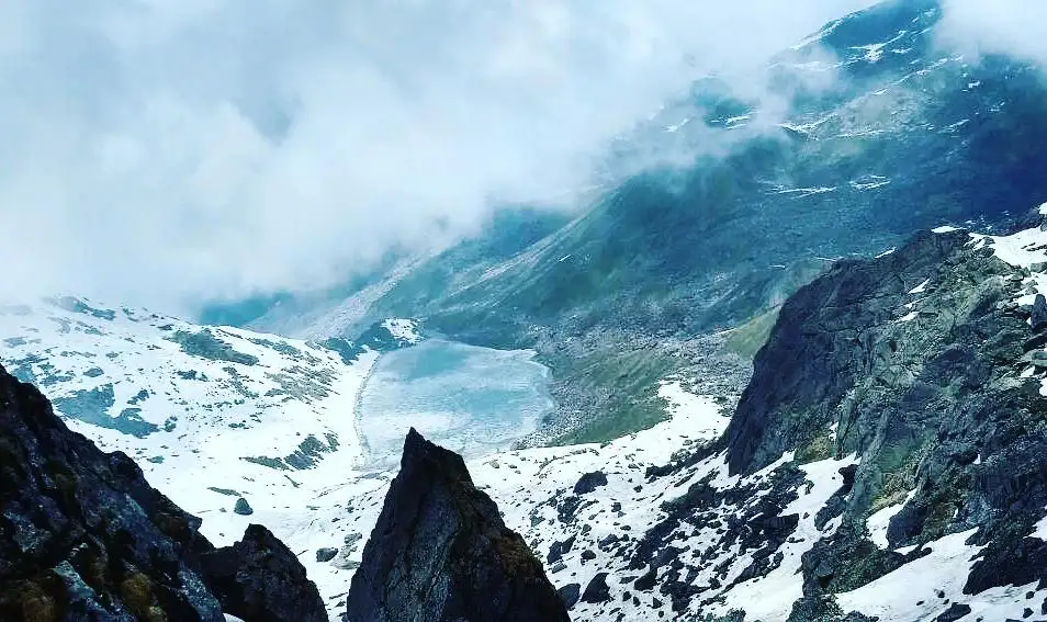
- High lake at about 4,135 m above Kedarnath, often still partly frozen in early summer, named after Vasuki, the Naag Raja
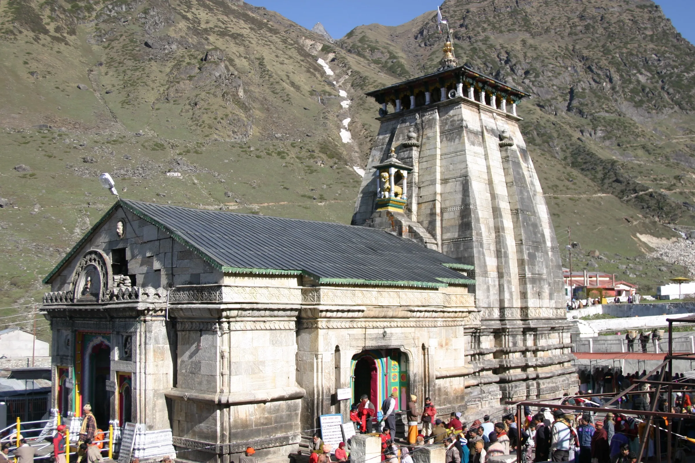
- Darshan at Shri Kedarnath Dham, one of the twelve Jyotirlingas of Bhagwan Shiva, before and after the climb
- Views of the Chaukhamba massif, Kedarnath peak and the Mandakini valley from the ridge above the lake
- The 16 km pilgrim path from Gaurikund to Kedarnath via Jungle Chatti, Bhimbali and Linchauli
Risks
- Acute mountain sickness: the lake day climbs from 3,583 m to 4,135 m and back after one night at Kedarnath; operators say it is not for first-time trekkers.
- Steep final ascent on loose scree and boulders with no marked trail; weather changes fast, so start around 5 am and be back at Kedarnath by mid-afternoon.
- Late June to August monsoon brings rain and landslide risk on the Gaurikund-Kedarnath stretch; one guide advises avoiding this window.
- Snow can cover the trail and the lake into June in some years; early-season walkers may find it snowbound.
- No shelter, shops or charging beyond Kedarnath, and camping at the lake is not confirmed: check with the Kedarnath Wildlife Division before planning a night there.
Know before you go
Questions
How far is Vasuki Tal from Kedarnath?
About 8 km one way from Kedarnath temple, so about 16 km there and back, usually done as a 5-8 hour day walk. Add the 16 km path from Gaurikund to Kedarnath each way, about 48 km in all.
Do I need a permit for Vasuki Tal?
Kedarnath Yatra registration is mandatory for everyone going to Kedarnath, and trekkers going beyond the temple are advised to register at the police/SDRF post there. The lake lies in Kedarnath Wildlife Sanctuary, and the forest office at Sonprayag has issued entry permits. We could not confirm a current official fee, so check locally.
When is the best time for the Vasuki Tal trek?
May to June and mid-September to October. Kedarnath Dham is closed in winter (from around Bhai Dooj to late April or May), and the monsoon from late June to August brings landslides on the approach.
Can beginners do the Vasuki Tal trek?
It is not a good first high-altitude trek. The climb above 4,000 m is steep and on loose ground, so prior experience above 3,000 m and a night at Kedarnath to acclimatise are advised. A local guide is strongly recommended.
Is there mobile network on the way to Vasuki Tal?
Jio works at Kedarnath and is the most reliable network on the main path, but there is no signal once you cross the ridge towards the lake.
In an emergency
Save these numbers before you lose signal. Tap to call.
- 112All emergenciesIndia’s single emergency number — works in every state
- 108Ambulance
- 1077District disaster control room
You are in
District: RudraprayagUttarakhand
- Nearest hospital
- Medical post at Kedarnath for first care and oxygen; serious cases are taken down to Rudraprayag.
- Last ATM
- Sonprayag, but it is often empty; carry cash from Rudraprayag.
- Phone network
- Jio 4G/5G works at Kedarnath and is the most reliable network on the Gaurikund-Kedarnath path; there is no signal on the ridge or at Vasuki Tal.
Before you set off
- Tell someone your route and when you will be back.
- Carry a charged phone and a power bank.
- Download an offline map of the route.
- Turn back if the weather turns bad — the mountain will wait.
Questions about Kedarnath Vasuki Tal
No questions yet. Ask something and trekkers who have done it can answer.
Share your trek photo with #TreksAndTrails
I trekked this
Did Kedarnath Vasuki Tal look different from this page? Tell us what changed and we will check it.
Where this comes from
Sources
Last reviewed:
- Vasuki Tal — Incredible India (Ministry of Tourism) (official)
- The Ultimate Vasuki Tal Trek - Kedarnath Guide (2026) — Mountroutes
- Kedarnath and Vasuki Tal Trek Package (6-Day) — Waytoindia
- Kedarnath Vasuki Tal Trek — Tour My India
- Vasuki Tal Trek Guide: Distance, Route, Height & Tips — Chardham Tour
- Vasuki Tal Kedarnath Trek — Himalaya Shelter
- Vasuki Tal Trek Guide 2024: History, Highlights, Best Time, How To Reach And Itinerary — Scoutripper
- Places to Visit Near Kedarnath: A Complete Pilgrim & Traveller Guide — Explurger
- Vasuki Tal Kedarnath Trek - Lake Trek Guide — Exploring Wings Travels
- Kedarnath Vasuki Tal Trek at ₹ 12000/person — Hippies Adventures
Photos: Hari Kandala, CC BY-SA 4.0; Ankitsingh123, CC BY-SA 4.0; Photos Worldwide, CC0