Kamrunag Trek
Mandi, Himachal Pradesh
Opens without signal on this phone, with the map file and checklist. Saved for offline →
- Max altitude
- 3,334 m
- Satellite terrain suggests about 2,903 m
- Days
- 1 day
- Distance
- 12 km
- Difficulty
- Moderate
Only about 6 km each way, but the path from Rohanda climbs steeply through dense forest the whole way (3-4 hours up), and the return the same day makes it a long, knee-testing day for unfit walkers.
Photos
On the trail
The route
Day by day
Day 1 · highest point
Rohanda → Rohanda (via Kamrunag lake and temple)
2,120 m → 3,334 m → 2,120 m
Ups and downs
Altitude profile
Where it is
Map
Trailhead and high point only — not a recorded track. Use it with a proper map.
Weather
Next 5 days on the trail
Live forecast for the trailhead and the high point. Mountain weather changes fast — check again on the morning you start.
Trailhead · Rohanda
at 2,120 mLoading forecast…
High point · Kamrunag lake and temple of Dev Kamrunag
at 3,334 mLoading forecast…
Each day: high / low °C · rain mm and chance · snow cm · wind km/h
Weather data: Open-Meteo.comModel forecast, not an official warning. For alerts follow IMD and the local administration.
Plan the trip
How to reach
- Trailhead
- Rohanda (nearest town: Sundernagar)
- Nearest railway
- Joginder Nagar (narrow gauge, about 101 km)
- Nearest airport
- Bhuntar Airport, Kullu (about 104 km)
- By road
- Sundernagar (about 35 km to Rohanda); Mandi (about 47 km to Rohanda)
- Drive
- About 6 h from Chandigarh
Plan the trip
Permits and fees
We could not confirm the current permit rules and fees from an official source. Check with the local forest department or tourism office before you go.
Plan the trip
Cost
Self-guided
₹300–2,000
With an operator
₹1,500–4,000
Per person, ex-Mandi. Both ranges are estimates: we found no operator publishing a current price for this short pilgrimage walk (one 4-day Rohanda-Kamrunag-Shikari Devi package on Lokalee is quoted per group in USD only). Self-guided: bus or shared taxi Mandi/Sundernagar to Rohanda and back, food, and optionally a simple night at Rohanda. Guided: hiring a local guide from Rohanda for the day, plus transport.
Gear
Top picks for this trek
The gear that matters most on this route, chosen from its altitude, season and risks.
 Ad · affiliate link
 Ad · affiliate link
 Ad · affiliate link
 Ad · affiliate link
 Ad · affiliate link
 Ad · affiliate link
 Ad · affiliate link
- Ad · affiliate link
Store buttons open a search on that store, not a product we picked. As an Amazon Associate we earn from qualifying purchases. Photos show the kind of item, not a specific product. Affiliate disclosure
Packing checklist
Matched to this trek: altitude, season, days and the risks on the route.
Packed 0 of 29
Nights near 3,334 m can drop close to freezing even in summer. Pack one more warm layer than you think.
Tick each item as it goes in the bag.
Know before you go
Good to know
- Mobile network
- Not confirmed by any source; expect signal on the Rohanda road and patchy coverage on the forest trail.
- Last ATM
- Not confirmed for Rohanda; carry cash from Sundernagar or Mandi.
- Nearest hospital
- Sundernagar and Mandi for first care; Shri Lal Bahadur Shastri Government Medical College, Ner Chowk (Mandi) for serious cases.
- Water
- Visitor reviews mention natural water sources along the Rohanda path; carry at least 2 litres and treat stream water.
Highlights
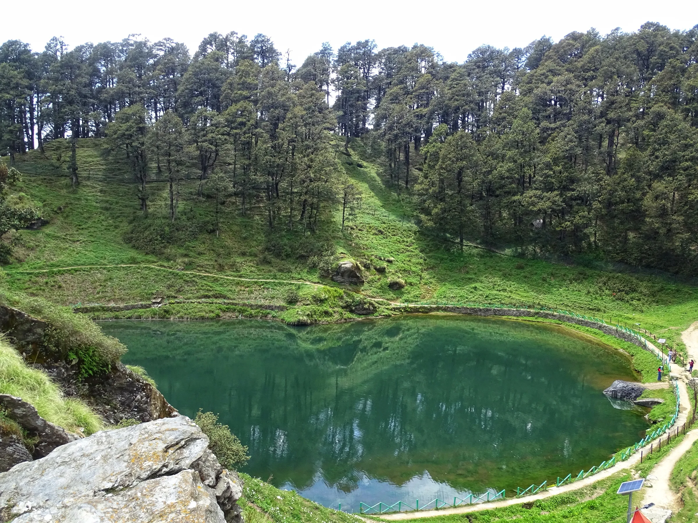
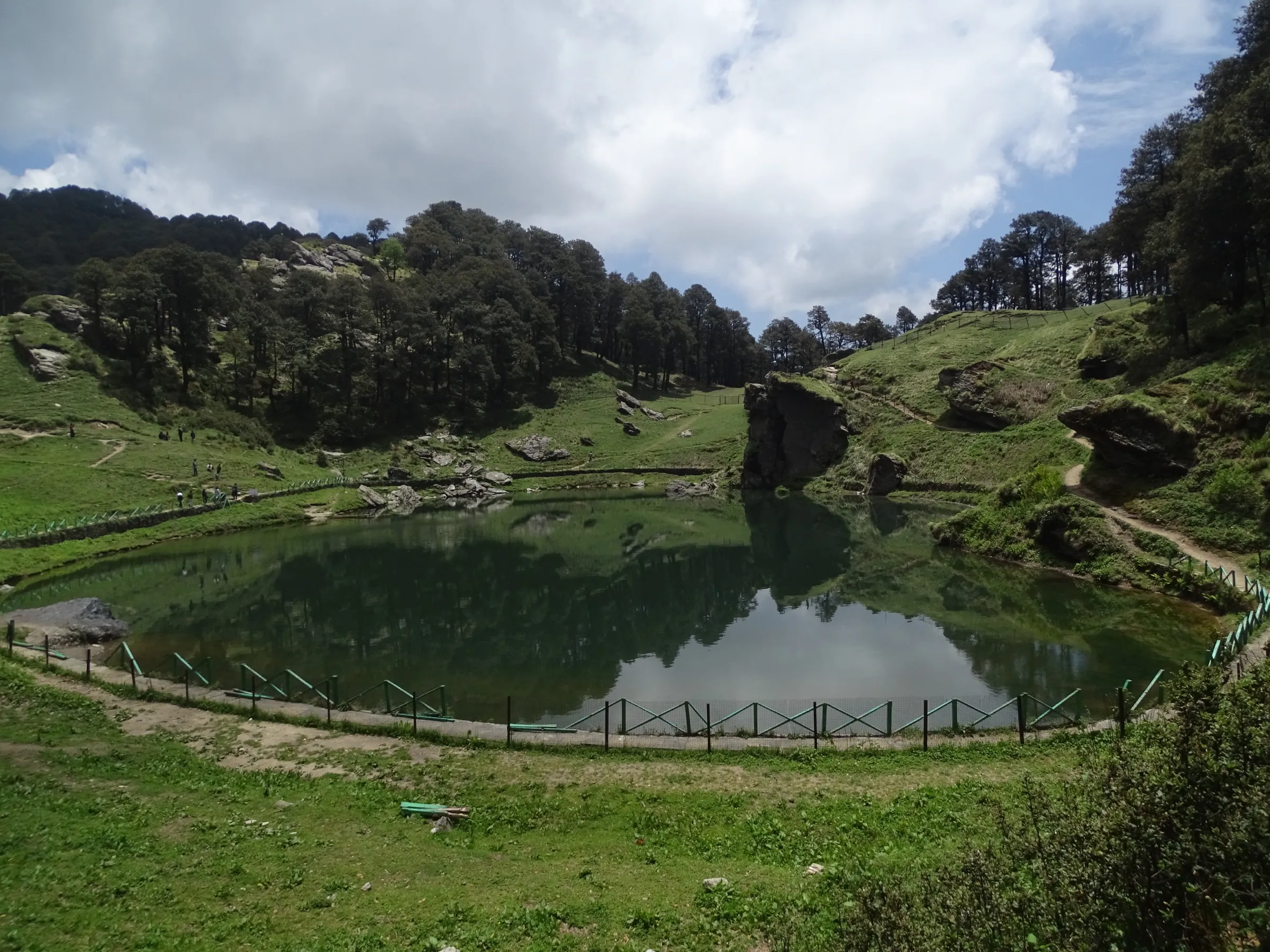
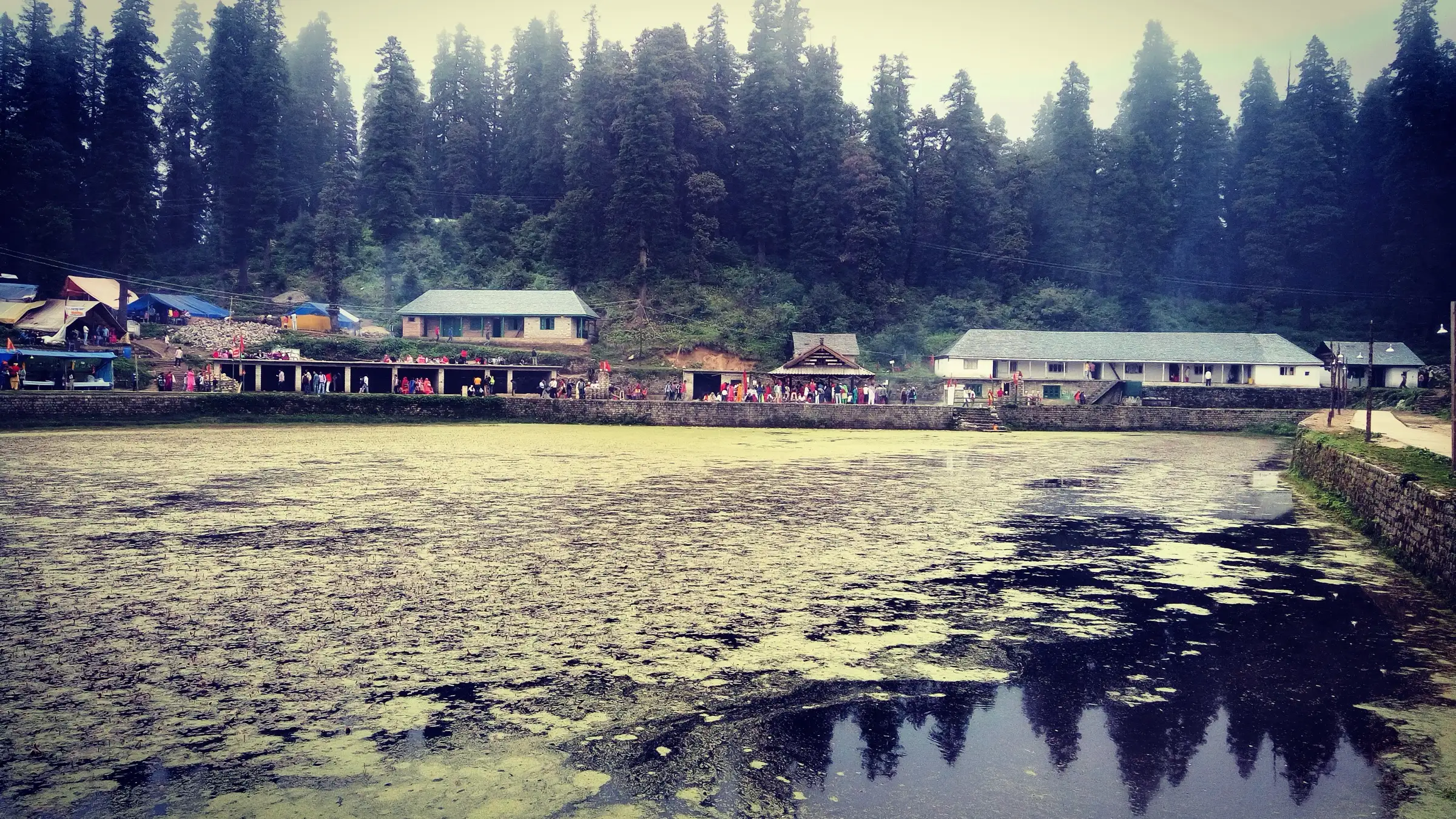
- Darshan of Dev Kamrunag at his pent-roof temple beside the sacred lake, where devotees offer gold, silver and coins when their wishes are fulfilled
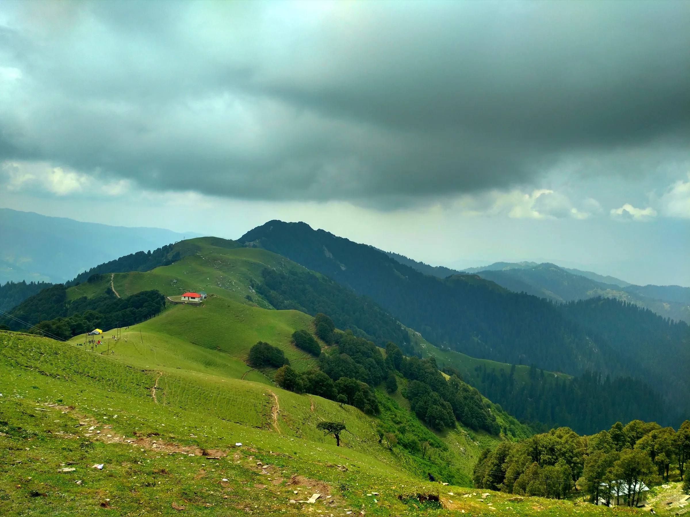
- A steep walk of about 6 km from Rohanda through thick deodar forest
- Views of the Dhauladhar range and the Balh valley from the lake
- The big Sarnahuli fair in mid-June, when Dev Kamrunag's devotees gather at the lake
Risks
- The path is steep and runs through dense forest; stay on the main track, as visitors report getting lost on shortcuts.
- Winters bring heavy snowfall and below-freezing temperatures; the lake freezes and the path becomes very difficult. We found no formal winter closure, so check locally before going between December and March.
- Monsoon (July-August) rain makes the forest path slippery and cloud often hides the views; no source names these as closed months.
- Very large crowds during the mid-June Sarnahuli fair; start early and expect queues for darshan.
- The lake area is a declared Biodiversity Heritage Site inside a demarcated protected forest (D.P.F. Kamrunag); camping and fire rules should be checked with the forest office.
Know before you go
Questions
How long is the Kamrunag trek from Rohanda?
The Mandi district administration gives the on-foot route from Rohanda to Kamrunag as about 6 km on a steep mountain path, taking 3 to 4 hours one way. Most people walk up and back the same day (about 12 km).
How do I reach Rohanda?
Rohanda is on the Sundernagar-Karsog road, about 35 km from Sundernagar and 47 km from Mandi by road. The nearest airport is Bhuntar (Kullu), about 104 km away, and the nearest railhead is the narrow-gauge line at Joginder Nagar, about 101 km away.
What is the best time to visit Kamrunag?
May-June and September-October, when the weather is pleasant and the path is usually free of snow. Winters bring heavy snowfall and the lake freezes. The Sarnahuli fair in mid-June is the busiest time.
Why do devotees offer gold and coins in Kamrunag lake?
Devotees offer gold, silver and coins in the lake when Dev Kamrunag fulfils their wishes; the tradition is centuries old. The katha of the region reveres Dev Kamrunag as the Yaksha king of the Mahabharata who was worshipped by the Pandavas.
Is there a road to Kamrunag temple now?
A devotee quoted by The Tribune in October 2024 said a metalled road had made access to the temple easier, but the classic approach is still the 6 km walk from Rohanda. We could not confirm where that road ends, so ask locally.
In an emergency
Save these numbers before you lose signal. Tap to call.
- 112All emergenciesIndia’s single emergency number — works in every state
- 108Ambulance
- 1077District disaster control room
You are in
District: MandiHimachal Pradesh
- Nearest hospital
- Sundernagar and Mandi for first care; Shri Lal Bahadur Shastri Government Medical College, Ner Chowk (Mandi) for serious cases.
- Last ATM
- Not confirmed for Rohanda; carry cash from Sundernagar or Mandi.
- Phone network
- Not confirmed by any source; expect signal on the Rohanda road and patchy coverage on the forest trail.
Before you set off
- Tell someone your route and when you will be back.
- Carry a charged phone and a power bank.
- Download an offline map of the route.
- Turn back if the weather turns bad — the mountain will wait.
Questions about Kamrunag
No questions yet. Ask something and trekkers who have done it can answer.
Share your trek photo with #TreksAndTrails
I trekked this
Did Kamrunag look different from this page? Tell us what changed and we will check it.
Where this comes from
Sources
Last reviewed:
- KAMRUNAG LAKE | District Mandi, Government of Himachal Pradesh — District Administration Mandi, Government of Himachal Pradesh (official)
- Kamrunag Lake — Wikipedia
- The Kamrunag Lake In Himachal Pradesh Offers Serene Landscapes — TravelTriangle
- Kamrunag Lake — Explurger
- Offbeat Himachal hiking / trekking (Mandi - Rohanda - Kamrunag - Shikari Devi) — Lokalee
- Mandi's Kamrunag deity pays maiden visit to Kullu — The Tribune
- Identification of Trekking Routes in Himachal Pradesh (Sep 2024) — HP Forest Department (Ecotourism) (official)
Photos: Dhiman.ashishpro, CC BY-SA 4.0; Nomeshwer Sharma, CC BY-SA 4.0