Kaisdhar Trek
Kullu, Himachal Pradesh
Opens without signal on this phone, with the map file and checklist. Saved for offline →
- Max altitude
- 2,500 m
- Days
- 2 days
- Distance
- 11 km
- Difficulty
- Easy
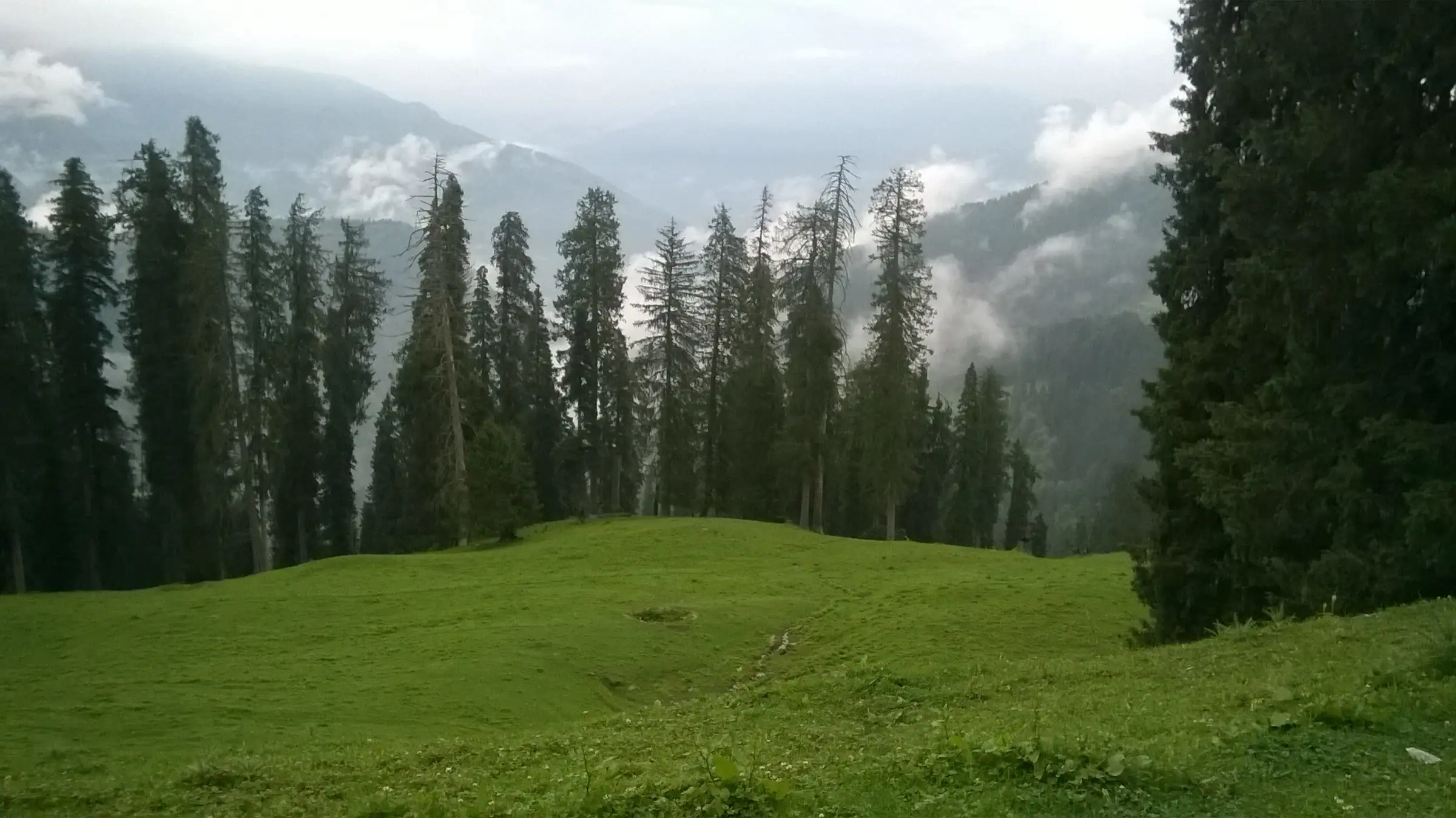
Short days of about 4.5 km and 6.5 km on a broad, well-marked forest trail that contours between roughly 2,100 m and 2,500 m with no major climbs; only a narrow grassy ledge just before Kaisdhar and slippery mud in the monsoon need care.
Photos
On the trail
The route
Day by day
Day 1 · highest point
Lot village (drive from Kullu) → Kaisdhar
2,350 m → 2,500 m
Day 2
Kaisdhar → Peej / Shilabai road-head (via Kaisdhar Eco Trail), drive to Kullu
2,500 m → 2,090 m
Ups and downs
Altitude profile
Where it is
Map
Trailhead and high point only — not a recorded track. Use it with a proper map.
Weather
Next 5 days on the trail
Live forecast for the trailhead and the high point. Mountain weather changes fast — check again on the morning you start.
Trailhead · Lot village
at 2,350 mLoading forecast…
High point · Kaisdhar ridge (Forest Rest House)
at 2,500 mLoading forecast…
Each day: high / low °C · rain mm and chance · snow cm · wind km/h
Weather data: Open-Meteo.comModel forecast, not an official warning. For alerts follow IMD and the local administration.
Plan the trip
How to reach
- Trailhead
- Lot village (nearest town: Kullu)
- Nearest railway
- Chandigarh (about 240 km from Kullu by road)
- Nearest airport
- Kullu-Manali Airport, Bhuntar
- By road
- Kullu (Lot village is about 19 km from Kullu by road); Manali (about 41 km to Lot from Indiahikes' campus near Manali, roughly 2.5 hours)
- Drive
- About 8 h from Chandigarh
Plan the trip
Permits and fees
We could not confirm the current permit rules and fees from an official source. Check with the local forest department or tourism office before you go.
Plan the trip
Cost
Self-guided
₹1,500–4,000
With an operator
₹7,450–7,570
Per person, ex-Manali for the guided figure, ex-Kullu for self-guided. Only one operator price could be found: Indiahikes lists ₹7,450 (+₹120 trek insurance) for its 4-day Manali Kaisdhar trek, but its page (October 2026) says it is currently not running the trek. Self-guided is an estimate: a shared taxi from Kullu to Lot, one night in a tent at the dhaba or the Forest Rest House at Kaisdhar with meals, any eco-trail ticket, and the ride back from Shilabai/Peej.
Gear
Top picks for this trek
The gear that matters most on this route, chosen from its altitude, season and risks.
 Ad · affiliate link
 Ad · affiliate link
 Ad · affiliate link
 Ad · affiliate link
 Ad · affiliate link
 Ad · affiliate link
 Ad · affiliate link
 Ad · affiliate link
Store buttons open a search on that store, not a product we picked. As an Amazon Associate we earn from qualifying purchases. Photos show the kind of item, not a specific product. Affiliate disclosure
Packing checklist
Matched to this trek: altitude, season, days and the risks on the route.
Packed 0 of 23
Tick each item as it goes in the bag.
Know before you go
Good to know
- Mobile network
- A 2024 trip report says Jio and Airtel signal is good along the whole trail and at the Jamdagni Rishi temple in Shilabai.
- Last ATM
- Kullu town (carry cash; none on the trail)
- Nearest hospital
- Regional Hospital Kullu
- Water
- Springs along the trail, a potable tap at the Jamdagni Rishi temple in Shilabai, and the dhaba at Kaisdhar. Treat stream water.
Highlights
- A broad, gently contouring trail through dense deodar, kail and fir forest above the Lag valley, with wooden bridges and rain shelters on the Kaisdhar Eco Trail
- The Kaisdhar Forest Rest House, built in 1920-21 in the British period, in a grassy clearing ringed by giant deodars
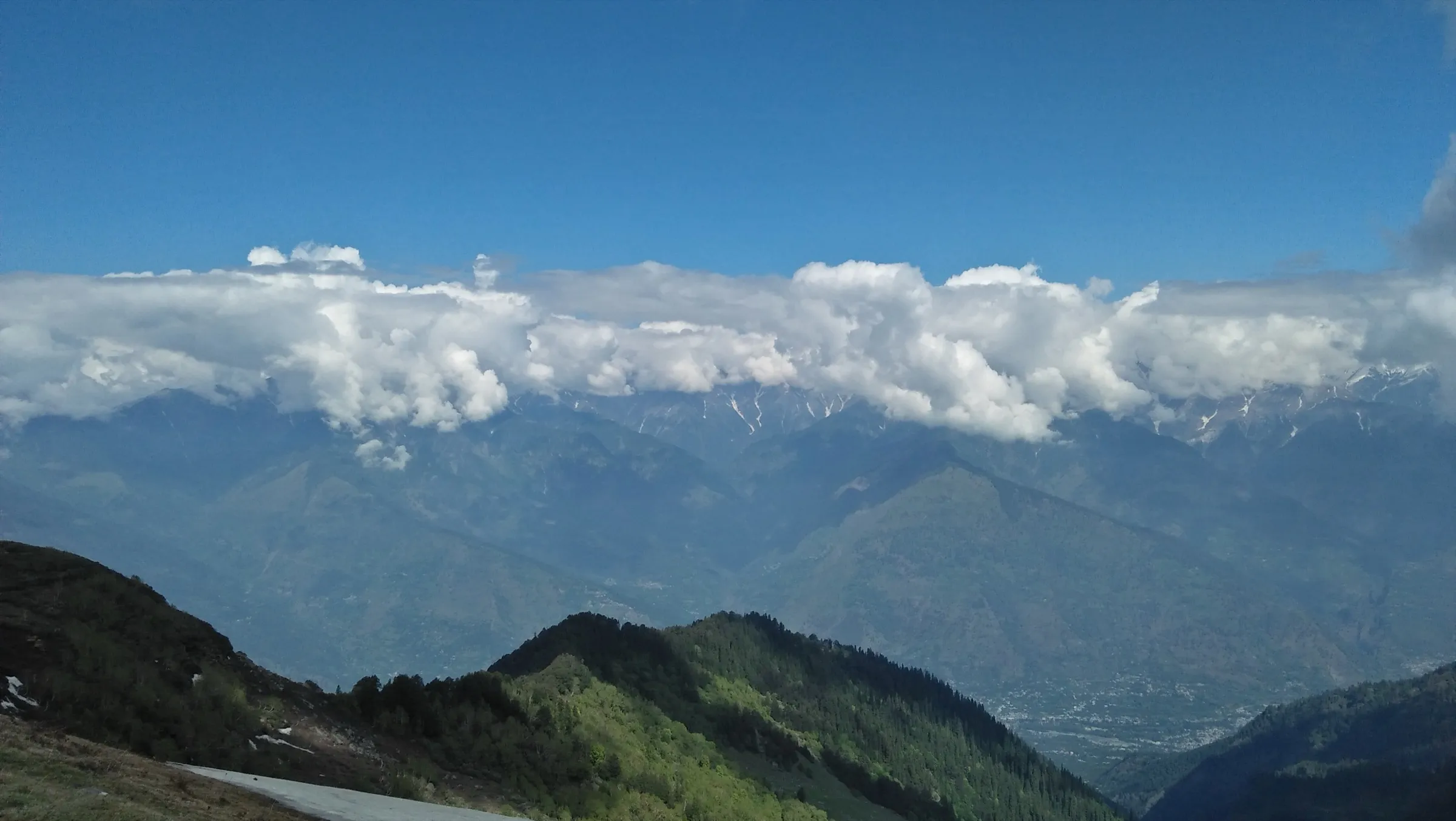
- Views of the Pir Panjal and Dhauladhar ranges and of the villages across the Lag valley
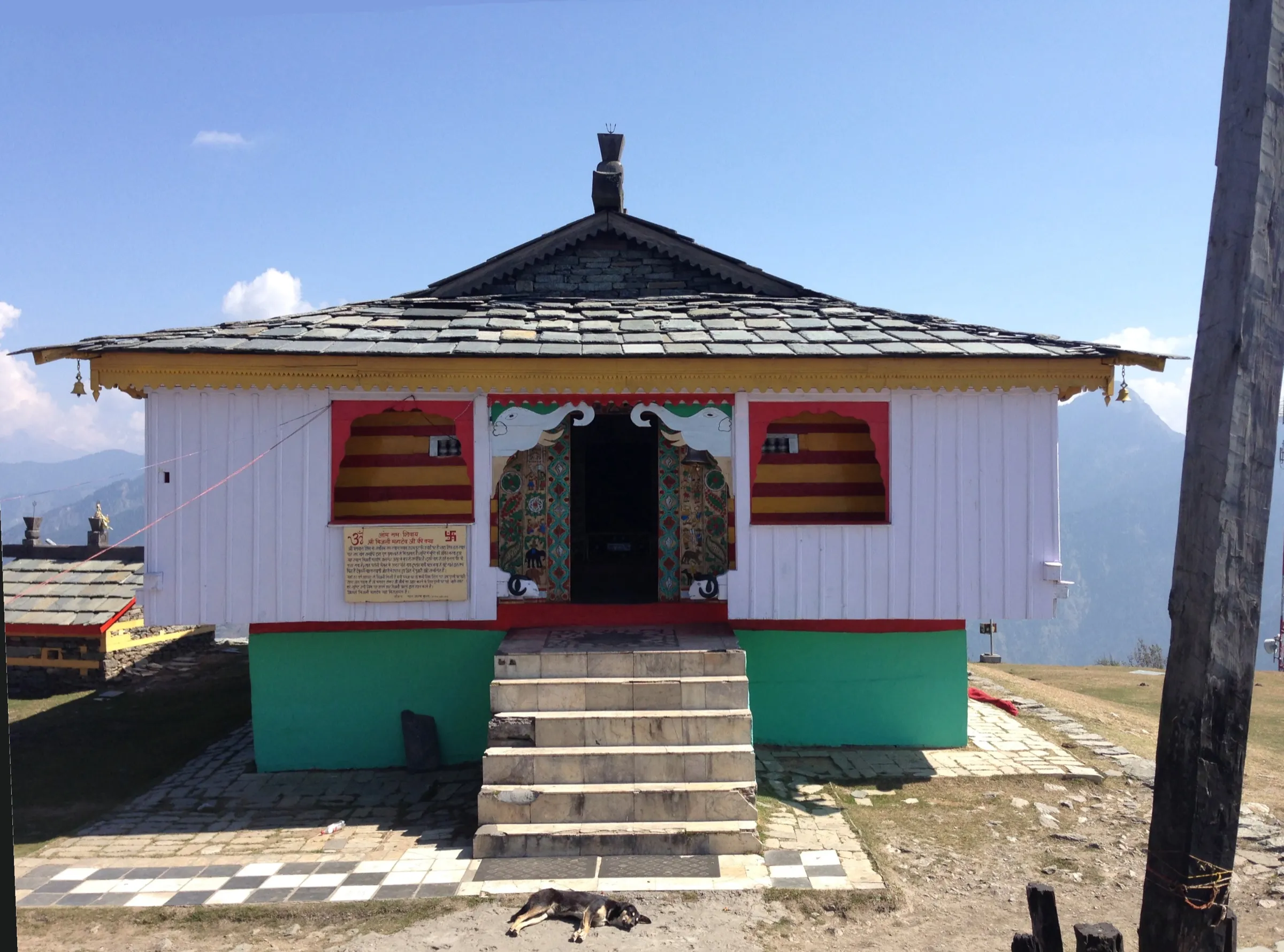
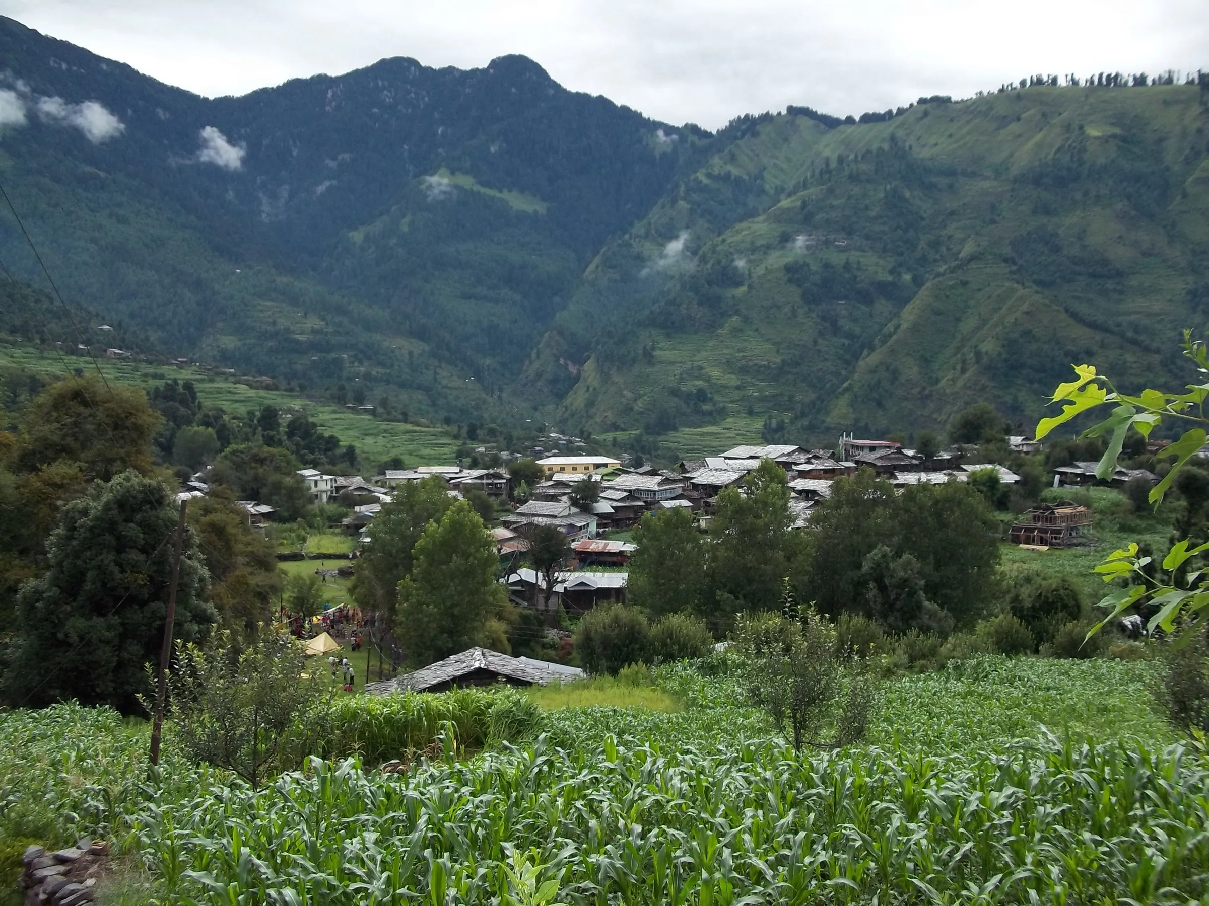
- Wood-and-stone houses of Lot village and the Jamdagni Rishi temple at Shilabai
- A good first Himalayan trek for families, with a dhaba serving meals and tents at Kaisdhar
Risks
- The trail is slippery in July-August monsoon rain, and temperatures drop sharply in rain and wind even at this modest height; carry warm layers.
- A narrow grassy ledge just before Kaisdhar: stay close to the hillside.
- Snow can cover the trail from mid-January to February; carry microspikes or check conditions locally.
- Side tracks and a newly built road near Bain and Shilabai can lead hikers off the trail; use an offline map or ask locals.
- Forest check posts may ask for photo ID; the eco-trail gate has a ticket counter. Fees were not confirmed from an official source.
Know before you go
Questions
Is Kaisdhar a good trek for beginners and families?
Yes. Indiahikes designed it for beginners and families: the trails are short and mostly flat with hardly any tricky sections. A 2024 trip report also calls it beginner-friendly, with one broad trail, few blind turns and locals using it every day.
Can you drive to Kaisdhar?
No. The Kaisdhar rest house is not on a road. You walk in about 4.5 km from Lot village or about 6.5 km on the Kaisdhar Eco Trail from the Shilabai/Peej side; the Jamdagni Rishi temple at Shilabai is the road-head.
Where can I stay at Kaisdhar?
There is a Forest Rest House built in 1920-21, and a dhaba near it that serves meals and offers tents for 4-6 people and camping space behind it, with a toilet. Check rest-house booking with the Kullu forest division.
What is the best time to do the Kaisdhar trek?
Spring (March-April) and autumn (October-December) give clear views of the Pir Panjal and Dhauladhar ranges. Summer is pleasant in the forest shade. Monsoon makes the trail slippery, and snow can lie from mid-January to February.
How high is Kaisdhar?
Indiahikes gives Kaisdhar's ridge as 8,202 ft (about 2,500 m), and route maps show a high point of about 2,470 m. The board on the Forest Rest House reads 8,300 ft.
In an emergency
Save these numbers before you lose signal. Tap to call.
- 112All emergenciesIndia’s single emergency number — works in every state
- 108Ambulance
- 1077District disaster control room
You are in
District: KulluHimachal Pradesh
- Nearest hospital
- Regional Hospital Kullu
- Last ATM
- Kullu town (carry cash; none on the trail)
- Phone network
- A 2024 trip report says Jio and Airtel signal is good along the whole trail and at the Jamdagni Rishi temple in Shilabai.
Before you set off
- Tell someone your route and when you will be back.
- Carry a charged phone and a power bank.
- Download an offline map of the route.
- Turn back if the weather turns bad — the mountain will wait.
Questions about Kaisdhar
No questions yet. Ask something and trekkers who have done it can answer.
Share your trek photo with #TreksAndTrails
I trekked this
Did Kaisdhar look different from this page? Tell us what changed and we will check it.
Where this comes from
Sources
Last reviewed:
- Manali Kaisdhar Trek — Indiahikes
- Identification of Trekking Routes in Himachal Pradesh (245 routes), Sep 2024 — No. 100 Lot to Kaisdhar — Himachal Pradesh Forest Department (Ecotourism) (official)
- Kaisdhar - perfect trail for beginners — Creedaz (trip report)
- Kais Dhar — iso-maps
Photos: Divyansh Vardhan, CC BY-SA 4.0; Madhrakangri, CC BY 4.0; Divyansh Vardhan, CC BY-SA 4.0; Madhrakangri, CC BY 4.0