Bhubhu Pass Trek
Mandi and Kullu, Himachal Pradesh
Opens without signal on this phone, with the map file and checklist. Saved for offline →
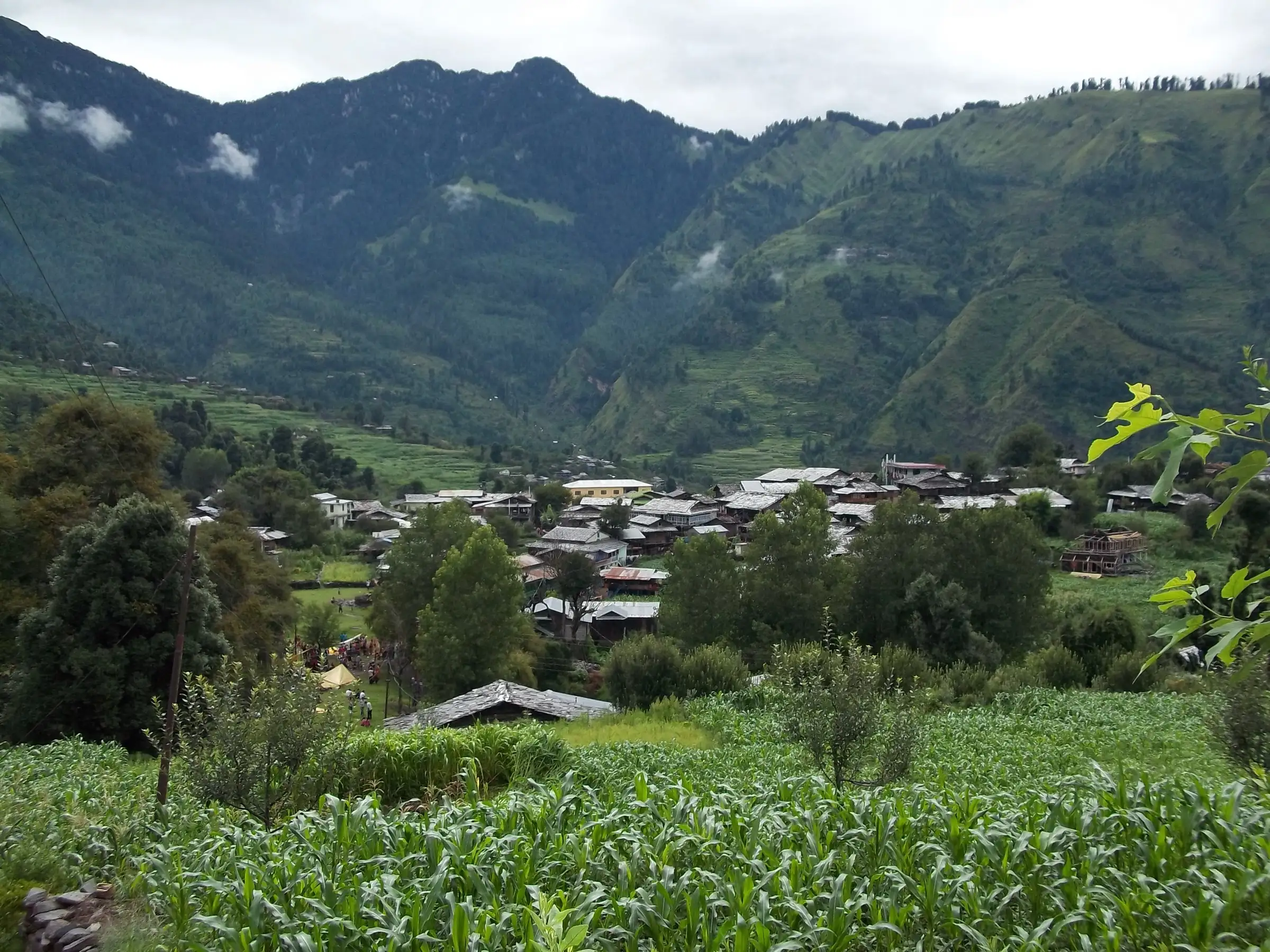
- Max altitude
- 2,900 m
- Days
- 2 days
- Distance
- 15 km
- Difficulty
- Moderate
A low pass, but the last kilometre is steep on both sides, the climb from the Mandi side is long and sun-exposed, and the shaded Kullu-side descent has few trail marks and can hold hard snow into spring.
Photos
On the trail
The route
Day by day
Day 1
Jogindernagar or Mandi → Silhabdhani (Silh-Badhani)
1,220 m → 1,990 m
Day 2 · highest point
Silhabdhani (Silh-Badhani) → Kadon, Lug Valley (drive to Kullu)
1,990 m → 2,900 m → 2,040 m
Ups and downs
Altitude profile
Where it is
Map
Trailhead and high point only — not a recorded track. Use it with a proper map.
Weather
Next 5 days on the trail
Live forecast for the trailhead and the high point. Mountain weather changes fast — check again on the morning you start.
Trailhead · Silhabdhani (Silh-Badhani)
at 1,990 mLoading forecast…
High point · Bhubhu Jot (Bhubhu Pass)
at 2,900 mLoading forecast…
Each day: high / low °C · rain mm and chance · snow cm · wind km/h
Weather data: Open-Meteo.comModel forecast, not an official warning. For alerts follow IMD and the local administration.
Plan the trip
How to reach
- Trailhead
- Silhabdhani (Silh-Badhani) (nearest town: Barot)
- Nearest railway
- Pathankot (about 175 km); the narrow-gauge Kangra Valley line ends at Jogindernagar
- Nearest airport
- Bhuntar Airport, Kullu
- By road
- Mandi or Jogindernagar by bus towards Barot to Tikken Bridge, then cab or bus via Dharmedh to Silhabdhani; Kullu (about 11 km by road from Kadon in the Lug Valley, at the end of the crossing)
- Drive
- About 8 h from Chandigarh
Plan the trip
Permits and fees
We could not confirm the current permit rules and fees from an official source. Check with the local forest department or tourism office before you go.
Plan the trip
Cost
Self-guided
₹2,500–5,000
With an operator
₹8,000–12,000
Per person. Few operators sell this crossing. Thrillophilia lists a 5-day Bhubhu Pass package ex-Manali at ₹8,600 (October 2026), but marks it currently unavailable, and it follows a longer variant (Lug Valley to Barot over Bhubhu Pass and the Kangra ridge). The upper end of the guided range is our estimate for a private guide-and-porter trip. Self-guided is an estimate ex-Mandi: bus to Tikken Bridge, cab to Silhabdhani, a night at the Forest Rest House or a village homestay, a local guide from Barot, and a taxi from Kadon to Kullu.
Gear
Top picks for this trek
The gear that matters most on this route, chosen from its altitude, season and risks.
 Ad · affiliate link
 Ad · affiliate link
 Ad · affiliate link
 Ad · affiliate link
- Ad · affiliate link
 Ad · affiliate link
 Ad · affiliate link
 Ad · affiliate link
Store buttons open a search on that store, not a product we picked. As an Amazon Associate we earn from qualifying purchases. Photos show the kind of item, not a specific product. Affiliate disclosure
Packing checklist
Matched to this trek: altitude, season, days and the risks on the route.
Packed 0 of 23
Monsoon months (Jun–Jul, Sep): pack everything in plastic or a dry bag and wear shoes with good grip.
Tick each item as it goes in the bag.
Know before you go
Good to know
- Mobile network
- Not confirmed. Expect patchy signal in Silhabdhani and Kadon and none on the pass section.
- Last ATM
- Not confirmed; carry cash from Jogindernagar or Mandi (or Kullu on the other side).
- Nearest hospital
- Jogindernagar or Mandi on the Chuhar Valley side; Kullu on the Lug Valley side.
- Water
- Indiahikes reports a rivulet beside the trail on the Mandi-side climb, so drinking water is easy to find on the way up. Treat all stream water.
Highlights
- An old village crossing between the Chuhar Valley (Mandi) and the Lug Valley (Kullu)
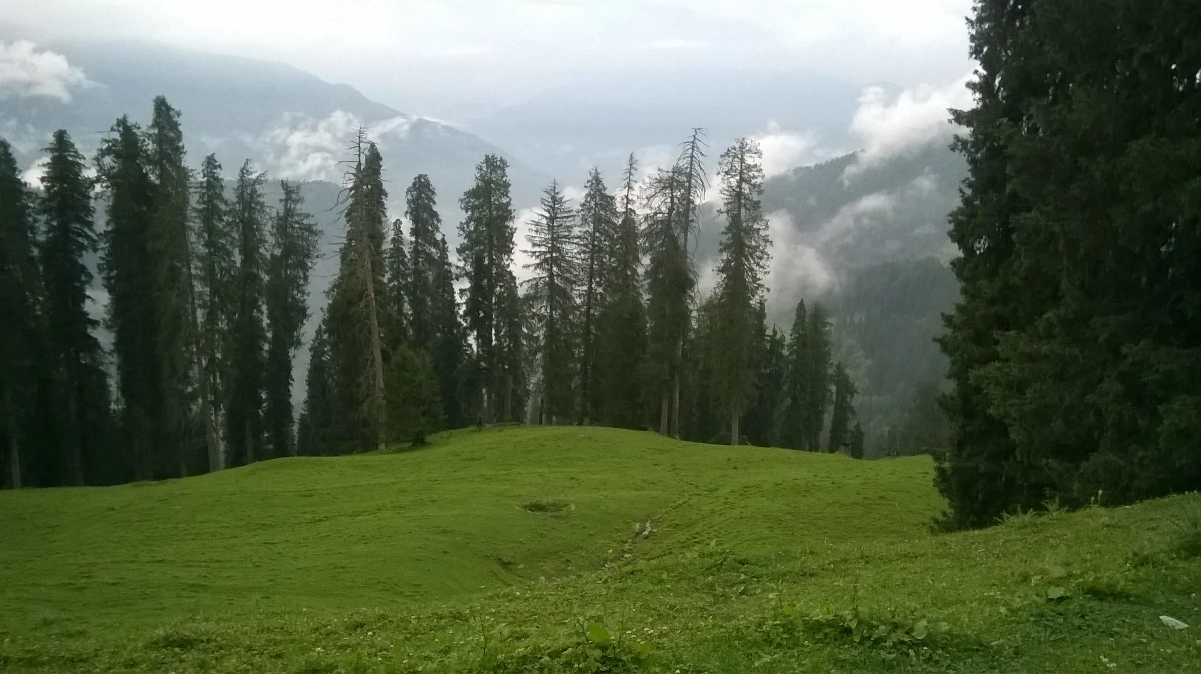
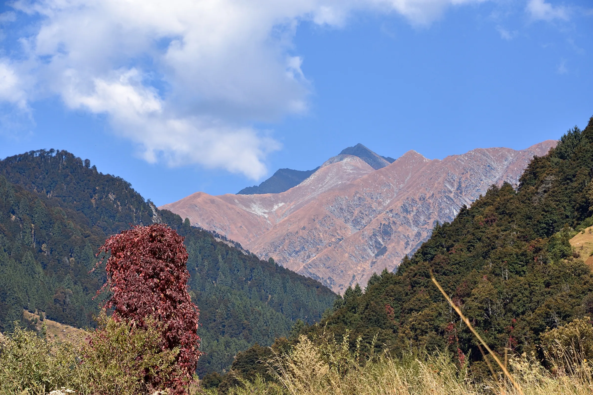
- Views of Deo Tibba and Indrasan and the Pir Panjal and Dhauladhar ranges from the pass top
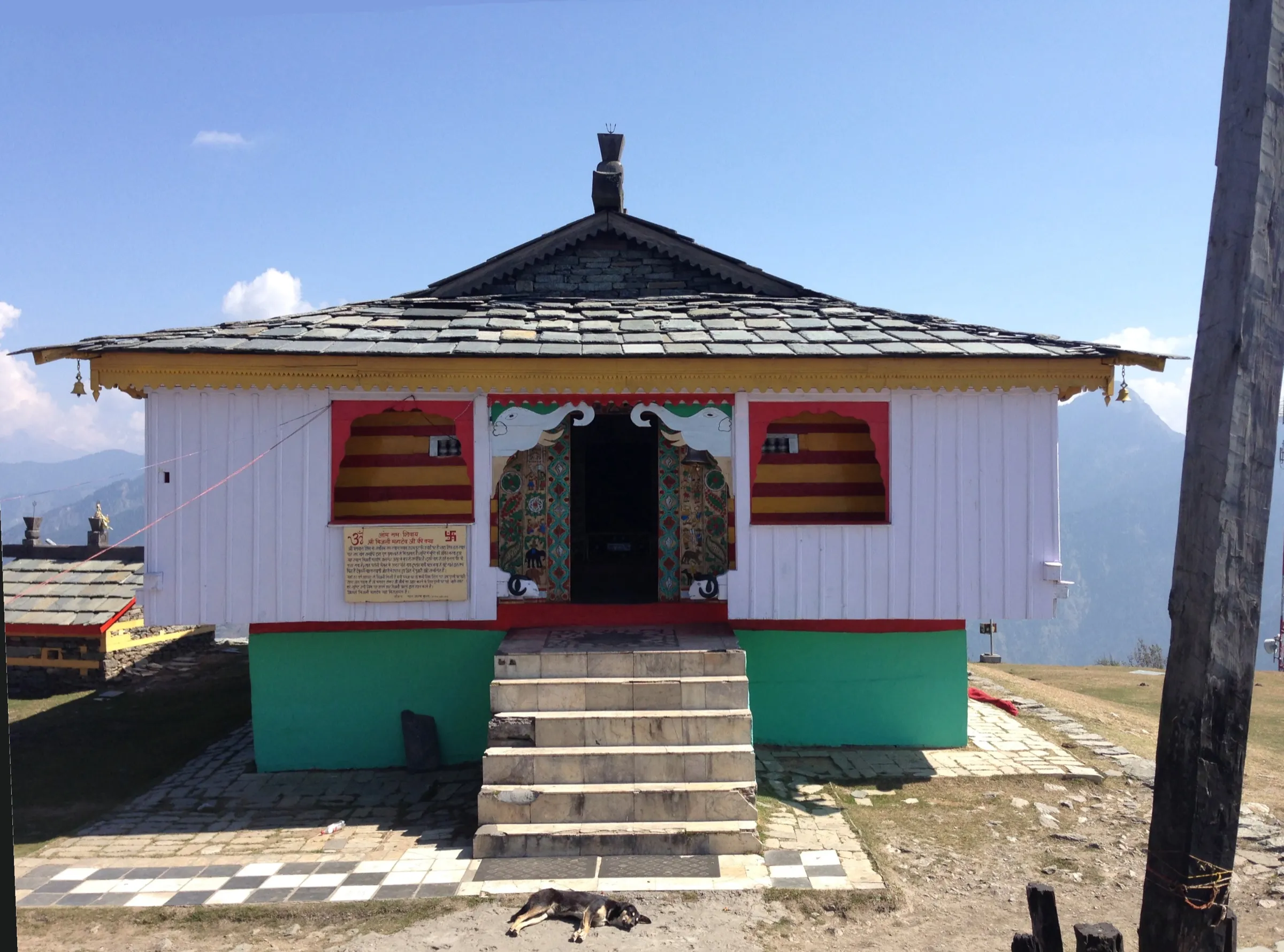
- Dev Pashakot temple at Devgarh and the Hurang Narayan temple, devtas of the Chuhar Valley
- Rhododendron forest above Silhabdhani, the last village on the Mandi side
Risks
- The Kullu-side descent is shaded and steep, with few trail marks; in April Indiahikes found a stretch of about 500 m of hard snow, so carry microspikes in spring and late autumn.
- The trail sees little use since roads came, so it is easy to lose; hire a local guide from Barot or ask villagers before leaving Silhabdhani.
- Rain is likely through the season, and snow can fall in April and September; monsoon (July-August) makes the descent slippery.
- Village and temple customs in the Chuhar Valley are strict; ask before entering temples or taking photographs.
Know before you go
Questions
How high is Bhubhu Pass and how hard is the trek?
Indiahikes gives the pass as about 2,900 m (9,280 ft) and rates the trek moderate. It is low, but the final kilometre is steep from both sides, and the Kullu-side descent is shaded, poorly marked and can hold snow, so it is not ideal as a first trek.
Where does the Bhubhu Pass trek start and end?
It crosses from the Chuhar Valley in Mandi district to the Lug Valley in Kullu district. Indiahikes' route starts at Tikken Bridge on the Barot road and walks via Devgarh and Dharmedh to Silhabdhani, but a road now reaches Silhabdhani, so most of that first day can be done by cab. The crossing ends at Kadon in the Lug Valley, about 11 km from Kullu.
When is the best time to cross Bhubhu Pass?
Indiahikes gives early May to July and late September as the best season. Rain is likely at any time, and snow can fall in April and September; snow lingers longest on the shaded Kullu side.
Do I need a permit for Bhubhu Pass?
Indiahikes says no trekking permit is needed, only a police registration for non-Himachalis. We could not confirm current registration rules with an official source, so check with the police or district administration in Mandi or Kullu before you go.
Is there a road over Bhubhu Jot?
No. The pass is crossed on foot. A road tunnel under Bhubu Jot, on a planned Ghatasani-Shilha-Bhubu Jot-Kullu highway, has been discussed for years, and Tribune reports say the Centre has cleared it. Until it is built, the only way over is the walking trail.
Can I do a longer trek over Bhubhu Pass?
Yes. Some operators sell a 5-day variant from Manali: drive to Dalighat in the Lug Valley, cross Bhubhu Pass (a small Bhagwan Ganesh shrine marks the top), then follow the ridge via Jhingbhan and Dentbhial down to Barot. From the Lug Valley you can also continue over Himri Pass towards Manali.
In an emergency
Save these numbers before you lose signal. Tap to call.
- 112All emergenciesIndia’s single emergency number — works in every state
- 108Ambulance
- 1077District disaster control room
You are in
District: Mandi and KulluHimachal Pradesh
- Nearest hospital
- Jogindernagar or Mandi on the Chuhar Valley side; Kullu on the Lug Valley side.
- Last ATM
- Not confirmed; carry cash from Jogindernagar or Mandi (or Kullu on the other side).
- Phone network
- Not confirmed. Expect patchy signal in Silhabdhani and Kadon and none on the pass section.
Before you set off
- Tell someone your route and when you will be back.
- Carry a charged phone and a power bank.
- Download an offline map of the route.
- Turn back if the weather turns bad — the mountain will wait.
Questions about Bhubhu Pass
No questions yet. Ask something and trekkers who have done it can answer.
Share your trek photo with #TreksAndTrails
I trekked this
Did Bhubhu Pass look different from this page? Tell us what changed and we will check it.
Where this comes from
Sources
Last reviewed:
- Bhubhu Pass Trek (documented trek, by Tarun Goel) — Indiahikes
- Silhabdhani Trail to Bhubhu Pass - Hiking Route — Outmap
- Army team embarks on eco-friendly expedition (19 June 2025) — The Tribune
- Bhubhu Pass Trek, Manali — Thrillophilia
- Bhubu Pass Trek For 4 Nights / 5 Days Tour (Himachal Tour Guide) — Himachal Tour Guide
Photos: Gopal Krishan, CC BY-SA 4.0; Harvinder Chandigarh, CC BY-SA 4.0