Ghanchakkar Trek
Ahilyanagar (Ahmednagar), Maharashtra
Opens without signal on this phone, with the map file and checklist. Saved for offline →
- Max altitude
- 1,532 m
- Days
- 1 day
- Distance
- 12 km
- Difficulty
- Moderate
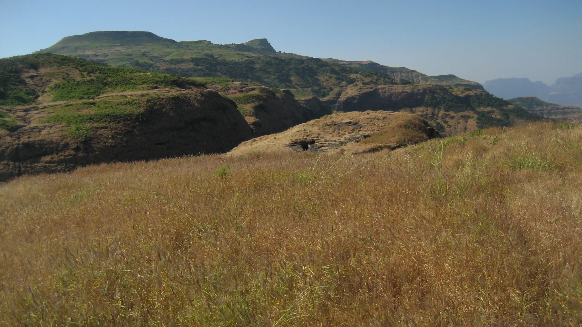
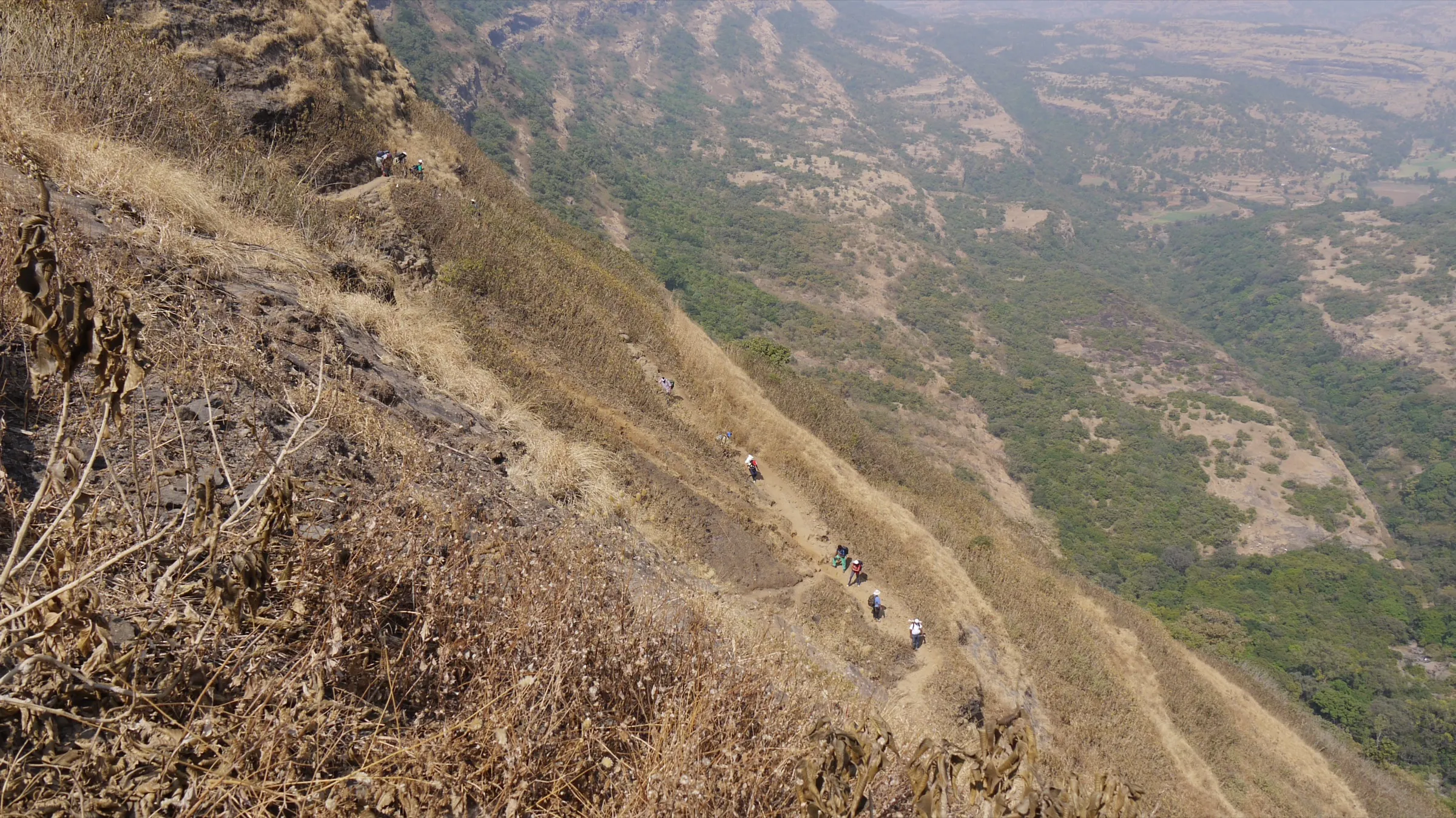
Operators grade it moderate or medium: about 600 m of climbing from Shirpunje over roughly 6 km each way, steep at the start, then a traverse and grassy plateau to the summit. A 2023 GPS track rates the Bhairavgad–Ghanchakkar loop difficult, and the return over the Bhairavgad ridge is a narrow scree traverse.
Photos
On the trail
The route
Day by day
Day 1 · highest point
Shirpunje → Shirpunje (via Ghanchakkar summit)
940 m → 1,532 m → 940 m
Ups and downs
Altitude profile
Where it is
Map
Trailhead and high point only — not a recorded track. Use it with a proper map.
Weather
Next 5 days on the trail
Live forecast for the trailhead and the high point. Mountain weather changes fast — check again on the morning you start.
Trailhead · Shirpunje
at 940 mLoading forecast…
High point · Ghanchakkar summit
at 1,532 mLoading forecast…
Each day: high / low °C · rain mm and chance · snow cm · wind km/h
Weather data: Open-Meteo.comModel forecast, not an official warning. For alerts follow IMD and the local administration.
Plan the trip
How to reach
- Trailhead
- Shirpunje (nearest town: Rajur (Akole taluka))
- Nearest railway
- Kasara (used by operators from Mumbai); Igatpuri is the nearest mainline station
- Nearest airport
- Chhatrapati Shivaji Maharaj International Airport, Mumbai (Nashik airport is closer but has few flights)
- By road
- Mumbai via Kasara, Igatpuri, Ghoti and Bhandardara to Rajur, then about 22–27 km on to Shirpunje; Pune via Alephata, Otur and Rajur (a 2017 trip report took about 5.5 hours by car); Kasara to Shirpunje by hired jeep takes operators about 2.5 to 3 hours at night; there is no regular public transport to the village
- Drive
- About 6 h from Mumbai
Plan the trip
Permits and fees
We could not confirm the current permit rules and fees from an official source. Check with the local forest department or tourism office before you go.
Plan the trip
Cost
Self-guided
₹600–2,500
With an operator
₹1,199–1,800
Per person, ex-Kasara or ex-Pune, as published in October 2026. Treks and Trails India: ₹1,199 ex-Kasara (train), ₹1,399 ex-Pune (bus), ₹1,599 listed price, with transport, breakfast and evening refreshments. Ramblers India: ₹1,400 ex-Kasara with breakfast, lunch and forest entry fee (Shirpunje Bhairavgad–Ghanchakkar, 3 October 2026). GAF (Giripremi Adventure Foundation): ₹1,800 incl. GST ex-Pune for its Bhairavgad and Ghanchakkar plateau trek. Self-guided is an estimate: local train to Kasara and a share of a hired jeep to Shirpunje and back, a village meal and a local guide from Shirpunje. The peak lies in the Kalsubai–Harishchandragad Wildlife Sanctuary; operators include a forest entry fee, but we found no official rate, so check locally.
Gear
Top picks for this trek
The gear that matters most on this route, chosen from its altitude, season and risks.
 Ad · affiliate link
 Ad · affiliate link
 Ad · affiliate link
 Ad · affiliate link
- Ad · affiliate link
 Ad · affiliate link
 Ad · affiliate link
 Ad · affiliate link
Store buttons open a search on that store, not a product we picked. As an Amazon Associate we earn from qualifying purchases. Photos show the kind of item, not a specific product. Affiliate disclosure
Packing checklist
Matched to this trek: altitude, season, days and the risks on the route.
Packed 0 of 22
Monsoon months (Sep): pack everything in plastic or a dry bag and wear shoes with good grip.
Tick each item as it goes in the bag.
Know before you go
Good to know
- Mobile network
- Not reported by our sources; expect weak or no signal in the sanctuary and on the plateau.
- Last ATM
- Not confirmed; carry cash from Rajur, Akole or Igatpuri.
- Nearest hospital
- Not confirmed; Shirpunje has a government health sub-centre (OpenStreetMap). For anything serious, Akole or Nashik.
- Water
- Wikipedia notes only one small water source on the plateau, available in the cooler months and dry by summer; the cisterns on Bhairavgad hold water if you return that way. Treks and Trails India asks for at least 3 litres per person.
Highlights
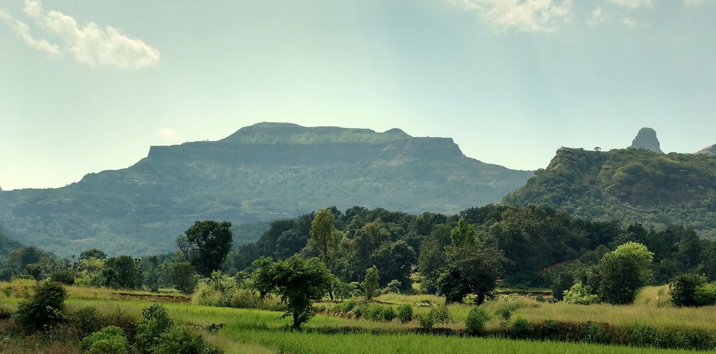
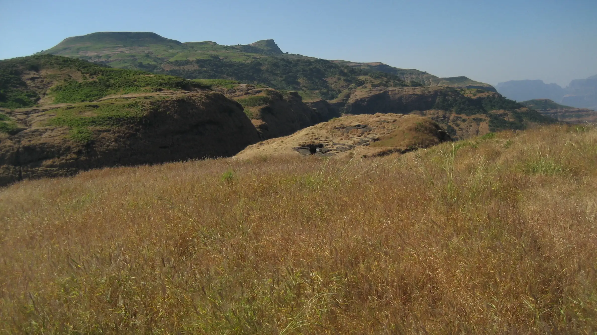
- One of the highest summits of the Maharashtra Sahyadri (about 1,520–1,532 m), on a wide grassy plateau it shares with Muda
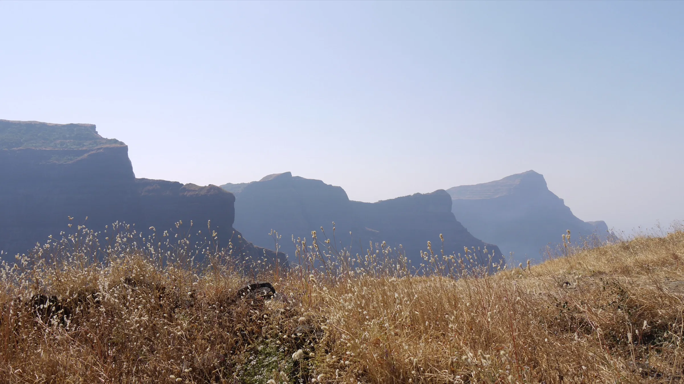
- 360-degree view: Ratangad, the Khutta pinnacle, Katrabai and Gawaldev to the west, Bhandardara lake below, and the Junnar forts to the south
- Post-monsoon wildflower meadows on the plateau (operators run 'flower special' batches in early October)
- Can be combined with Bhairavgad (Shirpunje), its cave shrine of Bhagwan Bhairavnath and rock-cut cisterns, as a loop from the same village
Risks
- The mountain is bare with no tree cover: hot and exposed after mid-morning in the dry months, with strong wind and, an operator notes, cold nights even in May. Start at dawn.
- Very little water on the trail; carry at least 3 litres per person.
- The ridge traverse between Ghanchakkar and Bhairavgad is narrow, scree-covered and overgrown in places; a 2017 trip report describes a fall on scree while descending. Hire a local guide from Shirpunje, as the route is not marked.
- Rock bee nests sit on the traverse; pass them quietly. Leopards live in the sanctuary.
- Monsoon (June–August) makes the steep slopes slippery and fog hides the route. In 2025 the Forest Department closed nearby Kalsubai, Ratangad and Alang–Madan–Kulang until 10 August; check with the Rajur/Bhandardara forest office for the current year's monsoon order.
- Remote base: no regular buses reach Shirpunje, so arrange a jeep from Rajur or Kasara and plan the return before dark.
Know before you go
Questions
Where does the Ghanchakkar trek start?
From Shirpunje village, on the north side of the mountain, about 22–27 km from Rajur in Akole taluka. A longer, indirect route also goes from Kumshet via the Katrabai col and Muda (about 4 hours, per Wikipedia).
How long is the Ghanchakkar trek and how much time does it take?
Treks and Trails India gives about 6 km one way, 3 hours up and 2 hours down. Wikipedia puts the summit about 2.5 hours from Shirpunje. Combined with Bhairavgad as a loop, a 2023 GPS track measures about 10.9 km and Ramblers India quotes about 15 km.
How high is Ghanchakkar, and is it the third highest peak in Maharashtra?
Wikipedia gives 1,532 m and calls it the third highest peak in the Maharashtra Sahyadri; Treks and Trails India gives 1,520 m and Ramblers India 1,502 m. Rankings differ: Treks and Trails India calls Ghanchakkar the fourth highest and neighbouring Gawaldev the third. Satellite terrain reads about 1,477 m at the mapped summit.
Can Ghanchakkar and Bhairavgad be done in one day?
Yes. Groups climb Bhairavgad from Shirpunje, then cross to the Ghanchakkar plateau and summit and return to the village, all in one day; Ramblers India plans about 7 to 8 hours of walking.
When is the best time to do Ghanchakkar?
Just after the monsoon, in September and October, when the plateau flowers; winter to February is also good. Avoid hot afternoons in summer, as the mountain has no shade and almost no water.
In an emergency
Save these numbers before you lose signal. Tap to call.
- 112All emergenciesIndia’s single emergency number — works in every state
- 108Ambulance
- 1077District disaster control room
You are in
District: Ahilyanagar (Ahmednagar)Maharashtra
- Nearest hospital
- Not confirmed; Shirpunje has a government health sub-centre (OpenStreetMap). For anything serious, Akole or Nashik.
- Last ATM
- Not confirmed; carry cash from Rajur, Akole or Igatpuri.
- Phone network
- Not reported by our sources; expect weak or no signal in the sanctuary and on the plateau.
Before you set off
- Tell someone your route and when you will be back.
- Carry a charged phone and a power bank.
- Download an offline map of the route.
- Turn back if the weather turns bad — the mountain will wait.
Questions about Ghanchakkar
No questions yet. Ask something and trekkers who have done it can answer.
Share your trek photo with #TreksAndTrails
I trekked this
Did Ghanchakkar look different from this page? Tell us what changed and we will check it.
Where this comes from
Sources
Last reviewed:
- Ghanchakkar Peak Trek (tour listing by the operator Treks and Trails India, treksandtrails.org; not this site) — Treks and Trails India
- Ghanchakkar — Wikipedia
- Shirpunje Bhairavgad - Ghanchakkar Trek (Flowers Special), 3 Oct 2026 — Ramblers India
- Shirpunje Bhairavgad & Ghanchakkar Plateau Trek (Ahilyanagar Chapter) — Giripremi Adventure Foundation (GAF)
- India: Maharashtra: Bhairavgadh (Shirpunje) - Ghanchakkar peaks loop hike (Wikiloc) — HikerPatrick.Com (Wikiloc GPS track)
- Ghanchakkar and Shirpunje Bhairavgad - Welcoming Summer of 2017 — Prashant Kothawade (blog)
- Ghanchakkar Dogar (natural=peak) — OpenStreetMap
Photos: pankajshirke, Public domain; Arun Sawant, CC BY-SA 4.0