Debrigarh Sanctuary Trek
Bargarh, Odisha
Opens without signal on this phone, with the map file and checklist. Saved for offline →
- Max altitude
- 208 m
- Days
- 1 day
- Distance
- 20 km
- Difficulty
- Easy
A roughly 20 km forest walk on low ground beside the Hirakud reservoir with almost no climbing; the length and the heat, plus the need to stay alert near gaur, are the main demands.
About this trek
Debrigarh Sanctuary
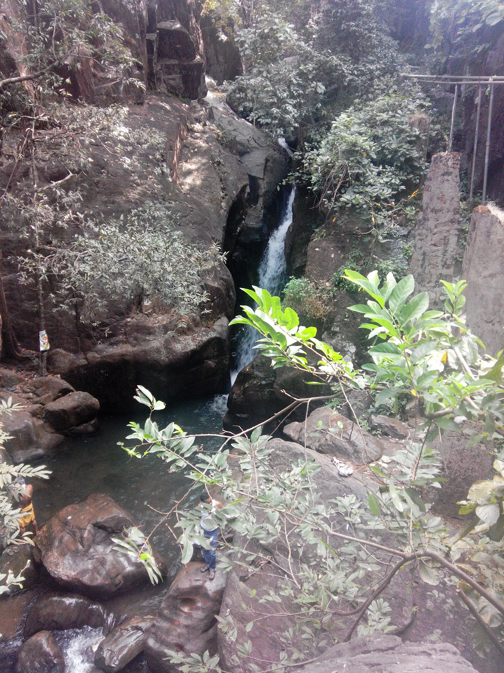
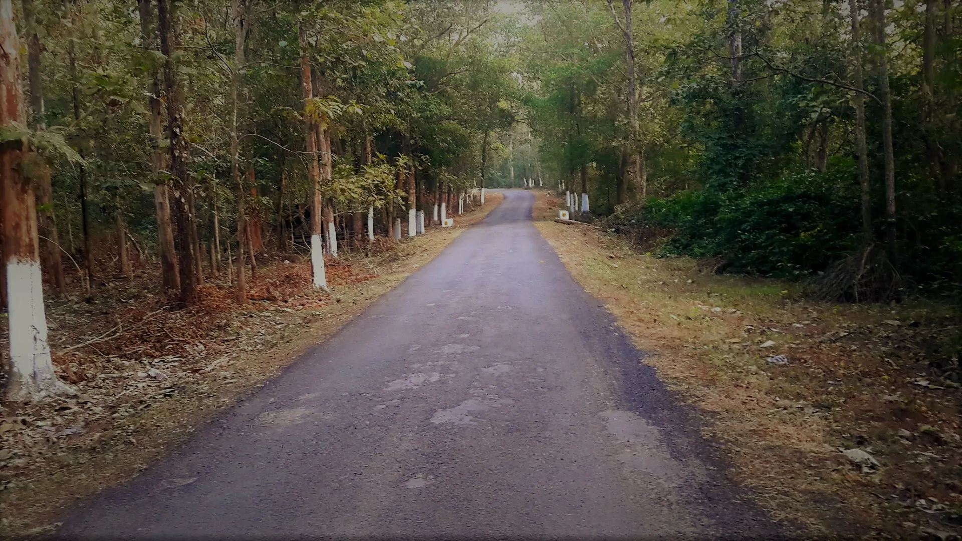
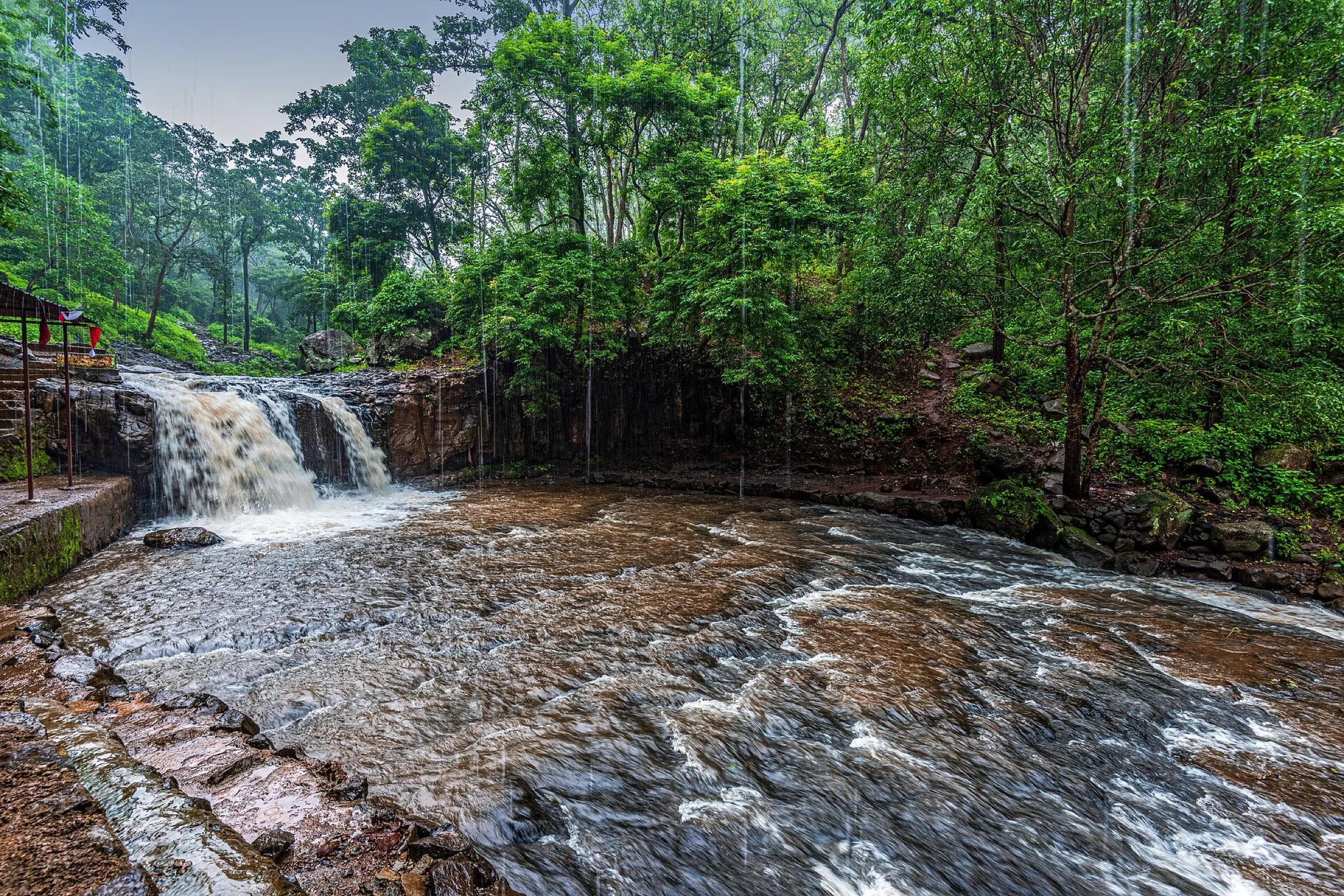
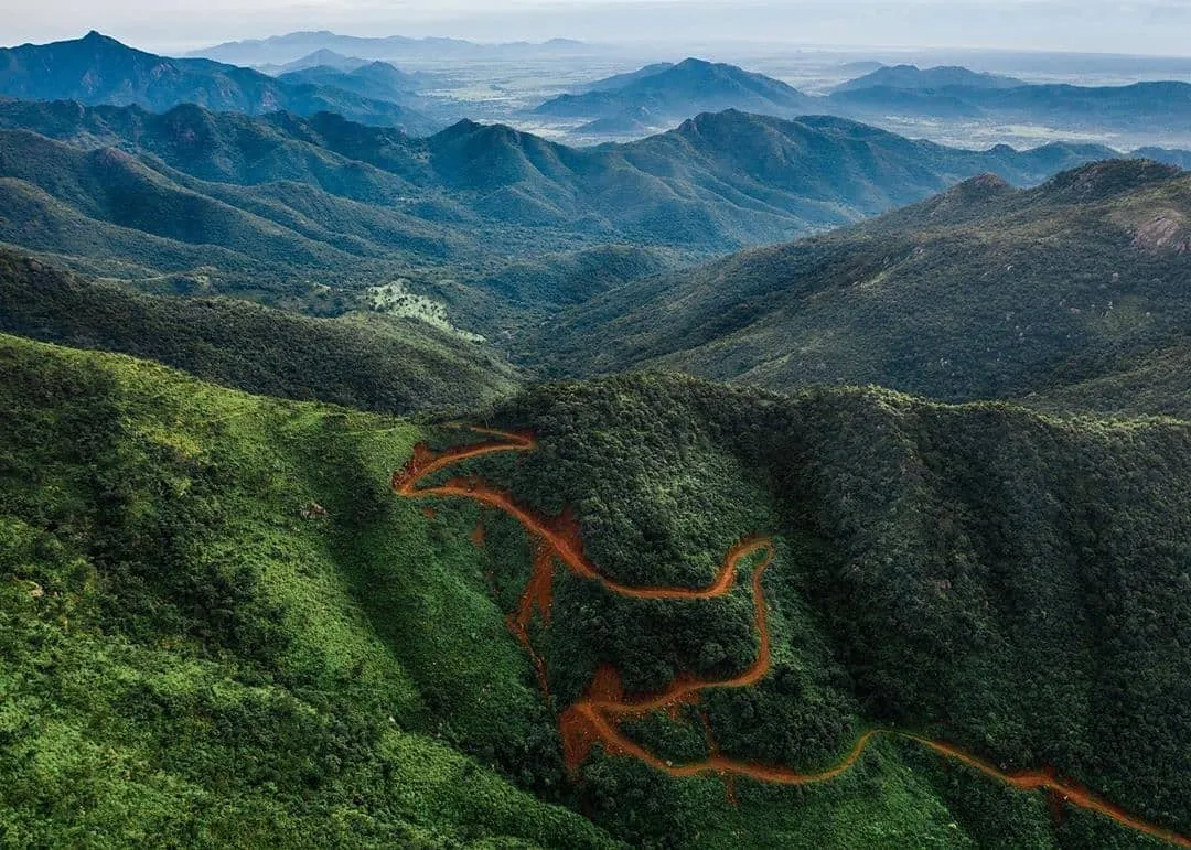
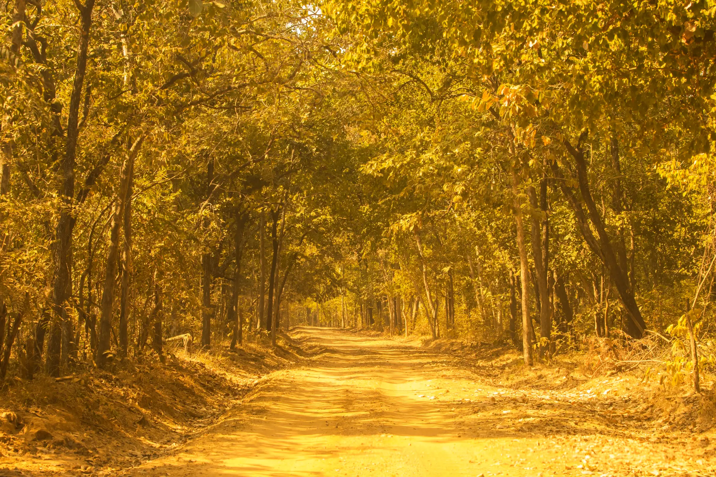
Debrigarh is a wildlife sanctuary of about 347 sq km beside the Hirakud reservoir in Bargarh district, Odisha. The walk follows a forest route of about 20 km from the Dhodrokusum forest office to Chaurasimal on low, nearly flat ground in mixed deciduous forest. A herd of gaur lives along the route, so a forest guard must go with you and you need permission at Dhodrokusum first. It suits fit walkers and wildlife watchers in the cooler months, November to April.
Photos
On the trail
The route
Day by day
Day 1 · highest point
Dhodrokusum → Chaurasimal
195 m → 208 m → 208 m
- Permission is taken at the Dhodrokusum forest office at the end of the Hirakud right dyke road, and a forest guard walks with you.
- The route is about 20 km of forest track through mixed deciduous forest, with the reservoir bounding the sanctuary on the north and east.
- Outlook Traveller names the resident gaur herd on this stretch; keep a safe distance and follow the guard's directions.
- The Zero Point halt on the dyke road shows forest on one side and the reservoir on the other, and winter brings migratory ducks.
Ups and downs
Altitude profile
Where it is
Map
Trailhead and high point only — not a recorded track. Use it with a proper map.
Weather
Next 5 days on the trail
Live forecast for the trailhead and the high point. Mountain weather changes fast — check again on the morning you start.
Trailhead · Dhodrokusum
at 195 mLoading forecast…
High point · Chaurasimal (on route; the exact high point is not mapped)
at 208 mLoading forecast…
Each day: high / low °C · rain mm and chance · snow cm · wind km/h
Weather data: Open-Meteo.comModel forecast, not an official warning. For alerts follow IMD and the local administration.
Plan the trip
How to reach
- Trailhead
- Dhodrokusum (nearest town: Sambalpur)
- Nearest railway
- Sambalpur
- Nearest airport
- Biju Patnaik International Airport, Bhubaneswar (about 280 km by road from Sambalpur)
- By road
- Sambalpur (about 35 km to the sanctuary entry gate, via the Hirakud right dyke road to the Dhodrokusum forest office)
- Drive
- About 6 h from Bhubaneswar
Plan the trip
Permits and fees
We could not confirm the current permit rules and fees from an official source. Check with the local forest department or tourism office before you go.
Plan the trip
Cost
Self-guided
₹1,500–4,000
With an operator
₹3,000–8,000
Per person, ex-Sambalpur. No operator price could be fetched (the Indiahikes page blocked us), so these are reasoned estimates only: a hired vehicle to Dhodrokusum shared by a group, forest entry and a mandatory forest guard, and a forest rest house or eco-cottage night. Confirm all fees with the Hirakud Wildlife Division, Sambalpur.
Gear
Top picks for this trek
The gear that matters most on this route, chosen from its altitude, season and risks.
 Ad · affiliate link
 Ad · affiliate link
 Ad · affiliate link
- Ad · affiliate link
 Ad · affiliate link
 Ad · affiliate link
 Ad · affiliate link
 Ad · affiliate link
Store buttons open a search on that store, not a product we picked. As an Amazon Associate we earn from qualifying purchases. Photos show the kind of item, not a specific product. Affiliate disclosure
Packing checklist
Matched to this trek: altitude, season, days and the risks on the route.
Packed 0 of 16
Hot days in Mar–Apr: start at first light and carry extra water and ORS.
Tick each item as it goes in the bag.
Know before you go
Good to know
- Mobile network
- Not confirmed; expect patchy or no mobile signal inside the sanctuary.
- Last ATM
- Sambalpur or Hirakud (not confirmed on the route)
- Nearest hospital
- Sambalpur (VIMSAR, Burla), about 35 km or more from the entry gate
- Water
- Not confirmed; carry all your water for a 20 km day.
Highlights
- A 20 km forest walk from Dhodrokusum to Chaurasimal beside the Hirakud reservoir, known for a resident herd of gaur
- Wildlife-rich Barapahad hills: cheetal, sambar, gaur, leopard and over 200 bird species recorded in the sanctuary
- Winter waterfowl on the reservoir, and forest rest houses at Dhodrokusum and Dechua
Risks
- Wild gaur use the route; a forest guard must accompany you and you should keep a safe distance and stay cautious.
- Entry needs permission from the Dhodrokusum forest office; walking without it is not allowed.
- One report gave a closure over the monsoon (mid-June to end-October); we could not confirm this on an official page, so check dates with the Hirakud Wildlife Division before planning.
- Summer heat is severe on this low ground; the altitude and route timings here are unverified estimates.
Know before you go
Questions
How long is the Debrigarh trek?
Outlook Traveller describes about 20 km of forest trekking from Dhodrokusum to Chaurasimal. The Odisha forest department lists the Dhodrokusum-Chaurasimal forest road at about 21 km.
Do I need permission to trek in Debrigarh?
Yes. Permission is required from the Dhodrokusum forest office at the end of the dyke road, and a forest guard must accompany walkers. Bookings for rooms go through the DFO, Hirakud Wildlife Division, Sambalpur.
When is the best time to visit Debrigarh?
Odishabytes gives November to April as the best time. Winter also brings migratory ducks to the Hirakud reservoir. Confirm any monsoon closure with the forest division.
How do I reach Debrigarh from Sambalpur?
Take the right dyke road from Hirakud Dam, about 20 km north of Sambalpur, to the Dhodrokusum forest office; the sanctuary entry gate is about 35 km from town. Sambalpur has rail links to Kolkata and Bhubaneswar.
In an emergency
Save these numbers before you lose signal. Tap to call.
- 112All emergenciesIndia’s single emergency number — works in every state
- 108Ambulance
- 1077District disaster control room
You are in
District: BargarhOdisha
- Nearest hospital
- Sambalpur (VIMSAR, Burla), about 35 km or more from the entry gate
- Last ATM
- Sambalpur or Hirakud (not confirmed on the route)
- Phone network
- Not confirmed; expect patchy or no mobile signal inside the sanctuary.
Before you set off
- Tell someone your route and when you will be back.
- Carry a charged phone and a power bank.
- Download an offline map of the route.
- Turn back if the weather turns bad — the mountain will wait.
Questions about Debrigarh Sanctuary
No questions yet. Ask something and trekkers who have done it can answer.
Share your trek photo with #TreksAndTrails
I trekked this
Did Debrigarh Sanctuary look different from this page? Tell us what changed and we will check it.
Where this comes from
Sources
Last reviewed:
- Odisha's Green Secret: Debrigarh Wildlife Sanctuary — Outlook Traveller
- Sambalpur — Wikivoyage
- Paradise comes visiting Debrigarh Wildlife Sanctuary in Odisha — OdishaBytes
- Debrigarh Wildlife Sanctuary — Wikipedia
Photos: Amudha Har (via Flickr), CC BY-SA 2.0; Tofan1988, CC BY-SA 4.0; Manas Nayak, CC BY-SA 4.0