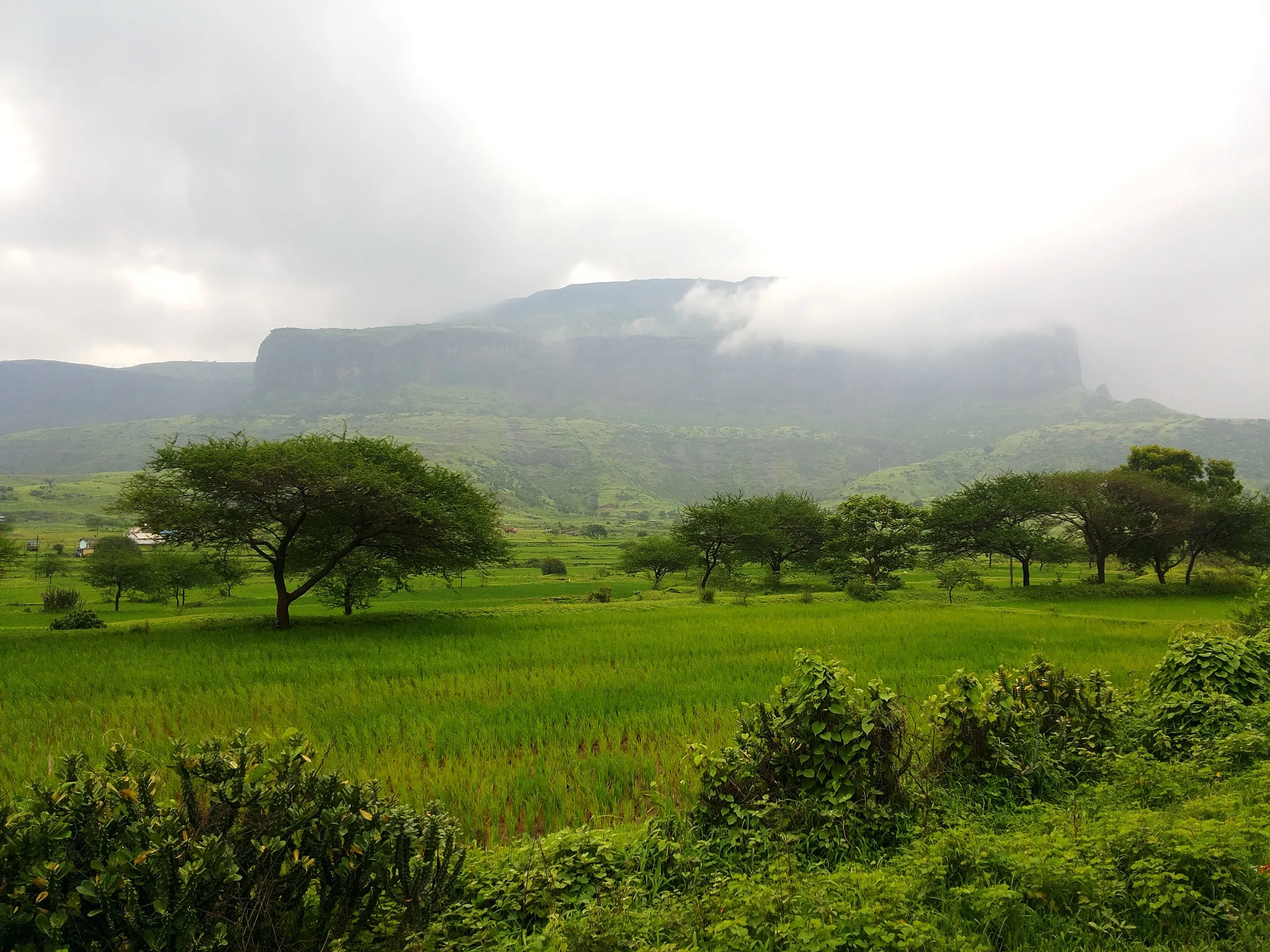
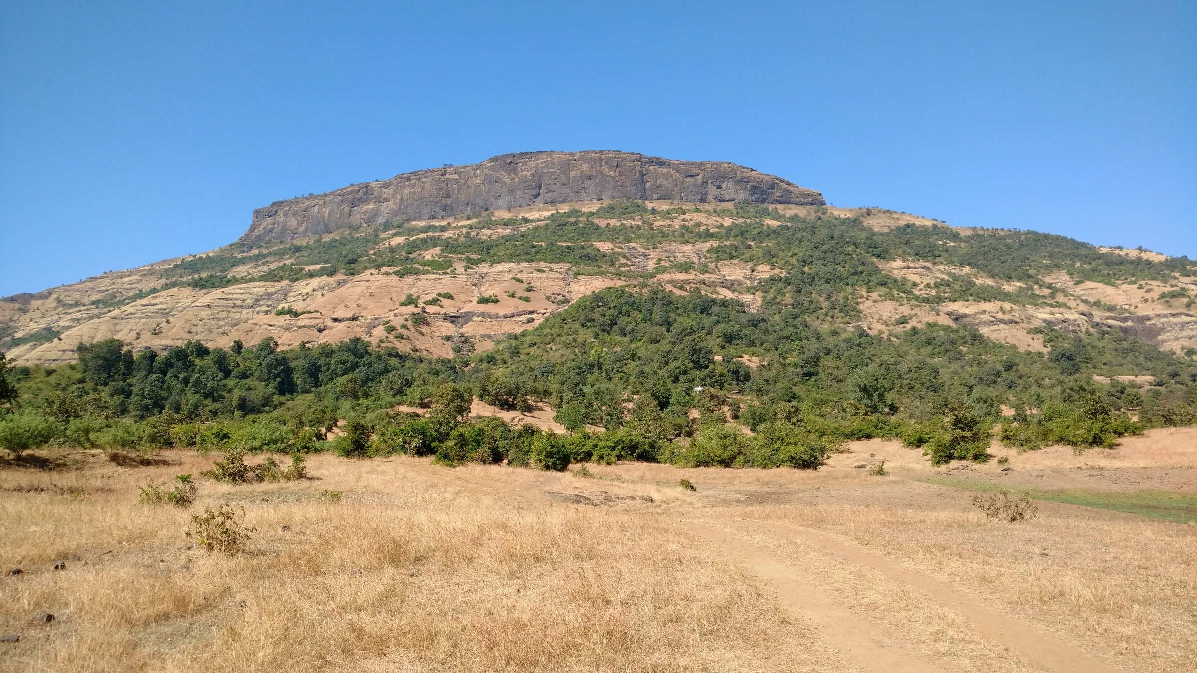
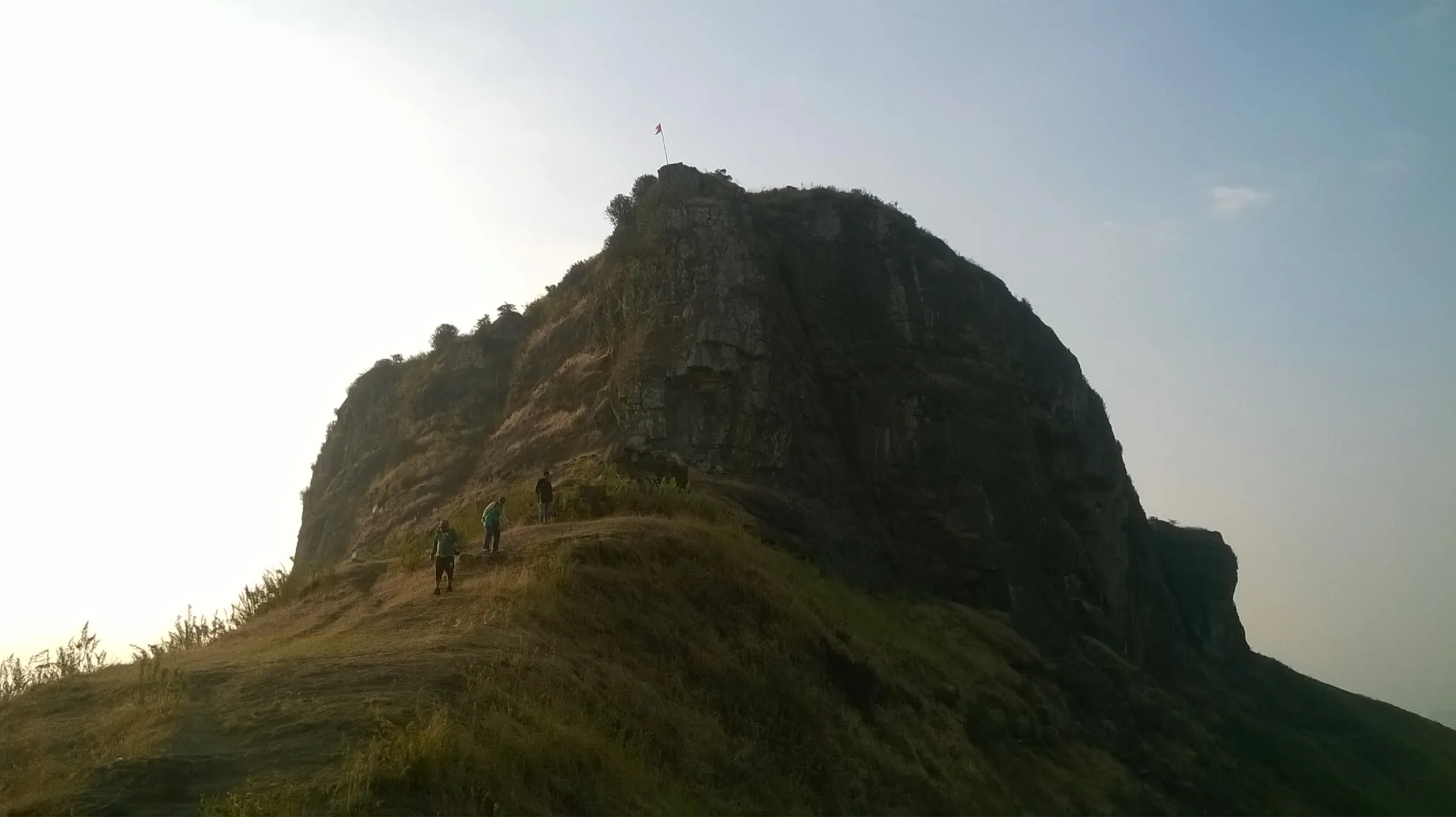
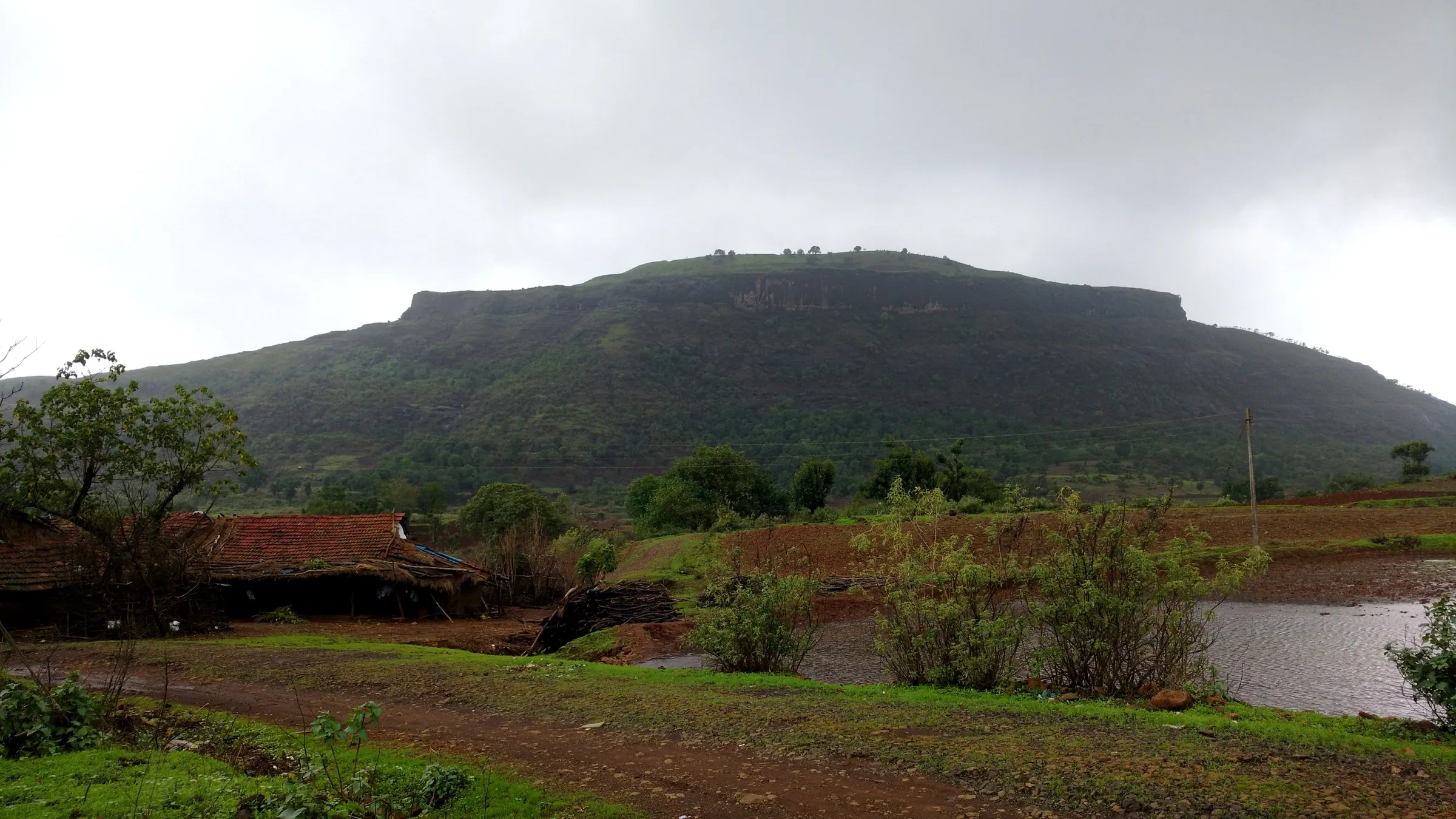
Brahmagiri Trimbakeshwar Trek
Nashik, Maharashtra
Opens without signal on this phone, with the map file and checklist. Saved for offline →
- Max altitude
- 1,295 m
- Days
- 1 day
- Distance
- 8 km
- Difficulty
- Moderate
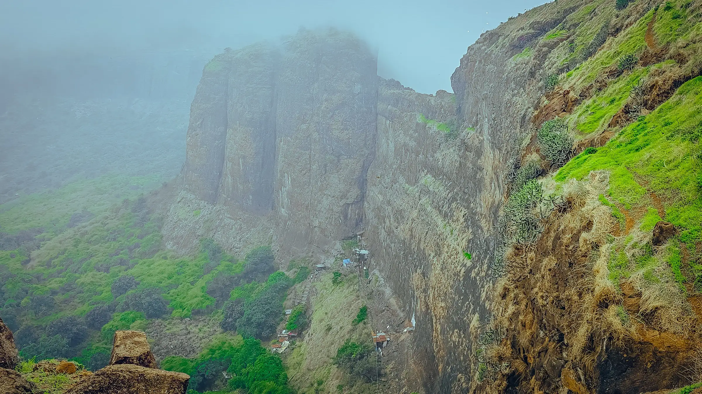
About 750 steep stone steps climb some 500 m from Trimbakeshwar to the top in 1-2 hours; the optional Bhandardurg extension drops about 55 steps into a deep trench, needs crawling through two half-buried doorways and crosses a narrow natural rock wall with drops on both sides.
Photos
On the trail
The route
Day by day
Day 1 · highest point
Trimbakeshwar → Trimbakeshwar (via Gangadwar, Brahmagiri top, Jatamandir and Bhandardurg)
750 m → 1,295 m → 750 m
Ups and downs
Altitude profile
Where it is
Map
Trailhead and high point only — not a recorded track. Use it with a proper map.
Weather
Next 5 days on the trail
Live forecast for the trailhead and the high point. Mountain weather changes fast — check again on the morning you start.
Trailhead · Trimbakeshwar
at 750 mLoading forecast…
High point · Brahmagiri top (Trimbakgad)
at 1,295 mLoading forecast…
Each day: high / low °C · rain mm and chance · snow cm · wind km/h
Weather data: Open-Meteo.comModel forecast, not an official warning. For alerts follow IMD and the local administration.
Plan the trip
How to reach
- Trailhead
- Trimbakeshwar
- Nearest railway
- Nashik Road (about 40 km); Igatpuri on the Mumbai side
- Nearest airport
- Nashik (Ozar) Airport; Chhatrapati Shivaji Maharaj International Airport, Mumbai, for most flights
- By road
- Nashik (about 30 km; state buses and shared jeeps run to Trimbakeshwar); Mumbai (about 180 km via the Mumbai-Nashik highway and Igatpuri)
- Drive
- About 1 h from Nashik
Plan the trip
Permits and fees
We could not confirm the current permit rules and fees from an official source. Check with the local forest department or tourism office before you go.
Plan the trip
Cost
Self-guided
₹150–600
With an operator
₹650–1,000
Per person, ex-Nashik. Guided: Thrillophilia lists a 14-hour Brahmagiri Trek Nashik at ₹650 (marked down from ₹1,000), seen October 2026; we found no second operator price. Self-guided is an estimate: state bus or shared jeep Nashik-Trimbakeshwar and back, plus breakfast and snacks at the stalls at the base. Travel pages say there is no entry fee, but check locally.
Gear
Top picks for this trek
The gear that matters most on this route, chosen from its altitude, season and risks.
 Ad · affiliate link
 Ad · affiliate link
 Ad · affiliate link
 Ad · affiliate link
 Ad · affiliate link
- Ad · affiliate link
 Ad · affiliate link
 Ad · affiliate link
Store buttons open a search on that store, not a product we picked. As an Amazon Associate we earn from qualifying purchases. Photos show the kind of item, not a specific product. Affiliate disclosure
Packing checklist
Matched to this trek: altitude, season, days and the risks on the route.
Packed 0 of 22
Monsoon months (Jun–Sep): pack everything in plastic or a dry bag and wear shoes with good grip.
Tick each item as it goes in the bag.
Know before you go
Good to know
- Mobile network
- Not documented by our sources. Trimbakeshwar is a busy pilgrim town; check coverage on the hill before relying on it.
- Last ATM
- Trimbakeshwar town (not confirmed by our sources); carry cash for the stalls at the base.
- Nearest hospital
- Not confirmed for Trimbakeshwar by our sources; Nashik city, about 30 km away, for serious cases.
- Water
- No water or food facilities on the forts, so carry water from Trimbakeshwar. Durgbharari notes two rock-cut cisterns on top, one with drinkable water; treat any water you take from them.
Highlights
- Darshan at Gangadwar, where Maa Godavari emerges as a small spring from a gomukh at the shrine of Maa Ganga, with the Gorakshanath caves and 108 Swayambhu Mahadev shrines nearby
- The Jatamandir (Shiv Jata Mandir) on top of Brahmagiri, the sacred source of Maa Godavari linked to Gautam Rishi's tapasya
- Views over Trimbakeshwar Jyotirlinga, the town and the ridges to Harihar, Anjaneri and Tringalwadi
- Optional crossing to Bhandardurg fort over a narrow natural rock wall, through a rock-cut trench and half-buried doorways
- Stone steps built in 1908 by two merchants, Seth Lalchand Jashodanand Bhambhani and Seth Ganeshdas
Risks
- The stone steps are steep and become very slippery in monsoon rain and fog; wear shoes with good grip.
- The Bhandardurg extension crosses a natural rock wall about 8-10 ft wide with steep drops on both sides, and needs crawling through two half-buried doorways; skip it in strong wind, rain or with children.
- In June 2026 the Nashik forest division (Deputy Conservator of Forests) declared Brahmagiri an alcohol-free zone, banned selfies, photos and reels near forts and waterfalls in the Trimbakeshwar area, and said tourist spots can be closed without prior notice during heavy rain. Harihar Fort nearby was shut 'until further notice' on 19 August 2026. No closure of Brahmagiri was found, but check with the Trimbakeshwar forest range before a monsoon visit.
- Large troops of monkeys on the route snatch food and bottles; keep them inside your bag.
- Crowds are heavy on festival days and around the Simhastha Kumbh Mela at Trimbakeshwar; start early.
Know before you go
Questions
Is Brahmagiri open in the 2026 monsoon?
We found no order closing Brahmagiri. A June 2026 forest department order made Brahmagiri an alcohol-free zone, banned photos and reels near forts and waterfalls around Trimbakeshwar, and allows closures without notice in heavy rain. Neighbouring Harihar Fort was closed on 19 August 2026, so check locally before you go.
How many steps are there to Brahmagiri, and how long does the climb take?
Trip reports count about 750 stone steps. Wikipedia gives about 45 minutes from the base to Gangadwar and the Gorakshanath caves, and about 45 minutes more to the top. A September 2025 trip report covering Gomukh, Jatamandir and Bhandardurg took from 7:15 am to 2 pm.
Where is the source of the Godavari on Brahmagiri?
The Godavari is honoured as Maa Ganga coming down on Brahmagiri. The Shiva Purana tells how Gautam Rishi did tapasya here and Bhagwan Shiva released Ganga as the Godavari, then stayed at the foot of the hill as Trimbakeshwar Jyotirlinga. Pilgrims take darshan at Gangadwar, where the water flows from a gomukh, and at the Jatamandir on top.
Is the Brahmagiri trek suitable for beginners?
Trip reports call the main climb beginner-friendly because it is on steps, though steep and slippery in rain. The Bhandardurg extension, with its trench, crawl-through doorways and narrow rock wall, is harder and best left to confident walkers.
How high is Brahmagiri?
Most sources give 1,295 m (4,248 ft). Trimbakeshwar town sits at about 750 m, so you climb roughly 500 m. Trekupindia gives 1,294 m for Trimbakgad on top.
In an emergency
Save these numbers before you lose signal. Tap to call.
- 112All emergenciesIndia’s single emergency number — works in every state
- 108Ambulance
- 1077District disaster control room
You are in
District: NashikMaharashtra
- Nearest hospital
- Not confirmed for Trimbakeshwar by our sources; Nashik city, about 30 km away, for serious cases.
- Last ATM
- Trimbakeshwar town (not confirmed by our sources); carry cash for the stalls at the base.
- Phone network
- Not documented by our sources. Trimbakeshwar is a busy pilgrim town; check coverage on the hill before relying on it.
Before you set off
- Tell someone your route and when you will be back.
- Carry a charged phone and a power bank.
- Download an offline map of the route.
- Turn back if the weather turns bad — the mountain will wait.
Questions about Brahmagiri Trimbakeshwar
No questions yet. Ask something and trekkers who have done it can answer.
Share your trek photo with #TreksAndTrails
I trekked this
Did Brahmagiri Trimbakeshwar look different from this page? Tell us what changed and we will check it.
Where this comes from
Sources
Last reviewed:
- Brahmagiri (Maharashtra) — Wikipedia
- Trymbakgad — Wikipedia
- Brahmagiri and Bhandardurg trek, Nashik (updated 12 September 2025) — Urban Chats
- Monsoon Treks Nashik: Spiritual & Historical Journey on Brahmagiri (3 July 2025) — Inditales
- Brahmagiri Range Trek — Trekupindia
- Brahmagiri Fort: Your Complete Guide To The Scenic Trekking Spot — TripXL
- Durgbhandar — Durgbharari
- Brahmagiri Trek, Nashik — Thrillophilia
- Nashik: Restrictions at tourist spots following heavy rain; Harihar Fort limited to 300 visitors daily (24 June 2026) — Free Press Journal
- Nashik: Harihar Fort shut until further notice due to adverse weather, safety risks (20 August 2026) — Free Press Journal
Photos: Dhanwantpatil1699, CC BY 4.0; Bramhesh Patil, CC BY-SA 4.0; Dhanwantpatil1699, CC BY 4.0; Ketankale, CC BY-SA 4.0