Bhaskargad Trek
Nashik, Maharashtra
Opens without signal on this phone, with the map file and checklist. Saved for offline →
- Max altitude
- 1,089 m
- Days
- 1 day
- Distance
- 6 km
- Difficulty
- Moderate
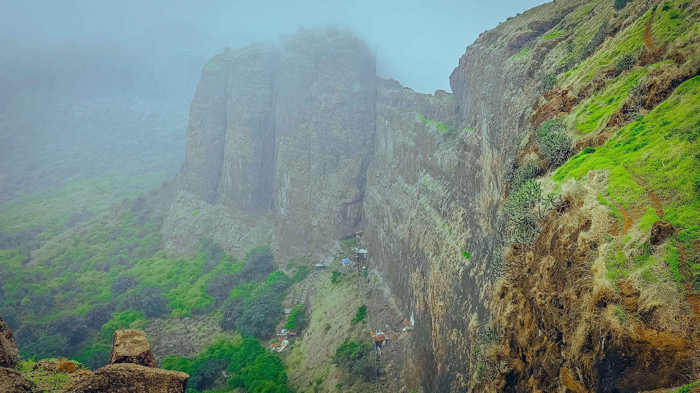
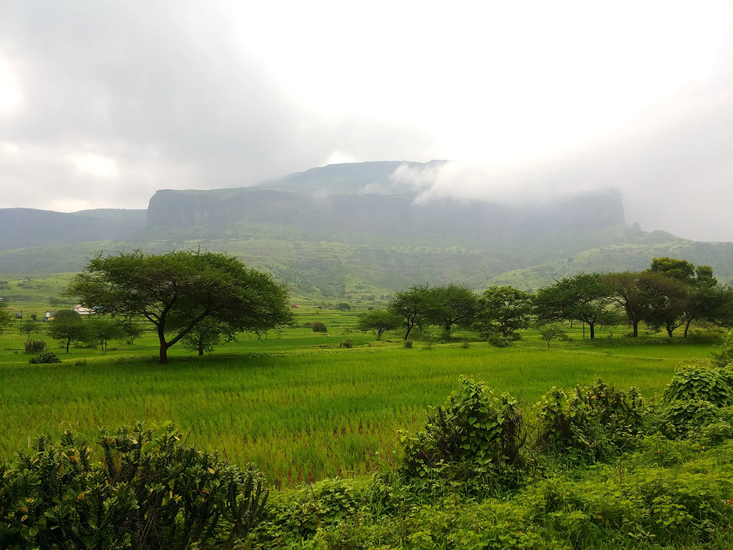
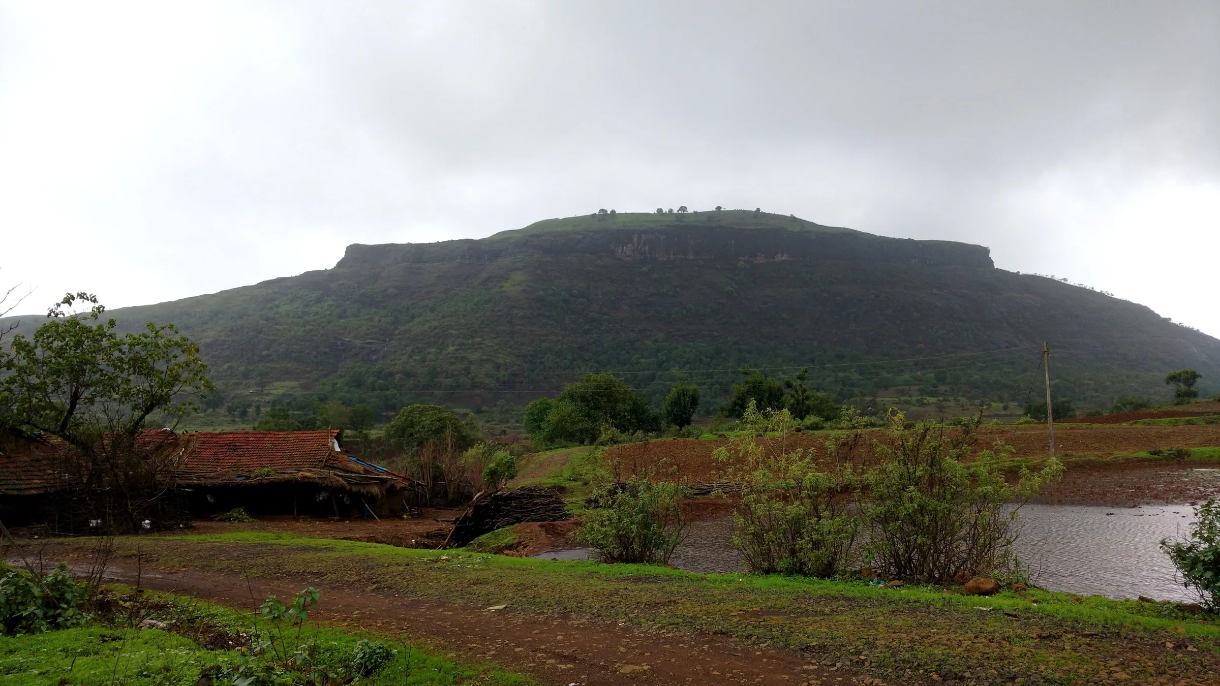
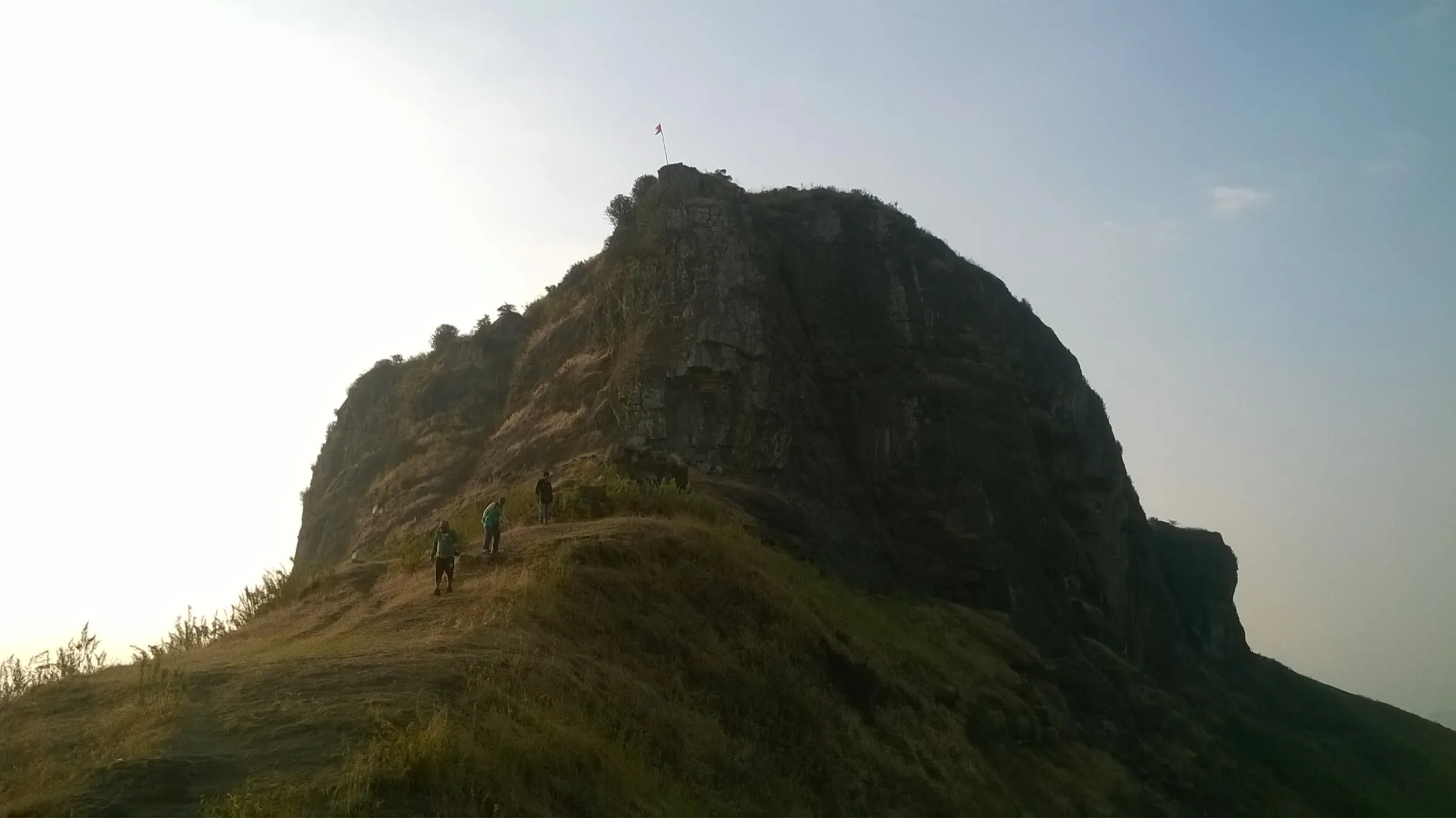
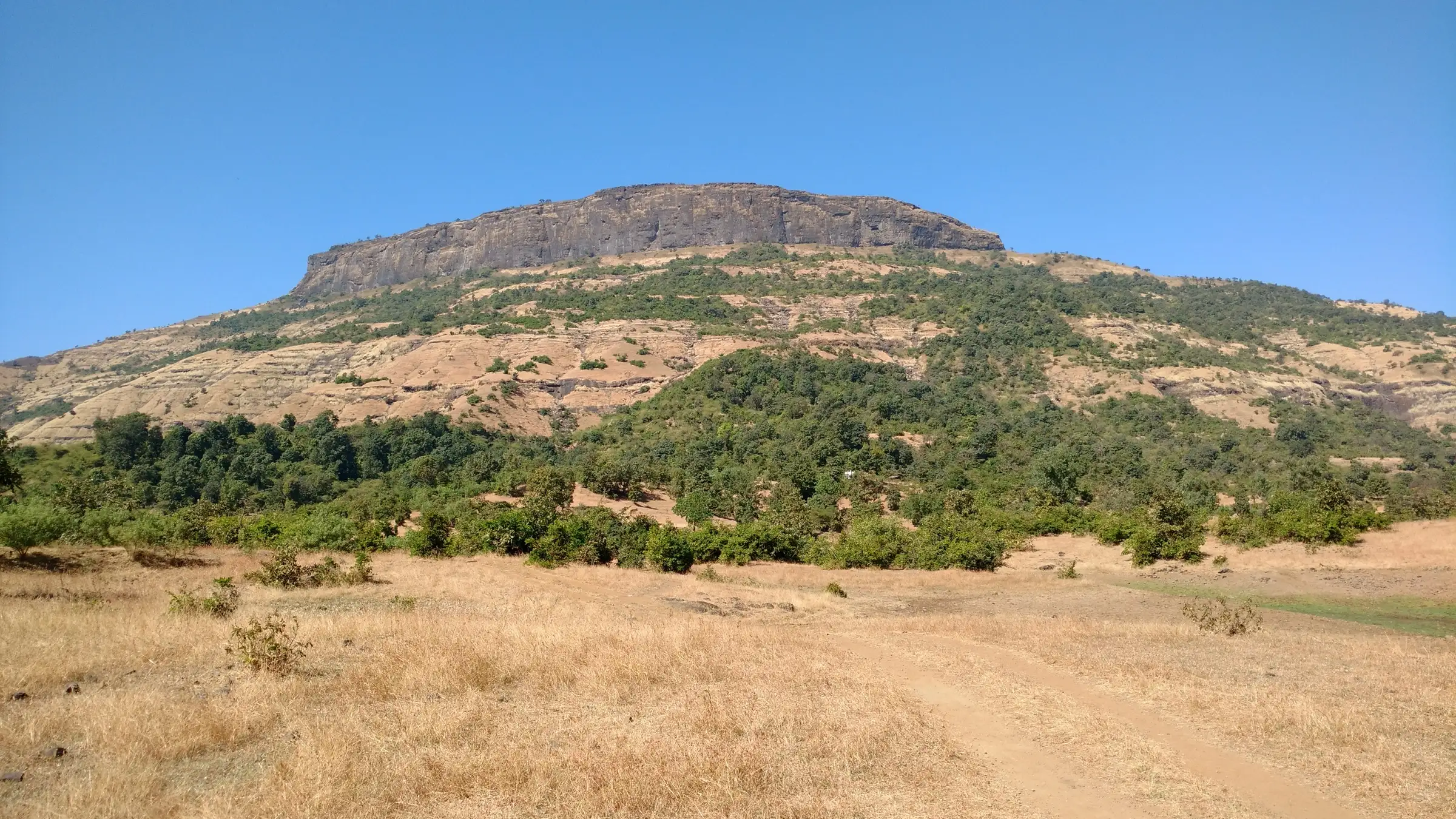
A steady climb of roughly 450 m through scrub and Karvi to the scarp, then a long traverse under the rock wall and rock-cut steps partly buried in fallen debris; Durgbharari grades it medium, while a trip report calls it simple but needing good stamina.
Photos
On the trail
The route
Day by day
Day 1 · highest point
Nirgudpada → Nirgudpada
620 m → 1,089 m → 620 m
Ups and downs
Altitude profile
Where it is
Map
Trailhead and high point only — not a recorded track. Use it with a proper map.
Weather
Next 5 days on the trail
Live forecast for the trailhead and the high point. Mountain weather changes fast — check again on the morning you start.
Trailhead · Nirgudpada (Dahalepada)
at 620 mLoading forecast…
High point · Bhaskargad top
at 1,089 mLoading forecast…
Each day: high / low °C · rain mm and chance · snow cm · wind km/h
Weather data: Open-Meteo.comModel forecast, not an official warning. For alerts follow IMD and the local administration.
Plan the trip
How to reach
- Trailhead
- Nirgudpada (Dahalepada) (nearest town: Trimbakeshwar)
- Nearest railway
- Igatpuri (Kasara also used via Khodala)
- Nearest airport
- Nashik (Ozar) Airport; Mumbai for most trekkers
- By road
- Nashik (about 41 km via Trimbakeshwar); Mumbai (about 170 km via the Mumbai–Nashik highway and Ghoti); Igatpuri / Ghoti (bus towards Trimbakeshwar, or shared jeep from Ghoti bus stand, getting off at Nirgudpada)
- Drive
- About 4.5 h from Mumbai
Plan the trip
Permits and fees
We could not confirm the current permit rules and fees from an official source. Check with the local forest department or tourism office before you go.
Plan the trip
Cost
Self-guided
₹500–1,500
With an operator
₹1,299
Guided price is one operator's published one-day package ex-Mumbai (Treks and Trails, ₹1,299 incl. overnight bus); we found no second current operator price. Self-guided estimate ex-Mumbai: local train to Kasara or Igatpuri, shared jeep/bus to Nirgudpada (a trip report quotes ₹50 for the Kasara–Khodala jeep), plus food; a private taxi costs more.
Gear
Top picks for this trek
The gear that matters most on this route, chosen from its altitude, season and risks.
 Ad · affiliate link
 Ad · affiliate link
 Ad · affiliate link
 Ad · affiliate link
 Ad · affiliate link
 Ad · affiliate link
- Ad · affiliate link
 Ad · affiliate link
Store buttons open a search on that store, not a product we picked. As an Amazon Associate we earn from qualifying purchases. Photos show the kind of item, not a specific product. Affiliate disclosure
Packing checklist
Matched to this trek: altitude, season, days and the risks on the route.
Packed 0 of 17
Tick each item as it goes in the bag.
Know before you go
Good to know
- Mobile network
- Not confirmed by our sources; expect patchy mobile signal in the village and on the hill.
- Last ATM
- Trimbakeshwar or Igatpuri/Ghoti (none reported in Nirgudpada)
- Nearest hospital
- Trimbakeshwar (roughly 15 km by road); larger hospitals in Nashik
- Water
- None reliable on the route. Rock-cut cisterns on top may hold monsoon water (one has been cleaned by volunteers), but sources advise carrying all drinking water.
Highlights
- Rock-cut stairs winding up through a cleft in the scarp to a half-buried carved main gate
- Rock-hewn water cisterns and a small idol of Veer Maruti (Bhagwan Hanuman) on top
- Close views of neighbouring Harihar, Utwad and the Trimbakeshwar range
- A quiet, offbeat fort that shares its base village with Harihar
Risks
- Rock-cut steps are partly blocked by fallen stones and rampart debris; footing is loose and the gate must be entered stooping.
- Sections under the overhanging scarp and along the exposed ridge become slippery in the monsoon.
- No drinking water, food or shelter on the fort or along the route; carry enough for the whole day.
- Monsoon 2026: the Nashik West forest division restricted tourist spots in the Trimbakeshwar forest area (selfie/reel ban near forts, alcohol ban, right to close spots without notice), and neighbouring Harihar was closed by a Forest Range Officer order of 19 Aug 2026. Bhaskargad was not named in either order — check with the Trimbakeshwar forest range office before going.
Know before you go
Questions
Is Bhaskargad closed like Harihar Fort?
The August 2026 Trimbakeshwar Forest Range order reported by the Free Press Journal names only Harihar Fort, and the June 2026 Nashik West division rules name Harihar, Brahmagiri and nearby waterfalls, not Bhaskargad. The administration can close tourist spots without notice, so confirm locally before you go.
Which is the base village for Bhaskargad?
Nirgudpada, the same village used for Harihar; Wikipedia and one operator name its hamlet Dahalepada (Dahalewadi), from where the trail starts on a hillock south of the village.
How long does the Bhaskargad climb take?
About an hour to the scarp and 15–20 minutes more up the rock-cut steps; Durgbharari puts the village-to-top time at about 2.5 hours, and a trip report took about 90 minutes. Allow 30 minutes to 2 hours to see the fort.
Can Bhaskargad and Harihar be done on the same day?
Yes when both are open — a trip report climbed Basgad in the morning and Harihar in the afternoon from the same base village. Harihar is currently closed by a forest order, so check first.
Is there water on Bhaskargad?
Not reliably. There are several rock-cut cisterns, and one has been cleaned to hold monsoon water, but sources say to carry enough drinking water.
In an emergency
Save these numbers before you lose signal. Tap to call.
- 112All emergenciesIndia’s single emergency number — works in every state
- 108Ambulance
- 1077District disaster control room
You are in
District: NashikMaharashtra
- Nearest hospital
- Trimbakeshwar (roughly 15 km by road); larger hospitals in Nashik
- Last ATM
- Trimbakeshwar or Igatpuri/Ghoti (none reported in Nirgudpada)
- Phone network
- Not confirmed by our sources; expect patchy mobile signal in the village and on the hill.
Before you set off
- Tell someone your route and when you will be back.
- Carry a charged phone and a power bank.
- Download an offline map of the route.
- Turn back if the weather turns bad — the mountain will wait.
Questions about Bhaskargad
No questions yet. Ask something and trekkers who have done it can answer.
Share your trek photo with #TreksAndTrails
I trekked this
Did Bhaskargad look different from this page? Tell us what changed and we will check it.
Where this comes from
Sources
Last reviewed:
- Bhaskargad — Wikipedia
- Basgad / Bhaskargad — Durgbharari
- Basgad Bhaskargad trek blog — The Free Bird
- Bhaskargad Fort Trek — Treks and Trails India
- Nashik: Harihar Fort Shut Until Further Notice Due To Adverse Weather, Safety Risks — Free Press Journal
- Nashik: Tourist Entry Restricted at Trimbakeshwar Spots Amid Heavy Rain; Only 300 Allowed At Harihar Fort Daily — Free Press Journal
Photos: Ccmarathe, CC BY-SA 4.0; Ccmarathe, CC BY-SA 4.0; Wind Hashira, CC BY-SA 4.0