Anjaneri Trek
Nashik, Maharashtra
Opens without signal on this phone, with the map file and checklist. Saved for offline →
- Max altitude
- 1,300 m
- Days
- 1 day
- Distance
- 5.4 km
- Difficulty
- Easy
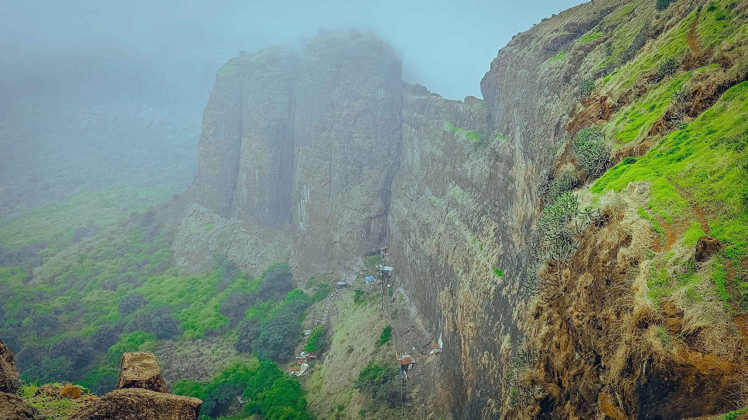
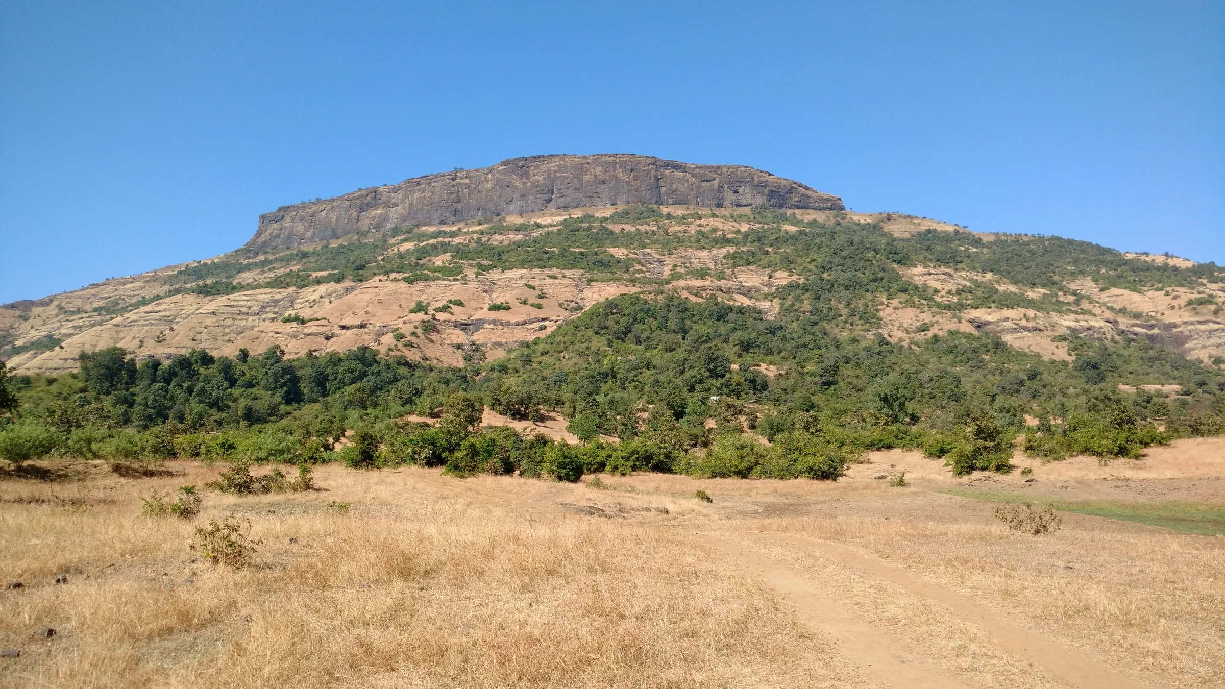
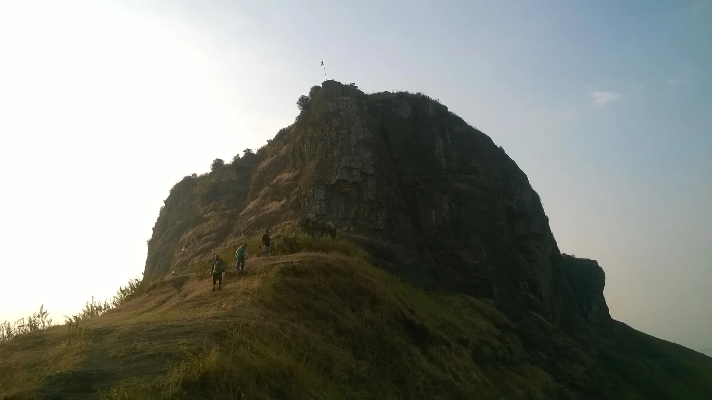
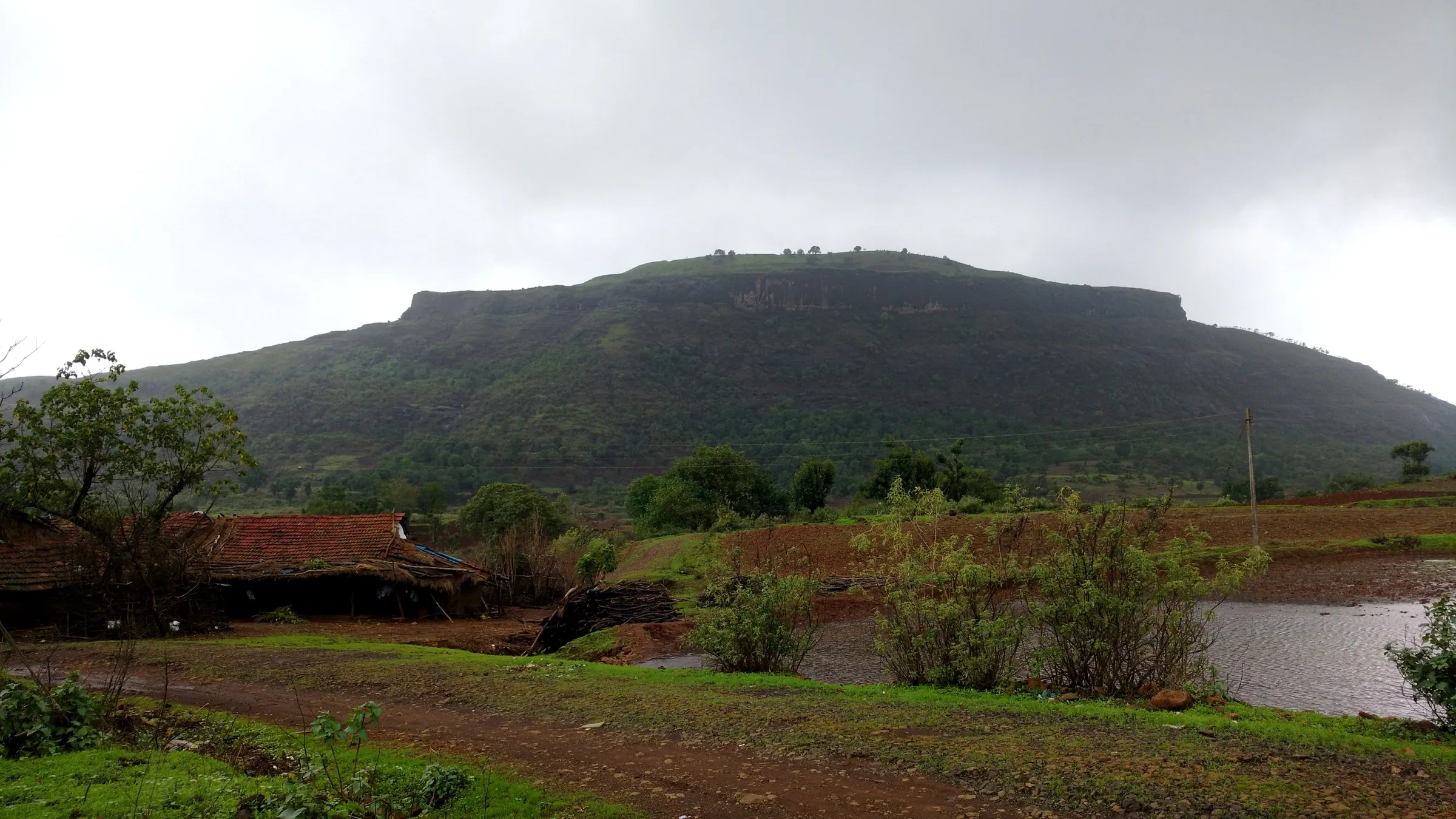
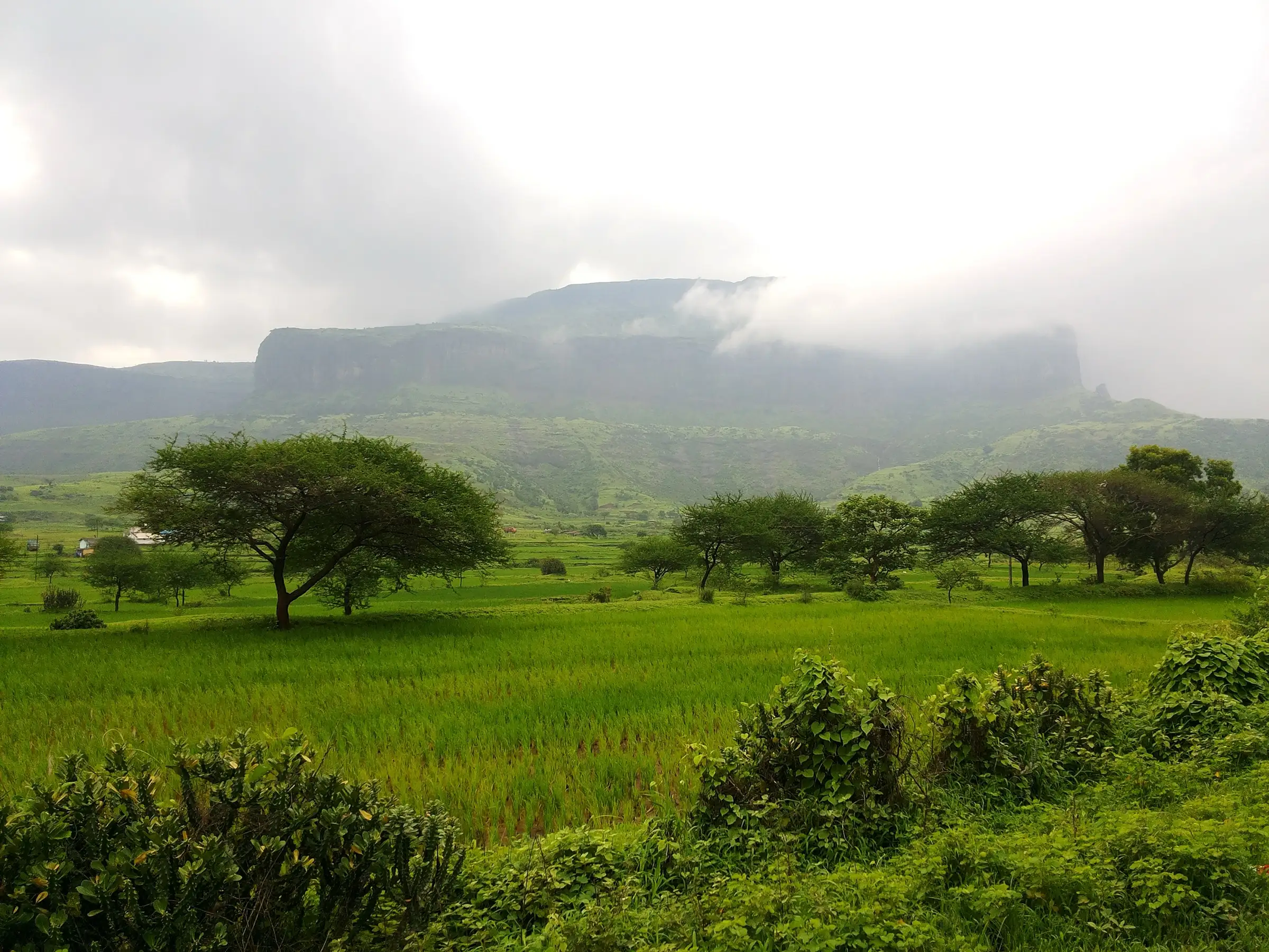
A short day climb of about 400 m on rock-cut steps, a boulder section and a forest path to the plateau. Dry, it suits a fit beginner; in monsoon the boulders and mossy forest steps turn slippery and operators rate it moderate.
Photos
On the trail
The route
Day by day
Day 1 · highest point
Anjaneri forest checkpost → Anjaneri forest checkpost (via Anjani Mata temple and the Hanuman temple on top)
886 m → 1,300 m → 886 m
Ups and downs
Altitude profile
Where it is
Map
Trailhead and high point only — not a recorded track. Use it with a proper map.
Weather
Next 5 days on the trail
Live forecast for the trailhead and the high point. Mountain weather changes fast — check again on the morning you start.
Trailhead · Anjaneri forest checkpost (Anjaneri village)
at 886 mLoading forecast…
High point · Anjaneri Fort top (Hanuman temple)
at 1,300 mLoading forecast…
Each day: high / low °C · rain mm and chance · snow cm · wind km/h
Weather data: Open-Meteo.comModel forecast, not an official warning. For alerts follow IMD and the local administration.
Plan the trip
How to reach
- Trailhead
- Anjaneri forest checkpost (Anjaneri village) (nearest town: Trimbakeshwar)
- Nearest railway
- Nashik Road
- Nearest airport
- Nashik (Ozar); Mumbai for most flights
- By road
- Nashik (about 20 km on the Nashik–Trimbakeshwar road; turn at Anjaneri Phata); Trimbakeshwar (about 6 km towards Nashik); Mumbai (about 180 km via the Mumbai–Agra highway and Nashik, or by train to Kasara and a hired jeep)
- Drive
- About 4 h from Mumbai
Plan the trip
Permits and fees
We could not confirm the current permit rules and fees from an official source. Check with the local forest department or tourism office before you go.
Plan the trip
Cost
Self-guided
₹300–1,000
With an operator
₹999–1,499
Per person. Guided: Treks and Trails India (treksandtrails.org) lists ₹999 without transport and ₹1,499 with an overnight non-AC bus ex-Mumbai (breakfast and trek leader included); its night-trek listings ex-Kasara show ₹1,100–1,200. We found only this one operator's published price. Self-guided is an estimate ex-Nashik: a state bus to Anjaneri (Indiahikes quotes about ₹30 each way), the forest entry fee at the checkpost, and snacks from the shops on the trail; a hired jeep from Kasara costs about ₹700 more.
Gear
Top picks for this trek
The gear that matters most on this route, chosen from its altitude, season and risks.
 Ad · affiliate link
 Ad · affiliate link
 Ad · affiliate link
 Ad · affiliate link
 Ad · affiliate link
- Ad · affiliate link
 Ad · affiliate link
 Ad · affiliate link
Store buttons open a search on that store, not a product we picked. As an Amazon Associate we earn from qualifying purchases. Photos show the kind of item, not a specific product. Affiliate disclosure
Packing checklist
Matched to this trek: altitude, season, days and the risks on the route.
Packed 0 of 23
Monsoon months (Sep): pack everything in plastic or a dry bag and wear shoes with good grip.
Tick each item as it goes in the bag.
Know before you go
Good to know
- Mobile network
- Not documented by our sources. The base sits on the busy Nashik–Trimbakeshwar road; check coverage on the plateau before relying on it.
- Last ATM
- Not confirmed for Anjaneri village; Nashik and Trimbakeshwar have banks and ATMs, so carry cash for the entry fee and trail shops.
- Nearest hospital
- Jupiter Multi-Speciality Hospital, MIDC Ambad, Nashik, about 18 km from Anjaneri village (Indiahikes).
- Water
- No potable water source on the trail. Carry at least 2 litres from the base; the few shops on the trail may sell water. The lakes on the plateau are the village's drinking water: do not swim or wash in them.
Highlights
- Darshan at the temple of Mata Anjani, where she performed tapas, and at the Hanuman temple on top, where Shri Hanuman is worshipped in his Bal (child) form at his janmasthan
- A wide plateau meadow of about 4 km that blooms with wildflowers after the monsoon, including the Cape York Lily
- The foot-shaped lake below the summit, seen whole from the top, with Anjaneri Lake beyond it
- Views from the top across to Brahmagiri above Trimbakeshwar and the Godavari dam
- Rock-cut Jain caves and temple remains on the lower trail; the hill is also the Anjaneri Conservation Reserve, notified in 2017 for vultures
Risks
- The boulder section and the rock-cut steps in the forest become very slippery in the monsoon from moss and running water; wear shoes with good grip and descend carefully.
- In heavy rain the forest department restricts entry at its discretion; on 21 July 2024 more than 250 trekkers were caught on the plateau in heavy rain and walked down by forest staff (StayVista).
- Many monkeys on the trail snatch food; keep food covered and do not react to them.
- Exposed cliff edges on the plateau; photography at the edges is prohibited.
- Peak summer is hot and exposed with little shade on the meadow; start early and carry enough water.
Know before you go
Questions
Why is Anjaneri sacred?
Anjaneri is the janmasthan (birthplace) of Shri Hanuman and is named after his mother, Mata Anjani. Sant Eknath's Bhavartha Ramayana tells that Mata Anjani performed long tapas on this hill and Bhagwan Shiva blessed her by taking birth as her son, Hanuman. The trail passes the Anjani Mata temple, and the temple on top worships Shri Hanuman as a child.
How long does the Anjaneri trek take?
Indiahikes times it at about 40 minutes from the forest checkpost to the Anjani Mata temple (1.2 km) and about an hour more to the Hanuman temple on top (1.5 km). From the village, StayVista gives 3–4 hours up and 5–6 hours for the round trip with halts at the temples, caves and lake.
Is there an entry fee, and do I need a guide?
An entry fee including parking is paid at the forest checkpost, where you also register your name and contact details. Indiahikes quoted ₹50 in 2022; we could not confirm the current official fee, so check at the checkpost. No guide is needed: the route is a single, signposted trail.
Can I camp on Anjaneri?
No. Camping is prohibited on the hill, which is a notified conservation reserve. DSLR cameras are also restricted by the forest department; phone photos are allowed, but not at the cliff edges.
Can beginners do Anjaneri in the monsoon?
A fit beginner can do it in dry weather. In the monsoon the boulder section and mossy forest steps get slippery, so go in a group, wear grip shoes, and turn back in active heavy rain, when the forest department may also stop entry.
In an emergency
Save these numbers before you lose signal. Tap to call.
- 112All emergenciesIndia’s single emergency number — works in every state
- 108Ambulance
- 1077District disaster control room
You are in
District: NashikMaharashtra
- Nearest hospital
- Jupiter Multi-Speciality Hospital, MIDC Ambad, Nashik, about 18 km from Anjaneri village (Indiahikes).
- Last ATM
- Not confirmed for Anjaneri village; Nashik and Trimbakeshwar have banks and ATMs, so carry cash for the entry fee and trail shops.
- Phone network
- Not documented by our sources. The base sits on the busy Nashik–Trimbakeshwar road; check coverage on the plateau before relying on it.
Before you set off
- Tell someone your route and when you will be back.
- Carry a charged phone and a power bank.
- Download an offline map of the route.
- Turn back if the weather turns bad — the mountain will wait.
Questions about Anjaneri
No questions yet. Ask something and trekkers who have done it can answer.
Share your trek photo with #TreksAndTrails
I trekked this
Did Anjaneri look different from this page? Tell us what changed and we will check it.
Where this comes from
Sources
Last reviewed:
- The Complete Guide to the Anjaneri Fort Trek — Indiahikes
- Anjaneri Fort Trek — Treks and Trails India (treksandtrails.org)
- Anjaneri Trek: The 4,264 ft Nashik Plateau Where a Waterfall Falls Upwards — StayVista
- Anjaneri — Wikipedia
- Nashik: Forest Department Imposes Strict Curbs At Harihar Fort, Waterfalls After Tourist Attack Near Bhavli Dam — Free Press Journal
Photos: Coolgama, CC BY-SA 4.0; Adwait, CC BY-SA 4.0; Adwait, CC BY-SA 4.0