Bir Billing to Rajgundha Trek
Kangra, Himachal Pradesh
Opens without signal on this phone, with the map file and checklist. Saved for offline →
- Max altitude
- 2,730 m
- Days
- 3 days
- Distance
- 14 km
- Difficulty
- Moderate
One long day of 12-14 km and 5-6 hours on forest trail, with a steep climb from Billing (about 2,400 m) to Chhina Pass (about 2,730 m) and a downhill, mostly flat walk into Rajgundha; the Kangra district rates it moderate to hard, and it gets much harder in snow.
Photos
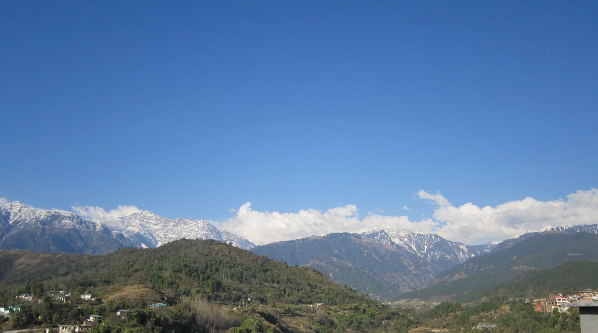
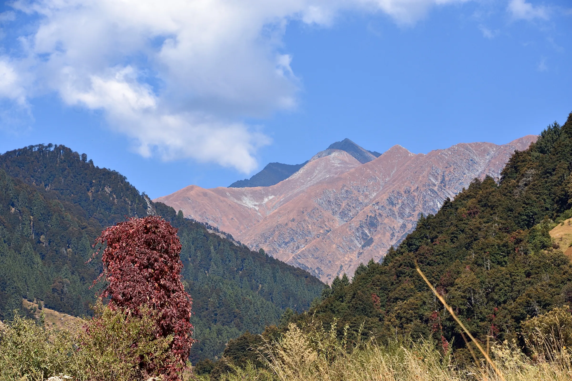
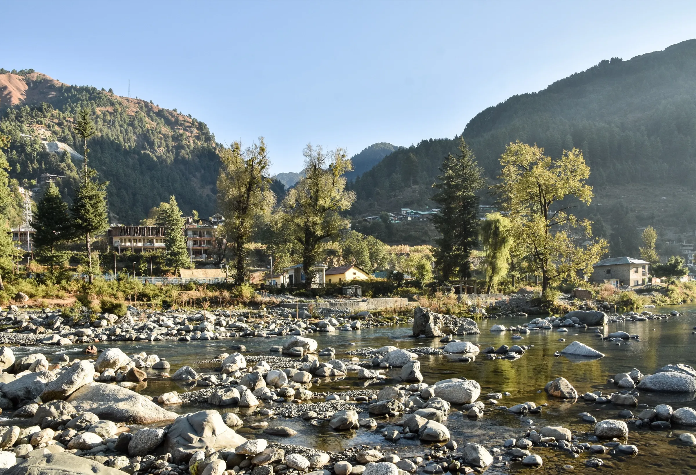
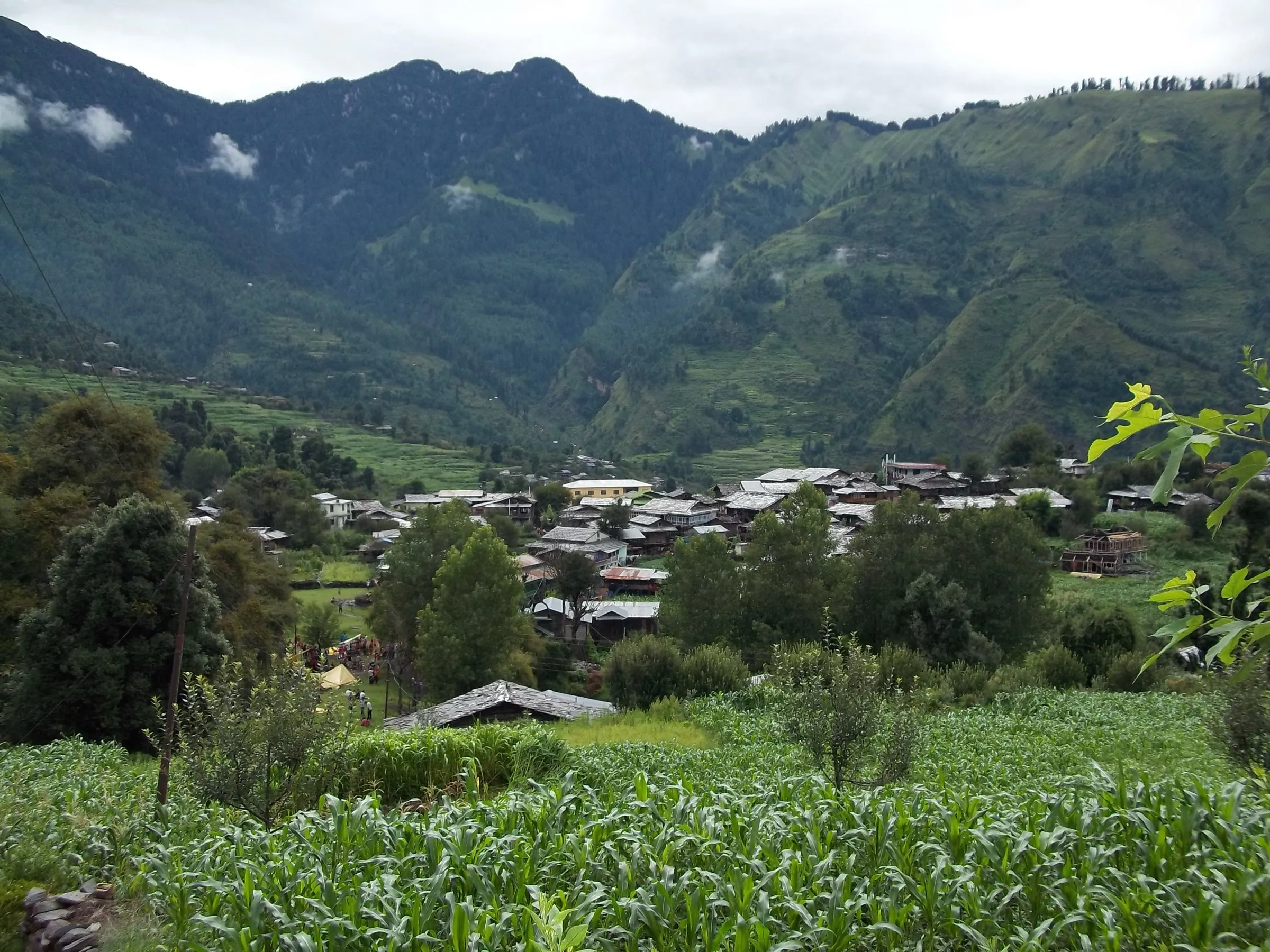
On the trail
The route
Day by day
Day 1
Gaggal (Kangra airport) or Dharamshala → Bir
770 m → 1,550 m
Day 2 · highest point
Billing (drive up from Bir) → Rajgundha (via Chhina Pass)
2,410 m → 2,730 m → 2,500 m
Day 3
Rajgundha → Bir (by road via Billing, or walk back the same trail)
2,500 m → 1,550 m
Ups and downs
Altitude profile
Where it is
Map
Trailhead and high point only — not a recorded track. Use it with a proper map.
Weather
Next 5 days on the trail
Live forecast for the trailhead and the high point. Mountain weather changes fast — check again on the morning you start.
Trailhead · Billing
at 2,410 mLoading forecast…
High point · Chhina Pass (Chaina / Channa Pass)
at 2,730 mLoading forecast…
Each day: high / low °C · rain mm and chance · snow cm · wind km/h
Weather data: Open-Meteo.comModel forecast, not an official warning. For alerts follow IMD and the local administration.
Plan the trip
How to reach
- Trailhead
- Billing (nearest town: Bir)
- Nearest railway
- Ahju on the Pathankot-Jogindernagar narrow-gauge line (about 3 km from Bir); Pathankot (about 140 km) is the nearest broad-gauge station
- Nearest airport
- Gaggal (Kangra / Dharamshala) Airport, about 70 km from Bir
- By road
- Dharamshala (about 60-70 km to Bir, 3-4 hours); Delhi (about 480-520 km to Bir by HRTC or private Volvo bus or taxi); Bir to Billing (about 14 km by taxi), where the trail starts
- Drive
- About 13 h from Delhi
Plan the trip
Permits and fees
We could not confirm the current permit rules and fees from an official source. Check with the local forest department or tourism office before you go.
Plan the trip
Cost
Self-guided
₹2,500–5,000
With an operator
₹5,000–11,200
Per person, ex-Bir. Guided prices seen October 2026: Himtrek ₹5,000 + 5% GST for its 4-day Bir-Billing-Chinna Pass winter trek (meals, camps, guide and Bir-Billing transport included; no 2026 dates listed); a 3-day Bir Billing + Rajgundha guided trek on Headout lists ₹11,200 including transfers from Chandigarh (it does not say whether that is per person). Self-guided is an estimate: taxi Bir-Billing, a local guide (advised, as the trail is easy to lose), one homestay night in Rajgundha with meals, and a taxi back from Rajgundha (Wanderlog quotes about ₹2,200-2,500 per vehicle from Bir); costs fall when a group shares the vehicles and guide.
Gear
Top picks for this trek
The gear that matters most on this route, chosen from its altitude, season and risks.
 Ad · affiliate link
 Ad · affiliate link
 Ad · affiliate link
 Ad · affiliate link
 Ad · affiliate link
 Ad · affiliate link
 Ad · affiliate link
 Ad · affiliate link
Store buttons open a search on that store, not a product we picked. As an Amazon Associate we earn from qualifying purchases. Photos show the kind of item, not a specific product. Affiliate disclosure
Packing checklist
Matched to this trek: altitude, season, days and the risks on the route.
Packed 0 of 31
Snow on the trail in Mar: microspikes, gaiters and a warm layer are not optional.
Tick each item as it goes in the bag.
Know before you go
Good to know
- Mobile network
- Patchy beyond Billing; one Bir guide says BSNL has the widest coverage if you trek to Billing or beyond. Expect little or no signal in Rajgundha.
- Last ATM
- Bir Bazaar (only 1-2 ATMs); carry cash for homestays
- Nearest hospital
- Health centres at Bir and Baijnath for first care; Palampur or Dr. RPGMC Tanda (Kangra) for serious cases
- Water
- Few reliable sources between Billing and Chhina Pass; streams and the Uhl river near Rajgundha. Carry 2 litres from Billing and boil or treat all water.
Highlights
- Start at Billing, the famous paragliding take-off, with gliders launching beside the trail
- Climb through rhododendron, deodar and oak forest in the Dhauladhar Wildlife Sanctuary to Chhina Pass, with views across to Thamsar Pass
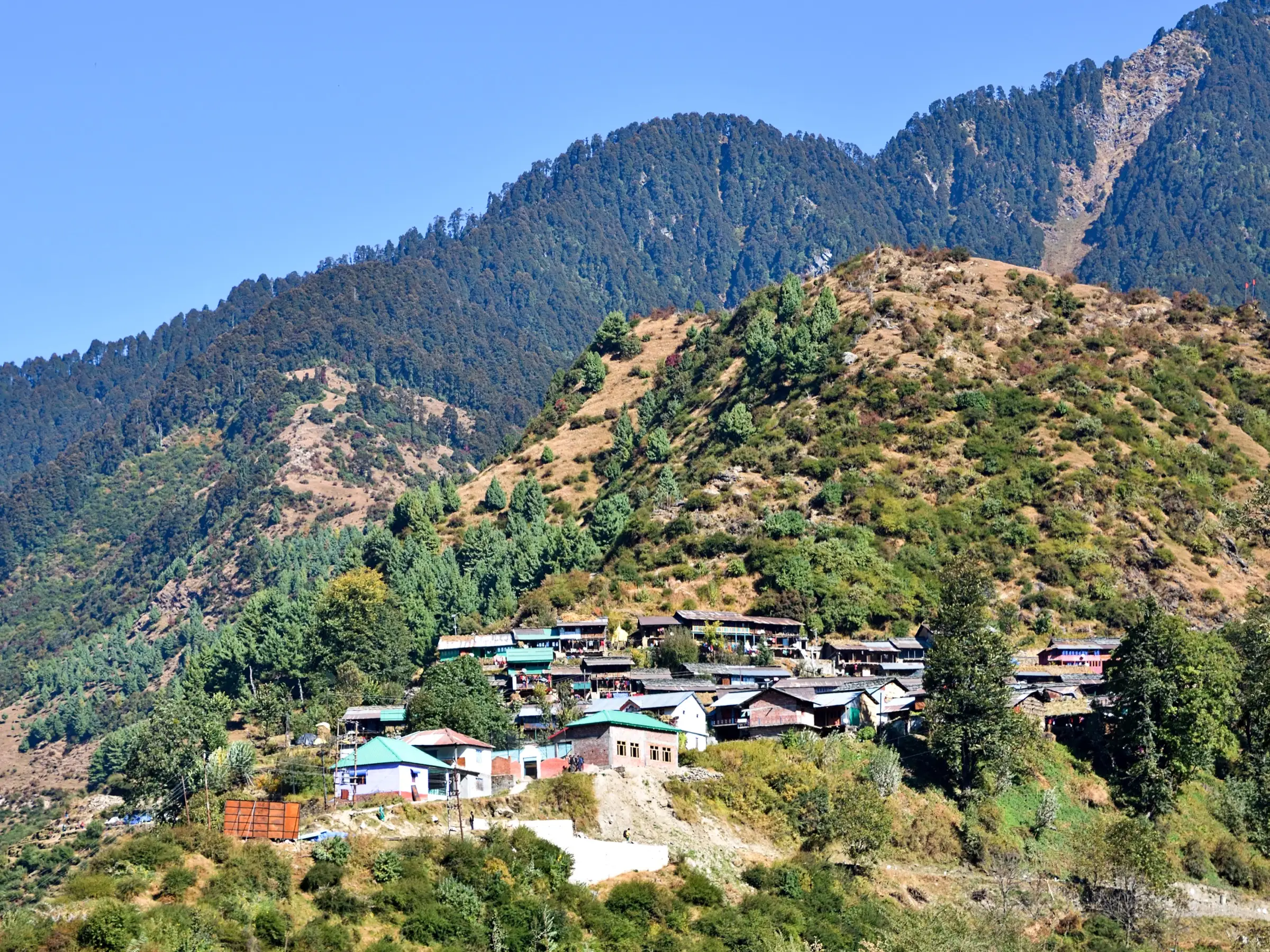
- Night in Rajgundha, a quiet Gaddi and farming village of stone-and-mud houses in the Uhl valley (Chhota Bhangal)
- Clear dark skies for Milky Way views, and the chance to see Himalayan monal in the forest
Risks
- Kangra district has made registration compulsory at the Rajgundha check post (one of 10 trekking check posts set up in November 2025 under the Disaster Management Act); trekking without registering can lead to legal action. Register before you start and check the current rules with the Kangra district administration.
- Winter (December to March) brings heavy snow: the Kangra district page says access routes are mostly closed and treks are often closed then, and one trekker describes knee-deep snow and numb hands on the climb to Chhina Pass in January. Go in winter only with a local guide.
- Monsoon (July-August) is risky because of landslides and heavy rain; the Kangra district advises avoiding it.
- A narrow, partly off-road jeep road now reaches Billing, Chhina Pass and Rajgundha (about 25-30 km by vehicle from Bir), so parts of the walk can meet vehicle traffic; the walking trail itself is separate and is easy to lose without a guide.
- Kangra's ban on trekking above 3,000 m (DDMA, January 2026) does not reach this route (high point about 2,730 m), but do not continue towards Thamsar Pass or Bara Bhangal without checking it.
Know before you go
Questions
How long is the trek from Billing to Rajgundha?
The Kangra district administration gives 12-14 km and 5-6 hours from Billing, rating it moderate to hard. The trail climbs steeply to Chhina Pass (about 2,730 m) and then runs downhill and mostly flat into Rajgundha. Most people stay a night in Rajgundha and drive or walk back the next day.
What is the best time for the Bir Billing to Rajgundha trek?
March to June and September to October, according to the Kangra district. July and August bring landslide risk, and from December to March heavy snow often closes the roads and the trek. Some operators do run a snow trek to Chinna Pass in winter.
Do I need a permit for the Rajgundha trek?
We found no permit fee, but since November 2025 Kangra district requires every trekker to register at the Rajgundha check post, which is one of 10 trekking check posts. Guided groups usually handle forest camping charges in the package. Check current rules locally before you go.
Can you drive to Rajgundha instead of trekking?
Yes. The Kangra district says a narrow 25-30 km mountain road with an off-road section reaches Rajgundha from Bir in 1.5-2 hours, but the last stretch needs a sturdy vehicle. Many people trek one way from Billing and drive back.
Is there mobile network on the trek?
Coverage is patchy beyond Billing. One local guide says BSNL works best on the treks above Bir. Bir Bazaar has only one or two ATMs, so carry cash for homestays in Rajgundha.
In an emergency
Save these numbers before you lose signal. Tap to call.
- 112All emergenciesIndia’s single emergency number — works in every state
- 108Ambulance
- 1077District disaster control room
You are in
District: KangraHimachal Pradesh
- Nearest hospital
- Health centres at Bir and Baijnath for first care; Palampur or Dr. RPGMC Tanda (Kangra) for serious cases
- Last ATM
- Bir Bazaar (only 1-2 ATMs); carry cash for homestays
- Phone network
- Patchy beyond Billing; one Bir guide says BSNL has the widest coverage if you trek to Billing or beyond. Expect little or no signal in Rajgundha.
Before you set off
- Tell someone your route and when you will be back.
- Carry a charged phone and a power bank.
- Download an offline map of the route.
- Turn back if the weather turns bad — the mountain will wait.
Questions about Bir Billing to Rajgundha
No questions yet. Ask something and trekkers who have done it can answer.
Share your trek photo with #TreksAndTrails
I trekked this
Did Bir Billing to Rajgundha look different from this page? Tell us what changed and we will check it.
Where this comes from
Sources
Last reviewed:
- Rajgundha Valley (District Kangra, last updated 30 Mar 2026) — District Administration Kangra (official)
- Adventure Tourism: Rajgundha Trek — District Administration Kangra (official)
- Joginder Nagar Valley — Wikipedia
- Bir Billing Winter Trek — Himtrek
- Embark On An Off Beat Destination Of Rajgundha Valley — TravelTriangle
- Bir Billing: More Than Paragliding (updated April 2026) — Discover with Dheeraj
- Bir-Billing to Barot Trek, Part 1 (trip report, January 2019) — Tripoto
- From Chandigarh: Bir Billing & Rajgundha Valley Guided Trek with Accommodation — Headout
- Hanumangarh Trek (road from Bir to Chhina Pass) — District Administration Kangra (official)
- Check posts set up at 10 entry points to strengthen safety of trekkers in Kangra (15 Nov 2025) — The Tribune
- Rajgundha Valley — Wanderlog
Photos: Timothy Gonsalves, CC BY-SA 4.0; Okorok, CC BY-SA 3.0; Timothy Gonsalves, CC BY-SA 4.0