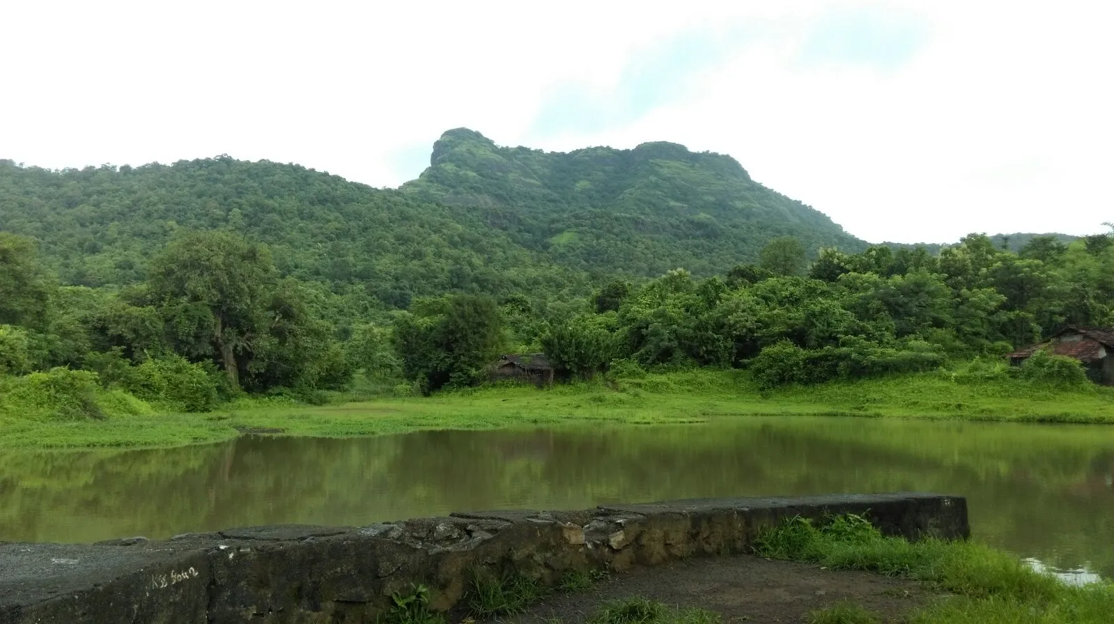
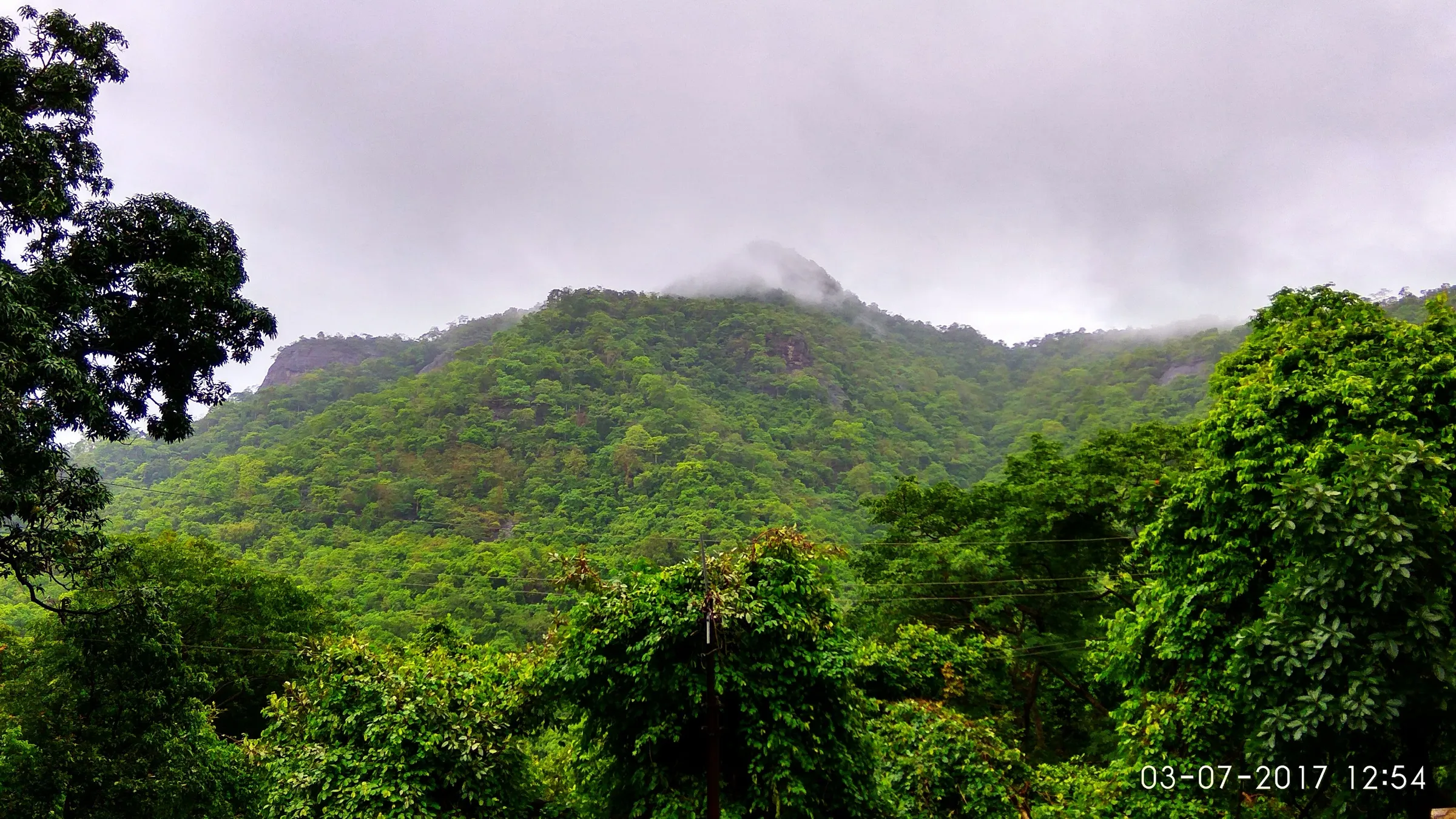
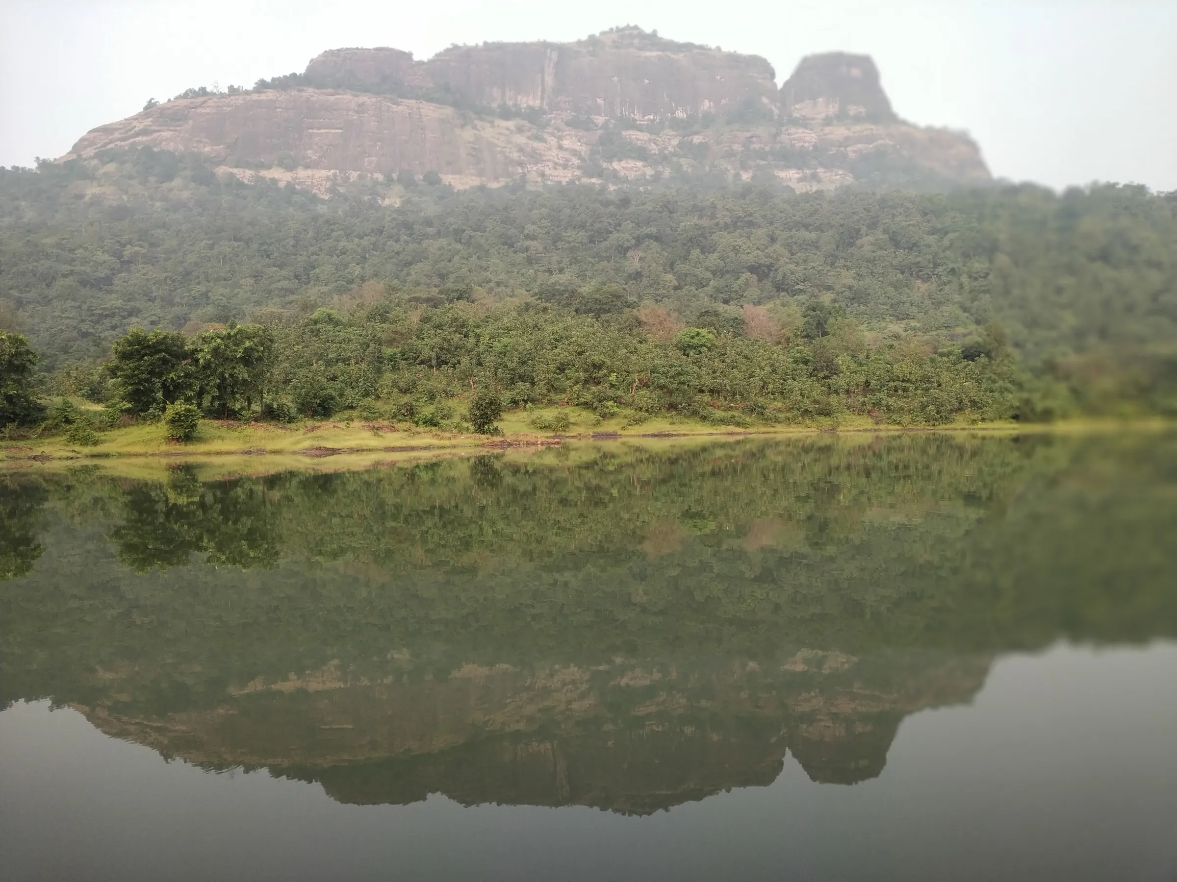
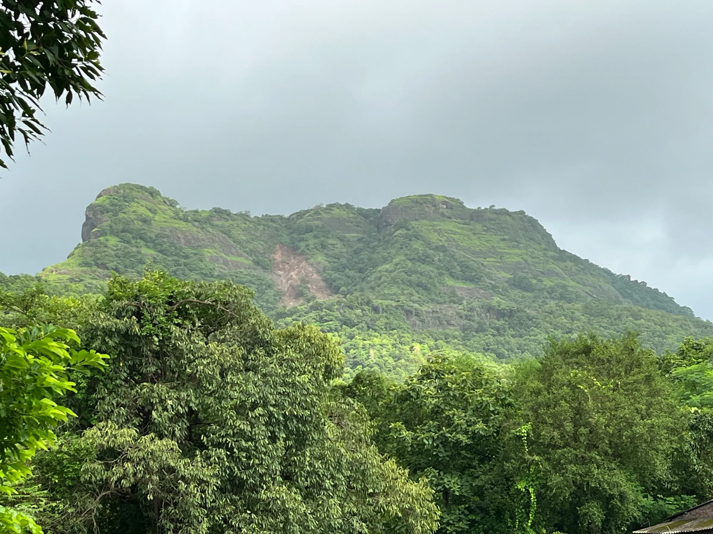
Asherigad Trek
Palghar, Maharashtra
Opens without signal on this phone, with the map file and checklist. Saved for offline →
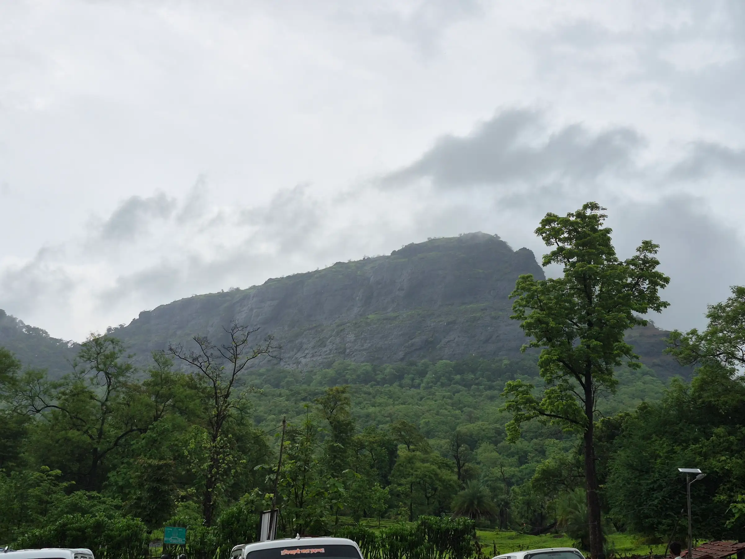
- Max altitude
- 512 m
- Days
- 1 day
- Distance
- 6 km
- Difficulty
- Moderate
Operators grade it moderate: about 440 m of climbing on a forest trail to a col, then a steep zig-zag scramble up a rock face to the fort entrance, which has a ladder on the steepest section. Trekshitiz grades it hard because the rock section is tricky and dangerous in the monsoon.
Photos
On the trail
The route
Day by day
Day 1 · highest point
Khodkona → Khodkona
70 m → 512 m → 70 m
Ups and downs
Altitude profile
Where it is
Map
Trailhead and high point only — not a recorded track. Use it with a proper map.
Weather
Next 5 days on the trail
Live forecast for the trailhead and the high point. Mountain weather changes fast — check again on the morning you start.
Trailhead · Khodkona
at 70 mLoading forecast…
High point · Asherigad fort top
at 512 mLoading forecast…
Each day: high / low °C · rain mm and chance · snow cm · wind km/h
Weather data: Open-Meteo.comModel forecast, not an official warning. For alerts follow IMD and the local administration.
Plan the trip
How to reach
- Trailhead
- Khodkona (nearest town: Manor)
- Nearest railway
- Palghar (Western Railway); Dahanu Road is about 24 km away via Chilhar Phata
- Nearest airport
- Chhatrapati Shivaji Maharaj International Airport, Mumbai (about 100 km by road)
- By road
- Mumbai to Khodkona on the Mumbai–Ahmedabad Highway (NH 48), about 104 km; the village lies between Mastan Naka and Charoti Naka, near Mendhavan Khind; Palghar station to Manor or Mastan Naka by bus or shared vehicle, then a local rickshaw to Khodkona; ST buses on the Palghar–Kasa route stop at the Khodkona bus stop on the highway
- Drive
- About 3 h from Mumbai
Plan the trip
Permits and fees
We could not confirm the current permit rules and fees from an official source. Check with the local forest department or tourism office before you go.
Plan the trip
Cost
Self-guided
₹300–700
With an operator
₹750–1,575
Per person, ex-Mumbai for guided day treks. Mischief Treks lists Rs 750 if you reach the base yourself and Rs 1,400 with a Mumbai bus pickup. Treks and Trails India (treksandtrails.org) lists Rs 799 without transport and Rs 1,399 with transport. Vagabond Experiences runs a night trek for sunrise at Rs 1,500 plus 5% GST, with jeeps from Virar. Self-guided estimate is ex-Palghar: train to Palghar, then a bus or shared vehicle to Manor and a rickshaw to Khodkona, plus snacks. No entry fee was found.
Gear
Top picks for this trek
The gear that matters most on this route, chosen from its altitude, season and risks.
 Ad · affiliate link
 Ad · affiliate link
 Ad · affiliate link
 Ad · affiliate link
 Ad · affiliate link
 Ad · affiliate link
 Ad · affiliate link
- Ad · affiliate link
Store buttons open a search on that store, not a product we picked. As an Amazon Associate we earn from qualifying purchases. Photos show the kind of item, not a specific product. Affiliate disclosure
Packing checklist
Matched to this trek: altitude, season, days and the risks on the route.
Packed 0 of 18
Tick each item as it goes in the bag.
Know before you go
Good to know
- Mobile network
- Not confirmed by any source. The base is close to NH 48, so expect signal at the base village; coverage on the hill is unknown
- Last ATM
- Manor or Palghar (not confirmed by a source; carry cash)
- Nearest hospital
- Not confirmed by a source; the nearest towns with medical facilities are Manor and Palghar
- Water
- Trekshitiz says one of the rock-cut tanks on top holds drinkable water all year, and three more tanks off a side path have clear water, but the tanks along the climb are not drinkable. Fill up at the village well; Mischief Treks asks for at least 2 litres per person
Highlights
- A Portuguese coat of arms carved in stone on the fort, from the time the fort marked the northern edge of Portuguese territory (16th–18th century)
- Dense forest on the approach, shady even in summer
- Rock-cut steps, water cisterns and a large cave on the top plateau; Trekshitiz also reports a half-buried cannon in one tank
- A small carved image of Bhagwan Ganesh on the rock face below the entrance, and a shrine of Vaghdev, worshipped by the local Adivasi community
- Views over the Manor area, the Mumbai–Ahmedabad highway and neighbouring Kohoj fort to the south-west
- Popular as a night trek for sunrise from the top
Risks
- Exposure: the entrance was destroyed with explosives, so the last section is a steep, zig-zag climb up a rock face. Trekshitiz advises climbing without a backpack and with help from an experienced climber; Bijoor's trip report and Vagabond Experiences mention a ladder on the steepest part
- Monsoon (June–September): the rock section becomes slippery and dangerous. Treks and Trails India advises avoiding the monsoon because of slippery trails and landslide risk, though several operators still run monsoon batches
- Leeches in the forest during the monsoon
- No Palghar district or Forest Department monsoon ban covering Asherigad was found for 2025–26; check local notices before a June–September visit
- The plateau is large and overgrown with shoulder-high bushes in places; stay on the main path or go with someone who knows the route
Know before you go
Questions
How high is Asherigad and how long does the trek take?
Wikipedia, Trekshitiz and Mischief Treks give the height as 1,680 ft (about 512 m). Reaching the top takes about 2–3 hours from Khodkona, and the round trip takes 4–5 hours. Mischief Treks says it is about 2 hours up and 2 hours down.
What is the base village for Asherigad and how do I get there?
The base village is Khodkona, on the Mumbai–Ahmedabad Highway (NH 48) between Mastan Naka and Charoti Naka, about 104 km from Mumbai. Take a train to Palghar, then a bus or shared vehicle towards Manor and a rickshaw to Khodkona. ST buses on the Palghar–Kasa route also stop at Khodkona.
Is the Asherigad trek difficult for beginners?
Most operators grade it moderate. The forest trail to the col is easy but climbs all the way. The final rock face below the entrance is steep and zig-zagging, with a ladder at the hardest point. Fit beginners can do it with an experienced group. Trekshitiz grades it hard and warns that this section is dangerous in the monsoon.
When is the best time to visit Asherigad?
Treks and Trails India recommends October to February. Trekshitiz says the fort can be visited all year. Monsoon treks are popular for the greenery, but the rock section gets slippery, so take extra care in the rain.
Can I stay overnight on Asherigad?
Trekshitiz says about 10–12 people can stay in the temple and on the plinth outside it, and that you must bring your own food. Wikipedia mentions a cave on the fort and says villagers can arrange a night stay and food at a reasonable cost.
In an emergency
Save these numbers before you lose signal. Tap to call.
- 112All emergenciesIndia’s single emergency number — works in every state
- 108Ambulance
- 1077District disaster control room
You are in
District: PalgharMaharashtra
- Nearest hospital
- Not confirmed by a source; the nearest towns with medical facilities are Manor and Palghar
- Last ATM
- Manor or Palghar (not confirmed by a source; carry cash)
- Phone network
- Not confirmed by any source. The base is close to NH 48, so expect signal at the base village; coverage on the hill is unknown
Before you set off
- Tell someone your route and when you will be back.
- Carry a charged phone and a power bank.
- Download an offline map of the route.
- Turn back if the weather turns bad — the mountain will wait.
Questions about Asherigad
No questions yet. Ask something and trekkers who have done it can answer.
Share your trek photo with #TreksAndTrails
I trekked this
Did Asherigad look different from this page? Tell us what changed and we will check it.
Where this comes from
Sources
Last reviewed:
- Asheri fort — Wikipedia
- Asherigad, Western Ghats, Sahyadri, Adventure, Trekking (archived copy) — Trekshitiz
- Asherigad Fort Trek — Mischief Treks
- Asherigad | A Sunrise Trek Through The Night — Vagabond Experiences
- Asherigad Fort Trek 2026 (tour listing by the operator Treks and Trails India, treksandtrails.org; not this site) — Treks and Trails India
- ASHERIGAD | Durgbharari — Durgbharari
- Trek to Asherigad - protector of the Palghar region (trip report, 2014) — bijoor.me
Photos: Suraj Digrase, CC0; Suraj Digrase, CC0; Ccmarathe, CC BY-SA 4.0; Ccmarathe, CC BY-SA 4.0