Yulla Kanda Trek
Kinnaur, Himachal Pradesh
Opens without signal on this phone, with the map file and checklist. Saved for offline →
- Max altitude
- 3,895 m
- Days
- 3 days
- Distance
- 24 km
- Difficulty
- Moderate
No technical sections, but about 12 km and roughly 1,400 m of climbing each way from Yulla Khas (about 2,450 m) to a lake at 3,895 m, starting with village stairs and ending in a steep alpine climb, with stream crossings that flood in heavy rain.
Photos
On the trail
The route
Day by day
Day 1
Shimla → Yulla Khas (drive via Narkanda, Rampur and Tapri)
2,200 m → 2,450 m
Day 2
Yulla Khas → Meadow camp above the forest
2,450 m → 3,300 m
Day 3 · highest point
Meadow camp → Yulla Khas (via Yulla Kanda lake and temple)
3,300 m → 3,895 m → 2,450 m
Ups and downs
Altitude profile
Where it is
Map
Trailhead and high point only — not a recorded track. Use it with a proper map.
Weather
Next 5 days on the trail
Live forecast for the trailhead and the high point. Mountain weather changes fast — check again on the morning you start.
Trailhead · Yulla Khas
at 2,450 mLoading forecast…
High point · Yulla Kanda lake and Shri Krishna temple
at 3,895 mLoading forecast…
Each day: high / low °C · rain mm and chance · snow cm · wind km/h
Weather data: Open-Meteo.comModel forecast, not an official warning. For alerts follow IMD and the local administration.
Plan the trip
How to reach
- Trailhead
- Yulla Khas (nearest town: Tapri)
- Nearest railway
- Shimla (narrow gauge from Kalka); Kalka is the nearest broad-gauge station
- Nearest airport
- Shimla Airport (Jubbarhatti), with more flights at Chandigarh
- By road
- Shimla via Narkanda and Rampur Bushahr to Tapri on NH-5, then a steep local road up to Yulla Khas; Chandigarh or Delhi by overnight bus to Shimla, then HRTC buses towards Reckong Peo to Tapri and a local taxi to Yulla Khas
- Drive
- About 6 h from Shimla
Plan the trip
Permits and fees
We could not confirm the current permit rules and fees from an official source. Check with the local forest department or tourism office before you go.
Plan the trip
Cost
Self-guided
₹3,000–7,000
With an operator
₹7,000–12,000
Per person. Guided prices published October 2026, both ex-Delhi with overnight transport: Byko Journeys ₹7,000 (quad) to ₹8,000 (double) + 5% GST for 3 days; Himtrek ₹10,998 (listed ₹11,999) + 5% GST for 3 days with forest entry fees included. Self-guided is an estimate ex-Shimla: HRTC bus to Tapri and back, a local taxi to Yulla Khas, one or two homestay nights, a hired sleeping bag or tent, and a local guide if you are not sure of the upper route.
Gear
Top picks for this trek
The gear that matters most on this route, chosen from its altitude, season and risks.
 Ad · affiliate link
 Ad · affiliate link
 Ad · affiliate link
 Ad · affiliate link
 Ad · affiliate link
 Ad · affiliate link
 Ad · affiliate link
 Ad · affiliate link
Store buttons open a search on that store, not a product we picked. As an Amazon Associate we earn from qualifying purchases. Photos show the kind of item, not a specific product. Affiliate disclosure
Packing checklist
Matched to this trek: altitude, season, days and the risks on the route.
Packed 0 of 34
Nights near 3,895 m can drop close to freezing even in summer. Pack one more warm layer than you think.
Tick each item as it goes in the bag.
Know before you go
Good to know
- Mobile network
- Operators warn of limited connectivity; expect signal only around the village and road, and none on the upper trail.
- Last ATM
- Rampur Bushahr is the last large town on the route with banks; carry enough cash for homestays and taxis.
- Nearest hospital
- First care in the Nichar/Tapri area; the district hospital is at Reckong Peo and the larger hospital at Khaneri, Rampur Bushahr.
- Water
- Streams and small waterfalls along the forest and meadow sections; treat or boil all water. The Yulla Kanda lake is sacred, so do not wash in it or use soap near it.
Highlights
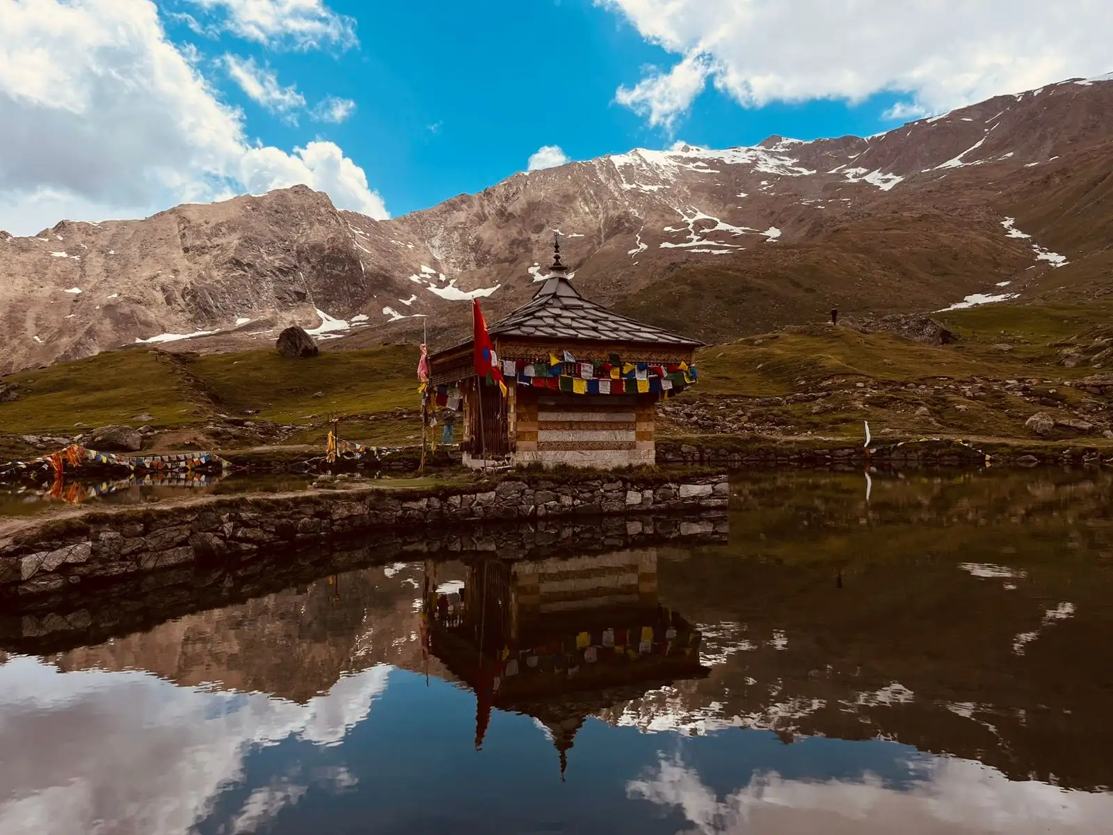
- Darshan at the Shri Krishna temple that stands in the middle of the Yulla Kanda lake at about 3,895 m, widely called the highest Krishna temple in the world
- The Janmashtami yatra, when villagers, lamas and devotees from across Kinnaur climb to the lake for bhajan, kirtan and puja of Bhagwan Shri Krishna
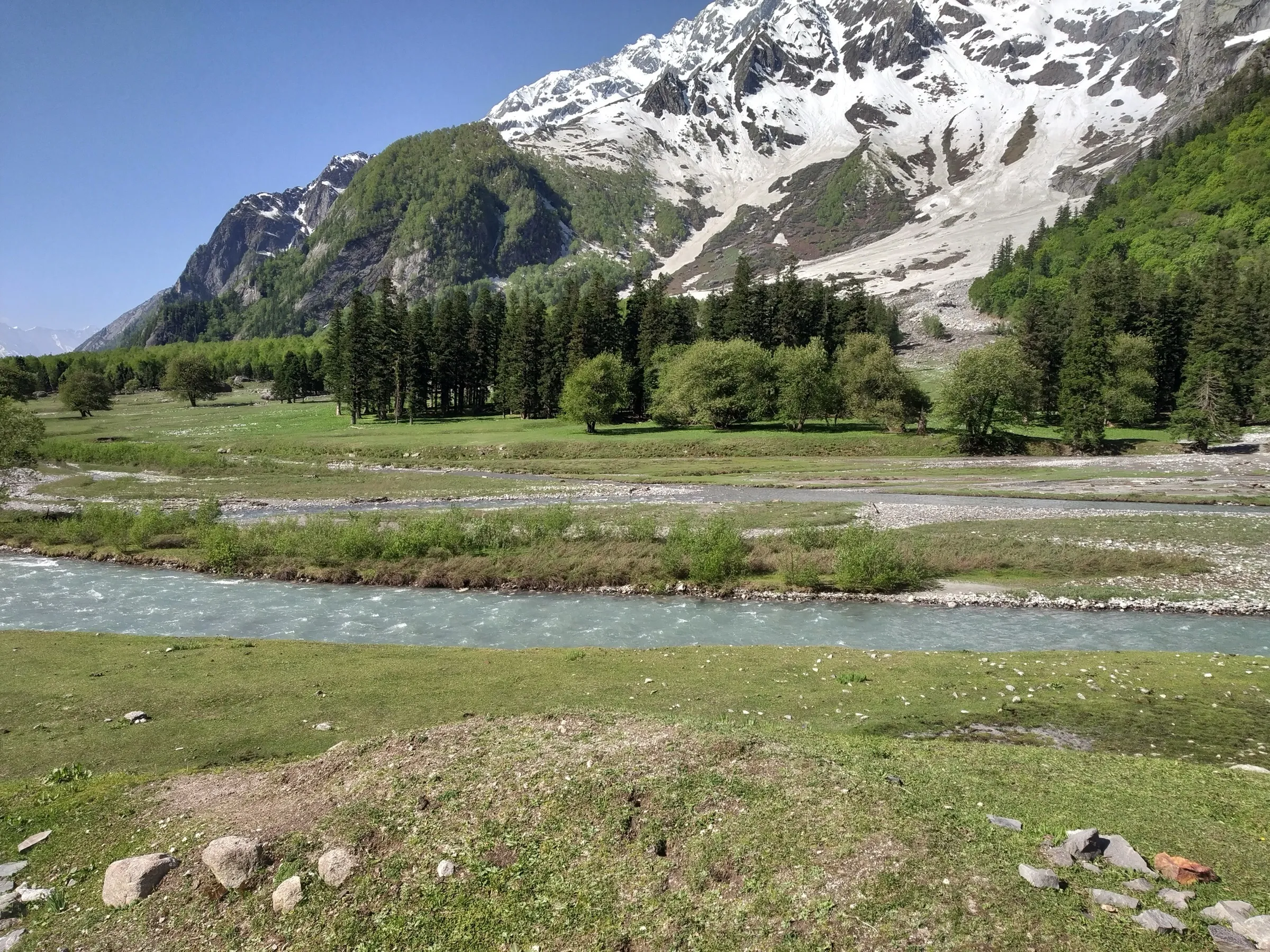
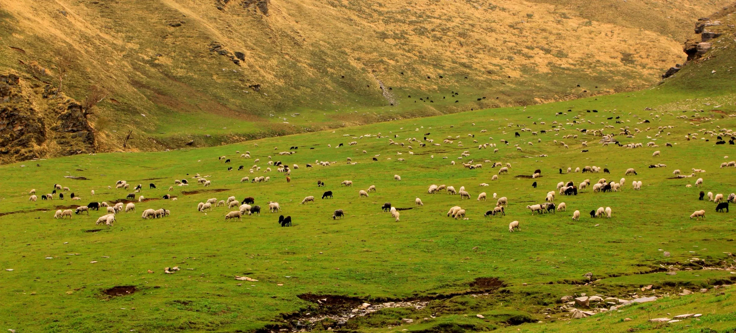
- A climb from the apple orchards of Yulla Khas through deodar, pine and oak forest into open alpine meadows
- Views across Kinnaur's ranges and passes such as Buran Ghati, Listigarang and Kashang from the top of the kanda
Risks
- Heavy rain floods the nallahs on the route: in August 2025 about 150 Janmashtami pilgrims were stranded on the way down and had to be rescued by Tapri police and villagers. Kinnaur police ask trekkers not to go during heavy rain.
- Monsoon (July-September) also brings landslides and shooting stones on NH-5 and the Tapri-Yulla road; keep a buffer day.
- The lake is at about 3,895 m and the climb from Yulla Khas is roughly 1,400 m; walk slowly and descend if you get a headache, nausea or dizziness.
- The upper trail has several paths and few markers; trekkers have lost the way to the shelter hut after dark. Start early and turn back in time to finish the descent in daylight.
- A Kinnaur district order of October 2021 halted treks in the district 'till further orders'; we found no order closing Yulla Kanda and the 2026 Janmashtami yatra went ahead, but check with Tapri police station or the Nichar SDM office before you go.
Know before you go
Questions
How long is the Yulla Kanda trek?
Operators and trek accounts put the walk from Yulla Khas to the lake at about 12 km one way, so about 24 km up and back. Nobody has published a reliable GPS track, so treat it as an estimate. Most groups take two trekking days with a night at a camp in the meadows; strong trekkers do it in one long day.
What is the altitude of Yulla Kanda?
The lake and Shri Krishna temple are at about 3,895 m (12,778 ft). Yulla Khas village, where the walk starts, is at roughly 2,450 m.
When is the best time to visit Yulla Kanda?
Mid-May to mid-October. May and June can still have snow near the lake; September and early October give the clearest skies. In July and August heavy rain can flood the stream crossings and block the roads.
When is the Janmashtami yatra at Yulla Kanda?
The yatra is held on Janmashtami (4 September in 2026; 25 August in 2027 by the panchang). Devotees start up the day before and sing bhajan and kirtan at the lake through the night. The temple committee and district administration organise it; confirm arrangements with them before you go, and expect crowds and queues for darshan.
How do I reach Yulla Khas?
Go to Shimla, then take a bus towards Reckong Peo along NH-5 via Narkanda and Rampur to Tapri in Kinnaur. From Tapri a steep local road climbs to Yulla Khas; local taxis run it. Homestays in the village can lend sleeping bags.
In an emergency
Save these numbers before you lose signal. Tap to call.
- 112All emergenciesIndia’s single emergency number — works in every state
- 108Ambulance
- 1077District disaster control room
You are in
District: KinnaurHimachal Pradesh
- Nearest hospital
- First care in the Nichar/Tapri area; the district hospital is at Reckong Peo and the larger hospital at Khaneri, Rampur Bushahr.
- Last ATM
- Rampur Bushahr is the last large town on the route with banks; carry enough cash for homestays and taxis.
- Phone network
- Operators warn of limited connectivity; expect signal only around the village and road, and none on the upper trail.
Before you set off
- Tell someone your route and when you will be back.
- Carry a charged phone and a power bank.
- Download an offline map of the route.
- Turn back if the weather turns bad — the mountain will wait.
Questions about Yulla Kanda
No questions yet. Ask something and trekkers who have done it can answer.
Share your trek photo with #TreksAndTrails
I trekked this
Did Yulla Kanda look different from this page? Tell us what changed and we will check it.
Where this comes from
Sources
Last reviewed:
- Yulla Kanda Trek 2026: Magical Way to World's Highest Temple — Himtrek
- This Trek Takes You To The Highest Krishna Temple In The World — Outlook Traveller
- Krishna Temple - Yulla Kanda — Himalayan Dream Treks
- Yulla Kanda Trek Distance and Route 2026: Yulla Khas to the Lake — Travel Coffee
- Yulla Kanda Trek During Janmashtami 2027: Crowds, Camps and Local Customs — Travel Coffee
- Yulla Kanda — Byko Journeys
- 150 stranded tourists rescued from Yulla Kanda trek in Kinnaur — The Tribune
- Yulla Kanda Trek — Indian Treks
Photos: Agyayjeet, CC BY-SA 4.0; Ashish sharmma, CC BY 4.0; Ashish sharmma, CC BY-SA 4.0