Larsa We Trek
Kinnaur and Lahaul and Spiti, Himachal Pradesh
Opens without signal on this phone, with the map file and checklist. Saved for offline →
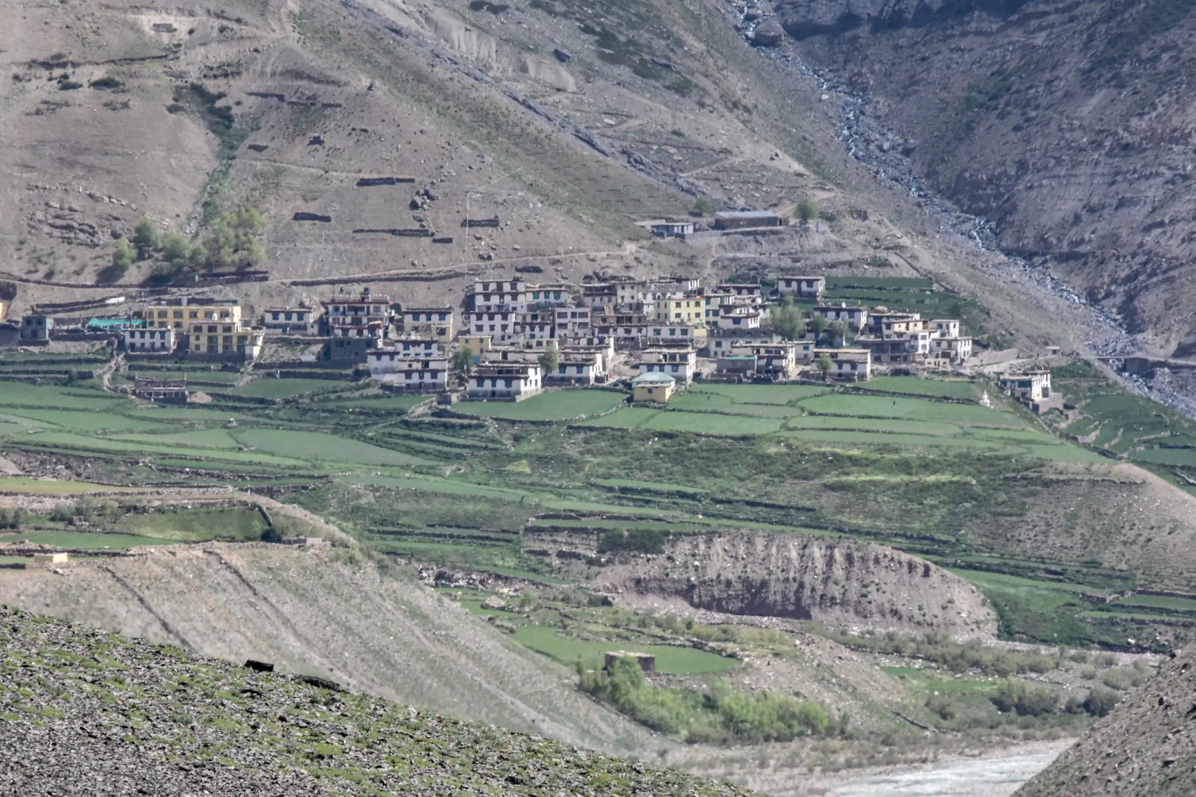
- Max altitude
- 5,280 m
- Days
- 10 days
- Distance
- 83 km
- Difficulty
- Difficult
A remote crossover from the Lippa valley in Kinnaur to the Pin valley in Spiti over a 5,280 m pass, with a glacier and moraine crossing the day before the pass, long walking days, steep climbs and several nights above 4,000 m. Bikat Adventures rates it Difficult and accepts only trekkers with 7-10 Himalayan trek days and earlier experience above 4,500 m.
Photos
On the trail
The route
Day by day
Day 1
Shimla → Kalpa (drive, about 225 km)
2,200 m → 2,960 m
Day 2
Kalpa → Asrang (drive via Lippa)
2,960 m → 3,320 m
Day 3
Asrang → Pulling (via Tokto and Porang)
3,320 m → 3,900 m
Day 4
Pulling → Bicho Thach (via Kangte)
3,900 m → 4,000 m
Day 5
Bicho Thach → Tapang
4,000 m → 4,150 m
Day 6
Tapang → Larsa (across the glacier)
4,150 m → 4,700 m
Day 7 · highest point
Larsa → Ansa (Ensa) Sumdo via Larsa We
4,700 m → 5,280 m → 4,200 m
Day 8
Ansa (Ensa) Sumdo → Tiling (Tailing) village, Pin valley
4,200 m → 3,715 m
Day 9
Tiling → Kaza (drive)
3,715 m → 3,650 m
Day 10
Kaza → Departure (Raacho Trekkers drives on to Manali via Kunzum Pass)
3,650 m → 2,050 m
Ups and downs
Altitude profile
Where it is
Map
Trailhead and high point only — not a recorded track. Use it with a proper map.
Weather
Next 5 days on the trail
Live forecast for the trailhead and the high point. Mountain weather changes fast — check again on the morning you start.
Trailhead · Asrang (Lippa valley, Kinnaur)
at 3,320 mLoading forecast…
High point · Larsa We pass (Kinnaur-Spiti divide)
at 5,280 mLoading forecast…
Each day: high / low °C · rain mm and chance · snow cm · wind km/h
Weather data: Open-Meteo.comModel forecast, not an official warning. For alerts follow IMD and the local administration.
Plan the trip
How to reach
- Trailhead
- Asrang (Lippa valley, Kinnaur) (nearest town: Kalpa (start) and Kaza (finish))
- Nearest railway
- Shimla (narrow gauge from Kalka); Kalka and Chandigarh for broad-gauge trains
- Nearest airport
- Shimla (Jubbarhatti) for a few flights; Chandigarh has more. On the way out, Bhuntar (Kullu-Manali) via Kaza-Manali
- By road
- Shimla to Kalpa about 225 km, 8-10 hours, then Kalpa to Asrang in the Lippa valley by road (operators drive it on day 2); Return: Tiling (Pin valley) to Kaza by road, then Kaza to Manali over Kunzum Pass and through the Atal Tunnel, or back down the Spiti-Kinnaur road to Shimla
- Drive
- About 11 h from Shimla
Plan the trip
Permits and fees
We could not confirm the current permit rules and fees from an official source. Check with the local forest department or tourism office before you go.
Plan the trip
Cost
Self-guided
₹20,000–35,000
With an operator
₹30,000–45,000
Per person, ex-Shimla (finishing at Kaza). Neither operator publishes a fixed price: Bikat Adventures lists the trek as 'On Request + 5% GST' (Kalpa to Kaza), and Raacho Trekkers runs fixed or custom departures without a published fare. The guided range is our estimate for a 10-day fully supported crossover with a glacier day, transport Shimla-Kalpa-Asrang and Tiling-Kaza, and porters; ask operators for a quote. Self-guided is also an estimate: buses or shared taxis to Kalpa and from Kaza, a local guide who knows the glacier (essential), porters or mules, tent and stove hire, and food for six trekking days.
Gear
Top picks for this trek
The gear that matters most on this route, chosen from its altitude, season and risks.
 Ad · affiliate link
 Ad · affiliate link
 Ad · affiliate link
 Ad · affiliate link
 Ad · affiliate link
 Ad · affiliate link
 Ad · affiliate link
 Ad · affiliate link
Store buttons open a search on that store, not a product we picked. As an Amazon Associate we earn from qualifying purchases. Photos show the kind of item, not a specific product. Affiliate disclosure
Packing checklist
Matched to this trek: altitude, season, days and the risks on the route.
Packed 0 of 36
Nights near 5,280 m can drop close to freezing even in summer. Pack one more warm layer than you think.
Tick each item as it goes in the bag.
Know before you go
Good to know
- Mobile network
- Mobile signal in Kalpa and Kaza. Operators do not report any coverage between Asrang and Tiling; plan for no signal for six days.
- Last ATM
- Reckong Peo and Kalpa on the Kinnaur side; Kaza has ATMs at the end. Carry cash.
- Nearest hospital
- Regional Hospital, Reckong Peo (Kinnaur side); Community Health Centre, Kaza (Spiti side).
- Water
- The trail follows the river and glacial streams for most days (Bikat and Raacho describe the walk along the river to Tapang). Glacial water is silty; filter and treat all water.
Highlights
- A true crossover from green Kinnaur (Lippa valley) into the cold desert of the Pin valley in Spiti over a 5,280 m pass
- Sloping meadows at Pulling and shepherd grounds at Bicho Thach above the Taiti (Tetti) stream
- A glacier and moraine approach to Larsa, with a glacial lake near the pass
- Descent through Ansa (Ensa) Sumdo to Tiling village in the Pin valley, close to Mudh and the Pin Valley National Park
- One of the least-walked crossings in Himachal; the Himalayan Club listed the 'Larsa Way pass: Larsa Garang (Taiti Garang) to Pin valley' in 1987
Risks
- Glacier travel on the day to Larsa and a long pass day at 5,280 m; Bikat carries a static rescue rope, harnesses and carabiners. Hidden crevasses, rockfall on moraine and fresh snow are possible.
- Altitude sickness: several nights above 4,000 m and a 5,280 m crossing with no easy escape once beyond Tapang. Bikat asks for 7-10 earlier Himalayan trek days and experience above 4,500 m.
- River and stream crossings; TrekUp India says July-August snowmelt is what makes the crossings possible, and water rises in the afternoon and after rain.
- Very remote: no villages between Asrang and Tiling, no mobile signal, and evacuation means walking back or over the pass.
- Kinnaur: an October 2021 Kinnaur Deputy Commissioner order under the Disaster Management Act halted all treks in the district 'till further orders' (Himachal Watcher); we found no order lifting it, but operators still sell Kinnaur treks. The 7 September 2022 Kinnaur ban covers routes linking Uttarkashi with Kinnaur, not this one. Get written confirmation from the Kinnaur district administration (Reckong Peo) before you go.
- Spiti: since June 2026 the Lahaul-Spiti DDMA requires prior registration with an authorised officer and a check-out on return; solo trekking is discouraged. A winter trekking ban was imposed in the district on 27 November 2024 'until further orders'.
- A September 2022 Himachal disaster-management advisory asked districts to restrict treks above 15,000 ft (about 4,570 m) outside 1 May-15 September; a late-September crossing may not be allowed.
- Since June 2025 the Forest Department (Kaza) charges a daily entry fee in Spiti's eco-sensitive areas including Pin valley (reported as ₹150 per Indian and ₹500 per foreigner per day) plus tent fees; confirm the current fee at the Kaza forest office. Raacho Trekkers says inner line permits are arranged by the operator, as the Lippa valley lies in the Kinnaur border belt; check the requirement for your nationality.
Know before you go
Questions
Where is the Larsa We trek and where does it start and end?
It crosses the divide between Kinnaur and Spiti in Himachal Pradesh. Operators drive from Shimla to Kalpa and on to Asrang in the Lippa valley, walk up the Taiti stream past Pulling, Bicho Thach, Tapang and Larsa, cross the Larsa We pass, and descend through Ansa (Ensa) Sumdo to Tiling village in the Pin valley, then drive to Kaza.
How high is Larsa We and how long is the trek?
Bikat Adventures and TrekUp India give the pass as 5,280 m; Raacho Trekkers gives 5,275 m. Satellite terrain at the OpenStreetMap pass point reads about 5,281 m. The full programme is 10 days from Shimla to Kaza, with six walking days; Bikat states about 83 km.
When is the best time to do the Larsa We trek?
July to September. Bikat and Raacho Trekkers give July to September, and TrekUp India says mid-July to mid-September, when snowmelt has opened the river crossings. Snow closes the pass from autumn to early summer, and Spiti has had a winter trekking ban since November 2024.
Is the Larsa We trek suitable for beginners?
No. Bikat says it is only for experienced trekkers because of long walks, steep climbs, constant high altitude and a taxing pass, and asks for 7-10 earlier Himalayan trek days with experience above 4,500 m. There is a glacier crossing before the pass.
Do I need a permit for the Larsa We trek?
Check locally. Raacho Trekkers says operators arrange inner line permits for the Kinnaur border belt; on the Spiti side the Lahaul-Spiti DDMA requires trekker registration (since June 2026) and the Forest Department charges a daily eco-sensitive-zone entry fee in Pin valley. We found no official fee list for this route.
In an emergency
Save these numbers before you lose signal. Tap to call.
- 112All emergenciesIndia’s single emergency number — works in every state
- 108Ambulance
- 1077District disaster control room
You are in
District: Kinnaur and Lahaul and SpitiHimachal Pradesh
- Nearest hospital
- Regional Hospital, Reckong Peo (Kinnaur side); Community Health Centre, Kaza (Spiti side).
- Last ATM
- Reckong Peo and Kalpa on the Kinnaur side; Kaza has ATMs at the end. Carry cash.
- Phone network
- Mobile signal in Kalpa and Kaza. Operators do not report any coverage between Asrang and Tiling; plan for no signal for six days.
Before you set off
- Tell someone your route and when you will be back.
- Carry a charged phone and a power bank.
- Download an offline map of the route.
- Turn back if the weather turns bad — the mountain will wait.
Questions about Larsa We
No questions yet. Ask something and trekkers who have done it can answer.
Share your trek photo with #TreksAndTrails
I trekked this
Did Larsa We look different from this page? Tell us what changed and we will check it.
Where this comes from
Sources
Last reviewed:
- Larsa We Trek - Kalpa to Kaza — Bikat Adventures
- Larsa We Pass Trek – Kinnaur to Spiti Valley Traverse — Raacho Trekkers
- A Note on Kinnaur (Harish Kapadia, Himalayan Journal 43, 1987) — The Himalayan Club
- Trekkers must register before hitting Lahaul-Spiti trails now (25 Jun 2026) — The Tribune
- Winter sets in, trekking, climbing banned in Lahaul-Spiti dist (27 Nov 2024) — The Tribune
- Forest dept imposes entry, activity fee in Spiti's eco-sensitive zones (10 Jun 2025) — The Tribune
- Himachal government restricts trekking in high-altitude tracks from September 15 — The Tribune
- Trekking in Kinnaur banned after two tragedies (26 Oct 2021) — Himachal Watcher
Photos: Timothy A. Gonsalves, CC BY-SA 4.0; Timothy A. Gonsalves, CC BY-SA 4.0