Kinner Kailash Trek
Kinnaur, Himachal Pradesh
Opens without signal on this phone, with the map file and checklist. Saved for offline →
- Max altitude
- 4,800 m
- Days
- 4 days
- Distance
- 37 km
- Difficulty
- Difficult
A climb of about 2,650 m from Tangling (about 2,150 m) to the Shivling at about 4,800 m in two to three days, with a very steep forest ridge (Kailash Dhaar) on day 1, a long summit day over boulders, moraine and snow patches above Parvati Kund, no water on long stretches and a high risk of altitude sickness. Indiahikes calls it difficult and not for beginners.
Photos
On the trail
The route
Day by day
Day 1
Tangling → Malling Khata (Ganesh Park)
2,150 m → 3,590 m
Day 2
Malling Khata (Ganesh Park) → Bheem Dwar (Gufa)
3,590 m → 3,780 m
Day 3 · highest point
Bheem Dwar (Gufa) → Bheem Dwar (Gufa) via Parvati Kund and the Shivling
3,780 m → 4,800 m → 3,780 m
Day 4
Bheem Dwar (Gufa) → Tangling
3,780 m → 2,150 m
Ups and downs
Altitude profile
Where it is
Map
Trailhead and high point only — not a recorded track. Use it with a proper map.
Weather
Next 5 days on the trail
Live forecast for the trailhead and the high point. Mountain weather changes fast — check again on the morning you start.
Trailhead · Tangling
at 2,150 mLoading forecast…
High point · Kinner Kailash Shivling
at 4,800 mLoading forecast…
Each day: high / low °C · rain mm and chance · snow cm · wind km/h
Weather data: Open-Meteo.comModel forecast, not an official warning. For alerts follow IMD and the local administration.
Plan the trip
How to reach
- Trailhead
- Tangling (nearest town: Reckong Peo)
- Nearest railway
- Shimla (narrow gauge from Kalka); Kalka is the nearest broad-gauge station
- Nearest airport
- Chandigarh (IXC); Shimla airport has only limited flights
- By road
- Shimla; Chandigarh; Reckong Peo
- Drive
- About 8 h from Shimla
Plan the trip
Permits and fees
We could not confirm the current permit rules and fees from an official source. Check with the local forest department or tourism office before you go.
Plan the trip
Cost
Self-guided
₹6,000–12,000
With an operator
₹15,000–25,000
Guided: Manimahesh Hills Travel listed a 6-day yatra package ex-Chandigarh at ₹19,500 per adult with tax (2024 fixed departures; price may have changed), and the TourTravelWorld guide quotes about ₹15,000–25,000 for packages. Self-guided estimate ex-Reckong Peo: bus or taxi to Tangling, a local guide and porter for four days (hire in Reckong Peo or Tangling), food, tent hire, and the yatra registration, medical check and green tax (amounts not published).
Gear
Top picks for this trek
The gear that matters most on this route, chosen from its altitude, season and risks.
 Ad · affiliate link
 Ad · affiliate link
 Ad · affiliate link
 Ad · affiliate link
 Ad · affiliate link
 Ad · affiliate link
 Ad · affiliate link
 Ad · affiliate link
Store buttons open a search on that store, not a product we picked. As an Amazon Associate we earn from qualifying purchases. Photos show the kind of item, not a specific product. Affiliate disclosure
Packing checklist
Matched to this trek: altitude, season, days and the risks on the route.
Packed 0 of 36
Nights near 4,800 m can drop close to freezing even in summer. Pack one more warm layer than you think.
Tick each item as it goes in the bag.
Know before you go
Good to know
- Mobile network
- Mobile signal in Reckong Peo and around Tangling; expect weak or no signal on the upper trail (not confirmed by our sources)
- Last ATM
- Reckong Peo
- Nearest hospital
- Regional Hospital, Reckong Peo; a primary health centre at Tangling, and the administration runs a medical camp at the registration point during the yatra
- Water
- Indiahikes: a stream about 2.5 km above Tangling, then no water until Malling Khata (Ashiqui Park); plenty at Bheem Dwar; none between Bheem Dwar and Parvati Kund or from Parvati Kund to the Shivling, so carry enough for the summit day
Highlights
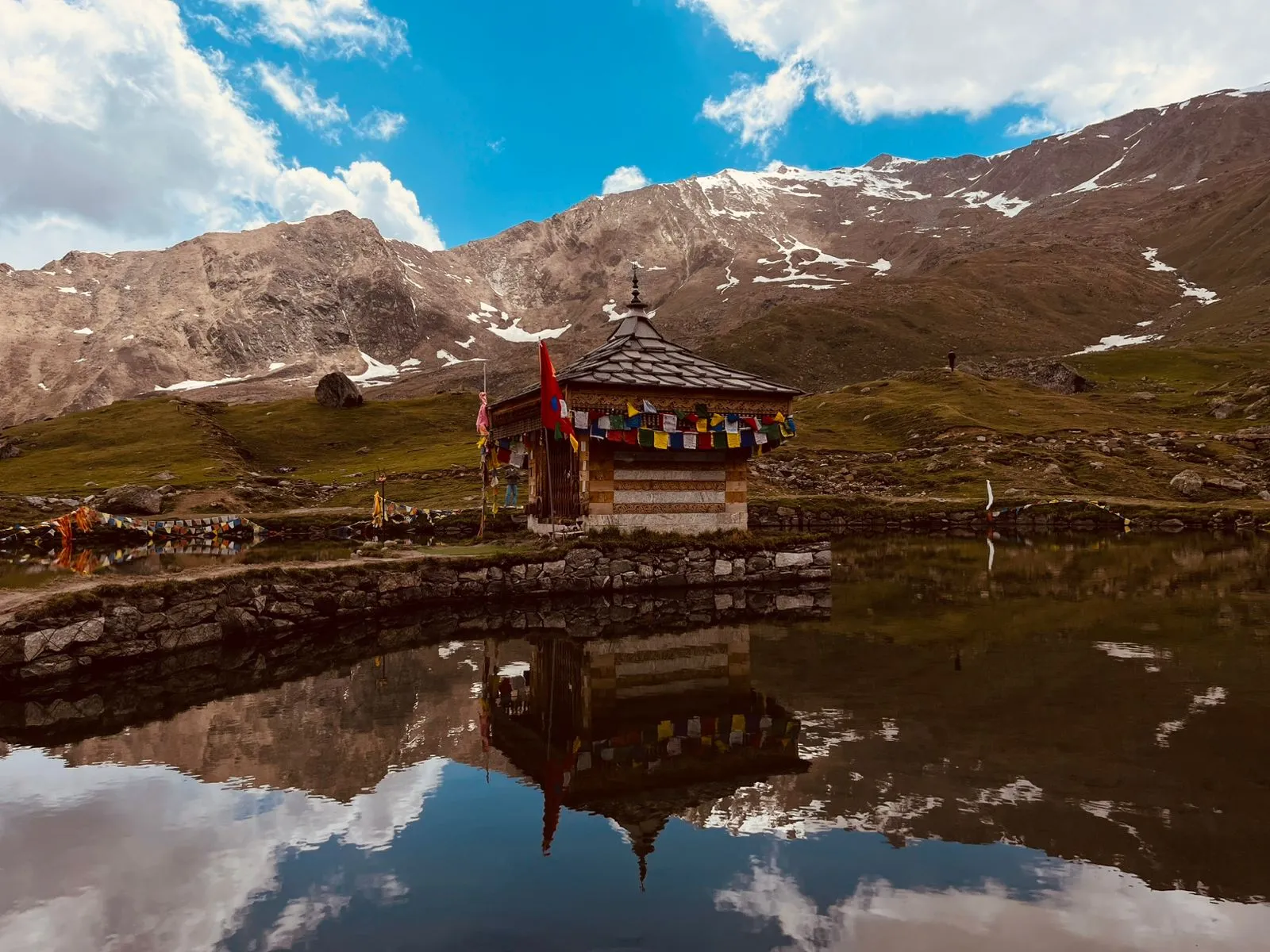
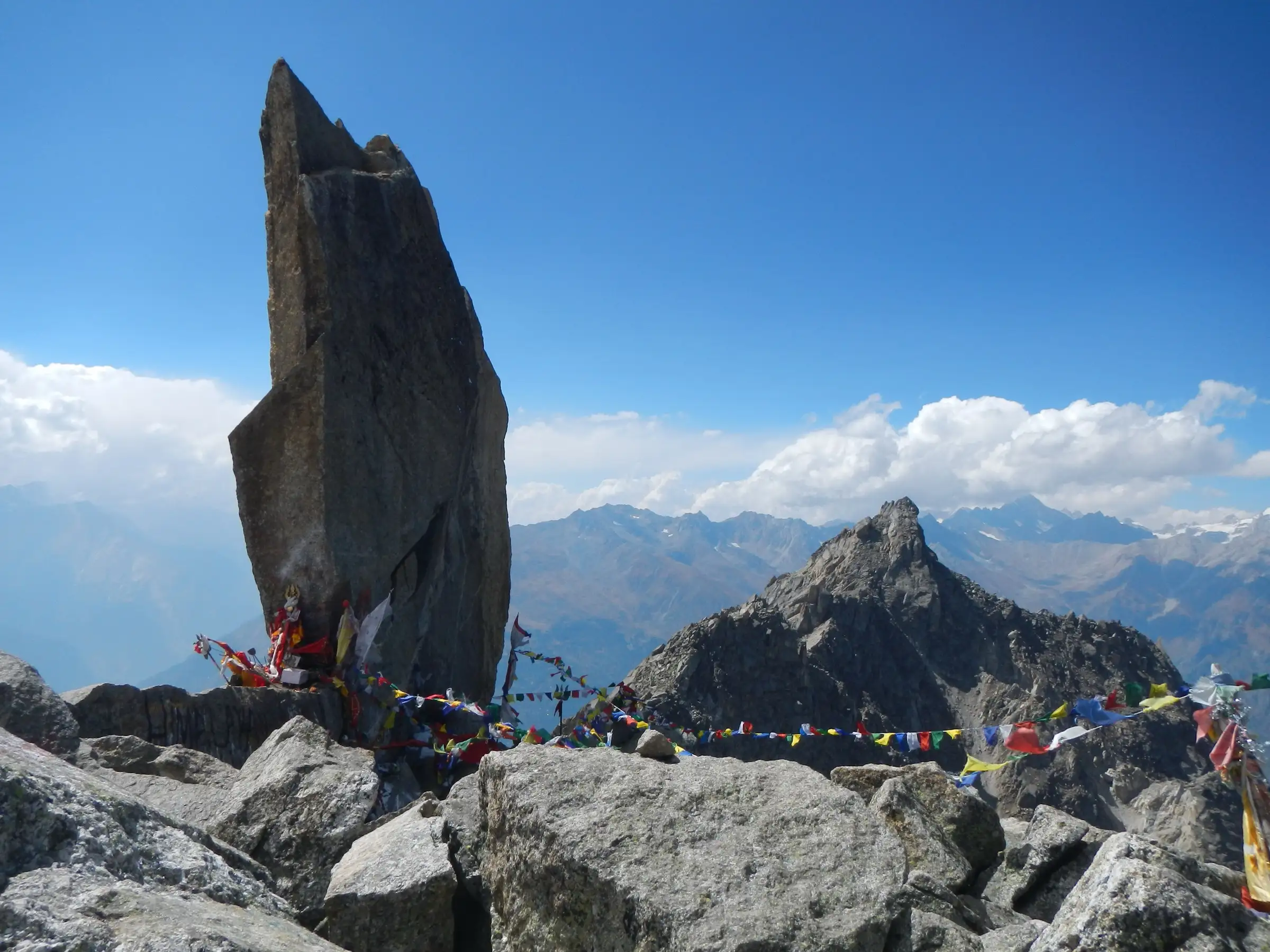
- Darshan of the Kinner Kailash Shivling, a 79-foot rock pillar of Bhagwan Shiva on the Kinner Kailash range, one of the Panch Kailash
- Parvati Kund, a small glacial kund below the Shivling where pilgrims pray to Mata Parvati and Mahadev before the final climb
- Camping at the Malling Khata meadow (Ganesh Park) with views over Kalpa, Reckong Peo and the Sutlej valley
- The steep climb up Kailash Dhaar through deodar forest past Bara Pathar and the old Bara Ped deodar
- Views of Jorkanden (6,473 m) and the Kinner Kailash peaks from the top
Risks
- The Kinnaur administration runs this as a registered yatra in a short window (2026: 30 July to 10 August from Tangling, then 17 to 23 August by the Purwani route). Registration, a medical check and a green tax are compulsory, with a daily cap; Trip To Temples says you cannot go on the yatra before or after the official window. Check with the DC office in Reckong Peo before planning any other dates.
- The 2026 yatra was suspended in late June 'until further orders' after a scouting team found large glaciers between Malling Khata and the Shivling and unstable boulders and fresh rockfall between Gufa and Sorang; the dates can change or be cancelled at short notice for weather.
- High risk of altitude sickness: you climb about 2,650 m in two days with no road exit. Turn back if you feel breathless or dizzy.
- The summit day crosses boulders, moraine, snow and glacier ice with rockfall; follow only the marked route with stone cairns and never use shortcuts.
- Night trekking is banned by the administration's yatra rules, even though the 2026 Purwani-route notice had pilgrims leave Danglidean for the cave at about 1:30 am; follow the instructions of the guides and police on the route.
- Monsoon rain brings landslides and cloudbursts in Kinnaur; roads to Reckong Peo can be cut.
Know before you go
Questions
When is the Kinner Kailash Yatra held?
The Kinnaur district administration fixes the dates each year, usually in late July and August. In 2026 the yatra ran from 30 July to 10 August from Tangling, with a later window of 17 to 23 August by the Purwani route. Dates can change or be suspended for weather.
Is registration compulsory for Kinner Kailash?
Yes. The administration's 2026 rules say no one may start without registration and a health check-up. In 2026, 375 pilgrims a day were allowed (175 online on hpkinnaur.nic.in, 125 offline at Tangling, 75 through the Kinnaur adventure tour operators' association). The Purwani-route window allowed 50 a day, registered offline at Purwani from 7 to 10 am, with the medical check and green tax done there.
How long is the Kinner Kailash trek and how many days does it take?
Indiahikes gives 17–19 km one way from Tangling, so about 35–40 km there and back; the Manimahesh Hills Travel package lists 35 km. Fit trekkers do it in 2–3 days; most packages give 3–4 trekking days, camping at Malling Khata (Ganesh Park) and Gufa.
How high is the Kinner Kailash Shivling?
About 4,800 m (Wikipedia; the Manimahesh Hills Travel package says 4,810 m), which matches satellite terrain. The Kinner Kailash peak itself is about 6,050 m and is not climbed.
Is the Kinner Kailash trek difficult?
Yes. Indiahikes calls it a difficult trek that is not for beginners, with a very high risk of altitude sickness; the final climb from Parvati Kund to the Shivling is a steep scramble over moraine and rock.
In an emergency
Save these numbers before you lose signal. Tap to call.
- 112All emergenciesIndia’s single emergency number — works in every state
- 108Ambulance
- 1077District disaster control room
You are in
District: KinnaurHimachal Pradesh
- Nearest hospital
- Regional Hospital, Reckong Peo; a primary health centre at Tangling, and the administration runs a medical camp at the registration point during the yatra
- Last ATM
- Reckong Peo
- Phone network
- Mobile signal in Reckong Peo and around Tangling; expect weak or no signal on the upper trail (not confirmed by our sources)
Before you set off
- Tell someone your route and when you will be back.
- Carry a charged phone and a power bank.
- Download an offline map of the route.
- Turn back if the weather turns bad — the mountain will wait.
Questions about Kinner Kailash
No questions yet. Ask something and trekkers who have done it can answer.
Share your trek photo with #TreksAndTrails
I trekked this
Did Kinner Kailash look different from this page? Tell us what changed and we will check it.
Where this comes from
Sources
Last reviewed:
- Kinnaur Kailash Yatra 2026 – Important Public Notice — District Kinnaur, Government of Himachal Pradesh (official)
- Kinnaur Kailash Yatra 2026 To Begin From July 30 After Safety Review — Outlook Traveller
- Kinner Kailash Shivlingam Trek — Indiahikes
- Kinnaur Kailash — Wikipedia
- 5 Nights - 6 Days Kinner Kailash Yatra Trek Tour (Manimahesh Hills Travel) — Manimahesh Hills Travel
- Kinner Kailash Yatra - An Epic Journey of Adventure and Devotion — Trip To Temples
- Kinner Kailash Trek | High-Altitude Sacred Trek in Himachal Pradesh — TrekUp India
- Shrikhand Mahadev, Kinnaur Kailash yatras suspended — News Arena India
Photos: Nicojonesgodel, CC BY-SA 4.0; Narender Sharma, Blue Particle Solutions, CC BY-SA 4.0; Sumita Roy Dutta, CC BY-SA 4.0