Charang Valley Trek
Kinnaur, Himachal Pradesh
Opens without signal on this phone, with the map file and checklist. Saved for offline →
- Max altitude
- 5,242 m
- Days
- 6 days
- Distance
- 60 km
- Difficulty
- Challenging
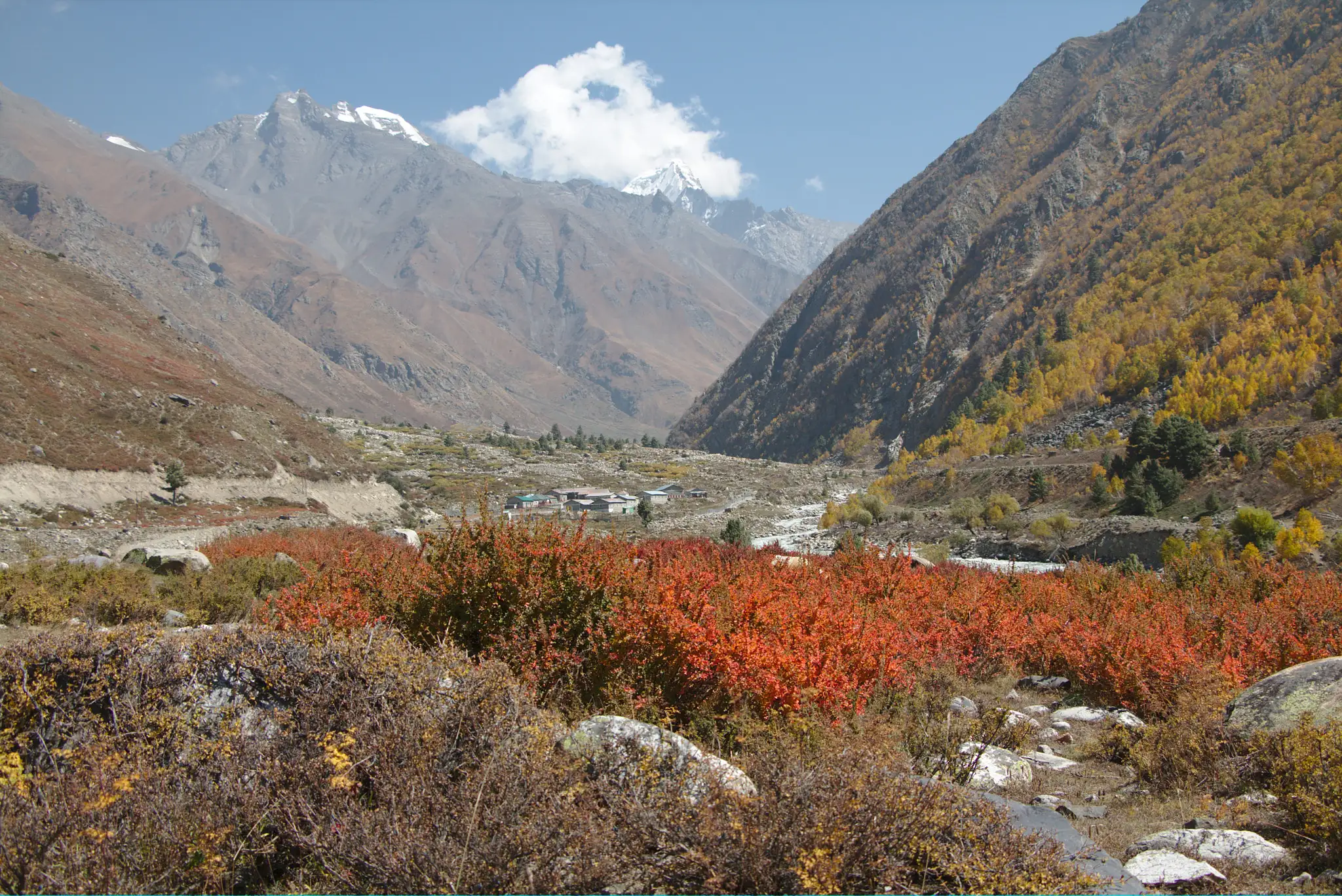
A remote crossing of Charang La (about 5,242 m) with no villages or mobile signal after Charang, unmarked boulder and moraine trail, a barefoot stream crossing, a thin snow bridge and a 60–70 degree snow slope below the pass, then a descent of about 1,800 m to Chitkul on the same day.
Photos
On the trail
The route
Day by day
Day 1
Reckong Peo (drive to Thangi) → Shurting via Lambar
2,730 m → 3,410 m
Day 2
Shurting → Charang village
3,410 m → 3,500 m
Day 3
Charang village → Camp I below Lalanti (via Lalanti pass)
3,500 m → 4,500 m → 4,200 m
Day 4
Camp I → Camp II beyond Lalanti
4,200 m → 4,200 m
Day 5
Camp II → Charang La base (glacial lake)
4,200 m → 4,800 m
Day 6 · highest point
Charang La base → Chitkul (via Charang La)
4,800 m → 5,242 m → 3,460 m
Ups and downs
Altitude profile
Where it is
Map
Trailhead and high point only — not a recorded track. Use it with a proper map.
Weather
Next 5 days on the trail
Live forecast for the trailhead and the high point. Mountain weather changes fast — check again on the morning you start.
Trailhead · Thangi
at 2,730 mLoading forecast…
High point · Charang La
at 5,242 mLoading forecast…
Each day: high / low °C · rain mm and chance · snow cm · wind km/h
Weather data: Open-Meteo.comModel forecast, not an official warning. For alerts follow IMD and the local administration.
Plan the trip
How to reach
- Trailhead
- Thangi (nearest town: Reckong Peo)
- Nearest railway
- Shimla (narrow gauge from Kalka); Kalka is the nearest broad-gauge station
- Nearest airport
- Shimla (Jubbarhatti) has limited flights; Chandigarh (IXC) is the usual airport
- By road
- Shimla; Reckong Peo; Kalka
- Drive
- About 12 h from Shimla
Plan the trip
Permits and fees
We could not confirm the current permit rules and fees from an official source. Check with the local forest department or tourism office before you go.
Plan the trip
Cost
Self-guided
₹12,000–20,000
With an operator
₹16,000–20,000
Ex-Reckong Peo, trek portion only. Himalaya Shelter lists ₹16,000 per person plus 5% GST; a 2026 Discover with Dheeraj guide puts operator packages at about ₹10,000–20,000 and a shared do-it-yourself trip (guide, porter or pony, food, tents, jeep to Thangi and back from Chitkul) at about ₹12,000–20,000 per person for a group of 4–6. Only one operator price was confirmed; add travel to Kinnaur.
Gear
Top picks for this trek
The gear that matters most on this route, chosen from its altitude, season and risks.
 Ad · affiliate link
 Ad · affiliate link
 Ad · affiliate link
 Ad · affiliate link
 Ad · affiliate link
 Ad · affiliate link
 Ad · affiliate link
 Ad · affiliate link
Store buttons open a search on that store, not a product we picked. As an Amazon Associate we earn from qualifying purchases. Photos show the kind of item, not a specific product. Affiliate disclosure
Packing checklist
Matched to this trek: altitude, season, days and the risks on the route.
Packed 0 of 37
Nights near 5,242 m can drop close to freezing even in summer. Pack one more warm layer than you think.
Tick each item as it goes in the bag.
Know before you go
Good to know
- Mobile network
- No mobile signal on the trail after Charang village; Reckong Peo is the last reliable network
- Last ATM
- Reckong Peo
- Nearest hospital
- Reckong Peo (district headquarters); there is no medical help between Charang and Chitkul
- Water
- Streams at the camps; fill up at Charang (Indiahikes notes no water for 4–5 hours above the village) and at the snow bridge below the pass, after which there is no water for 5–6 hours on the descent to Chitkul
Highlights
- The traditional parikrama of Kinner Kailash, the abode of Bhagwan Shiv, crossing from the Tirung valley to the Baspa valley over Charang La
- Charang village and the old Rangrik (Rangrik Tungma) monastery, the last settlement before days of complete wilderness
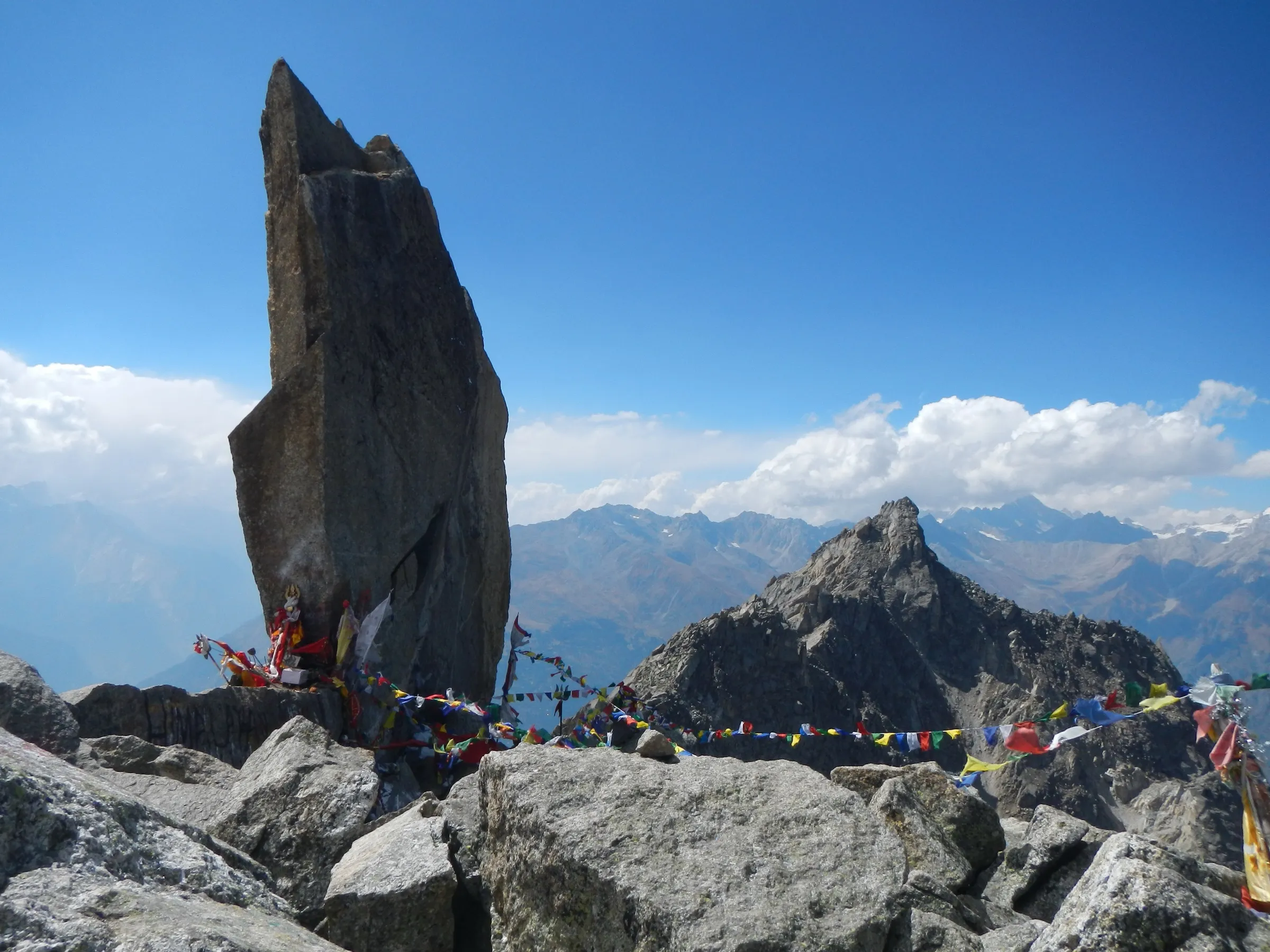
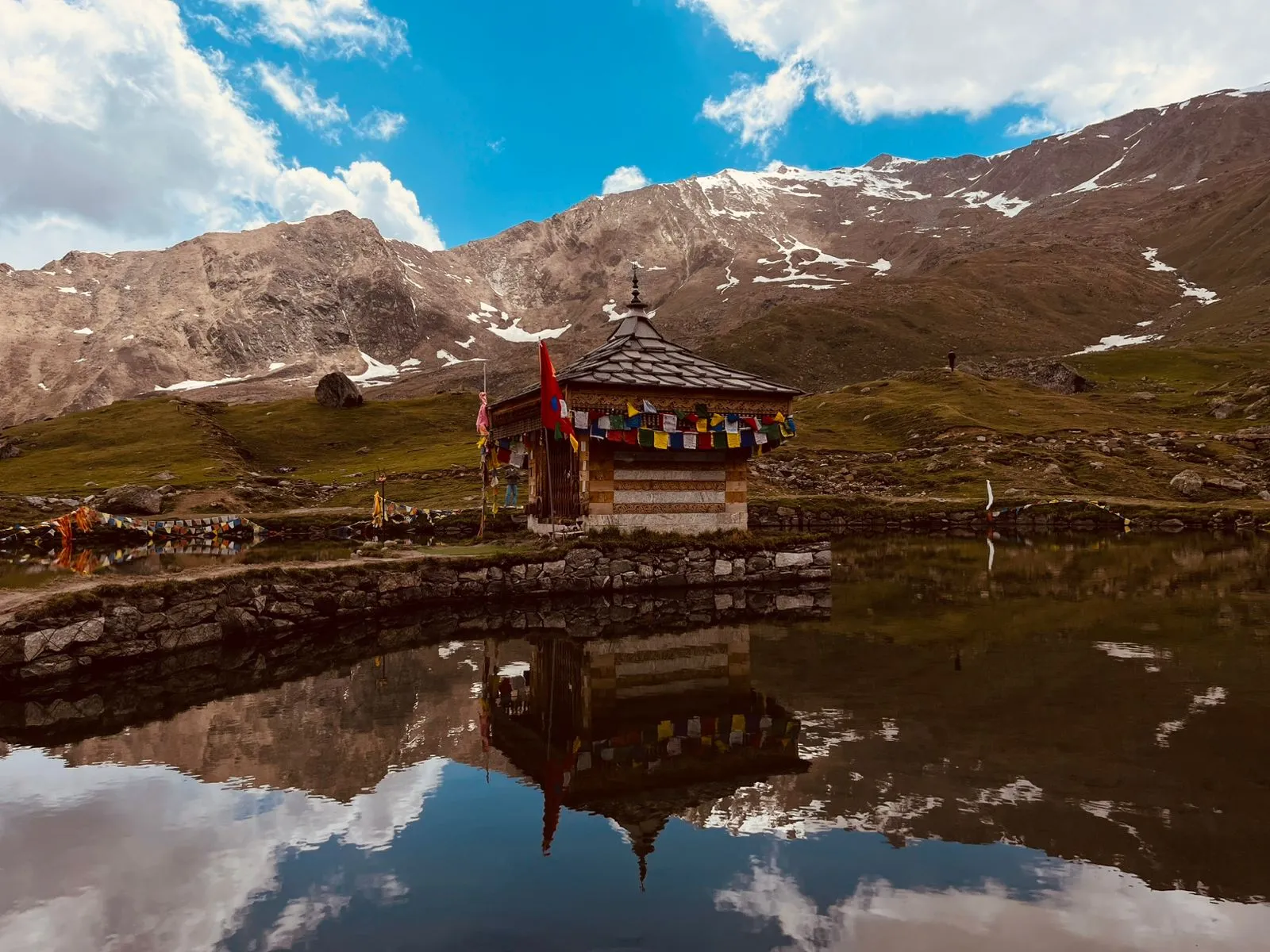
- Lalanti meadows and a glacial lake at Charang La base with a small stone shrine of trishuls where parikrama pilgrims offer prayers
- Views of Rangrik Rang, the Racho group and Saro peaks, and of the Kinner Kailash range from the pass
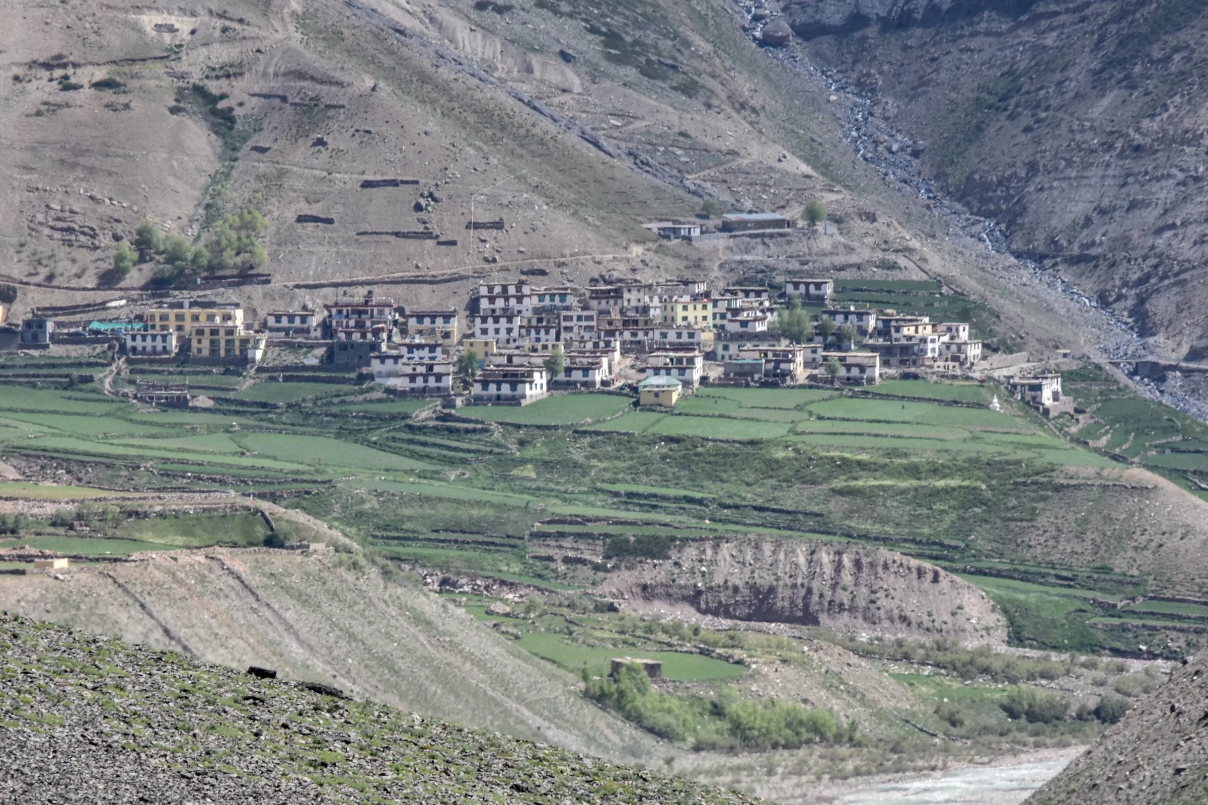
- Finishing in Chitkul, the last inhabited village on the Baspa river near the Tibet border
Risks
- Kinnaur: an October 2021 Kinnaur Deputy Commissioner order under the Disaster Management Act halted all treks in the district 'till further orders' (Himachal Watcher); we found no order lifting it, but operators still sell Kinnaur treks. Get written confirmation from the Kinnaur district administration (Reckong Peo) before you go.
- Altitude: the pass day climbs from about 4,800 m to 5,242 m and then drops about 1,800 m to Chitkul in 9–12 hours; acclimatise at Reckong Peo or Kalpa and take a rest day at Charang
- Unmarked trail: above Charang there are only stone cairns, no people and no signal; trekkers have lost the way here, so go with a guide who has done the crossing
- Snow bridge and steep snow slope (60–70 degrees) below Charang La; Indiahikes advises carrying a rope and ice axe if inexperienced
- Loose scree, landslide-prone sections and a barefoot crossing of an ice-cold stream before the base camp
- Snow: operators say Charang La can stay snowbound in June and the first snows return by late September or October; winter closes the high trail
- Border area: ITBP checkpost at Shurting; photography of military installations is prohibited and foreigners need a Protected Area Permit
Know before you go
Questions
How difficult is the Charang Valley (Charang La) trek?
It is a hard trek for experienced high-altitude trekkers. Indiahikes rates it moderate-difficult and does not recommend doing it on your own; other operators call it difficult. The hardest day climbs Charang La (about 5,242 m / 17,198 ft) and descends to Chitkul (about 3,460 m) the same day over moraine, snow and loose scree.
Is the Charang La trek the same as the Kinner Kailash parikrama?
Yes. The Thangi–Charang–Lalanti–Charang La–Chitkul route is the traditional Kinner Kailash parikrama. It is different from the Kinner Kailash Shivling yatra from Tangling or Purwani, which climbs to the Shivling and returns the same way.
Do I need a permit for the Charang La trek?
Indian citizens carry a government photo ID, which is checked at the ITBP post at Shurting. The Kinnaur district administration says foreigners may visit Thangi, Lambar, Charang and Kunu only in sponsored groups of two or more with a Protected Area Permit. A 2026 trekking guide reports that, since 2019, all trekkers also need prior permission from the district tourism office at Reckong Peo. We could not find a current official fee, so check with the SDM / tourism office at Reckong Peo before you go.
What is the best time for the Charang Valley trek?
Roughly June to September. A trekker's report names June and September; a 2026 guide says July to September, when Charang La is usually free of hard snow; Himalaya Shelter lists September–October. Avoid winter, when snow closes the high trail.
How long is the trek and where does it start?
About 60 km from Thangi to Chitkul. Most groups drive from Reckong Peo past Thangi to near Lambar and walk 4–6 days, often adding a rest day at Charang.
In an emergency
Save these numbers before you lose signal. Tap to call.
- 112All emergenciesIndia’s single emergency number — works in every state
- 108Ambulance
- 1077District disaster control room
You are in
District: KinnaurHimachal Pradesh
- Nearest hospital
- Reckong Peo (district headquarters); there is no medical help between Charang and Chitkul
- Last ATM
- Reckong Peo
- Phone network
- No mobile signal on the trail after Charang village; Reckong Peo is the last reliable network
Before you set off
- Tell someone your route and when you will be back.
- Carry a charged phone and a power bank.
- Download an offline map of the route.
- Turn back if the weather turns bad — the mountain will wait.
Questions about Charang Valley
No questions yet. Ask something and trekkers who have done it can answer.
Share your trek photo with #TreksAndTrails
I trekked this
Did Charang Valley look different from this page? Tell us what changed and we will check it.
Where this comes from
Sources
Last reviewed:
- Charang Ghati Trek — Indiahikes
- Charang Valley Trek — Himalaya Shelter
- Charang Valley Trek | Most challenging Trek, Himachal — Himalayan Hikers
- Kinner Kailash Parikrama Trek Log — Raacho Trekkers
- Kinnaur Kailash Parikrama Trek 2026: Complete Guide to the Sacred Circuit — Discover with Dheeraj
- Tourist Guidelines | District Kinnaur — District Administration Kinnaur, Government of Himachal Pradesh (official)
- Trekking in Kinnaur banned after two tragedies (26 Oct 2021) — Himachal Watcher
Photos: Ravi Kumar, CC BY 3.0; Anamdas, CC BY-SA 4.0; Amareshwara Sainadh, CC BY-SA 3.0